How to get to Progressive Orthotics by bus?
Click on the bus route to see step by step directions with maps, line arrival times and updated time schedules.
From Austin O'brien, Edmonton
39 minFrom Eastglen School, Edmonton
71 minFrom K-Days, Edmonton
66 minFrom Alberta Avenue, Edmonton
60 minFrom Blackmud Creek, Edmonton
72 minFrom Hawrelak Park, Edmonton
74 minFrom Kaye Edmonton Clinic Outpatient Referrals, Edmonton
27 minFrom Windermere Town Centre, Edmonton
77 minFrom Timeless by Khaylan, Edmonton
83 minFrom Alchemy Customs, Edmonton
60 min
Bus stops near Progressive Orthotics in Edmonton
Light Rail stations near Progressive Orthotics in Edmonton
Bus lines to Progressive Orthotics in Edmonton
What are the closest stations to Progressive Orthotics?
The closest stations to Progressive Orthotics are:
- 99 Street & 44 Avenue is 161 meters away, 3 min walk.
- Gateway Boulevard & Whitemud Drive is 346 meters away, 5 min walk.
- 99 Street & Whitemud Drive E is 373 meters away, 6 min walk.
- 97 Street & 45 Avenue is 504 meters away, 7 min walk.
- Avonmore Stop is 2709 meters away, 35 min walk.
- Century Park Station is 2923 meters away, 38 min walk.
Which bus lines stop near Progressive Orthotics?
These bus lines stop near Progressive Orthotics: 055, 523.
What’s the nearest bus station to Progressive Orthotics in Edmonton?
The nearest bus station to Progressive Orthotics in Edmonton is 99 Street & 44 Avenue. It’s a 3 min walk away.
What time is the first light rail to Progressive Orthotics in Edmonton?
The VALLEY is the first light rail that goes to Progressive Orthotics in Edmonton. It stops nearby at 5:15 AM.
What time is the last light rail to Progressive Orthotics in Edmonton?
The VALLEY is the last light rail that goes to Progressive Orthotics in Edmonton. It stops nearby at 12:57 AM.
What time is the first bus to Progressive Orthotics in Edmonton?
The 055 is the first bus that goes to Progressive Orthotics in Edmonton. It stops nearby at 6:10 AM.
What time is the last bus to Progressive Orthotics in Edmonton?
The 523 is the last bus that goes to Progressive Orthotics in Edmonton. It stops nearby at 12:41 AM.
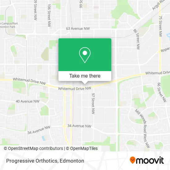
See Progressive Orthotics, Edmonton, on the map
Public Transit to Progressive Orthotics in Edmonton
Wondering how to get to Progressive Orthotics in Edmonton? Moovit helps you find the best way to get to Progressive Orthotics with step-by-step directions from the nearest public transit station.
Moovit provides free maps and live directions to help you navigate through your city. View schedules, routes, timetables, and find out how long does it take to get to Progressive Orthotics in real time.
Looking for the nearest stop or station to Progressive Orthotics? Check out this list of stops closest to your destination: 99 Street & 44 Avenue; Gateway Boulevard & Whitemud Drive; 99 Street & Whitemud Drive E; 97 Street & 45 Avenue; Avonmore Stop; Century Park Station.
Bus: 055, 523, 704, 503.
Want to see if there’s another route that gets you there at an earlier time? Moovit helps you find alternative routes or times. Get directions from and directions to Progressive Orthotics easily from the Moovit App or Website.
We make riding to Progressive Orthotics easy, which is why over 1.5 million users, including users in Edmonton, trust Moovit as the best app for public transit. You don’t need to download an individual bus app or train app, Moovit is your all-in-one transit app that helps you find the best bus time or train time available.
For information on prices of bus and light rail, costs and ride fares to Progressive Orthotics, please check the Moovit app.
Use the app to navigate to popular places including to the airport, hospital, stadium, grocery store, mall, coffee shop, school, college, and university.
Progressive Orthotics Address: 9817 44 Ave NW Edmonton, AB T6E street in Edmonton
- Aqua Market,
- Thauvette, Bussiere Design Assoc,
- Biz Plan World,
- Choi Motorsports,
- 5 Star Driving School,
- Young Yoon,
- Automotive Twin Tech,
- Delize Inc,
- Dan-Loc Bolt & Gasket,
- DT Auto Repair & Bodywork,
- Vishwas,
- Oil City Machining LTD,
- Gursach Immigration Solutions,
- Word International Ministries, Edmonton,
- Active Learning,
- Pro Aiders,
- Alberta Auto Center,
- Celestial Immigration and Éducation Services,
- Extreme Realty,
- Alpha Tile
Places Near Progressive Orthotics (Edmonton)
- Alberta Legislature Building, Edmonton,
- Cross Cancer Institute, Edmonton,
- Londonderry Mall, Edmonton,
- Borden Park, Edmonton,
- Edmonton VIA Rail Station, Edmonton,
- Kaye Edmonton Clinic, Edmonton,
- Rogers Place, Edmonton,
- Northgate Centre, Edmonton,
- Royal Alexandra Hospital, Edmonton,
- Edmonton Commonwealth Stadium, Edmonton,
- Grey Nuns Community Hospital, Edmonton,
- Kingsway Mall, Edmonton,
- Edmonton Valley Zoo, Edmonton,
- Canada Place Service Canada Centre, Edmonton,
- University of Alberta, Edmonton,
- Edmonton EXPO Centre, Edmonton,
- Fort Edmonton Park, Edmonton,
- West Edmonton Mall, Edmonton,
- Whyte Avenue, Edmonton,
- MacEwan University, Edmonton
How to get to popular places in Edmonton with public transit
Get around Edmonton by public transit!
Traveling around Edmonton has never been so easy. See step by step directions as you travel to any attraction, street or major public transit station. View bus and train schedules, arrival times, service alerts and detailed routes on a map, so you know exactly how to get to anywhere in Edmonton.
When traveling to any destination around Edmonton use Moovit's Live Directions with Get Off Notifications to know exactly where and how far to walk, how long to wait for your line, and how many stops are left. Moovit will alert you when it's time to get off — no need to constantly re-check whether yours is the next stop.
Wondering how to use public transit in Edmonton or how to pay for public transit in Edmonton? Moovit public transit app can help you navigate your way with public transit easily, and at minimum cost. It includes public transit fees, ticket prices, and costs. Looking for a map of Edmonton public transit lines? Moovit public transit app shows all public transit maps in Edmonton with all Bus and Light Rail routes and stops on an interactive map.
Edmonton has 2 transit type(s), including: Bus and Light Rail, operated by several transit agencies, including ETS LRT, ETS, Strathcona County Transit, St. Albert Transit, Spruce Grove Transit, Fort Saskatchewan Transit, Beaumont Transit and Leduc Transit