How to get to Project 216 by bus?
Click on the bus route to see step by step directions with maps, line arrival times and updated time schedules.
From Washington Yu Ying Public Charter School, Washington
68 minFrom MedStar Washington Hospital Center, Washington
47 minFrom Fannie Mae, Washington
49 minFrom The Cheesecake Factory, Washington
51 minFrom Smithsonian National Zoological Park, Washington
76 minFrom The Home Depot, Washington
69 minFrom Tenleytown, Washington
50 minFrom Embassy Of Ethiopia, Washington
51 minFrom Embassy Of Poland, Washington
49 minFrom Howard University, Washington
46 min
How to get to Project 216 by metro?
Click on the metro route to see step by step directions with maps, line arrival times and updated time schedules.
From Washington Yu Ying Public Charter School, Washington
72 minFrom MedStar Washington Hospital Center, Washington
75 minFrom Fannie Mae, Washington
91 minFrom The Cheesecake Factory, Washington
80 minFrom Smithsonian National Zoological Park, Washington
80 minFrom The Home Depot, Washington
65 minFrom Tenleytown, Washington
78 minFrom Embassy Of Ethiopia, Washington
85 minFrom Embassy Of Poland, Washington
70 minFrom Howard University, Washington
79 min
Bus stops near Project 216 in Montgomery County
Metro station near Project 216 in Montgomery County
- Silver Spring, 5 min walk,VIEW
Train station near Project 216 in Montgomery County
- Silver Spring Marc Wb, 6 min walk,VIEW
Bus lines to Project 216 in Montgomery County
What are the closest stations to Project 216?
The closest stations to Project 216 are:
- E Franklin Ave & Garwood St is 74 yards away, 2 min walk.
- University Bl+Franklin Av is 124 yards away, 2 min walk.
- Silver Spring is 365 yards away, 5 min walk.
- Silver Spring Marc Wb is 430 yards away, 6 min walk.
Which bus lines stop near Project 216?
These bus lines stop near Project 216: 14, M12.
Which metro line stops near Project 216?
RED (Glenmont)
What’s the nearest metro station to Project 216 in Montgomery County?
The nearest metro station to Project 216 in Montgomery County is Silver Spring. It’s a 5 min walk away.
What’s the nearest train station to Project 216 in Montgomery County?
The nearest train station to Project 216 in Montgomery County is Silver Spring Marc Wb. It’s a 6 min walk away.
What’s the nearest bus station to Project 216 in Montgomery County?
The nearest bus stations to Project 216 in Montgomery County are E Franklin Ave & Garwood St and University Bl+Franklin Av. The closest one is a 2 min walk away.
What time is the first metro to Project 216 in Montgomery County?
The RED is the first metro that goes to Project 216 in Montgomery County. It stops nearby at 5:07 AM.
What time is the last metro to Project 216 in Montgomery County?
The RED is the last metro that goes to Project 216 in Montgomery County. It stops nearby at 12:31 AM.
What time is the first train to Project 216 in Montgomery County?
The MARC is the first train that goes to Project 216 in Montgomery County. It stops nearby at 5:51 AM.
What time is the last train to Project 216 in Montgomery County?
The MARC is the last train that goes to Project 216 in Montgomery County. It stops nearby at 7:37 PM.
What time is the first bus to Project 216 in Montgomery County?
The M12 is the first bus that goes to Project 216 in Montgomery County. It stops nearby at 4:39 AM.
What time is the last bus to Project 216 in Montgomery County?
The M12 is the last bus that goes to Project 216 in Montgomery County. It stops nearby at 2:31 AM.
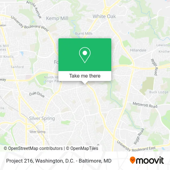
See Project 216, Montgomery County, on the map
Public Transit to Project 216 in Montgomery County
Wondering how to get to Project 216 in Montgomery County? Moovit helps you find the best way to get to Project 216 with step-by-step directions from the nearest public transit station.
Moovit provides free maps and live directions to help you navigate through your city. View schedules, routes, timetables, and find out how long does it take to get to Project 216 in real time.
Looking for the nearest stop or station to Project 216? Check out this list of stops closest to your destination: E Franklin Ave & Garwood St; University Bl+Franklin Av; Silver Spring; Silver Spring Marc Wb.
Bus: 14, M12, 19.Train: MARC.Metro: RED.
Want to see if there’s another route that gets you there at an earlier time? Moovit helps you find alternative routes or times. Get directions from and directions to Project 216 easily from the Moovit App or Website.
We make riding to Project 216 easy, which is why over 1.5 million users, including users in Montgomery County, trust Moovit as the best app for public transit. You don’t need to download an individual bus app or train app, Moovit is your all-in-one transit app that helps you find the best bus time or train time available.
For information on prices of bus and metro, costs and ride fares to Project 216, please check the Moovit app.
Use the app to navigate to popular places including to the airport, hospital, stadium, grocery store, mall, coffee shop, school, college, and university.
Project 216 Address: 216 E Franklin Ave Silver Spring, MD 20901 street in Montgomery County
- University Blvd E & E Franklin Ave,
- Eastern Middle,
- Eastern Middle School,
- Fire Engine Park,
- Embassy Series,
- Evergreen Consulting,
- Lafana Institute of Hope,
- Digital Masters,
- Lizzys Lodge,
- Jovial Smiles Dental,
- Saint Gregory Orthodox Church,
- Eli Turner Photography,
- Capable Plumbing Service,
- Grito de Fé,
- Church of Jesus Christ of Latter Day Saints,
- Southern Baptist Convention,
- YMCA,
- All Hours Lock & Key Silver Spring,
- Angela A Romero,
- Right on Time Media Engineering
Places Near Project 216 (Montgomery County)
- National Museum of African American History and Culture, Washington,
- Amazon Hq2, Arlington County,
- M&T Bank Stadium, Baltimore,
- The Anthem, Washington,
- Marriott Marquis Washington, DC, Washington,
- Pennsylvania Ave NW (3rd st and pennsylvania), Washington,
- Sibley Memorial Hospital, Washington,
- Capital One Arena, Washington,
- National Mall, Washington,
- Westfield Montgomery Mall, Montgomery County,
- Warner Theatre, Washington,
- PG Mall, Prince George's County,
- Camden Yards, Baltimore,
- Basilica of the National Shrine, Washington,
- Washington National Cathedral, Washington,
- National Zoo, Washington,
- Rock Creek Tennis Center, Washington,
- Washington DC VA Medical Center, Washington,
- Museum Of The Bible, Washington,
- Georgetown, Washington
How to get to popular places in Washington, D.C. - Baltimore, MD with public transit
Get around Montgomery County by public transit!
Traveling around Montgomery County has never been so easy. See step by step directions as you travel to any attraction, street or major public transit station. View bus and train schedules, arrival times, service alerts and detailed routes on a map, so you know exactly how to get to anywhere in Montgomery County.
When traveling to any destination around Montgomery County use Moovit's Live Directions with Get Off Notifications to know exactly where and how far to walk, how long to wait for your line, and how many stops are left. Moovit will alert you when it's time to get off — no need to constantly re-check whether yours is the next stop.
Wondering how to use public transit in Montgomery County or how to pay for public transit in Montgomery County? Moovit public transit app can help you navigate your way with public transit easily, and at minimum cost. It includes public transit fees, ticket prices, and costs. Looking for a map of Montgomery County public transit lines? Moovit public transit app shows all public transit maps in Montgomery County with all Bus, Train, Metro, Light Rail and Ferry routes and stops on an interactive map.
Washington, D.C. - Baltimore, MD has 5 transit type(s), including: Bus, Train, Metro, Light Rail and Ferry, operated by several transit agencies, including WMATA, Montgomery County Ride On, Fairfax Connector, TheBus, PRTC, DASH - Alexandria, Arlington Transit (ART), RTA of Central Maryland, MDOT MTA, MDOT MTA Light RailLink, MDOT MTA Commuter Bus, MDOT MTA Local Bus, FXBGO!, Virginia Railway Express (VRE) and MARC