Directions to Project Cores (Colombo) with public transportation
The following transit lines have routes that pass near Project Cores
How to get to Project Cores by bus?
Click on the bus route to see step by step directions with maps, line arrival times and updated time schedules.
From Rua Deputado Mário de Barros, Centro Cívico
48 minFrom Rua Paulo Turkiewicz, Tarumã
57 minFrom Bacacheri, Bacacheri
37 minFrom Parque Museu do Olho, Centro Cívico
49 minFrom Rua Atílio Bório, Alto Da Rua XV
38 minFrom Rua Marechal Hermes, Centro Cívico
48 minFrom Rua Camões, Alto Da Rua XV
46 minFrom Expotrade Convention Center, Pinhais
56 minFrom Hospital Vita Curitiba, Bairro Alto
33 minFrom Rua XV de Novembro, Colombo
50 min
Bus stops near Project Cores in Colombo
Bus lines to Project Cores in Colombo
- B69 MAD. CURITIBA / SÃO DIMAS, São Dimas → Terminal Guadalupe,VIEW
- B17 SANTA HELENA, Terminal Maracanã → Santa Helena,VIEW
- B30 ANA TERRA, Terminal Maracanã → Ana Terra,VIEW
- B29 ROÇA GRANDE / APDEC (VIA MARACANÃ), Terminal Roça Grande → APDEC,VIEW
- U01 SEDE / MARACANÃ, Terminal Maracanã → Terminal Sede Colombo,VIEW
- I90 CACHOEIRA / MARACANÃ, Terminal Maracanã → Terminal Cachoeira,VIEW
What are the closest stations to Project Cores?
The closest stations to Project Cores are:
- Rua Paschoa Lazarotto Toniolo, 1001 is 36 meters away, 1 min walk.
- Rua Paschoal Lazaroto Toniolo, 1020 is 36 meters away, 1 min walk.
- Rua Paschoal Lazaroto Toniolo, 579-681 is 168 meters away, 3 min walk.
- Rua Manoel Ribas, 399 is 462 meters away, 7 min walk.
- Rua São Pedro, 1148 is 705 meters away, 10 min walk.
Which bus lines stop near Project Cores?
These bus lines stop near Project Cores: B03 GUARAITUBA / ALTO DA XV (VIA MARACANÃ), B06 GUARAITUBA / RUI BARBOSA (VIA MARACANÃ / SEMIDIRETO), B20 GUARAITUBA / CABRAL (VIA MARACANÃ), B29 ROÇA GRANDE / APDEC (VIA MARACANÃ), I90 CACHOEIRA / MARACANÃ.
What’s the nearest bus station to Project Cores in Colombo?
The nearest bus stations to Project Cores in Colombo are Rua Paschoa Lazarotto Toniolo, 1001 and Rua Paschoal Lazaroto Toniolo, 1020. The closest one is a 1 min walk away.
What time is the first bus to Project Cores in Colombo?
The B69 MAD. CURITIBA / SÃO DIMAS is the first bus that goes to Project Cores in Colombo. It stops nearby at 4:07 AM.
What time is the last bus to Project Cores in Colombo?
The B69 MAD. CURITIBA / SÃO DIMAS is the last bus that goes to Project Cores in Colombo. It stops nearby at 1:56 AM.
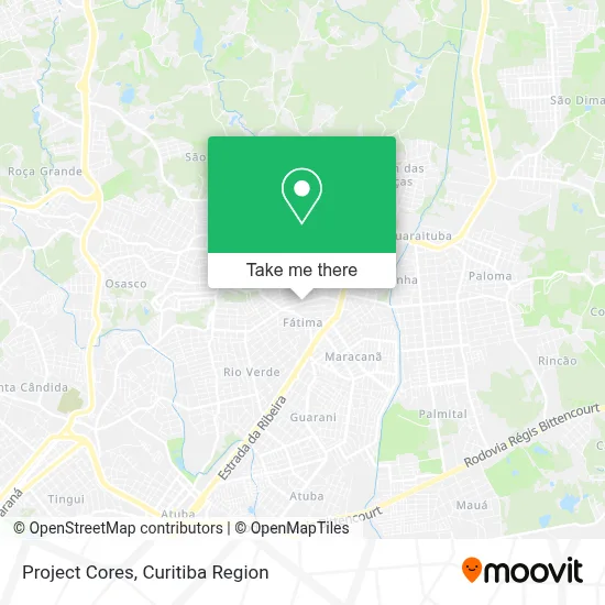
See Project Cores, Colombo, on the map
Public Transit to Project Cores in Colombo
Wondering how to get to Project Cores in Colombo? Moovit helps you find the best way to get to Project Cores with step-by-step directions from the nearest public transit station.
Moovit provides free maps and live directions to help you navigate through your city. View schedules, routes, timetables, and find out how long does it take to get to Project Cores in real time.
Looking for the nearest stop or station to Project Cores? Check out this list of stops closest to your destination: Rua Paschoa Lazarotto Toniolo; Rua Paschoal Lazaroto Toniolo; Rua Paschoal Lazaroto Toniolo; Rua Manoel Ribas; Rua São Pedro.
Bus: B03 GUARAITUBA / ALTO DA XV (VIA MARACANÃ), B06 GUARAITUBA / RUI BARBOSA (VIA MARACANÃ / SEMIDIRETO), B20 GUARAITUBA / CABRAL (VIA MARACANÃ), B29 ROÇA GRANDE / APDEC (VIA MARACANÃ), I90 CACHOEIRA / MARACANÃ, B69 MAD. CURITIBA / SÃO DIMAS, B17 SANTA HELENA, B30 ANA TERRA, U01 SEDE / MARACANÃ.
Want to see if there’s another route that gets you there at an earlier time? Moovit helps you find alternative routes or times. Get directions from and directions to Project Cores easily from the Moovit App or Website.
We make riding to Project Cores easy, which is why over 1.5 million users, including users in Colombo, trust Moovit as the best app for public transit. You don’t need to download an individual bus app or train app, Moovit is your all-in-one transit app that helps you find the best bus time or train time available.
For information on prices of bus, costs and ride fares to Project Cores, please check the Moovit app.
Use the app to navigate to popular places including to the airport, hospital, stadium, grocery store, mall, coffee shop, school, college, and university.
Project Cores Address: Rua Paschoa Lazarotto Toniolo, 989 Fátima Colombo-PR 83405-760 street in Colombo
- Centro Educacional Nova Geracao,
- Panificadora Aquarela,
- Academia Ag,
- Cristiano Marconato-Serralheria.,
- Kng Comunicacão,
- Escola Nova Geração,
- Barbearia Will,
- Alw Usinagem,
- C.E.I Mundo da Alegria,
- Studio das Unhas,
- J. Weber Ltda,
- Tico Ferrugem na Veia,
- Project Cores Pinturas,
- Garagem do Lanche,
- Ponto Ideal Comercio de Gas,
- Bar do Tio Iza,
- Condomínio Residencial Columbia,
- A. B. Reflorestadora,
- Christine Intimate,
- Elisianealinekugi
Places Near Project Cores (Colombo)
- Hospital Do Senhor - Madre Virgínia, São José Dos Pinhais,
- Jardim Botânico de Curitiba PR, Centro,
- Shopping Palladium, Portão,
- Hospital Nossa Senhora Das Graças, Mercês,
- Hospital do Rocio, Campo,
- Hospital Erasto Gaertner, Jardim Das Américas,
- Hospital Da Cruz Vermelha, Batel,
- Rua Martim Afonso 558, Mercês,
- Arena Da Baixada - Curitiba,
- Park Shopping Barigüi, Mossunguê,
- Rua General Mário Tourinho, Campina Do Siqueira,
- Hospital Madalena Sofia, Bairro Alto,
- Hhhhh, Fazendinha,
- Jockey Plaza Shopping Center, Tarumã,
- Hospital de Clínicas (HC - UFPR), Centro,
- Pontifícia Universidade Católica do Paraná (PUCPR), Prado Velho,
- Hospital Universitário Evangélico de Curitiba, Bigorrilho,
- Parque Barigui, Mercês,
- Hospital Angelina Caron, Campina Grande Do Sul,
- Shopping Estação, Rebouças
How to get to popular places in Curitiba Region with public transit
Get around Colombo by public transit!
Traveling around Colombo has never been so easy. See step by step directions as you travel to any attraction, street or major public transit station. View bus and train schedules, arrival times, service alerts and detailed routes on a map, so you know exactly how to get to anywhere in Colombo.
When traveling to any destination around Colombo use Moovit's Live Directions with Get Off Notifications to know exactly where and how far to walk, how long to wait for your line, and how many stops are left. Moovit will alert you when it's time to get off — no need to constantly re-check whether yours is the next stop.
Wondering how to use public transit in Colombo or how to pay for public transit in Colombo? Moovit public transit app can help you navigate your way with public transit easily, and at minimum cost. It includes public transit fees, ticket prices, and costs. Looking for a map of Colombo public transit lines? Moovit public transit app shows all public transit maps in Colombo with all Bus and Cable Car routes and stops on an interactive map.
Curitiba Region has 2 transit type(s), including: Bus and Cable Car, operated by several transit agencies, including Sistema Integrado de Mobilidade (URBS), Sistema Integrado de Mobilidade (AMEP), URBS (Cartões bancários e Dinheiro), URBS (Cartões bancários / Cartão URBS), AMEP (Cartões bancários / Cartão MetroCard), AMEP (Cartões bancários / Cartão MetroCard / Dinheiro), Viação Colombo (Dinheiro), TRIAR (Cartão TRIAR / Dinheiro), Empresa Curitiba Cerro Azul (Dinheiro), Expresso Nossa Senhora da Penha (Dinheiro), Empresa Campo Alto Tijucas (Dinheiro), Auto Viação São José (Cartão VEM / Dinheiro), BRT S/A (Cartão VEM / Dinheiro), TransPiedade (Cartão Cidadão / Dinheiro) and Oceânica Sul (Cartão Transporte / Dinheiro)