Directions to Project Excel (Huntington) with public transportation
The following transit lines have routes that pass near Project Excel
 Bus: 1, H20, H30.
- Train: PORT JEFFERSON BRANCH.
How to get to Project Excel by bus?
Click on the bus route to see step by step directions with maps, line arrival times and updated time schedules.
From Jake's 58 Casino, Islandia
108 minFrom Good Samaritan Hospital Medical Center, West Islip
110 minFrom Westbury, NY, Westbury
132 minFrom East Meadow, NY, East Meadow
105 minFrom Tanger Outlets, Deer Park, Deer Park
105 minFrom Woodbury Long Island, Woodbury
49 minFrom Plainview, NY, Plainview
61 minFrom Hauppauge ny, Hauppauge
110 minFrom Tanger Outlets, Deer Park
103 min
How to get to Project Excel by train?
Click on the train route to see step by step directions with maps, line arrival times and updated time schedules.
Bus stops near Project Excel in Huntington
Train station near Project Excel in Huntington
- Huntington, 51 min walk,VIEW
Bus lines to Project Excel in Huntington
What are the closest stations to Project Excel?
The closest stations to Project Excel are:
- Village Green Center is 199 yards away, 3 min walk.
- Nys 110/Prime Ave is 489 yards away, 6 min walk.
- Huntington is 4273 yards away, 51 min walk.
Which bus lines stop near Project Excel?
These bus lines stop near Project Excel: 1, H20, H30.
Which train line stops near Project Excel?
PORT JEFFERSON BRANCH (Port Jefferson)
What’s the nearest bus station to Project Excel in Huntington?
The nearest bus station to Project Excel in Huntington is Village Green Center. It’s a 3 min walk away.
What time is the first train to Project Excel in Huntington?
The PORT JEFFERSON BRANCH is the first train that goes to Project Excel in Huntington. It stops nearby at 3:07 AM.
What time is the last train to Project Excel in Huntington?
The PORT JEFFERSON BRANCH is the last train that goes to Project Excel in Huntington. It stops nearby at 3:07 AM.
What time is the first bus to Project Excel in Huntington?
The 1 is the first bus that goes to Project Excel in Huntington. It stops nearby at 5:14 AM.
What time is the last bus to Project Excel in Huntington?
The 1 is the last bus that goes to Project Excel in Huntington. It stops nearby at 10:16 PM.
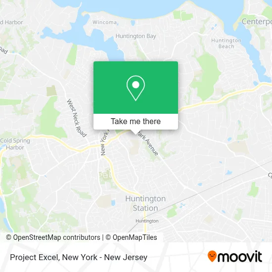
See Project Excel, Huntington, on the map
Public Transit to Project Excel in Huntington
Wondering how to get to Project Excel in Huntington? Moovit helps you find the best way to get to Project Excel with step-by-step directions from the nearest public transit station.
Moovit provides free maps and live directions to help you navigate through your city. View schedules, routes, timetables, and find out how long does it take to get to Project Excel in real time.
Looking for the nearest stop or station to Project Excel? Check out this list of stops closest to your destination: Village Green Center; Nys 110/Prime Ave; Huntington.
Bus: 1, H20, H30.Train: PORT JEFFERSON BRANCH.
Want to see if there’s another route that gets you there at an earlier time? Moovit helps you find alternative routes or times. Get directions from and directions to Project Excel easily from the Moovit App or Website.
We make riding to Project Excel easy, which is why over 1.7 million users, including users in Huntington, trust Moovit as the best app for public transit. You don’t need to download an individual bus app or train app, Moovit is your all-in-one transit app that helps you find the best bus time or train time available.
For information on prices of bus and train, costs and ride fares to Project Excel, please check the Moovit app.
Use the app to navigate to popular places including to the airport, hospital, stadium, grocery store, mall, coffee shop, school, college, and university.
Project Excel Address: 423 Park Ave street in Huntington
- Retro Picture Show,
- Huntington Sanctuary,
- Huntington Drug and Alcohol Counseling Center,
- Noom Events,
- Empire Youth Athletics Llc,
- John J. Flanagan Memorial Activity Center,
- Huntington Senior Citizens,
- Edible Arrangements,
- The Huntington Militia - 18th Century Living History,
- Ymca Field,
- Eileen Marie Gallagher, Md,
- Erika Kalabacas, Do,
- John Raymond Wagner, Md,
- Northwell Health Physician Partners Medicine at Huntington,
- Northwell Health Physician Partners Women's Specialty Care at Huntington,
- Natalia Cristina Flores, Md,
- Jean Marie Cacciabaudo, Md,
- Urvi D. Gandhi, Md,
- Ymca Long Island - Huntington,
- Laffey Real Estate | Huntington / Northport Office
Places Near Project Excel (Huntington)
- Times Square, Manhattan,
- Queens Center Mall, Queens,
- Wall Street, Manhattan,
- 66 John Street, Manhattan,
- 26 Federal Plaza, Manhattan,
- 1 Police Plaza, Manhattan,
- Bellevue Hospital, Manhattan,
- 111 Centre New York City Supreme Court, Manhattan,
- Katz's Deli, Manhattan,
- Chinatown, Manhattan,
- Pier 83, Manhattan,
- 376 Hudson Street, Manhattan,
- qqqq, Manhattan,
- Mountainside Hospital, Glen Ridge,
- SoHo, Manhattan,
- Rockefeller Center, Manhattan,
- 3 Stone St, Manhattan,
- 911 Memorial, Manhattan,
- Hudson Yards, Manhattan,
- San Gennaro Feast, Manhattan
How to get to popular places in New York - New Jersey with public transit
Get around Huntington by public transit!
Traveling around Huntington has never been so easy. See step by step directions as you travel to any attraction, street or major public transit station. View bus and train schedules, arrival times, service alerts and detailed routes on a map, so you know exactly how to get to anywhere in Huntington.
When traveling to any destination around Huntington use Moovit's Live Directions with Get Off Notifications to know exactly where and how far to walk, how long to wait for your line, and how many stops are left. Moovit will alert you when it's time to get off — no need to constantly re-check whether yours is the next stop.
Wondering how to use public transit in Huntington or how to pay for public transit in Huntington? Moovit public transit app can help you navigate your way with public transit easily, and at minimum cost. It includes public transit fees, ticket prices, and costs. Looking for a map of Huntington public transit lines? Moovit public transit app shows all public transit maps in Huntington with all Bus, Train, Subway, Light Rail, Ferry and Cable Car routes and stops on an interactive map.
New York - New Jersey has 6 transit type(s), including: Bus, Train, Subway, Light Rail, Ferry and Cable Car, operated by several transit agencies, including MTA Subway, Metro-North Railroad, LIRR, PATH, MTA New York City Transit - Express routes, MTA Bus, NJ Transit, NYC Ferry, NICE bus, Bee-Line Bus, NJ Transit Rail, Norwalk Transit District, Hartford Line, River Valley Transit and HART