How to get to Project Gorgeous by bus?
Click on the bus route to see step by step directions with maps, line arrival times and updated time schedules.
From Castleton Square Mall, Indianapolis
39 minFrom Indygo Bus Route 39A, Indianapolis City (Balance)
38 minFrom IU Health People Mover (Methodist Hospital Station), Indianapolis City (Balance)
34 minFrom Facade Tek, Indianapolis City (Balance)
88 minFrom Kamran and Company, Indianapolis City (Balance)
52 minFrom Forvis Mazars, Indianapolis City (Balance)
48 minFrom 38th North Dr / N Hawthorne Ln, Indianapolis City (Balance)
41 minFrom Wisheks, Indianapolis City (Balance)
81 minFrom N Meridian St / E 9th St, Indianapolis City (Balance)
38 minFrom Sandra Caribbean Food Market, Indianapolis City (Balance)
76 min
Bus stops near Project Gorgeous in Indianapolis City (Balance)
Bus lines to Project Gorgeous in Indianapolis City (Balance)
What are the closest stations to Project Gorgeous?
The closest stations to Project Gorgeous are:
- Broad Ripple Ave & Guilford Ave is 159 yards away, 2 min walk.
- Broad Ripple Station Nb is 451 yards away, 6 min walk.
Which bus lines stop near Project Gorgeous?
These bus lines stop near Project Gorgeous: 19, 82, 90.
What’s the nearest bus station to Project Gorgeous in Indianapolis City (Balance)?
The nearest bus station to Project Gorgeous in Indianapolis City (Balance) is Broad Ripple Ave & Guilford Ave. It’s a 2 min walk away.
What time is the first bus to Project Gorgeous in Indianapolis City (Balance)?
The 90 is the first bus that goes to Project Gorgeous in Indianapolis City (Balance). It stops nearby at 4:53 AM.
What time is the last bus to Project Gorgeous in Indianapolis City (Balance)?
The 90 is the last bus that goes to Project Gorgeous in Indianapolis City (Balance). It stops nearby at 1:09 AM.
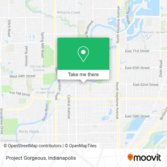
See Project Gorgeous, Indianapolis City (Balance), on the map
Public Transit to Project Gorgeous in Indianapolis City (Balance)
Wondering how to get to Project Gorgeous in Indianapolis City (Balance)? Moovit helps you find the best way to get to Project Gorgeous with step-by-step directions from the nearest public transit station.
Moovit provides free maps and live directions to help you navigate through your city. View schedules, routes, timetables, and find out how long does it take to get to Project Gorgeous in real time.
Looking for the nearest stop or station to Project Gorgeous? Check out this list of stops closest to your destination: Broad Ripple Ave & Guilford Ave; Broad Ripple Station Nb.
Bus: 19, 82, 90.
Want to see if there’s another route that gets you there at an earlier time? Moovit helps you find alternative routes or times. Get directions from and directions to Project Gorgeous easily from the Moovit App or Website.
We make riding to Project Gorgeous easy, which is why over 1.5 million users, including users in Indianapolis City (Balance), trust Moovit as the best app for public transit. You don’t need to download an individual bus app or train app, Moovit is your all-in-one transit app that helps you find the best bus time or train time available.
For information on prices of bus, costs and ride fares to Project Gorgeous, please check the Moovit app.
Use the app to navigate to popular places including to the airport, hospital, stadium, grocery store, mall, coffee shop, school, college, and university.
Project Gorgeous Address: 6251 Winthrop Ave street in Indianapolis City (Balance)
- Creative Kinetic Fitness,
- Win Townhomes,
- Library,
- The Momentum Group,
- Scott Diggity Dogs,
- Brothers Bar & Grill,
- STARBUCKS,
- Village Montessori School,
- Puerto Rico Rise Up,
- Spencer Residential Locksmith,
- Taylor Car Key Locksmith,
- Barber Studio,
- Linear Publishing,
- Stacy Deskins,
- Kilroy's Bar N' Grill (Kilroy's Sports Bar),
- University of Attitude,
- Circle City Athletics,
- COLD STONE CREAMERY,
- Ripple Deli,
- Indianapolis Web Design
Places Near Project Gorgeous (Indianapolis City (Balance))
- 119 W 19th St Parking, Indianapolis City (Balance),
- Jersey Barn, Indianapolis City (Balance),
- Train Ride At Castleton Mall, Indianapolis City (Balance),
- Lucas Oil Stadium, Indianapolis City (Balance),
- Castleton Square Mall, Indianapolis,
- Indianapolis Airport Zone 2, Indianapolis City (Balance),
- Gainbridge Fieldhouse, Indianapolis City (Balance),
- Eskenazi Hospital, Indianapolis City (Balance),
- Methodist Hospital of Indianapolis, Indianapolis City (Balance),
- I-465 / I-65 Interchange, Indianapolis City (Balance),
- Indianapolis Motor Speedway, Speedway,
- THE BALT, Indianapolis City (Balance),
- St. Vincent Hospital - Indianapolis, Indianapolis City (Balance),
- Lilly Corporate Center (Eli Lilly & Co), Indianapolis City (Balance),
- Indiana, Indianapolis City (Balance),
- St. Vincent entrance #1, Indianapolis City (Balance),
- Cotter's Massage Parlor With Happy Endings, Indianapolis City (Balance),
- Indiana Convention Center, Indianapolis City (Balance),
- I U Health Methodist Hospital, Indianapolis City (Balance),
- Plainfield, IN, Plainfield
How to get to popular places in Indianapolis with public transit
Get around Indianapolis City (Balance) by public transit!
Traveling around Indianapolis City (Balance) has never been so easy. See step by step directions as you travel to any attraction, street or major public transit station. View bus and train schedules, arrival times, service alerts and detailed routes on a map, so you know exactly how to get to anywhere in Indianapolis City (Balance).
When traveling to any destination around Indianapolis City (Balance) use Moovit's Live Directions with Get Off Notifications to know exactly where and how far to walk, how long to wait for your line, and how many stops are left. Moovit will alert you when it's time to get off — no need to constantly re-check whether yours is the next stop.
Wondering how to use public transit in Indianapolis City (Balance) or how to pay for public transit in Indianapolis City (Balance)? Moovit public transit app can help you navigate your way with public transit easily, and at minimum cost. It includes public transit fees, ticket prices, and costs. Looking for a map of Indianapolis City (Balance) public transit lines? Moovit public transit app shows all public transit maps in Indianapolis City (Balance) with all bus routes and stops on an interactive map.
Indianapolis has 1 transit type(s), including: bus, operated by several transit agencies, including IndyGo, FlixBus-us and Greyhound-us