Directions to Project Link (Roanoke) with public transportation
The following transit lines have routes that pass near Project Link
 Bus: 11, GREYHOUND US0600, 12, 86, 85.
- Train: NORTHEAST REGIONAL.
How to get to Project Link by bus?
Click on the bus route to see step by step directions with maps, line arrival times and updated time schedules.
How to get to Project Link by train?
Click on the train route to see step by step directions with maps, line arrival times and updated time schedules.
Bus stops near Project Link in Roanoke
Train station near Project Link in Roanoke
- Roanoke, 10 min walk,VIEW
Bus lines to Project Link in Roanoke
What are the closest stations to Project Link?
The closest stations to Project Link are:
- Mcdowell at 6th is 178 yards away, 3 min walk.
- Mcdowell at 6th (Blue Ridge Behavioral Health) is 240 yards away, 3 min walk.
- Orange Eb at 8th is 296 yards away, 4 min walk.
- Orange Wb at 8th is 325 yards away, 5 min walk.
- Moorman Wb at 8th is 643 yards away, 8 min walk.
- Roanoke is 780 yards away, 10 min walk.
Which bus lines stop near Project Link?
These bus lines stop near Project Link: 11, GREYHOUND US0600.
Which train line stops near Project Link?
NORTHEAST REGIONAL (Roanoke)
What’s the nearest train station to Project Link in Roanoke?
The nearest train station to Project Link in Roanoke is Roanoke. It’s a 10 min walk away.
What’s the nearest bus station to Project Link in Roanoke?
The nearest bus stations to Project Link in Roanoke are Mcdowell at 6th and Mcdowell at 6th (Blue Ridge Behavioral Health). The closest one is a 3 min walk away.
What time is the first train to Project Link in Roanoke?
The NORTHEAST REGIONAL is the first train that goes to Project Link in Roanoke. It stops nearby at 9:35 AM.
What time is the last train to Project Link in Roanoke?
The NORTHEAST REGIONAL is the last train that goes to Project Link in Roanoke. It stops nearby at 10:13 PM.
What time is the first bus to Project Link in Roanoke?
The 12 is the first bus that goes to Project Link in Roanoke. It stops nearby at 6:01 AM.
What time is the last bus to Project Link in Roanoke?
The 11 is the last bus that goes to Project Link in Roanoke. It stops nearby at 8:22 PM.
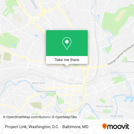
See Project Link, Roanoke, on the map
Public Transit to Project Link in Roanoke
Wondering how to get to Project Link in Roanoke? Moovit helps you find the best way to get to Project Link with step-by-step directions from the nearest public transit station.
Moovit provides free maps and live directions to help you navigate through your city. View schedules, routes, timetables, and find out how long does it take to get to Project Link in real time.
Looking for the nearest stop or station to Project Link? Check out this list of stops closest to your destination: Mcdowell at 6th; Mcdowell at 6th (Blue Ridge Behavioral Health); Orange Eb at 8th; Orange Wb at 8th; Moorman Wb at 8th; Roanoke.
Bus: 11, GREYHOUND US0600, 12, 86, 85, 91.Train: NORTHEAST REGIONAL.
Want to see if there’s another route that gets you there at an earlier time? Moovit helps you find alternative routes or times. Get directions from and directions to Project Link easily from the Moovit App or Website.
We make riding to Project Link easy, which is why over 1.5 million users, including users in Roanoke, trust Moovit as the best app for public transit. You don’t need to download an individual bus app or train app, Moovit is your all-in-one transit app that helps you find the best bus time or train time available.
For information on prices of bus and train, costs and ride fares to Project Link, please check the Moovit app.
Use the app to navigate to popular places including to the airport, hospital, stadium, grocery store, mall, coffee shop, school, college, and university.
Project Link Address: 611 McDowell Ave NW Roanoke, VA 24016 street in Roanoke
- Bebh,
- Assestment Center,
- Genoa Healthcare of Virgina,
- Mark Schleupner MD,
- Carilion Internal Medicine,
- The Burrell Center,
- Kimball NB at Orange,
- Soul Oasis Healing Spa,
- Simmons Simply Fitness by Diane,
- Hotel Roanoke,
- Washington Park,
- Addison Middle School,
- Adoracion Nocturna St Gerard.Roanoke VA,
- St Gerard Catholic Church,
- Blue Ridge Behavioral Healthcare Burrell Center,
- Guiding Star Church of God in Christ,
- Lucas Therapies,
- Sweet Union Baptist Church,
- Roanoke Concrete Co,
- McDowell WB at 5th
Places Near Project Link (Roanoke)
- National Zoo, Washington,
- Camden Yards, Baltimore,
- Georgetown, Washington,
- Basilica of the National Shrine, Washington,
- Warner Theatre, Washington,
- Museum Of The Bible, Washington,
- National Museum of African American History and Culture, Washington,
- Westfield Montgomery Mall, Montgomery County,
- Amazon Hq2, Arlington County,
- Pennsylvania Ave NW (3rd st and pennsylvania), Washington,
- Washington DC VA Medical Center, Washington,
- M&T Bank Stadium, Baltimore,
- The Anthem, Washington,
- Sibley Memorial Hospital, Washington,
- PG Mall, Prince George's County,
- Marriott Marquis Washington, DC, Washington,
- National Theatre, Washington,
- Capital One Arena, Washington,
- Rock Creek Tennis Center, Washington,
- Washington National Cathedral, Washington
How to get to popular places in Washington, D.C. - Baltimore, MD with public transit
Get around Roanoke by public transit!
Traveling around Roanoke has never been so easy. See step by step directions as you travel to any attraction, street or major public transit station. View bus and train schedules, arrival times, service alerts and detailed routes on a map, so you know exactly how to get to anywhere in Roanoke.
When traveling to any destination around Roanoke use Moovit's Live Directions with Get Off Notifications to know exactly where and how far to walk, how long to wait for your line, and how many stops are left. Moovit will alert you when it's time to get off — no need to constantly re-check whether yours is the next stop.
Wondering how to use public transit in Roanoke or how to pay for public transit in Roanoke? Moovit public transit app can help you navigate your way with public transit easily, and at minimum cost. It includes public transit fees, ticket prices, and costs. Looking for a map of Roanoke public transit lines? Moovit public transit app shows all public transit maps in Roanoke with all Bus, Train, Metro, Light Rail and Ferry routes and stops on an interactive map.
Washington, D.C. - Baltimore, MD has 5 transit type(s), including: Bus, Train, Metro, Light Rail and Ferry, operated by several transit agencies, including WMATA, Montgomery County Ride On, Fairfax Connector, TheBus, PRTC, DASH - Alexandria, Arlington Transit (ART), RTA of Central Maryland, MDOT MTA, MDOT MTA Light RailLink, MDOT MTA Commuter Bus, MDOT MTA Local Bus, FXBGO!, Virginia Railway Express (VRE) and MARC