How to get to Project Success by bus?
Click on the bus route to see step by step directions with maps, line arrival times and updated time schedules.
From Everwise Credit Union ATM/Itm, Indianapolis City (Balance)
55 minFrom Wayne Township Bus Depot, Indianapolis City (Balance)
40 minFrom Rockville Rd. and Holt Rd., Indianapolis City (Balance)
32 minFrom Emma Donnan Middle School, Indianapolis City (Balance)
24 minFrom 10th And Shadeland, Indianapolis City (Balance)
46 minFrom Super 8-Indianapolis Emerson Ave (Indianapolis Super Eight), Beech Grove
41 minFrom Indy Go Gas, Indianapolis City (Balance)
41 minFrom Meijer, Indianapolis City (Balance)
55 minFrom Edward's Transmissions+ Auto Systems Expert - Keystone, Indianapolis City (Balance)
38 minFrom Carquest, Indianapolis City (Balance)
43 min
Bus stops near Project Success in Indianapolis City (Balance)
Bus lines to Project Success in Indianapolis City (Balance)
What are the closest stations to Project Success?
The closest stations to Project Success are:
- Statehouse Station Nb is 157 yards away, 2 min walk.
- Washington St & Illinois St is 252 yards away, 3 min walk.
- Ohio St & Meridian St is 441 yards away, 6 min walk.
- Vermont St & Capitol Ave is 610 yards away, 8 min walk.
Which bus lines stop near Project Success?
These bus lines stop near Project Success: 24, 25, 37, 8, 90, 92.
What’s the nearest bus station to Project Success in Indianapolis City (Balance)?
The nearest bus station to Project Success in Indianapolis City (Balance) is Statehouse Station Nb. It’s a 2 min walk away.
What time is the first bus to Project Success in Indianapolis City (Balance)?
The 37 is the first bus that goes to Project Success in Indianapolis City (Balance). It stops nearby at 4:50 AM.
What time is the last bus to Project Success in Indianapolis City (Balance)?
The 90 is the last bus that goes to Project Success in Indianapolis City (Balance). It stops nearby at 12:54 AM.
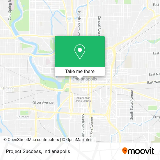
See Project Success, Indianapolis City (Balance), on the map
Public Transit to Project Success in Indianapolis City (Balance)
Wondering how to get to Project Success in Indianapolis City (Balance)? Moovit helps you find the best way to get to Project Success with step-by-step directions from the nearest public transit station.
Moovit provides free maps and live directions to help you navigate through your city. View schedules, routes, timetables, and find out how long does it take to get to Project Success in real time.
Looking for the nearest stop or station to Project Success? Check out this list of stops closest to your destination: Statehouse Station Nb; Washington St & Illinois St; Ohio St & Meridian St; Vermont St & Capitol Ave.
Bus: 24, 25, 37, 8, 90, 92, 11, 3, 6, 10, 15, 34.
Want to see if there’s another route that gets you there at an earlier time? Moovit helps you find alternative routes or times. Get directions from and directions to Project Success easily from the Moovit App or Website.
We make riding to Project Success easy, which is why over 1.5 million users, including users in Indianapolis City (Balance), trust Moovit as the best app for public transit. You don’t need to download an individual bus app or train app, Moovit is your all-in-one transit app that helps you find the best bus time or train time available.
For information on prices of bus, costs and ride fares to Project Success, please check the Moovit app.
Use the app to navigate to popular places including to the airport, hospital, stadium, grocery store, mall, coffee shop, school, college, and university.
Project Success Address: 150 W Market St street in Indianapolis City (Balance)
- FedEx Office,
- Reliable Source Talent,
- Entap,
- Mezze Cafe,
- 150 W Market,
- Capital Conference Center,
- Central Parkingsystems,
- Attorney List USA,
- Self-Advocates of Indiana,
- Indiana Charter School Board,
- Recp,
- Indiana Association of Realtors,
- Wise Investment Realty,
- Tnl Car Title Loans,
- Indianapolis Cooling and Heating,
- Dana Daniels,
- Boerger Investigative Services, LLC,
- Indianapolis Reverse Osmosis System,
- 3D Property Management,
- Real Estate Management Group
Places Near Project Success (Indianapolis City (Balance))
- Eskenazi Hospital, Indianapolis City (Balance),
- St. Vincent Hospital - Indianapolis, Indianapolis City (Balance),
- I-465 / I-65 Interchange, Indianapolis City (Balance),
- Gainbridge Fieldhouse, Indianapolis City (Balance),
- Indiana Convention Center, Indianapolis City (Balance),
- Indiana, Indianapolis City (Balance),
- Jersey Barn, Indianapolis City (Balance),
- Train Ride At Castleton Mall, Indianapolis City (Balance),
- Lilly Corporate Center (Eli Lilly & Co), Indianapolis City (Balance),
- Castleton Square Mall, Indianapolis,
- Cotter's Massage Parlor With Happy Endings, Indianapolis City (Balance),
- 119 W 19th St Parking, Indianapolis City (Balance),
- Methodist Hospital of Indianapolis, Indianapolis City (Balance),
- Indianapolis Motor Speedway, Speedway,
- St. Vincent entrance #1, Indianapolis City (Balance),
- Plainfield, IN, Plainfield,
- Indianapolis Airport Zone 2, Indianapolis City (Balance),
- THE BALT, Indianapolis City (Balance),
- Lucas Oil Stadium, Indianapolis City (Balance),
- I U Health Methodist Hospital, Indianapolis City (Balance)
How to get to popular places in Indianapolis with public transit
Get around Indianapolis City (Balance) by public transit!
Traveling around Indianapolis City (Balance) has never been so easy. See step by step directions as you travel to any attraction, street or major public transit station. View bus and train schedules, arrival times, service alerts and detailed routes on a map, so you know exactly how to get to anywhere in Indianapolis City (Balance).
When traveling to any destination around Indianapolis City (Balance) use Moovit's Live Directions with Get Off Notifications to know exactly where and how far to walk, how long to wait for your line, and how many stops are left. Moovit will alert you when it's time to get off — no need to constantly re-check whether yours is the next stop.
Wondering how to use public transit in Indianapolis City (Balance) or how to pay for public transit in Indianapolis City (Balance)? Moovit public transit app can help you navigate your way with public transit easily, and at minimum cost. It includes public transit fees, ticket prices, and costs. Looking for a map of Indianapolis City (Balance) public transit lines? Moovit public transit app shows all public transit maps in Indianapolis City (Balance) with all bus routes and stops on an interactive map.
Indianapolis has 1 transit type(s), including: bus, operated by several transit agencies, including IndyGo, FlixBus-us and Greyhound-us