How to get to Projeto Semeando Avivamento by bus?
Click on the bus route to see step by step directions with maps, line arrival times and updated time schedules.
From Jardim Anhangá, Duque De Caxias
52 minFrom Taquara, Duque De Caxias
78 minFrom Chácaras Rio-Petrópolis, Duque De Caxias
47 minFrom Monte do Azeite, Duque De Caxias
60 minFrom Outlet Premium Caxias, Duque De Caxias
53 minFrom Outlet Premium Rio de Janeiro, Duque De Caxias
56 minFrom Hospital Estadual Adão Pereira Nunes, Duque De Caxias
54 minFrom Santa Cruz Da Serra, Duque De Caxias
55 minFrom SESC Nogueira, Petrópolis
85 minFrom Xerém, Duque De Caxias
71 min
Bus stops near Projeto Semeando Avivamento in Petrópolis
Bus lines to Projeto Semeando Avivamento in Petrópolis
- 154N, Petrópolis - Xerém,VIEW
- 165, Lagoinha - Rodoviária Bingen,VIEW
- 172, Alto Independência,VIEW
- 174, Independência / Cacilda Becker (via Coronel Veiga),VIEW
- 175, Independência (Via Alto da Serra),VIEW
- 176, Independência / José Chaves (via Coronel Veiga),VIEW
- 177, Independência / Siméria / São Sebastião (Noturno),VIEW
- 178, Taquara,VIEW
- 180, Rodoviária (Via Quitandinha),VIEW
- 645, Honduras (via Gulf),VIEW
- 645, Honduras (Via Gulf),VIEW
- 646, Duques (via Coronel Veiga),VIEW
- 649, Quitandinha (via Alto da Serra),VIEW
- 650, Amazonas,VIEW
- 653, Venezuela,VIEW
- 654, Espírito Santo (via Rua Ceará),VIEW
- 655, Amazonas (Via Rua Alagoas),VIEW
- 657, Rio de Janeiro (via Alto da Serra),VIEW
- 660, Rio de Janeiro (via Rua Friburgo),VIEW
- 662, Alagoas / Rua C,VIEW
What are the closest stations to Projeto Semeando Avivamento?
The closest stations to Projeto Semeando Avivamento are:
- Rua General Rondon, 626 is 95 meters away, 2 min walk.
- Rua General Rondon, 399-537 is 122 meters away, 2 min walk.
- Rua Augusto Fragoso, 361 is 223 meters away, 4 min walk.
Which bus lines stop near Projeto Semeando Avivamento?
These bus lines stop near Projeto Semeando Avivamento: 154N, 646, 650, 662.
What’s the nearest bus station to Projeto Semeando Avivamento in Petrópolis?
The nearest bus stations to Projeto Semeando Avivamento in Petrópolis are Rua General Rondon, 626 and Rua General Rondon, 399-537. The closest one is a 2 min walk away.
What time is the first bus to Projeto Semeando Avivamento in Petrópolis?
The 177 is the first bus that goes to Projeto Semeando Avivamento in Petrópolis. It stops nearby at 3:09 AM.
What time is the last bus to Projeto Semeando Avivamento in Petrópolis?
The 177 is the last bus that goes to Projeto Semeando Avivamento in Petrópolis. It stops nearby at 3:09 AM.
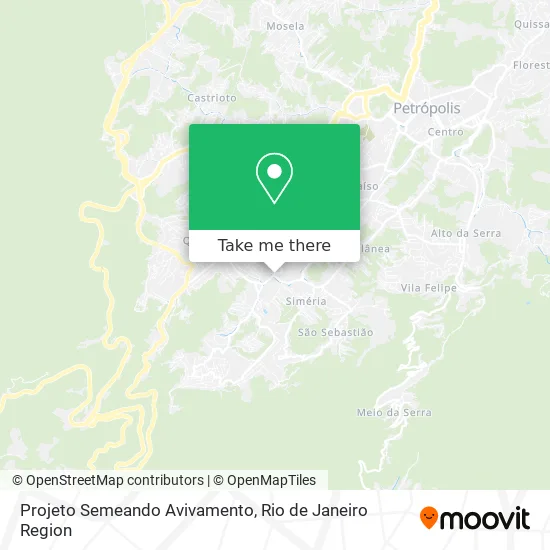
See Projeto Semeando Avivamento, Petrópolis, on the map
Public Transit to Projeto Semeando Avivamento in Petrópolis
Wondering how to get to Projeto Semeando Avivamento in Petrópolis? Moovit helps you find the best way to get to Projeto Semeando Avivamento with step-by-step directions from the nearest public transit station.
Moovit provides free maps and live directions to help you navigate through your city. View schedules, routes, timetables, and find out how long does it take to get to Projeto Semeando Avivamento in real time.
Looking for the nearest stop or station to Projeto Semeando Avivamento? Check out this list of stops closest to your destination: Rua General Rondon; Rua General Rondon; Rua Augusto Fragoso.
Bus: 154N, 646, 650, 662, 165, 172, 174, 175, 643, 648, 656, 179.
Want to see if there’s another route that gets you there at an earlier time? Moovit helps you find alternative routes or times. Get directions from and directions to Projeto Semeando Avivamento easily from the Moovit App or Website.
We make riding to Projeto Semeando Avivamento easy, which is why over 1.5 million users, including users in Petrópolis, trust Moovit as the best app for public transit. You don’t need to download an individual bus app or train app, Moovit is your all-in-one transit app that helps you find the best bus time or train time available.
For information on prices of bus, costs and ride fares to Projeto Semeando Avivamento, please check the Moovit app.
Use the app to navigate to popular places including to the airport, hospital, stadium, grocery store, mall, coffee shop, school, college, and university.
Projeto Semeando Avivamento Address: Rua Doutor Thouzet, 10 Petrópolis Petrópolis-RJ 25650-061 street in Petrópolis
- UBS Quitandinha,
- Shell Select,
- Unidade Básica De Saúde,
- Armazém Do Grão,
- Carde Solucoes Automotivas,
- Comdep - Quitandinha,
- Esquina de Oração,
- One Consulting,
- Companhia Municipal De Desenvolvimento De Petrópolis,
- QUITANDINHA,
- Luciana,
- Igreja Paz e Vida,
- Comunidade Cristã Paz e Vida,
- Moude Auto Vidros Comercio e Serviços,
- Quitandinha, Petropolis,
- Tita's Bar e Restaurante,
- Majestoso Cremerie,
- Tuca Terrarios and Duendes,
- Pedra da Lua,
- Bar do Andrezinho
Places Near Projeto Semeando Avivamento (Petrópolis)
- Avenida Rio Branco, Centro,
- Rodoviária Novo Rio (Rodoviária do Rio de Janeiro), Santo Cristo,
- Avenida Venezuela 134, Saúde,
- Rua Ulysses Guimarães 16, Cidade Nova,
- Shopping Rio Sul, Botafogo,
- Museu Do Amanhã, Centro,
- Shopping Downtown, Barra Da Tijuca,
- Niterói, Niterói,
- Feirão De Malhas, Duque De Caxias,
- Shopping Nova América, Del Castilho,
- Hospital Federal Cardoso Fontes, Jacarepaguá,
- Hospital Federal Do Andaraí, Andaraí,
- Praia do Arpoador, Ipanema,
- Feira Livre da Gloria, Glória,
- Shopping RioSul, Botafogo,
- Norte Shopping, Cachambi,
- Hospital Pedro Ernesto, Vila Isabel,
- Hospital Municipal Ronaldo Gazolla, Acari,
- Rio De Janeiro,
- Rua Licínio Cardoso, São Francisco Xavier
How to get to popular places in Rio de Janeiro Region with public transit
Get around Petrópolis by public transit!
Traveling around Petrópolis has never been so easy. See step by step directions as you travel to any attraction, street or major public transit station. View bus and train schedules, arrival times, service alerts and detailed routes on a map, so you know exactly how to get to anywhere in Petrópolis.
When traveling to any destination around Petrópolis use Moovit's Live Directions with Get Off Notifications to know exactly where and how far to walk, how long to wait for your line, and how many stops are left. Moovit will alert you when it's time to get off — no need to constantly re-check whether yours is the next stop.
Wondering how to use public transit in Petrópolis or how to pay for public transit in Petrópolis? Moovit public transit app can help you navigate your way with public transit easily, and at minimum cost. It includes public transit fees, ticket prices, and costs. Looking for a map of Petrópolis public transit lines? Moovit public transit app shows all public transit maps in Petrópolis with all Bus, Train, Metro, Light Rail, Ferry, Cable Car, Gondola and Funicular routes and stops on an interactive map.
Rio de Janeiro Region has 8 transit type(s), including: Bus, Train, Metro, Light Rail, Ferry, Cable Car, Gondola and Funicular, operated by several transit agencies, including TrensRJ, Metrô Rio, VLT Carioca, Barcas Rio, BRT MOBI-Rio, Auto Viação Alpha, Auto Viação Tijuca, Gire Transportes, Transurb, Viação Nossa Senhora das Graças, Consórcio INTERSUL, Braso Lisboa (Municipal), Caprichosa Auto Ônibus, Auto Viação Três Amigos and Rodoviária Âncora Matias