How to get to Promar by bus?
Click on the bus route to see step by step directions with maps, line arrival times and updated time schedules.
How to get to Promar by train?
Click on the train route to see step by step directions with maps, line arrival times and updated time schedules.
Bus stops near Promar in Warsaw
Train station near Promar in Warsaw
- Tychy Lodowisko, 24 min walk,VIEW
Cable Car stations near Promar in Warsaw
- Tychy Dąbrowskiego, 27 min walk,VIEW
Bus lines to Promar in Warsaw
- L, Tychy Barwna Cmentarz - Czułów Narcyzów,VIEW
- L, Bieruń Domy Polne - Tychy Rynek,VIEW
- L, Bieruń Domy Polne - Wartogłowiec Kościół,VIEW
- L, Bieruń Domy Polne - Czułów Narcyzów,VIEW
- L, Tychy Barwna Cmentarz - Tychy Rynek,VIEW
- L, Tychy Barwna Cmentarz - Wartogłowiec Kościół,VIEW
- L, Wartogłowiec Kościół - Bieruń Domy Polne,VIEW
- L, Tychy Rynek - Bieruń Domy Polne,VIEW
- L, Tychy Rynek - Tychy Barwna Cmentarz,VIEW
- L, Czułów Narcyzów - Tychy Barwna Cmentarz,VIEW
- L, Wartogłowiec Kościół - Tychy Barwna Cmentarz,VIEW
- 128, Tychy Towarowa - Tychy Fiat Brama Towarowa,VIEW
- 515, Tychy Dworzec PKP - Tychy Centrum Handlowe,VIEW
- 515, Tychy Dworzec PKP - Tychy Towarowa,VIEW
- 696, Wilkowyje Obywatelska - Tychy Zajezdnia,VIEW
- 696, Tychy Dworzec PKP - Tychy Sikorskiego Wiadukt,VIEW
- 696, Wilkowyje Obywatelska - Tychy Towarowa,VIEW
- 696, Wilkowyje Obywatelska - Tychy Sikorskiego Wiadukt,VIEW
- E, Tychy Sikorskiego Wiadukt - Tychy Sikorskiego Wiadukt,VIEW
- E, Tychy Osiedle "Z1" - Tychy Sikorskiego Wiadukt,VIEW
What are the closest stations to Promar?
The closest stations to Promar are:
- Tychy Wieniawskiego is 132 meters away, 2 min walk.
- Tychy Osiedle "W" is 549 meters away, 8 min walk.
- Paprocany Dymarek is 561 meters away, 8 min walk.
- Tychy Sikorskiego Kościół is 582 meters away, 8 min walk.
- Tychy Osiedle "T" is 709 meters away, 10 min walk.
- Tychy Lodowisko is 1834 meters away, 24 min walk.
- Tychy Dąbrowskiego is 2004 meters away, 27 min walk.
Which bus lines stop near Promar?
These bus lines stop near Promar: M10, M18.
Which train line stops near Promar?
S4 (Tychy Lodowisko)
What’s the nearest train station to Promar in Warsaw?
The nearest train station to Promar in Warsaw is Tychy Lodowisko. It’s a 24 min walk away.
What’s the nearest bus station to Promar in Warsaw?
The nearest bus station to Promar in Warsaw is Tychy Wieniawskiego. It’s a 2 min walk away.
What’s the nearest cable car station to Promar in Warsaw?
The nearest cable car station to Promar in Warsaw is Tychy Dąbrowskiego. It’s a 27 min walk away.
What time is the first train to Promar in Warsaw?
The S4 is the first train that goes to Promar in Warsaw. It stops nearby at 4:16 AM.
What time is the last train to Promar in Warsaw?
The S4 is the last train that goes to Promar in Warsaw. It stops nearby at 10:22 PM.
What time is the first bus to Promar in Warsaw?
The 4 is the first bus that goes to Promar in Warsaw. It stops nearby at 3:29 AM.
What time is the last bus to Promar in Warsaw?
The 1N is the last bus that goes to Promar in Warsaw. It stops nearby at 2:25 AM.
What time is the first cable car to Promar in Warsaw?
The H is the first cable car that goes to Promar in Warsaw. It stops nearby at 4:33 AM.
What time is the last cable car to Promar in Warsaw?
The B is the last cable car that goes to Promar in Warsaw. It stops nearby at 12:08 AM.
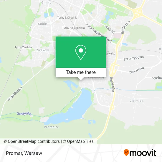
See Promar, Warsaw, on the map
Public Transit to Promar in Warsaw
Wondering how to get to Promar in Warsaw? Moovit helps you find the best way to get to Promar with step-by-step directions from the nearest public transit station.
Moovit provides free maps and live directions to help you navigate through your city. View schedules, routes, timetables, and find out how long does it take to get to Promar in real time.
Looking for the nearest stop or station to Promar? Check out this list of stops closest to your destination: Tychy Wieniawskiego; Tychy Osiedle "W"; Paprocany Dymarek; Tychy Sikorskiego Kościół; Tychy Osiedle "T"; Tychy Lodowisko; Tychy Dąbrowskiego.
Bus: M10, M18, L, L, L, L, L, L, L, L, L, L, 128, 515, 515, 696, 696, 137, 137, 137, 137, 137.Train: S4.Cable Car: 254, 254, H, H.
Want to see if there’s another route that gets you there at an earlier time? Moovit helps you find alternative routes or times. Get directions from and directions to Promar easily from the Moovit App or Website.
We make riding to Promar easy, which is why over 1.5 million users, including users in Warsaw, trust Moovit as the best app for public transit. You don’t need to download an individual bus app or train app, Moovit is your all-in-one transit app that helps you find the best bus time or train time available.
For information on prices of bus and train, costs and ride fares to Promar, please check the Moovit app.
Use the app to navigate to popular places including to the airport, hospital, stadium, grocery store, mall, coffee shop, school, college, and university.
Promar Address: ulica Henryka Wieniawskiego 62, 43-110 Tychy street in Warsaw
- Alupol,
- Arena Malgorzata Piasecka Mroz,
- Dionemedia Damian Czokajło,
- Biuro Rachunkowości i Doradztwa Finansowego Credit sp. z o.o.,
- Jerzy Szot,
- Bruk-Pol Sc,
- Dtc Poland sp. z o.o.,
- Eden,
- Filia Urzędu Pocztowego, ulica Armii Krajowej,
- Ttj. Obsługa Inwestycji Budowlanych,
- Example sp. z o.o.,
- Belle Paris,
- Swiatlo Lasu Anna Nowicka,
- Salon Gier Komputerowych S C Gabryelczyk Bogdan Kocyla Dariusz,
- Wojciech Gargul Ceram-Dent Laboratorium Protetyki Stomatologicznej,
- Piotr Bartosz F.H. Domani,
- Vgm sp. z o.o.,
- Strefa Fitness,
- Art-Studio Galeria Sztuki Współczesnej. Rauszer Andrzej Tychy,
- Sylwetka Fitness Club
Places Near Promar (Warsaw)
- Centralny Szpital Kliniczny MSWiA ul. Wołoska, Warsaw,
- Domaniewska, Warsaw,
- Wołoska, Warsaw,
- Torwar, Warsaw,
- Galeria Północna, Warsaw,
- Szpital Spartanska, Warsaw,
- PGE Narodowy, Warsaw,
- Galeria Mokotów, Warsaw,
- Wołoska-Szpital 01, Warsaw,
- Szpital Czerniakowski, Warsaw,
- Banacha - Szpital Kliniczny, Warsaw,
- Instytut Kardiologii w Aninie, Warsaw,
- Szaserów - Szpital, Warsaw,
- Szpital Orłowskiego, Warsaw,
- CH Arkadia, Warsaw,
- Cmentarz Bródnowski, Warsaw,
- Stare Miasto, Warsaw,
- Postępu, Warsaw,
- Szpital Bielański, Warsaw,
- Sejm Rp, Warsaw
How to get to popular places in Warsaw with public transit
Get around Warsaw by public transit!
Traveling around Warsaw has never been so easy. See step by step directions as you travel to any attraction, street or major public transit station. View bus and train schedules, arrival times, service alerts and detailed routes on a map, so you know exactly how to get to anywhere in Warsaw.
When traveling to any destination around Warsaw use Moovit's Live Directions with Get Off Notifications to know exactly where and how far to walk, how long to wait for your line, and how many stops are left. Moovit will alert you when it's time to get off — no need to constantly re-check whether yours is the next stop.
Wondering how to use public transit in Warsaw or how to pay for public transit in Warsaw? Moovit public transit app can help you navigate your way with public transit easily, and at minimum cost. It includes public transit fees, ticket prices, and costs. Looking for a map of Warsaw public transit lines? Moovit public transit app shows all public transit maps in Warsaw with all Bus, Train, Metro, Light Rail, Ferry and Cable Car routes and stops on an interactive map.
Warsaw has 6 transit type(s), including: Bus, Train, Metro, Light Rail, Ferry and Cable Car, operated by several transit agencies, including Warszawski Transport Publiczny, Warszawska Kolej Dojazdowa, Koleje Mazowieckie, ZTP Kraków, Miasto Piastów, Miasto Ząbki, Koleje Małopolskie, Komunikacja Miejska Łomianki, Gmina Pruszków, MPK Wrocław, MZDiK Radom, UM w Grodzisku Mazowieckim, UM w Nowym Dworze Mazowieckim, UM Płońsk and Koleje Dolnośląskie