How to get to Promd Health Va by bus?
Click on the bus route to see step by step directions with maps, line arrival times and updated time schedules.
From Citi Open, Washington
74 minFrom National Children’S Museum, Washington
68 minFrom L'Enfant Plaza, Washington
67 minFrom Children's National Columbia heights shuttle, Washington
78 minFrom United States Patent & Trademark Office (USPTO), Alexandria
60 minFrom REI, Washington
83 minFrom Inova Fairfax Hospital, Fairfax County
47 minFrom The Fairmont Washington, D.C., Washington
40 minFrom 9th St NW and H, Washington
61 minFrom Children's National - Main Hospital (Children's National Medical Center), Washington
95 min
How to get to Promd Health Va by metro?
Click on the metro route to see step by step directions with maps, line arrival times and updated time schedules.
From National Children’S Museum, Washington
27 minFrom L'Enfant Plaza, Washington
34 minFrom Children's National Columbia heights shuttle, Washington
45 minFrom United States Patent & Trademark Office (USPTO), Alexandria
45 minFrom REI, Washington
38 minFrom The Fairmont Washington, D.C., Washington
27 minFrom 9th St NW and H, Washington
31 minFrom Children's National - Main Hospital (Children's National Medical Center), Washington
66 min
Bus stops near Promd Health Va in Arlington County
Metro station near Promd Health Va in Arlington County
- East Falls Church, 19 min walk,VIEW
Bus lines to Promd Health Va in Arlington County
- 52, East Falls Church,VIEW
- A58, East To Farragut Sq,VIEW
- 51, Ballston,VIEW
- 72, Rock Spring,VIEW
- F50, West To Vienna,VIEW
- A70, West To Tysons,VIEW
- 622, Haymarket,VIEW
- 932, Rosslyn Ballston / Xfer at Pentagon To 981 For State Department,VIEW
- 972-R, Pentagon / Horner / Telegraph / Dale City Lots Via Minnieville,VIEW
- A76, North To Rosslyn,VIEW
What are the closest stations to Promd Health Va?
The closest stations to Promd Health Va are:
- Washington Blvd, Eb @ N Utah Street is 63 yards away, 1 min walk.
- N Glebe Rd + 11th St is 140 yards away, 2 min walk.
- N Fairfax Dr @ N Taylor St is 179 yards away, 3 min walk.
- Ballston+Bay K is 202 yards away, 3 min walk.
- East Falls Church is 1588 yards away, 19 min walk.
Which bus lines stop near Promd Health Va?
These bus lines stop near Promd Health Va: A58, A76, F60.
Which metro lines stop near Promd Health Va?
These metro lines stop near Promd Health Va: ORANGE, SILVER.
What’s the nearest metro station to Promd Health Va in Arlington County?
The nearest metro station to Promd Health Va in Arlington County is East Falls Church. It’s a 19 min walk away.
What’s the nearest bus station to Promd Health Va in Arlington County?
The nearest bus station to Promd Health Va in Arlington County is Washington Blvd, Eb @ N Utah Street. It’s a 1 min walk away.
What time is the first metro to Promd Health Va in Arlington County?
The ORANGE is the first metro that goes to Promd Health Va in Arlington County. It stops nearby at 5:10 AM.
What time is the last metro to Promd Health Va in Arlington County?
The SILVER is the last metro that goes to Promd Health Va in Arlington County. It stops nearby at 12:31 AM.
What time is the first bus to Promd Health Va in Arlington County?
The A70 is the first bus that goes to Promd Health Va in Arlington County. It stops nearby at 5:35 AM.
What time is the last bus to Promd Health Va in Arlington County?
The A58 is the last bus that goes to Promd Health Va in Arlington County. It stops nearby at 2:14 AM.
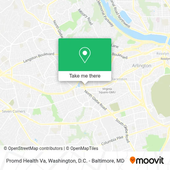
See Promd Health Va, Arlington County, on the map
Public Transit to Promd Health Va in Arlington County
Wondering how to get to Promd Health Va in Arlington County? Moovit helps you find the best way to get to Promd Health Va with step-by-step directions from the nearest public transit station.
Moovit provides free maps and live directions to help you navigate through your city. View schedules, routes, timetables, and find out how long does it take to get to Promd Health Va in real time.
Looking for the nearest stop or station to Promd Health Va? Check out this list of stops closest to your destination: Washington Blvd; N Glebe Rd + 11th St; N Fairfax Dr @ N Taylor St; Ballston+Bay K; East Falls Church.
Bus: A58, A76, F60, 52, 51, 72, F50, A70, 622, 932, 972-R.Metro: ORANGE, SILVER.
Want to see if there’s another route that gets you there at an earlier time? Moovit helps you find alternative routes or times. Get directions from and directions to Promd Health Va easily from the Moovit App or Website.
We make riding to Promd Health Va easy, which is why over 1.7 million users, including users in Arlington County, trust Moovit as the best app for public transit. You don’t need to download an individual bus app or train app, Moovit is your all-in-one transit app that helps you find the best bus time or train time available.
For information on prices of metro and bus, costs and ride fares to Promd Health Va, please check the Moovit app.
Use the app to navigate to popular places including to the airport, hospital, stadium, grocery store, mall, coffee shop, school, college, and university.
Promd Health Va Address: 1005 N Glebe Rd street in Arlington County
- Walmart,
- Placemakr Marymount Ballston,
- Blue Sky Laser & Tox,
- 1000,N Glebe Rd N Glebe Rd,
- Melting Pot,
- Eaglebank,
- Lot #142 950 N. Glebe Rd,
- Holiday Inn Arlington At Ballston,
- Uncle Julio's (Uncle Julios),
- Holiday Inn Arlington at Ballston an IHG Hotel,
- Wework 901 North Glebe Road,
- Virginia Tech - Research Center,
- Ballston Local,
- AVA Ballston,
- Bb&T,
- Washington Blvd and N Glebe Rd,
- WESTIN-Arlington Gateway (Arlington Westin),
- The Westin Arlington Gateway,
- Comfort Inn Ballston Arlington,
- The Jefferson
Places Near Promd Health Va (Arlington County)
- Museum Of The Bible, Washington,
- M&T Bank Stadium, Baltimore,
- National Museum of African American History and Culture, Washington,
- Capital One Arena, Washington,
- Warner Theatre, Washington,
- Washington DC VA Medical Center, Washington,
- Pennsylvania Ave NW (3rd st and pennsylvania), Washington,
- Amazon Hq2, Arlington County,
- National Zoo, Washington,
- The Anthem, Washington,
- Camden Yards, Baltimore,
- Washington National Cathedral, Washington,
- Basilica of the National Shrine, Washington,
- Sibley Memorial Hospital, Washington,
- Marriott Marquis Washington, DC, Washington,
- Rock Creek Tennis Center, Washington,
- Georgetown, Washington,
- National Theatre, Washington,
- PG Mall, Prince George's County,
- Westfield Montgomery Mall, Montgomery County
How to get to popular places in Washington, D.C. - Baltimore, MD with public transit
Get around Arlington County by public transit!
Traveling around Arlington County has never been so easy. See step by step directions as you travel to any attraction, street or major public transit station. View bus and train schedules, arrival times, service alerts and detailed routes on a map, so you know exactly how to get to anywhere in Arlington County.
When traveling to any destination around Arlington County use Moovit's Live Directions with Get Off Notifications to know exactly where and how far to walk, how long to wait for your line, and how many stops are left. Moovit will alert you when it's time to get off — no need to constantly re-check whether yours is the next stop.
Wondering how to use public transit in Arlington County or how to pay for public transit in Arlington County? Moovit public transit app can help you navigate your way with public transit easily, and at minimum cost. It includes public transit fees, ticket prices, and costs. Looking for a map of Arlington County public transit lines? Moovit public transit app shows all public transit maps in Arlington County with all Bus, Train, Metro, Light Rail and Ferry routes and stops on an interactive map.
Washington, D.C. - Baltimore, MD has 5 transit type(s), including: Bus, Train, Metro, Light Rail and Ferry, operated by several transit agencies, including WMATA, Montgomery County Ride On, Fairfax Connector, TheBus, PRTC, DASH - Alexandria, Arlington Transit (ART), RTA of Central Maryland, MDOT MTA, MDOT MTA Light RailLink, MDOT MTA Commuter Bus, MDOT MTA Local Bus, FXBGO!, Virginia Railway Express (VRE) and MARC