How to get to Prometheus Project Foundation by bus?
Click on the bus route to see step by step directions with maps, line arrival times and updated time schedules.
From Trinity Church, Manhattan
45 minFrom 1 New York Plaza, Manhattan
51 minFrom Ground Zero, Manhattan
44 minFrom 168 St, Manhattan
71 minFrom Aaaaa Aaaa, Bronx
100 minFrom Washington Heights, Manhattan
70 minFrom Broadway and 168th St, Manhattan
70 minFrom Apollo Theater, Manhattan
56 minFrom MetLife Stadium, East Rutherford
46 min
How to get to Prometheus Project Foundation by train?
Click on the train route to see step by step directions with maps, line arrival times and updated time schedules.
How to get to Prometheus Project Foundation by subway?
Click on the subway route to see step by step directions with maps, line arrival times and updated time schedules.
Bus stops near Prometheus Project Foundation in Manhattan
Subway stations near Prometheus Project Foundation in Manhattan
Bus lines to Prometheus Project Foundation in Manhattan
- QM1, Fresh Meadows - Midtown Express,VIEW
- M5, George Washington Bridge - 31 St & 6 Av,VIEW
- QM5, Glen Oaks - Midtown Express,VIEW
- QM6, Lake Success - Midtown Express,VIEW
- M7, Harlem - 14th Street,VIEW
- M55, W 44 St - South Ferry,VIEW
- SIM8, Arden Hts Via Richmond Av Via Woodrow Rd,VIEW
- SIM22, Eltingville Via Ar Kill Rd Via Richmond,VIEW
- SIM25, Tottenville Via Rossville Av Via Foster,VIEW
- SIM26, Midtown Via 42 St Via Madison Av,VIEW
- SIM30, Rosebank Via Forest Av,VIEW
- M42, East Side U N-1 Av Crosstown,VIEW
- QM4, Electchester 164 St Via Jewel Av,VIEW
- W44, Midtown / W 39th Street,VIEW
- QM2, Bay Terrace Bell Bl Via Whitestone Exy,VIEW
- QM20, Bay Terrace 211 St Via Willets Pt Bl,VIEW
- 42ND ST, Midtown / W 39th Street,VIEW
- QM15, Arverne Beach 54 St Via Woodhaven Bl Via Cross Bay Bl,VIEW
- QM16, Neponsit Riis Park Via Cross Bay Bl Via Rock Bch Bl,VIEW
- QM17, Midtown 57 St Via 6 Av,VIEW
What are the closest stations to Prometheus Project Foundation?
The closest stations to Prometheus Project Foundation are:
- 6 Av/W 42 St is 112 yards away, 2 min walk.
- W 42 St/Av Of the Americas is 163 yards away, 3 min walk.
- 6 Av/W 45 St is 168 yards away, 3 min walk.
- 6 Avenue & West 44 Street is 202 yards away, 3 min walk.
- 6 Av/W 44 St is 211 yards away, 3 min walk.
- W 42nd St & 6th Ave (Westbound) is 217 yards away, 3 min walk.
- 47-50 Sts-Rockefeller Ctr is 279 yards away, 4 min walk.
- 6 Av/W 43 St is 282 yards away, 4 min walk.
- Times Sq-42 St is 357 yards away, 5 min walk.
Which bus lines stop near Prometheus Project Foundation?
These bus lines stop near Prometheus Project Foundation: M1, M2, M42, M5, M55.
Which train lines stop near Prometheus Project Foundation?
These train lines stop near Prometheus Project Foundation: 2, YEL.
Which subway lines stop near Prometheus Project Foundation?
These subway lines stop near Prometheus Project Foundation: 1, 7, D, W.
What’s the nearest subway station to Prometheus Project Foundation in Manhattan?
The nearest subway station to Prometheus Project Foundation in Manhattan is 47-50 Sts-Rockefeller Ctr. It’s a 4 min walk away.
What’s the nearest bus station to Prometheus Project Foundation in Manhattan?
The nearest bus station to Prometheus Project Foundation in Manhattan is 6 Av/W 42 St. It’s a 2 min walk away.
What time is the first subway to Prometheus Project Foundation in Manhattan?
The N is the first subway that goes to Prometheus Project Foundation in Manhattan. It stops nearby at 3:00 AM.
What time is the last subway to Prometheus Project Foundation in Manhattan?
The N is the last subway that goes to Prometheus Project Foundation in Manhattan. It stops nearby at 4:02 AM.
What time is the first bus to Prometheus Project Foundation in Manhattan?
The M42 is the first bus that goes to Prometheus Project Foundation in Manhattan. It stops nearby at 3:00 AM.
What time is the last bus to Prometheus Project Foundation in Manhattan?
The M42 is the last bus that goes to Prometheus Project Foundation in Manhattan. It stops nearby at 3:00 AM.
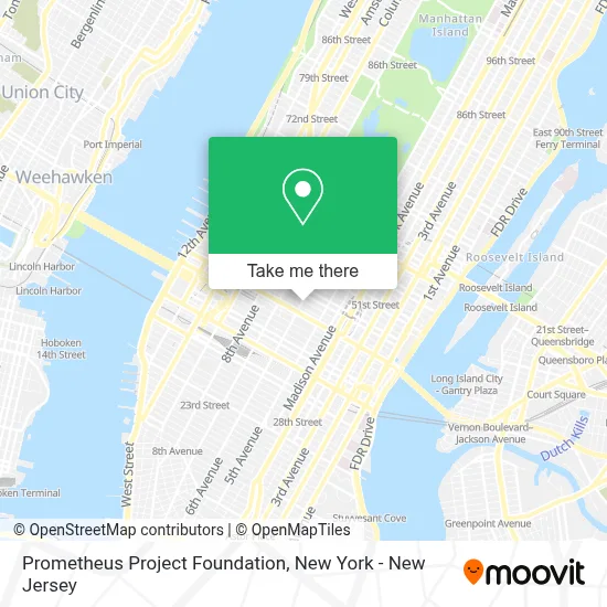
See Prometheus Project Foundation, Manhattan, on the map
Public Transit to Prometheus Project Foundation in Manhattan
Wondering how to get to Prometheus Project Foundation in Manhattan? Moovit helps you find the best way to get to Prometheus Project Foundation with step-by-step directions from the nearest public transit station.
Moovit provides free maps and live directions to help you navigate through your city. View schedules, routes, timetables, and find out how long does it take to get to Prometheus Project Foundation in real time.
Looking for the nearest stop or station to Prometheus Project Foundation? Check out this list of stops closest to your destination: 6 Av/W 42 St; W 42 St/Av Of the Americas; 6 Av/W 45 St; 6 Avenue & West 44 Street; 6 Av/W 44 St; W 42nd St & 6th Ave (Westbound); 47-50 Sts-Rockefeller Ctr; 6 Av/W 43 St; Times Sq-42 St.
Bus: M1, M2, M42, M5, M55, QM1, QM5, QM6, M7, QM4, SIM8, SIM22, SIM25, SIM26, SIM30.Train: 2, YEL.Subway: 1, 7, D, W, B, F, FX, M, N, Q, R, S.
Want to see if there’s another route that gets you there at an earlier time? Moovit helps you find alternative routes or times. Get directions from and directions to Prometheus Project Foundation easily from the Moovit App or Website.
We make riding to Prometheus Project Foundation easy, which is why over 1.5 million users, including users in Manhattan, trust Moovit as the best app for public transit. You don’t need to download an individual bus app or train app, Moovit is your all-in-one transit app that helps you find the best bus time or train time available.
For information on prices of subway, bus and train, costs and ride fares to Prometheus Project Foundation, please check the Moovit app.
Use the app to navigate to popular places including to the airport, hospital, stadium, grocery store, mall, coffee shop, school, college, and university.
Prometheus Project Foundation Address: 1120 6th Ave street in Manhattan
- Artisan Photo Restoration,
- Dynamic Portraits Nyc,
- Adam Personnel Inc.,
- International Media Express,
- Advertiser Perceptions,
- World Of Travel & Event Management,
- Sankin Speech Improvement,
- Wiserbrand,
- Linda A. Hamilton, Cpa,
- Iconnel,
- Inamerica Education,
- Bbc Studios,
- Mark Wang,
- Jc Protection,
- The Paper Bag Players,
- Jerry Wang Real Estate Broker,
- The Law Office Of Laura S. Outeda,
- Marzano Lawyers Pllc,
- Hantman & Associates,
- Bbc Learning
Places Near Prometheus Project Foundation (Manhattan)
- Katz's Deli, Manhattan,
- Wall Street, Manhattan,
- Chinatown, Manhattan,
- 26 Federal Plaza, Manhattan,
- 111 Centre New York City Supreme Court, Manhattan,
- 66 John Street, Manhattan,
- 1 Police Plaza, Manhattan,
- qqqq, Manhattan,
- Bellevue Hospital, Manhattan,
- San Gennaro Feast, Manhattan,
- 911 Memorial, Manhattan,
- Mountainside Hospital, Glen Ridge,
- Queens Center Mall, Queens,
- Pier 83, Manhattan,
- SoHo, Manhattan,
- 3 Stone St, Manhattan,
- 376 Hudson Street, Manhattan,
- Hudson Yards, Manhattan,
- Times Square, Manhattan,
- Rockefeller Center, Manhattan
How to get to popular places in New York - New Jersey with public transit
Get around Manhattan by public transit!
Traveling around Manhattan has never been so easy. See step by step directions as you travel to any attraction, street or major public transit station. View bus and train schedules, arrival times, service alerts and detailed routes on a map, so you know exactly how to get to anywhere in Manhattan.
When traveling to any destination around Manhattan use Moovit's Live Directions with Get Off Notifications to know exactly where and how far to walk, how long to wait for your line, and how many stops are left. Moovit will alert you when it's time to get off — no need to constantly re-check whether yours is the next stop.
Wondering how to use public transit in Manhattan or how to pay for public transit in Manhattan? Moovit public transit app can help you navigate your way with public transit easily, and at minimum cost. It includes public transit fees, ticket prices, and costs. Looking for a map of Manhattan public transit lines? Moovit public transit app shows all public transit maps in Manhattan with all Bus, Train, Subway, Light Rail, Ferry and Cable Car routes and stops on an interactive map.
New York - New Jersey has 6 transit type(s), including: Bus, Train, Subway, Light Rail, Ferry and Cable Car, operated by several transit agencies, including MTA Subway, Metro-North Railroad, LIRR, PATH, MTA New York City Transit - Express routes, MTA Bus, NJ Transit, NYC Ferry, NICE bus, Bee-Line Bus, NJ Transit Rail, Norwalk Transit District, Hartford Line, River Valley Transit and HART