How to get to Prometric Testing Center by bus?
Click on the bus route to see step by step directions with maps, line arrival times and updated time schedules.
From Auto Locksmith Near Me, Indianapolis City (Balance)
66 minFrom Holiday Inn-Indianapolis Airport, Indianapolis City (Balance)
120 minFrom LD 136 (Science Building), Indianapolis City (Balance)
39 minFrom MSA 3 Riley Outpatient Center, Indianapolis City (Balance)
32 minFrom Beautiful African Hair Braiding, Indianapolis City (Balance)
58 minFrom Indianapolis Airport Zone 2, Indianapolis City (Balance)
48 minFrom Lockfield Commons, Indianapolis City (Balance)
44 minFrom Eli Lilly LTC South, Indianapolis City (Balance)
81 min
Bus stop near Prometric Testing Center in Indianapolis City (Balance)
- Rockville Rd & Girls School Rd, 6 min walk,VIEW
Bus lines to Prometric Testing Center in Indianapolis City (Balance)
- 10, Meijer Avon,VIEW
What are the closest stations to Prometric Testing Center?
The closest stations to Prometric Testing Center are:
- Rockville Rd & Girls School Rd is 440 yards away, 6 min walk.
Which bus lines stop near Prometric Testing Center?
These bus lines stop near Prometric Testing Center: 10, 8.
What’s the nearest bus station to Prometric Testing Center in Indianapolis City (Balance)?
The nearest bus station to Prometric Testing Center in Indianapolis City (Balance) is Rockville Rd & Girls School Rd. It’s a 6 min walk away.
What time is the first bus to Prometric Testing Center in Indianapolis City (Balance)?
The 10 is the first bus that goes to Prometric Testing Center in Indianapolis City (Balance). It stops nearby at 6:16 AM.
What time is the last bus to Prometric Testing Center in Indianapolis City (Balance)?
The 10 is the last bus that goes to Prometric Testing Center in Indianapolis City (Balance). It stops nearby at 12:19 AM.
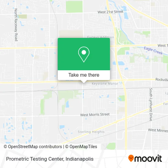
See Prometric Testing Center, Indianapolis City (Balance), on the map
Public Transit to Prometric Testing Center in Indianapolis City (Balance)
Wondering how to get to Prometric Testing Center in Indianapolis City (Balance)? Moovit helps you find the best way to get to Prometric Testing Center with step-by-step directions from the nearest public transit station.
Moovit provides free maps and live directions to help you navigate through your city. View schedules, routes, timetables, and find out how long does it take to get to Prometric Testing Center in real time.
Looking for the nearest stop or station to Prometric Testing Center? Check out this list of stops closest to your destination: Rockville Rd & Girls School Rd.
Bus: 10, 8.
Want to see if there’s another route that gets you there at an earlier time? Moovit helps you find alternative routes or times. Get directions from and directions to Prometric Testing Center easily from the Moovit App or Website.
We make riding to Prometric Testing Center easy, which is why over 1.5 million users, including users in Indianapolis City (Balance), trust Moovit as the best app for public transit. You don’t need to download an individual bus app or train app, Moovit is your all-in-one transit app that helps you find the best bus time or train time available.
For information on prices of bus, costs and ride fares to Prometric Testing Center, please check the Moovit app.
Use the app to navigate to popular places including to the airport, hospital, stadium, grocery store, mall, coffee shop, school, college, and university.
Prometric Testing Center Address: 77 S Girls School Rd street in Indianapolis City (Balance)
- Kerrie Coe,
- Nutrition Plus,
- Appliance Repair Kitchenaide Certified,
- I & M Familystore,
- Anthony's Garage Door,
- Ministerio Internacional Jesucristo es Mi Refugio Indiana,
- Room To Bloom Pre School,
- John Lannan: Allstate Insurance,
- Schultz Michael,
- Penn Millers Insurance,
- Industrial Waste MGT Consulting GRP,
- New Testament Christian Church of Indianapolis,
- Murray Rahvy,
- Abc-Locksmith Locksmith,
- Remington on Rockville,
- Eli Lilly Corporate Center 31 / 5 Queen Mary,
- 15minute-Locksmith,
- 101 Welcome Way Blvd West Dr,
- Primal Wellness,
- Phillip Sternshein Attorney
Places Near Prometric Testing Center (Indianapolis City (Balance))
- I-465 / I-65 Interchange, Indianapolis City (Balance),
- Lilly Corporate Center (Eli Lilly & Co), Indianapolis City (Balance),
- Methodist Hospital of Indianapolis, Indianapolis City (Balance),
- Eskenazi Hospital, Indianapolis City (Balance),
- Indianapolis Motor Speedway, Speedway,
- Train Ride At Castleton Mall, Indianapolis City (Balance),
- Indianapolis Airport Zone 2, Indianapolis City (Balance),
- I U Health Methodist Hospital, Indianapolis City (Balance),
- Gainbridge Fieldhouse, Indianapolis City (Balance),
- Cotter's Massage Parlor With Happy Endings, Indianapolis City (Balance),
- Indiana, Indianapolis City (Balance),
- St. Vincent entrance #1, Indianapolis City (Balance),
- Jersey Barn, Indianapolis City (Balance),
- Indiana Convention Center, Indianapolis City (Balance),
- THE BALT, Indianapolis City (Balance),
- Plainfield, IN, Plainfield,
- St. Vincent Hospital - Indianapolis, Indianapolis City (Balance),
- Lucas Oil Stadium, Indianapolis City (Balance),
- Castleton Square Mall, Indianapolis,
- 119 W 19th St Parking, Indianapolis City (Balance)
How to get to popular places in Indianapolis with public transit
Get around Indianapolis City (Balance) by public transit!
Traveling around Indianapolis City (Balance) has never been so easy. See step by step directions as you travel to any attraction, street or major public transit station. View bus and train schedules, arrival times, service alerts and detailed routes on a map, so you know exactly how to get to anywhere in Indianapolis City (Balance).
When traveling to any destination around Indianapolis City (Balance) use Moovit's Live Directions with Get Off Notifications to know exactly where and how far to walk, how long to wait for your line, and how many stops are left. Moovit will alert you when it's time to get off — no need to constantly re-check whether yours is the next stop.
Wondering how to use public transit in Indianapolis City (Balance) or how to pay for public transit in Indianapolis City (Balance)? Moovit public transit app can help you navigate your way with public transit easily, and at minimum cost. It includes public transit fees, ticket prices, and costs. Looking for a map of Indianapolis City (Balance) public transit lines? Moovit public transit app shows all public transit maps in Indianapolis City (Balance) with all bus routes and stops on an interactive map.
Indianapolis has 1 transit type(s), including: bus, operated by several transit agencies, including IndyGo, FlixBus-us and Greyhound-us