How to get to Promo Tech by bus?
Click on the bus route to see step by step directions with maps, line arrival times and updated time schedules.
From The Funplex, East Hanover
411 minFrom Plainfield, NJ, Plainfield
425 minFrom Lakeland Bus Stop, Parsippany-Troy Hills
509 minFrom Robert Wood Johnson University Hospital, New Brunswick
375 minFrom Parsippany, NJ, Parsippany-Troy Hills
521 minFrom Highland Park, NJ, Highland Park
389 minFrom MMNJ, Parsippany-Troy Hills
270 minFrom Mountain Creek Waterpark, West Milford
421 minFrom Rutgers, New Brunswick
376 min
Bus stops near Promo Tech in New York - New Jersey
Bus lines to Promo Tech in New York - New Jersey
- 95, Summer Loop,VIEW
- 5, Humboldt,VIEW
- 10, Tresckow/Mcadoo,VIEW
- 15, Wilkes Barre,VIEW
- 20, Bmead/Weatherly,VIEW
- 40, Freeland,VIEW
- 50, Ne/Nw Diamond,VIEW
- 70, West Hazleton,VIEW
- 80, Hazle Mktplace,VIEW
- 100, Sunday Loop,VIEW
- 110, Sat Night Loop,VIEW
- FAB10, Williamsport -> New York (P.A.B.T.),VIEW
- FAB11, New York (P.A.B.T.) -> Williamsport,VIEW
- FAB20, Williamsport -> Philadelphia Express,VIEW
- FAB21, Philadelphia Express -> Williamsport,VIEW
- FAB770, Harrisburg -> Scranton,VIEW
- FAB771, Scranton -> Harrisburg,VIEW
What are the closest stations to Promo Tech?
The closest stations to Promo Tech are:
- Diamond Ave and Alter St is 458 yards away, 6 min walk.
- Church Street Station is 686 yards away, 9 min walk.
- Hazleton is 768 yards away, 10 min walk.
Which bus lines stop near Promo Tech?
These bus lines stop near Promo Tech: FAB11, FAB21.
What’s the nearest bus station to Promo Tech in New York - New Jersey?
The nearest bus station to Promo Tech in New York - New Jersey is Diamond Ave and Alter St. It’s a 6 min walk away.
What time is the first bus to Promo Tech in New York - New Jersey?
The 40 is the first bus that goes to Promo Tech in New York - New Jersey. It stops nearby at 5:00 AM.
What time is the last bus to Promo Tech in New York - New Jersey?
The 95 is the last bus that goes to Promo Tech in New York - New Jersey. It stops nearby at 9:22 PM.
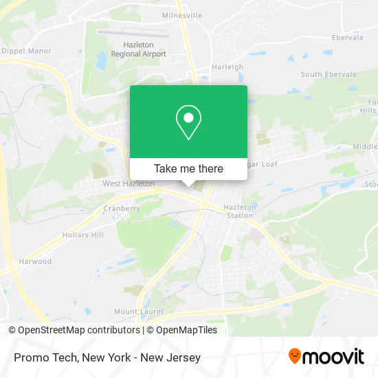
See Promo Tech, New York - New Jersey, on the map
Public Transit to Promo Tech in New York - New Jersey
Wondering how to get to Promo Tech in New York - New Jersey? Moovit helps you find the best way to get to Promo Tech with step-by-step directions from the nearest public transit station.
Moovit provides free maps and live directions to help you navigate through your city. View schedules, routes, timetables, and find out how long does it take to get to Promo Tech in real time.
Looking for the nearest stop or station to Promo Tech? Check out this list of stops closest to your destination: Diamond Ave and Alter St; Church Street Station; Hazleton.
Bus: FAB11, FAB21, 95, 5, 10, 15, 20, 40, FAB10, FAB20, FAB770.
Want to see if there’s another route that gets you there at an earlier time? Moovit helps you find alternative routes or times. Get directions from and directions to Promo Tech easily from the Moovit App or Website.
We make riding to Promo Tech easy, which is why over 1.5 million users, including users in New York - New Jersey, trust Moovit as the best app for public transit. You don’t need to download an individual bus app or train app, Moovit is your all-in-one transit app that helps you find the best bus time or train time available.
For information on prices of bus and train, costs and ride fares to Promo Tech, please check the Moovit app.
Use the app to navigate to popular places including to the airport, hospital, stadium, grocery store, mall, coffee shop, school, college, and university.
Promo Tech Address: 428 W Maple St Hazleton, PA 18201 street in New York - New Jersey
- Techniclean Air Systems,
- Automobile Shop,
- Zamudio's Mexico Tacos,
- East Joel G Rev,
- Zion Church,
- Autobahn Collision Experts,
- Community Bible Fellowship,
- Community Bible Fellowship Church,
- Turnbach Funeral Home,
- American Property Abstract,
- Ogurkis Law,
- A&A Auto Store #17,
- Downtown Hazleton, Pa,
- Deco Curtains,
- Gerald E Williams Dmd,
- Hazleton Moms,
- Wow Cafe & Lounge,
- Station 33 Tropical,
- Western Union,
- Veronica's Travel
Places Near Promo Tech (New York - New Jersey)
- Wall Street, Manhattan,
- Bellevue Hospital, Manhattan,
- Rockefeller Center, Manhattan,
- Katz's Deli, Manhattan,
- 66 John Street, Manhattan,
- Pier 83, Manhattan,
- SoHo, Manhattan,
- 911 Memorial, Manhattan,
- Mountainside Hospital, Glen Ridge,
- qqqq, Manhattan,
- Chinatown, Manhattan,
- Hudson Yards, Manhattan,
- 376 Hudson Street, Manhattan,
- 3 Stone St, Manhattan,
- 1 Police Plaza, Manhattan,
- 26 Federal Plaza, Manhattan,
- San Gennaro Feast, Manhattan,
- Times Square, Manhattan,
- Queens Center Mall, Queens,
- 111 Centre New York City Supreme Court, Manhattan
How to get to popular places in New York - New Jersey with public transit
Get around New York - New Jersey by public transit!
Traveling around New York - New Jersey has never been so easy. See step by step directions as you travel to any attraction, street or major public transit station. View bus and train schedules, arrival times, service alerts and detailed routes on a map, so you know exactly how to get to anywhere in New York - New Jersey.
When traveling to any destination around New York - New Jersey use Moovit's Live Directions with Get Off Notifications to know exactly where and how far to walk, how long to wait for your line, and how many stops are left. Moovit will alert you when it's time to get off — no need to constantly re-check whether yours is the next stop.
Wondering how to use public transit in New York - New Jersey or how to pay for public transit in New York - New Jersey? Moovit public transit app can help you navigate your way with public transit easily, and at minimum cost. It includes public transit fees, ticket prices, and costs. Looking for a map of New York - New Jersey public transit lines? Moovit public transit app shows all public transit maps in New York - New Jersey with all Bus, Train, Subway, Light Rail, Ferry and Cable Car routes and stops on an interactive map.
New York - New Jersey has 6 transit type(s), including: Bus, Train, Subway, Light Rail, Ferry and Cable Car, operated by several transit agencies, including MTA Subway, Metro-North Railroad, LIRR, PATH, MTA New York City Transit - Express routes, MTA Bus, NJ Transit, NYC Ferry, NICE bus, Bee-Line Bus, NJ Transit Rail, Norwalk Transit District, Hartford Line, River Valley Transit and HART