How to get to Proretail 2.0 by bus?
Click on the bus route to see step by step directions with maps, line arrival times and updated time schedules.
From Montecatini, Montecatini-Terme
45 minFrom Data Medica, Montecatini-Terme
38 minFrom Montecatini Center, Montecatini-Terme
39 minFrom Montecatini Center Station, Montecatini-Terme
39 minFrom Montecatini Terme, Montecatini-Terme
41 minFrom Florence - Italy, Montecatini-Terme
43 minFrom Pescia Railway Station, Pescia
79 minFrom Uzzano, Uzzano
72 minFrom Pescia Hospital, Pescia
94 minFrom Bingo, Montecatini-Terme
43 min
How to get to Proretail 2.0 by train?
Click on the train route to see step by step directions with maps, line arrival times and updated time schedules.
From Montecatini, Montecatini-Terme
55 minFrom Data Medica, Montecatini-Terme
48 minFrom Montecatini Center, Montecatini-Terme
47 minFrom Montecatini Center Station, Montecatini-Terme
49 minFrom Montecatini Terme, Montecatini-Terme
50 minFrom Florence - Italy, Montecatini-Terme
53 minFrom Pescia Railway Station, Pescia
25 minFrom Uzzano, Uzzano
67 minFrom Bingo, Montecatini-Terme
63 min
Bus stops near Proretail 2.0 in Altopascio
Train station near Proretail 2.0 in Altopascio
- Altopascio, 16 min walk,VIEW
Bus lines to Proretail 2.0 in Altopascio
What are the closest stations to Proretail 2.0?
The closest stations to Proretail 2.0 are:
- Altopascio Benedetto Croce Square is 503 meters away, 7 min walk.
- Via Gavinana Gas Station is 572 meters away, 8 min walk.
- Altopascio is 1084 meters away, 14 min walk.
Which bus line stops near Proretail 2.0?
851 (Altopascio Piazza B. Croce)
Which train line stops near Proretail 2.0?
R (Pistoia/Pisa)
What’s the nearest train station to Proretail 2.0 in Altopascio?
The nearest train station to Proretail 2.0 in Altopascio is Altopascio. It’s a 16 min walk away.
What’s the nearest bus station to Proretail 2.0 in Altopascio?
The nearest bus station to Proretail 2.0 in Altopascio is Altopascio Benedetto Croce Square. It’s a 7 min walk away.
What time is the first train to Proretail 2.0 in Altopascio?
The R is the first train that goes to Proretail 2.0 in Altopascio. It stops nearby at 7:10 AM.
What time is the last train to Proretail 2.0 in Altopascio?
The R is the last train that goes to Proretail 2.0 in Altopascio. It stops nearby at 11:16 PM.
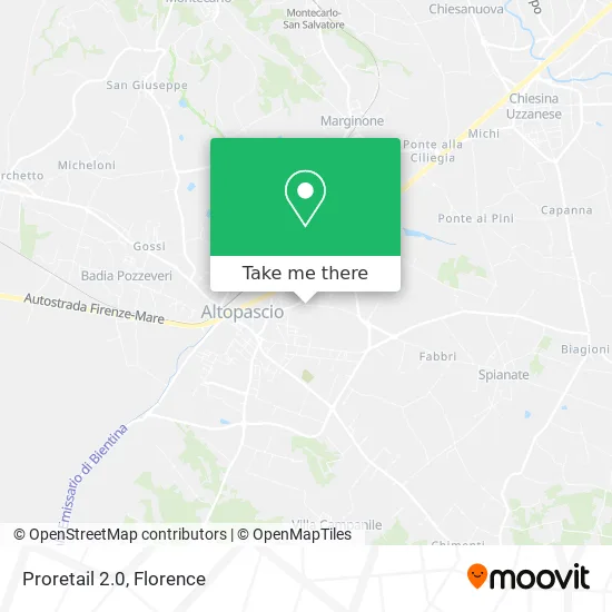
See Proretail 2.0, Altopascio, on the map
Public Transit to Proretail 2.0 in Altopascio
Wondering how to get to Proretail 2.0 in Altopascio? Moovit helps you find the best way to get to Proretail 2.0 with step-by-step directions from the nearest public transit station.
Moovit provides free maps and live directions to help you navigate through your city. View schedules, routes, timetables, and find out how long does it take to get to Proretail 2.0 in real time.
Looking for the nearest stop or station to Proretail 2.0? Check out this list of stops closest to your destination: Altopascio Benedetto Croce Square; Via Gavinana Gas Station; Altopascio.
Bus: 851, 20, E8, E8, E20, E20, E70, E7.Train: R.
Want to see if there’s another route that gets you there at an earlier time? Moovit helps you find alternative routes or times. Get directions from and directions to Proretail 2.0 easily from the Moovit App or Website.
We make riding to Proretail 2.0 easy, which is why over 1.5 million users, including users in Altopascio, trust Moovit as the best app for public transit. You don’t need to download an individual bus app or train app, Moovit is your all-in-one transit app that helps you find the best bus time or train time available.
For information on prices of train and bus, costs and ride fares to Proretail 2.0, please check the Moovit app.
Use the app to navigate to popular places including to the airport, hospital, stadium, grocery store, mall, coffee shop, school, college, and university.
Proretail 2.0 Address: Via del Palazzaccio, 63 55011 Altopascio street in Altopascio
- Potenti Real Estate,
- Mouse Sas by Camara Marlene,
- Cgt Logistica Sistemi SpA in Abbreviated Form Cls,
- It. Resources,
- Tc House by Hu Zhiting,
- Via delle Cerbaie Civ.26,
- Gd,
- Stock and Store,
- Corriere Jolly Transports by Bartolozzi Valerio and C.,
- Serban,
- Le Cerbaie,
- Og. .,
- Anfora Training Center,
- Giannino Distribution,
- Tigota',
- Hong Stamping by Qu Dan & C.,
- All in Night Club,
- Ci & Di Food,
- Candre Bijoux & Watch,
- Giuliana Guidi
Places Near Proretail 2.0 (Altopascio)
- Santa Maria Novella Station, Florence,
- Tobacco Manufacture, Florence,
- Mandela Forum (Nelson Mandela Forum), Florence,
- Michelangelo Square, Florence,
- Piero Palagi Hospital Facility-Florence, Florence,
- Nelson Mandela Forum, Florence,
- Viola Park, Bagno a Ripoli,
- Michelangelo Square, Florence,
- Torregalli Hospital Scandicci *, Scandicci,
- Santa Maria Nuova Hospital, Florence,
- I Gigli, Campi Bisenzio,
- OOO, Florence,
- IKEA Florence, Sesto Fiorentino,
- Verdi Theater, Florence,
- Cascine Park, Florence,
- Campi Bisenzio, Campi Bisenzio,
- Field of Mars, Florence,
- Artemio Franchi Municipal Stadium, Florence,
- Asmana, Campi Bisenzio,
- Wanny Palace, Florence
How to get to popular places in Florence with public transit
Get around Altopascio by public transit!
Traveling around Altopascio has never been so easy. See step by step directions as you travel to any attraction, street or major public transit station. View bus and train schedules, arrival times, service alerts and detailed routes on a map, so you know exactly how to get to anywhere in Altopascio.
When traveling to any destination around Altopascio use Moovit's Live Directions with Get Off Notifications to know exactly where and how far to walk, how long to wait for your line, and how many stops are left. Moovit will alert you when it's time to get off — no need to constantly re-check whether yours is the next stop.
Wondering how to use public transit in Altopascio or how to pay for public transit in Altopascio? Moovit public transit app can help you navigate your way with public transit easily, and at minimum cost. It includes public transit fees, ticket prices, and costs. Looking for a map of Altopascio public transit lines? Moovit public transit app shows all public transit maps in Altopascio with all Bus, Train, Light Rail, Ferry and Funicular routes and stops on an interactive map.
Florence has 5 transit type(s), including: Bus, Train, Light Rail, Ferry and Funicular, operated by several transit agencies, including Florence Urban - Tuscan Bus Lines, GEST, Livorno and Province - Tuscan Bus Lines, Arezzo, Florence and Provinces - Tuscan Bus Lines, Prato and Province - Tuscan Bus Lines, Lucca and Province - Tuscan Bus Lines, Massa, Carrara and Province - Tuscan Bus Lines, Pisa and Province - Tuscan Bus Lines, Grosseto, Siena and Provinces - Tuscan Bus Lines, Arezzo, Siena and Provinces - Tuscan Bus Lines, Florence and Province - Tuscan Bus Lines, Pistoia and Province - Tuscan Bus Lines, Siena and Province - Tuscan Bus Lines, Arezzo and Province - Tuscan Bus Lines and Trenitalia