How to get to Proscan Imaging by bus?
Click on the bus route to see step by step directions with maps, line arrival times and updated time schedules.
Bus stop near Proscan Imaging in Bonita Springs
- Tamiami Trl @ Pelicn Colny Blvd-Sb, 11 min walk,VIEW
Bus lines to Proscan Imaging in Bonita Springs
- 600, Coconut Pt. Mall - Plaza Del Lago @ Mediterranean,VIEW
What are the closest stations to Proscan Imaging?
The closest stations to Proscan Imaging are:
- Tamiami Trl @ Pelicn Colny Blvd-Sb is 844 yards away, 11 min walk.
Which bus lines stop near Proscan Imaging?
These bus lines stop near Proscan Imaging: 240, 600.
What’s the nearest bus station to Proscan Imaging in Bonita Springs?
The nearest bus station to Proscan Imaging in Bonita Springs is Tamiami Trl @ Pelicn Colny Blvd-Sb. It’s a 11 min walk away.
What time is the first bus to Proscan Imaging in Bonita Springs?
The 600 is the first bus that goes to Proscan Imaging in Bonita Springs. It stops nearby at 5:49 AM.
What time is the last bus to Proscan Imaging in Bonita Springs?
The 600 is the last bus that goes to Proscan Imaging in Bonita Springs. It stops nearby at 9:16 PM.
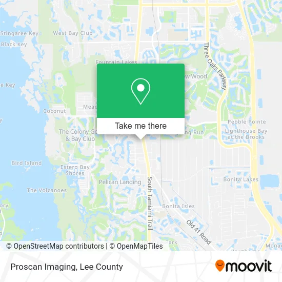
See Proscan Imaging, Bonita Springs, on the map
Public Transit to Proscan Imaging in Bonita Springs
Wondering how to get to Proscan Imaging in Bonita Springs? Moovit helps you find the best way to get to Proscan Imaging with step-by-step directions from the nearest public transit station.
Moovit provides free maps and live directions to help you navigate through your city. View schedules, routes, timetables, and find out how long does it take to get to Proscan Imaging in real time.
Looking for the nearest stop or station to Proscan Imaging? Check out this list of stops closest to your destination: Tamiami Trl @ Pelicn Colny Blvd-Sb.
Bus: 240, 600.
Want to see if there’s another route that gets you there at an earlier time? Moovit helps you find alternative routes or times. Get directions from and directions to Proscan Imaging easily from the Moovit App or Website.
We make riding to Proscan Imaging easy, which is why over 1.5 million users, including users in Bonita Springs, trust Moovit as the best app for public transit. You don’t need to download an individual bus app or train app, Moovit is your all-in-one transit app that helps you find the best bus time or train time available.
For information on prices of bus, costs and ride fares to Proscan Imaging, please check the Moovit app.
Use the app to navigate to popular places including to the airport, hospital, stadium, grocery store, mall, coffee shop, school, college, and university.
Proscan Imaging Address: 24040 S Tamiami Trl Bonita Springs, FL 34134 street in Bonita Springs
- PGP Title,
- Rinaldi Wealth Management,
- Pulte Homes,
- BMC Chefs,
- Bella Bistro,
- Sunbelt Title,
- Katrena Meyers,
- Dga Auto,
- Preserve at Corkscrew Homes,
- Adt,
- Oley Kinser Concierge Wealth, LLC,
- Neptune Bay at Tarpon Bay Condominium Associatio,
- Gulf Coast Cardiothoracic,
- Primerica,
- Colony Sales & Information Center,
- Westlinks Business Park Property Owners Associat,
- Carl Rafey, DC,
- Alemar Salon Bonita Springs,
- Future Floorz and Remodeling,
- Blink Charging
Places Near Proscan Imaging (Bonita Springs)
- Miromar Outlets, Estero,
- Amazon Warehouse Rsw5,
- Ft Myers Airport RSW,
- Flixbus, Fort Myers,
- Seminole Casino Hotel Immokalee,
- Pelican Landing Beach Shuttle, Bonita Springs,
- Rosa Parks Transportation Center, Fort Myers,
- US-41, Fort Myers,
- I-75 & MLK (Exit 138), Fort Myers,
- Edison Mall, Fort Myers,
- I-75 & Colonial (Exit 136), Fort Myers,
- U.S.-41 / Colonial Blvd. Intersection, Fort Myers,
- Walmart Supercenter, Fort Myers,
- Bonita Springs, FL, Bonita Springs,
- Lehigh Acres, FL, Lehigh Acres,
- Lee County Tax Collector, Cape Coral,
- All About U Naples Escorts, Pine Ridge,
- Bonita Beach, Bonita Springs,
- Bonita Bay Private Beach Club, Bonita Springs,
- Matlacha Nude Beach, Matlacha Isles-Matlacha Shores
How to get to popular places in Lee County with public transit
Get around Bonita Springs by public transit!
Traveling around Bonita Springs has never been so easy. See step by step directions as you travel to any attraction, street or major public transit station. View bus and train schedules, arrival times, service alerts and detailed routes on a map, so you know exactly how to get to anywhere in Bonita Springs.
When traveling to any destination around Bonita Springs use Moovit's Live Directions with Get Off Notifications to know exactly where and how far to walk, how long to wait for your line, and how many stops are left. Moovit will alert you when it's time to get off — no need to constantly re-check whether yours is the next stop.
Wondering how to use public transit in Bonita Springs or how to pay for public transit in Bonita Springs? Moovit public transit app can help you navigate your way with public transit easily, and at minimum cost. It includes public transit fees, ticket prices, and costs. Looking for a map of Bonita Springs public transit lines? Moovit public transit app shows all public transit maps in Bonita Springs with all bus routes and stops on an interactive map.
Lee County has 1 transit type(s), including: bus, operated by several transit agencies, including LeeTran, CAT and FlixBus-us