Directions to Protect All Insurance (Indianapolis City (Balance)) with public transportation
The following transit lines have routes that pass near Protect All Insurance
 Bus: 16.
How to get to Protect All Insurance by bus?
Click on the bus route to see step by step directions with maps, line arrival times and updated time schedules.
From Hair We Go 3, Greenwood
66 minFrom Lilly Corporate Center Bldg 88, Indianapolis City (Balance)
54 minFrom St. Mary of the Woods college, Indianapolis City (Balance)
48 minFrom Southport High School's Baseball Field, Indianapolis City (Balance)
72 minFrom Indy Go Gas, Indianapolis City (Balance)
46 minFrom Green Men Restoration, Indianapolis City (Balance)
57 minFrom Elanco Animal Health, Indianapolis City (Balance)
49 minFrom Irvington Plaza, Indianapolis City (Balance)
70 min
Bus stop near Protect All Insurance in Indianapolis City (Balance)
- Emerson Ave & Shelbyville Rd, 7 min walk,VIEW
Bus lines to Protect All Insurance in Indianapolis City (Balance)
- 16, County Line Rd,VIEW
What are the closest stations to Protect All Insurance?
The closest stations to Protect All Insurance are:
- Emerson Ave & Shelbyville Rd is 557 yards away, 7 min walk.
Which bus line stops near Protect All Insurance?
16 (County Line Rd)
What’s the nearest bus station to Protect All Insurance in Indianapolis City (Balance)?
The nearest bus station to Protect All Insurance in Indianapolis City (Balance) is Emerson Ave & Shelbyville Rd. It’s a 7 min walk away.
What time is the first bus to Protect All Insurance in Indianapolis City (Balance)?
The 16 is the first bus that goes to Protect All Insurance in Indianapolis City (Balance). It stops nearby at 4:58 AM.
What time is the last bus to Protect All Insurance in Indianapolis City (Balance)?
The 16 is the last bus that goes to Protect All Insurance in Indianapolis City (Balance). It stops nearby at 10:07 PM.
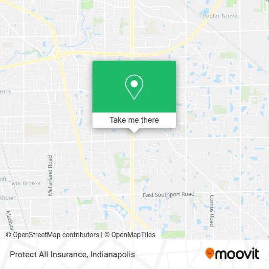
See Protect All Insurance, Indianapolis City (Balance), on the map
Public Transit to Protect All Insurance in Indianapolis City (Balance)
Wondering how to get to Protect All Insurance in Indianapolis City (Balance)? Moovit helps you find the best way to get to Protect All Insurance with step-by-step directions from the nearest public transit station.
Moovit provides free maps and live directions to help you navigate through your city. View schedules, routes, timetables, and find out how long does it take to get to Protect All Insurance in real time.
Looking for the nearest stop or station to Protect All Insurance? Check out this list of stops closest to your destination: Emerson Ave & Shelbyville Rd.
Bus: 16.
Want to see if there’s another route that gets you there at an earlier time? Moovit helps you find alternative routes or times. Get directions from and directions to Protect All Insurance easily from the Moovit App or Website.
We make riding to Protect All Insurance easy, which is why over 1.5 million users, including users in Indianapolis City (Balance), trust Moovit as the best app for public transit. You don’t need to download an individual bus app or train app, Moovit is your all-in-one transit app that helps you find the best bus time or train time available.
For information on prices of bus, costs and ride fares to Protect All Insurance, please check the Moovit app.
Use the app to navigate to popular places including to the airport, hospital, stadium, grocery store, mall, coffee shop, school, college, and university.
Protect All Insurance Address: 5905 S Emerson Ave street in Indianapolis City (Balance)
- Arch Advantage Foot & Ankle Center,
- Jody Workman American Family Insurance,
- Humphrey Cpa Group, Llc,
- Boulder Ridge Professional Center,
- Ready And Willing 2 Help Healthcare Llc,
- Be Our Guest Vacations,
- Leo's Market and Eatery,
- Marathon,
- Cassidy Locksmith,
- Burton Crossing,
- Cvs Pharmacy,
- Cvs Beauty,
- Atm Cvs,
- Iron Stride Stables,
- The Kennel at Arbor Lane,
- Herringa, Ed,
- Biofeedback Health Solutions, LLC,
- Point Of Hope Apostolic Church,
- Moral Cleaning Llc,
- Match House Realty
Places Near Protect All Insurance (Indianapolis City (Balance))
- 119 W 19th St Parking, Indianapolis City (Balance),
- Lucas Oil Stadium, Indianapolis City (Balance),
- Jersey Barn, Indianapolis City (Balance),
- Lilly Corporate Center (Eli Lilly & Co), Indianapolis City (Balance),
- Plainfield, IN, Plainfield,
- I U Health Methodist Hospital, Indianapolis City (Balance),
- Castleton Square Mall, Indianapolis,
- Train Ride At Castleton Mall, Indianapolis City (Balance),
- THE BALT, Indianapolis City (Balance),
- I-465 / I-65 Interchange, Indianapolis City (Balance),
- Indianapolis Motor Speedway, Speedway,
- Cotter's Massage Parlor With Happy Endings, Indianapolis City (Balance),
- St. Vincent Hospital - Indianapolis, Indianapolis City (Balance),
- St. Vincent entrance #1, Indianapolis City (Balance),
- Indiana Convention Center, Indianapolis City (Balance),
- Gainbridge Fieldhouse, Indianapolis City (Balance),
- Methodist Hospital of Indianapolis, Indianapolis City (Balance),
- Indiana, Indianapolis City (Balance),
- Eskenazi Hospital, Indianapolis City (Balance),
- Indianapolis Airport Zone 2, Indianapolis City (Balance)
How to get to popular places in Indianapolis with public transit
Get around Indianapolis City (Balance) by public transit!
Traveling around Indianapolis City (Balance) has never been so easy. See step by step directions as you travel to any attraction, street or major public transit station. View bus and train schedules, arrival times, service alerts and detailed routes on a map, so you know exactly how to get to anywhere in Indianapolis City (Balance).
When traveling to any destination around Indianapolis City (Balance) use Moovit's Live Directions with Get Off Notifications to know exactly where and how far to walk, how long to wait for your line, and how many stops are left. Moovit will alert you when it's time to get off — no need to constantly re-check whether yours is the next stop.
Wondering how to use public transit in Indianapolis City (Balance) or how to pay for public transit in Indianapolis City (Balance)? Moovit public transit app can help you navigate your way with public transit easily, and at minimum cost. It includes public transit fees, ticket prices, and costs. Looking for a map of Indianapolis City (Balance) public transit lines? Moovit public transit app shows all public transit maps in Indianapolis City (Balance) with all bus routes and stops on an interactive map.
Indianapolis has 1 transit type(s), including: bus, operated by several transit agencies, including IndyGo, FlixBus-us and Greyhound-us