Directions to Protel Wireless (Indianapolis City (Balance)) with public transportation
The following transit lines have routes that pass near Protel Wireless
 Bus: 82.
How to get to Protel Wireless by bus?
Click on the bus route to see step by step directions with maps, line arrival times and updated time schedules.
From Radioshack, Lawrence
137 minFrom Target (Target Store Nora-Plaza), Indianapolis City (Balance)
31 minFrom 38th North Dr / N Hawthorne Ln, Indianapolis City (Balance)
53 minFrom Eclipse Real Estate, Indianapolis City (Balance)
41 minFrom Carvel Club, Indianapolis City (Balance)
72 minFrom In-N-Out Burger (innout), Indianapolis City (Balance)
94 minFrom Avondale Meadows YMCA, Indianapolis City (Balance)
53 minFrom Kamran and Company, Indianapolis City (Balance)
91 minFrom Social Security, Indianapolis City (Balance)
83 minFrom Pendleton Pike, Exit 42, Indianapolis City (Balance)
74 min
Bus stop near Protel Wireless in Indianapolis City (Balance)
- Perimeter Rd & Knue Rd - Olive Garden, 7 min walk,VIEW
Bus lines to Protel Wireless in Indianapolis City (Balance)
- 82, Community Hosp North,VIEW
What are the closest stations to Protel Wireless?
The closest stations to Protel Wireless are:
- Perimeter Rd & Knue Rd - Olive Garden is 444 yards away, 7 min walk.
Which bus line stops near Protel Wireless?
82 (Glendale Town Center)
What’s the nearest bus station to Protel Wireless in Indianapolis City (Balance)?
The nearest bus station to Protel Wireless in Indianapolis City (Balance) is Perimeter Rd & Knue Rd - Olive Garden. It’s a 7 min walk away.
What time is the first bus to Protel Wireless in Indianapolis City (Balance)?
The 82 is the first bus that goes to Protel Wireless in Indianapolis City (Balance). It stops nearby at 5:02 AM.
What time is the last bus to Protel Wireless in Indianapolis City (Balance)?
The 82 is the last bus that goes to Protel Wireless in Indianapolis City (Balance). It stops nearby at 10:41 PM.
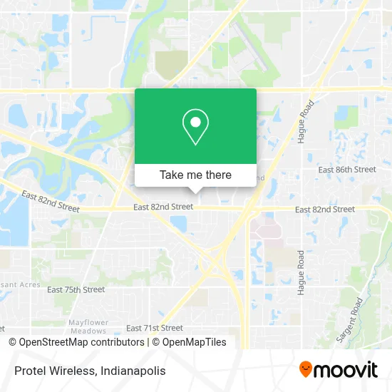
See Protel Wireless, Indianapolis City (Balance), on the map
Public Transit to Protel Wireless in Indianapolis City (Balance)
Wondering how to get to Protel Wireless in Indianapolis City (Balance)? Moovit helps you find the best way to get to Protel Wireless with step-by-step directions from the nearest public transit station.
Moovit provides free maps and live directions to help you navigate through your city. View schedules, routes, timetables, and find out how long does it take to get to Protel Wireless in real time.
Looking for the nearest stop or station to Protel Wireless? Check out this list of stops closest to your destination: Perimeter Rd & Knue Rd - Olive Garden.
Bus: 82.
Want to see if there’s another route that gets you there at an earlier time? Moovit helps you find alternative routes or times. Get directions from and directions to Protel Wireless easily from the Moovit App or Website.
We make riding to Protel Wireless easy, which is why over 1.5 million users, including users in Indianapolis City (Balance), trust Moovit as the best app for public transit. You don’t need to download an individual bus app or train app, Moovit is your all-in-one transit app that helps you find the best bus time or train time available.
For information on prices of bus, costs and ride fares to Protel Wireless, please check the Moovit app.
Use the app to navigate to popular places including to the airport, hospital, stadium, grocery store, mall, coffee shop, school, college, and university.
Protel Wireless Address: 6396 E 82nd St street in Indianapolis City (Balance)
- Indy's Finest - West Coast Swing Dance,
- Estereo Nightclub,
- Patel Brothers,
- Harmony,
- Viet Hua Food Market越华,
- Just Vapor,
- Mystic Images Tattoo,
- Kay's Beauty College Come Start Your Career Today,
- Relax Massage Of Castleton,
- Ragnarok Axe Throwing Llc,
- The Dr Of Barbering Llc,
- Chuancai Fang,
- Tantrum Indianapolis,
- Eleis Estetica Unisex,
- Umi Sushi And Seafood Buffet,
- Weekends Only Furniture & Mattress — Castleton,
- Air Force Recruiting Office,
- The Burger Den,
- Mama Saaj And Gyro,
- Banda Burrito
Places Near Protel Wireless (Indianapolis City (Balance))
- Jersey Barn, Indianapolis City (Balance),
- I-465 / I-65 Interchange, Indianapolis City (Balance),
- Gainbridge Fieldhouse, Indianapolis City (Balance),
- Lilly Corporate Center (Eli Lilly & Co), Indianapolis City (Balance),
- Eskenazi Hospital, Indianapolis City (Balance),
- Plainfield, IN, Plainfield,
- Train Ride At Castleton Mall, Indianapolis City (Balance),
- Indianapolis Motor Speedway, Speedway,
- Castleton Square Mall, Indianapolis,
- THE BALT, Indianapolis City (Balance),
- Lucas Oil Stadium, Indianapolis City (Balance),
- I U Health Methodist Hospital, Indianapolis City (Balance),
- Indiana Convention Center, Indianapolis City (Balance),
- Methodist Hospital of Indianapolis, Indianapolis City (Balance),
- 119 W 19th St Parking, Indianapolis City (Balance),
- Indianapolis Airport Zone 2, Indianapolis City (Balance),
- St. Vincent Hospital - Indianapolis, Indianapolis City (Balance),
- St. Vincent entrance #1, Indianapolis City (Balance),
- Cotter's Massage Parlor With Happy Endings, Indianapolis City (Balance),
- Indiana, Indianapolis City (Balance)
How to get to popular places in Indianapolis with public transit
Get around Indianapolis City (Balance) by public transit!
Traveling around Indianapolis City (Balance) has never been so easy. See step by step directions as you travel to any attraction, street or major public transit station. View bus and train schedules, arrival times, service alerts and detailed routes on a map, so you know exactly how to get to anywhere in Indianapolis City (Balance).
When traveling to any destination around Indianapolis City (Balance) use Moovit's Live Directions with Get Off Notifications to know exactly where and how far to walk, how long to wait for your line, and how many stops are left. Moovit will alert you when it's time to get off — no need to constantly re-check whether yours is the next stop.
Wondering how to use public transit in Indianapolis City (Balance) or how to pay for public transit in Indianapolis City (Balance)? Moovit public transit app can help you navigate your way with public transit easily, and at minimum cost. It includes public transit fees, ticket prices, and costs. Looking for a map of Indianapolis City (Balance) public transit lines? Moovit public transit app shows all public transit maps in Indianapolis City (Balance) with all bus routes and stops on an interactive map.
Indianapolis has 1 transit type(s), including: bus, operated by several transit agencies, including IndyGo, FlixBus-us and Greyhound-us