Provincie/Valerio Massimo stop - Thursday schedule
| Line | Direction | Time |
|---|---|---|
| NMB | Rebibbia (Metro B) | 3:12 AM |
| NMB | Rebibbia (Metro B) | 3:12 AM |
| NMB | Rebibbia (Metro B) | 3:31 AM |
| NMB | Rebibbia (Metro B) | 3:31 AM |
| NMB | Rebibbia (Metro B) | 3:50 AM |
| NMB | Rebibbia (Metro B) | 3:50 AM |
| NMB | Rebibbia (Metro B) | 4:09 AM |
| NMB | Rebibbia (Metro B) | 4:09 AM |
| NMB | Rebibbia (Metro B) | 4:29 AM |
| NMB | Rebibbia (Metro B) | 4:29 AM |
| NMB | Rebibbia (Metro B) | 4:48 AM |
| NMB | Rebibbia (Metro B) | 4:48 AM |
| 542 | Verano | 5:04 AM |
| NMB | Rebibbia (Metro B) | 5:07 AM |
| NMB | Rebibbia (Metro B) | 5:07 AM |
| 542 | Verano | 5:22 AM |
| 649 | Tiburtina Station (Metro B) | 5:22 AM |
| NMB | Rebibbia (Metro B) | 5:26 AM |
| NMB | Rebibbia (Metro B) | 5:26 AM |
| 542 | Verano | 5:31 AM |
| 542 | Verano | 5:40 AM |
| NMB | Rebibbia (Metro B) | 5:45 AM |
| NMB | Rebibbia (Metro B) | 5:45 AM |
| 649 | Tiburtina Station (Metro B) | 5:47 AM |
| 542 | Verano | 5:50 AM |
Directions to Provincie/Valerio Massimo stop (Roma) with public transit
The following transit lines have routes that pass near Provincie/Valerio Massimo
 Bus: 120F, 310, 490, 495, 542.
- Train: FL1, FL3, RV.
- Metro: B.
How to get to Provincie/Valerio Massimo stop by bus?
Click on the bus route to see step by step directions with maps, line arrival times and updated time schedules.
How to get to Provincie/Valerio Massimo stop by train?
Click on the train route to see step by step directions with maps, line arrival times and updated time schedules.
How to get to Provincie/Valerio Massimo stop by metro?
Click on the metro route to see step by step directions with maps, line arrival times and updated time schedules.
Bus stops near Provincie/Valerio Massimo stop in Roma
- Provincie/Valerio Massimo, 2 min walk,
- Tiburtina/Valerio Massimo, 3 min walk,
- Provinces, 3 min walk,
- Ippocrate/Provincie, 4 min walk,
- Lega Lombarda/Provincie, 4 min walk,
- Sapienza University, 9 min walk,
Light Rail stations near Provincie/Valerio Massimo station in Roma
- Verano, 8 min walk,
Bus lines to Provincie/Valerio Massimo stop in Roma
- 542, Piazza Delle Camelie,
- 71, Tiburtina Station (Metro B),
- 163, Verano,
- 545, St. Luke the Evangelist,
- 448, Balsamo Crivelli,
- 492, Cipro Metro Station (Line A),
- NMB, Sostitutiva MB | Laurentina (MB) - Rebibbia (MB),
- C3, Tiburtina (MB-FS) - Cimitero Flaminio,
- P10, Ateneo Salesiano - Rimessa Portonaccio,
- P20, Termini (MA-MB-FS) - Rimessa Portonaccio,
- 120F, Flamino (MA) - San Basilio,
- 490, Tiburtina (MB-Station) - Cornelia (MA),
- 495, Tiburtina (MB-FS) - Valle Aurelia (MA),
- 649, Tiburtina (MB-FS) - Termini (MA-MB-FS) - P.za Zama,
- 310, Termini (Metro A-Metro B-Railway),
- P02, Repubblica (Metro A),
- N3S, Ostiense Square-Pyramid (Metro-Rail),
- 88, Verano,
- N3D, Piazzale Ostiense-Piramide (Metro B-Rail Line),
What are the closest stations to Provincie/Valerio Massimo?
The closest stations to Provincie/Valerio Massimo are:
- Provincie/Valerio Massimo stop is 134 meters away, 2 min walk.
- Tiburtina/Valerio Massimo stop is 164 meters away, 3 min walk.
- Provinces stop is 200 meters away, 3 min walk.
- Ippocrate/Provincie stop is 290 meters away, 4 min walk.
- Lega Lombarda/Provincie stop is 300 meters away, 4 min walk.
- Verano station is 584 meters away, 8 min walk.
- Sapienza University stop is 700 meters away, 9 min walk.
Which bus lines stop near Provincie/Valerio Massimo?
These bus lines stop near Provincie/Valerio Massimo: 120F, 310, 490, 495, 542, 649.
Which train lines stop near Provincie/Valerio Massimo?
These train lines stop near Provincie/Valerio Massimo: FL1, FL3, RV.
Which metro line stops near Provincie/Valerio Massimo?
B (Rebibbia/Jonio)
What’s the nearest light rail station to Provincie/Valerio Massimo in Roma?
The nearest light rail station to Provincie/Valerio Massimo in Roma is Verano. It’s a 8 min walk away.
What’s the nearest bus station to Provincie/Valerio Massimo in Roma?
The nearest bus station to Provincie/Valerio Massimo in Roma is Provincie/Valerio Massimo. It’s a 2 min walk away.
What time is the first light rail to Provincie/Valerio Massimo in Roma?
The 2 is the first light rail that goes to Provincie/Valerio Massimo in Roma. It stops nearby at 4:46 AM.
What time is the last light rail to Provincie/Valerio Massimo in Roma?
The 3 is the last light rail that goes to Provincie/Valerio Massimo in Roma. It stops nearby at 2:01 AM.
What time is the first bus to Provincie/Valerio Massimo in Roma?
The NMB is the first bus that goes to Provincie/Valerio Massimo in Roma. It stops nearby at 3:06 AM.
What time is the last bus to Provincie/Valerio Massimo in Roma?
The NMB is the last bus that goes to Provincie/Valerio Massimo in Roma. It stops nearby at 3:32 AM.
Provincie/Valerio Massimo station
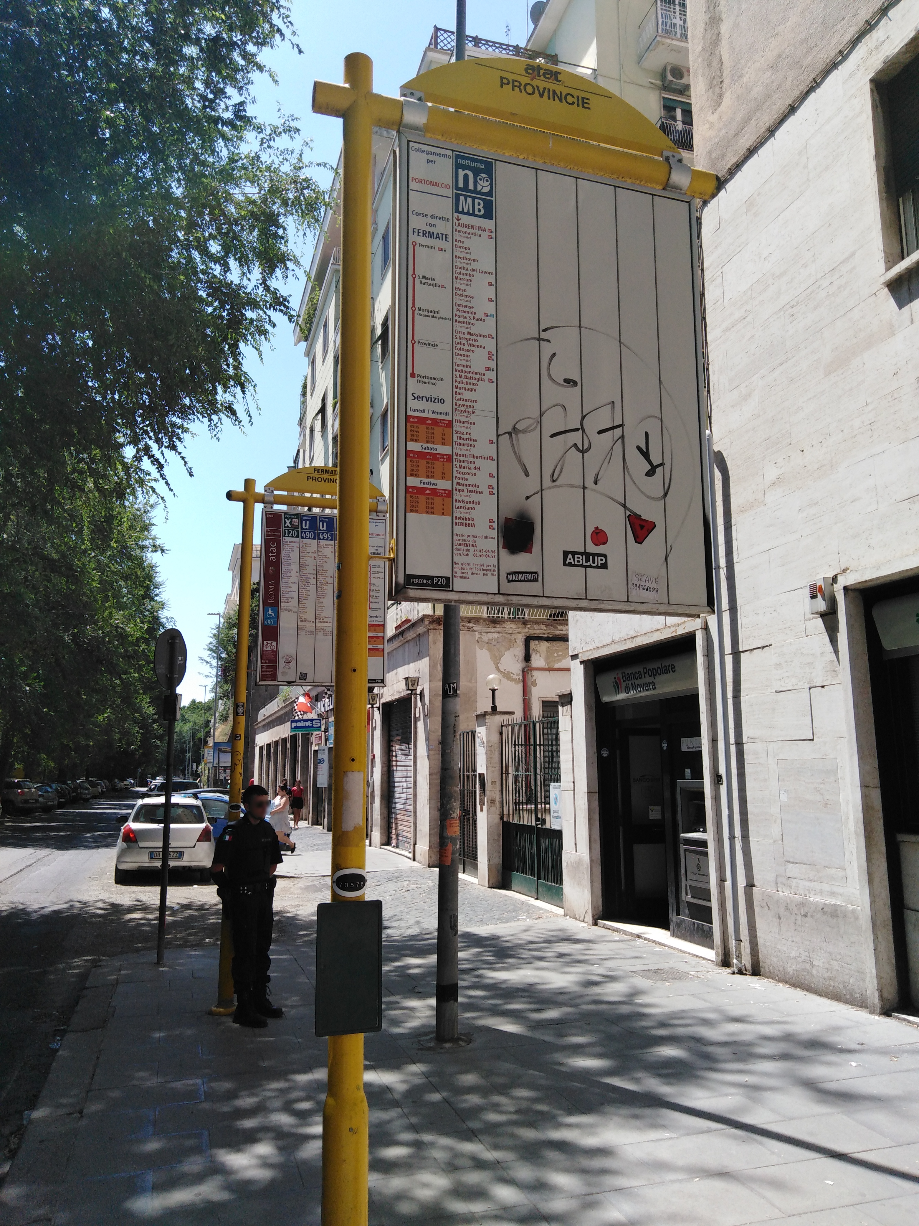 Taken by Michaela P
See Provincie/Valerio Massimo stop, Roma, on the map
Public transit to Provincie/Valerio Massimo stop (ID: 70577) in Roma
Looking for directions to Provincie/Valerio Massimo in Roma, Italy?
Download the Moovit App to find the current schedule and step-by-step directions for Bus, Metro or Train routes that pass through Provincie/Valerio Massimo.
Looking for the nearest stops closest to Provincie/Valerio Massimo ? Check out this list of closest stops to your destination: Provincie/Valerio Massimo; Tiburtina/Valerio Massimo; Provinces; Ippocrate/Provincie; Lega Lombarda/Provincie; Verano; Sapienza University.
Bus: 120F, 310, 490, 495, 542, 649, 71, 163, 545, 448, 492, NMB, C3, P10, P20, P02.Train: FL1, FL3, RV.Metro: B.
We make riding on public transit to Provincie/Valerio Massimo easy, which is why over 1.7 billion users, including users in Roma trust Moovit as the best app for public transit.
Use the app to navigate to popular places including to the airport, hospital, stadium, grocery store, mall, coffee shop, school, college, and university.
Provincie/Valerio Massimo stop’s code is 70577
The first line to this stop is NMB, at 3:12 AM, and the last line is NMB at 2:53 AM.
This stop serves ATAC’s lines
- Provincie/Valerio Massimo,
- Tiburtina/Valerio Massimo,
- Provinces,
- Ippocrate/Provincie,
- Lega Lombarda/Provincie,
- Sapienza University
Bus stops near Provincie/Valerio Massimo stop
- Verano
Light Rail station near Provincie/Valerio Massimo station
- Grotta Perfetta/Ardeatina,
- Bracciano Hospital,
- Flaminia/Tor Di Quinto,
- Poggio S. Lorenzo | Ponte Buita,
- Colli Portuensi/Fermi C.,
- Italian Forum/Sports Fields,
- Porta Pia,
- Aldrovandi,
- Rome/Via Tiberina (Procoio Nuovo),
- Via Manzoni/Tor Lupara,
- Risorgimento/S. Pietro,
- Lanuvio | Via Nettunense (Bellavista),
- Poggio Moiano via Salaria Vecchia via Ulivi,
- Collatina/Tor Sapienza (FL2),
- Arenula/Ministry of Justice,
- Olevano | Moro Square (Cartesio Institute),
- Boccea/Accursio,
- San Cesareo Cemetery,
- Verano/De Lollis,
- Tuscolana/Quadraro
Popular public transit stations in Roma
Get around Roma by public transit!
Traveling around Roma has never been so easy. See step by step directions as you travel to any attraction, street or major public transit station. View bus and train schedules, arrival times, service alerts and detailed routes on a map, so you know exactly how to get to anywhere in Roma.
When traveling to any destination around Roma use Moovit's Live Directions with Get Off Notifications to know exactly where and how far to walk, how long to wait for your line, and how many stops are left. Moovit will alert you when it's time to get off — no need to constantly re-check whether yours is the next stop.
Wondering how to use public transit in Roma or how to pay for public transit in Roma? Moovit public transit app can help you navigate your way with public transit easily, and at minimum cost. It includes public transit fees, ticket prices, and costs. Looking for a map of Roma public transit lines? Moovit public transit app shows all public transit maps in Roma with all Bus, Train, Metro, Light Rail, Ferry, Funicular and Gondola routes and stops on an interactive map.
Rome and Lazio has 7 transit type(s), including: Bus, Train, Metro, Light Rail, Ferry, Funicular and Gondola, operated by several transit agencies, including ATAC, Cotral, Trenitalia, Troiani Transportation Services, BIS, ATR Mobility, Tuscia, Shuttle, Seatour, Troiani Bus Lines, CSC Mobility, Terravision, ATRAL, Tambus and Sitbus