How to get to Proximity Tax by bus?
Click on the bus route to see step by step directions with maps, line arrival times and updated time schedules.
From Fairfax County Government Center, Fairfax County
36 minFrom Balian Springs, Fairfax County
94 minFrom Cia Headquarters, Fairfax County
76 minFrom Walmart, Arlington County
49 minFrom Liberty Crossing, Fairfax County
60 minFrom Hilton McLean Tysons Corner, Fairfax County
46 minFrom Nova- Alexandria Campus, Alexandria
61 minFrom Tysons Galleria, Fairfax County
42 minFrom The Westin Arlington Gateway, Arlington County
51 min
How to get to Proximity Tax by metro?
Click on the metro route to see step by step directions with maps, line arrival times and updated time schedules.
Bus stops near Proximity Tax in Fairfax County
Metro station near Proximity Tax in Fairfax County
- Dunn Loring Merrifield Metro Station, 17 min walk,VIEW
Bus lines to Proximity Tax in Fairfax County
What are the closest stations to Proximity Tax?
The closest stations to Proximity Tax are:
- Eskridge Rd+Strawberry Ln is 293 yards away, 4 min walk.
- Wilow Oaks Corporate Dr & Williams Dr is 512 yards away, 7 min walk.
- Arlington Bl+Prosperity Av is 588 yards away, 7 min walk.
- Gallows Rd And Gatehouse Rd is 774 yards away, 10 min walk.
- Dunn Loring Merrifield Metro Station is 1409 yards away, 17 min walk.
Which bus lines stop near Proximity Tax?
These bus lines stop near Proximity Tax: 401, 402, 671, F60, F62.
Which metro line stops near Proximity Tax?
ORANGE (Vienna)
What’s the nearest metro station to Proximity Tax in Fairfax County?
The nearest metro station to Proximity Tax in Fairfax County is Dunn Loring Merrifield Metro Station. It’s a 17 min walk away.
What’s the nearest bus station to Proximity Tax in Fairfax County?
The nearest bus station to Proximity Tax in Fairfax County is Eskridge Rd+Strawberry Ln. It’s a 4 min walk away.
What time is the first metro to Proximity Tax in Fairfax County?
The ORANGE is the first metro that goes to Proximity Tax in Fairfax County. It stops nearby at 5:00 AM.
What time is the last metro to Proximity Tax in Fairfax County?
The ORANGE is the last metro that goes to Proximity Tax in Fairfax County. It stops nearby at 12:32 AM.
What time is the first bus to Proximity Tax in Fairfax County?
The F61 is the first bus that goes to Proximity Tax in Fairfax County. It stops nearby at 5:03 AM.
What time is the last bus to Proximity Tax in Fairfax County?
The F61 is the last bus that goes to Proximity Tax in Fairfax County. It stops nearby at 2:35 AM.
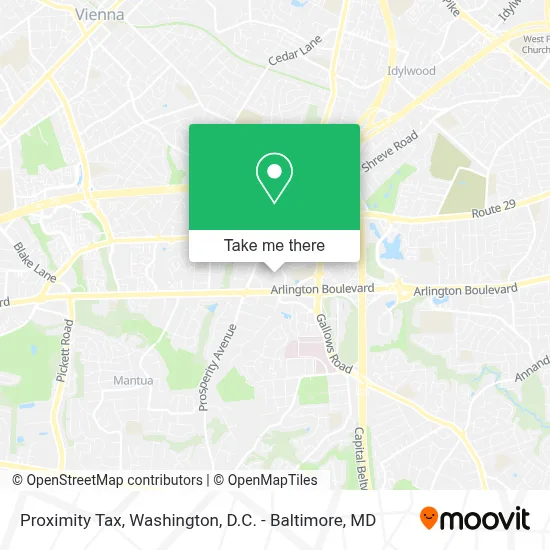
See Proximity Tax, Fairfax County, on the map
Public Transit to Proximity Tax in Fairfax County
Wondering how to get to Proximity Tax in Fairfax County? Moovit helps you find the best way to get to Proximity Tax with step-by-step directions from the nearest public transit station.
Moovit provides free maps and live directions to help you navigate through your city. View schedules, routes, timetables, and find out how long does it take to get to Proximity Tax in real time.
Looking for the nearest stop or station to Proximity Tax? Check out this list of stops closest to your destination: Eskridge Rd+Strawberry Ln; Wilow Oaks Corporate Dr & Williams Dr; Arlington Bl+Prosperity Av; Gallows Rd And Gatehouse Rd; Dunn Loring Merrifield Metro Station.
Bus: 401, 402, 671, F60, F62, F61.Metro: ORANGE.
Want to see if there’s another route that gets you there at an earlier time? Moovit helps you find alternative routes or times. Get directions from and directions to Proximity Tax easily from the Moovit App or Website.
We make riding to Proximity Tax easy, which is why over 1.7 million users, including users in Fairfax County, trust Moovit as the best app for public transit. You don’t need to download an individual bus app or train app, Moovit is your all-in-one transit app that helps you find the best bus time or train time available.
For information on prices of bus and metro, costs and ride fares to Proximity Tax, please check the Moovit app.
Use the app to navigate to popular places including to the airport, hospital, stadium, grocery store, mall, coffee shop, school, college, and university.
Proximity Tax Address: 3022 Javier Rd street in Fairfax County
- Prosperity Plaza 1,
- Vca Southpaws Veterinary Specialists & Emergency (Vca Animal Hospital),
- Rocket Media,
- Dewberry,
- Willow Oaks Corp Dr & Woodburn Bldg,
- Quest Diagnostics 8501 Arlington Blvd,
- Mosaic District,
- Prosperity Avenue & Arlington Boulevard,
- 8409 Lee Highway,
- Permere Presentation Services,
- Merrifield Post Office,
- Sweetwater Tavern,
- 8260 Corporate Center Campus,
- Luther Jackson Middle School,
- 8260 Willow Oaks Corporate Center,
- Unique Thrift Store,
- Willow Oaks Corporate Center Metro Shuttle,
- Extended Stay America,
- Merrifield, Virginia,
- Angelika Film Center at Mosaic
Places Near Proximity Tax (Fairfax County)
- Georgetown, Washington,
- National Museum of African American History and Culture, Washington,
- Sibley Memorial Hospital, Washington,
- Washington National Cathedral, Washington,
- Amazon Hq2, Arlington County,
- M&T Bank Stadium, Baltimore,
- Basilica of the National Shrine, Washington,
- Capital One Arena, Washington,
- Camden Yards, Baltimore,
- Marriott Marquis Washington, DC, Washington,
- National Theatre, Washington,
- Washington DC VA Medical Center, Washington,
- Pennsylvania Ave NW (3rd st and pennsylvania), Washington,
- Warner Theatre, Washington,
- Westfield Montgomery Mall, Montgomery County,
- Museum Of The Bible, Washington,
- PG Mall, Prince George's County,
- National Zoo, Washington,
- The Anthem, Washington,
- Rock Creek Tennis Center, Washington
How to get to popular places in Washington, D.C. - Baltimore, MD with public transit
Get around Fairfax County by public transit!
Traveling around Fairfax County has never been so easy. See step by step directions as you travel to any attraction, street or major public transit station. View bus and train schedules, arrival times, service alerts and detailed routes on a map, so you know exactly how to get to anywhere in Fairfax County.
When traveling to any destination around Fairfax County use Moovit's Live Directions with Get Off Notifications to know exactly where and how far to walk, how long to wait for your line, and how many stops are left. Moovit will alert you when it's time to get off — no need to constantly re-check whether yours is the next stop.
Wondering how to use public transit in Fairfax County or how to pay for public transit in Fairfax County? Moovit public transit app can help you navigate your way with public transit easily, and at minimum cost. It includes public transit fees, ticket prices, and costs. Looking for a map of Fairfax County public transit lines? Moovit public transit app shows all public transit maps in Fairfax County with all Bus, Train, Metro, Light Rail and Ferry routes and stops on an interactive map.
Washington, D.C. - Baltimore, MD has 5 transit type(s), including: Bus, Train, Metro, Light Rail and Ferry, operated by several transit agencies, including WMATA, Montgomery County Ride On, Fairfax Connector, TheBus, PRTC, DASH - Alexandria, Arlington Transit (ART), RTA of Central Maryland, MDOT MTA, MDOT MTA Light RailLink, MDOT MTA Commuter Bus, MDOT MTA Local Bus, FXBGO!, Virginia Railway Express (VRE) and MARC