How to get to Proyectos Lofer by bus?
Click on the bus route to see step by step directions with maps, line arrival times and updated time schedules.
From Real Jardín Botánico, Madrid
57 minFrom Villa del Prado, Madrid
83 minFrom Tienda Primark Gran Via, Madrid
57 minFrom Poligono Industrial Prado Overa, Leganés
65 minFrom Teatro Español, Área Metropolitana De Madrid Y Corredor Del Henares
52 minFrom Estación Sur de Autobuses de Madrid, Madrid
79 minFrom Teatro Lara, Madrid
61 minFrom Tanatorio Getafe, Getafe
84 minFrom Metro Callao, Madrid
57 minFrom Palacio De Liria, Área Metropolitana De Madrid Y Corredor Del Henares
57 min
How to get to Proyectos Lofer by train?
Click on the train route to see step by step directions with maps, line arrival times and updated time schedules.
From Real Jardín Botánico, Madrid
72 minFrom Villa del Prado, Madrid
77 minFrom Tienda Primark Gran Via, Madrid
92 minFrom Teatro Español, Área Metropolitana De Madrid Y Corredor Del Henares
78 minFrom Estación Sur de Autobuses de Madrid, Madrid
74 minFrom Teatro Lara, Madrid
90 minFrom Tanatorio Getafe, Getafe
111 minFrom Metro Callao, Madrid
91 minFrom Palacio De Liria, Área Metropolitana De Madrid Y Corredor Del Henares
89 min
How to get to Proyectos Lofer by metro?
Click on the metro route to see step by step directions with maps, line arrival times and updated time schedules.
From Real Jardín Botánico, Madrid
49 minFrom Villa del Prado, Madrid
45 minFrom Tienda Primark Gran Via, Madrid
59 minFrom Teatro Español, Área Metropolitana De Madrid Y Corredor Del Henares
48 minFrom Estación Sur de Autobuses de Madrid, Madrid
35 minFrom Teatro Lara, Madrid
52 minFrom Metro Callao, Madrid
47 minFrom Palacio De Liria, Área Metropolitana De Madrid Y Corredor Del Henares
54 min
Bus stops near Proyectos Lofer in Leganés
Metro stations near Proyectos Lofer in Leganés
Bus lines to Proyectos Lofer in Leganés
What are the closest stations to Proyectos Lofer?
The closest stations to Proyectos Lofer are:
- Lisboa - Beja is 73 meters away, 2 min walk.
- Coimbra - Jesús is 250 meters away, 4 min walk.
- San Nicasio is 549 meters away, 8 min walk.
- Joaquín Vilumbrales is 941 meters away, 12 min walk.
- La Fortuna is 2604 meters away, 34 min walk.
Which bus lines stop near Proyectos Lofer?
These bus lines stop near Proyectos Lofer: 1, 483, 486, 487.
Which train line stops near Proyectos Lofer?
C5 (Móstoles - El Soto)
Which metro line stops near Proyectos Lofer?
M-11 (La Fortuna)
What’s the nearest metro station to Proyectos Lofer in Leganés?
The nearest metro station to Proyectos Lofer in Leganés is San Nicasio. It’s a 8 min walk away.
What’s the nearest bus station to Proyectos Lofer in Leganés?
The nearest bus station to Proyectos Lofer in Leganés is Lisboa - Beja. It’s a 2 min walk away.
What time is the first metro to Proyectos Lofer in Leganés?
The M-11 is the first metro that goes to Proyectos Lofer in Leganés. It stops nearby at 6:05 AM.
What time is the last metro to Proyectos Lofer in Leganés?
The M-12 is the last metro that goes to Proyectos Lofer in Leganés. It stops nearby at 2:10 AM.
What time is the first bus to Proyectos Lofer in Leganés?
The N802 is the first bus that goes to Proyectos Lofer in Leganés. It stops nearby at 3:40 AM.
What time is the last bus to Proyectos Lofer in Leganés?
The N802 is the last bus that goes to Proyectos Lofer in Leganés. It stops nearby at 2:48 AM.
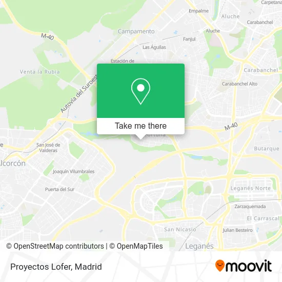
See Proyectos Lofer, Leganés, on the map
Public Transit to Proyectos Lofer in Leganés
Wondering how to get to Proyectos Lofer in Leganés? Moovit helps you find the best way to get to Proyectos Lofer with step-by-step directions from the nearest public transit station.
Moovit provides free maps and live directions to help you navigate through your city. View schedules, routes, timetables, and find out how long does it take to get to Proyectos Lofer in real time.
Looking for the nearest stop or station to Proyectos Lofer? Check out this list of stops closest to your destination: Lisboa - Beja; Coimbra - Jesús; San Nicasio; Joaquín Vilumbrales; La Fortuna.
Bus: 1, 483, 486, 487, N802.Train: C5.Metro: M-11, M-12, M-10.
Want to see if there’s another route that gets you there at an earlier time? Moovit helps you find alternative routes or times. Get directions from and directions to Proyectos Lofer easily from the Moovit App or Website.
We make riding to Proyectos Lofer easy, which is why over 1.5 million users, including users in Leganés, trust Moovit as the best app for public transit. You don’t need to download an individual bus app or train app, Moovit is your all-in-one transit app that helps you find the best bus time or train time available.
For information on prices of bus, metro and train, costs and ride fares to Proyectos Lofer, please check the Moovit app.
Use the app to navigate to popular places including to the airport, hospital, stadium, grocery store, mall, coffee shop, school, college, and university.
Proyectos Lofer Address: Calle Lisboa, 18 28917 Fortuna Leganés street in Leganés
- Calle Jesús / Calle San Pedro,
- Calle Beja, 4,
- Complementos Ynes,
- Cotton Sweety,
- Calle de Oporto,
- Carlos Gustavo Torrico Martín,
- Calle Beja,
- Calle Lisboa, 6,
- Calle Portalegre, 3,
- Calle de Oporto 7,
- Productos Cárnicos Segundo Sanz, S.L.,
- Calle de Braga,
- Bar Verde y Blanco,
- Tarancón, e,
- Polideportivo Municipal De La Fortuna,
- La Fortuna,
- Martin Perez Antonio,
- polideportivo la fortuna,
- Calle de Castelo Branco 2,
- Junta Municipal del Distrito de La Fortuna
Places Near Proyectos Lofer (Leganés)
- Nassica, Área Metropolitana De Madrid Y Corredor Del Henares,
- Mercadillo de Majadahonda, Majadahonda,
- Sala La Riviera, Madrid,
- Plaza Mayor, Madrid,
- Wizink Center, Madrid,
- Hospital Universitario Ramón y Cajal, Madrid,
- Centro Comercial Oasiz Madrid, Área Metropolitana De Madrid Y Corredor Del Henares,
- Calle de López de Hoyos 169, Madrid,
- Plenilunio, Área Metropolitana De Madrid Y Corredor Del Henares,
- Tres Aguas, Alcorcón,
- Estadio Wanda Metropolitano, Área Metropolitana De Madrid Y Corredor Del Henares,
- Centro Comercial Islazul, Área Metropolitana De Madrid Y Corredor Del Henares,
- Centro Comercial La Gavia, Área Metropolitana De Madrid Y Corredor Del Henares,
- Estacion de Chamartin, Madrid,
- Hospital Clínico Universitario San Carlos, Madrid,
- Hospital Universitario La Paz, Madrid,
- Mendez Alvaro, Madrid,
- Palacio De Vistalegre, Área Metropolitana De Madrid Y Corredor Del Henares,
- Centro Comercial La Vaguada, Área Metropolitana De Madrid Y Corredor Del Henares,
- Rastro De Madrid, Área Metropolitana De Madrid Y Corredor Del Henares
How to get to popular places in Madrid with public transit
Get around Leganés by public transit!
Traveling around Leganés has never been so easy. See step by step directions as you travel to any attraction, street or major public transit station. View bus and train schedules, arrival times, service alerts and detailed routes on a map, so you know exactly how to get to anywhere in Leganés.
When traveling to any destination around Leganés use Moovit's Live Directions with Get Off Notifications to know exactly where and how far to walk, how long to wait for your line, and how many stops are left. Moovit will alert you when it's time to get off — no need to constantly re-check whether yours is the next stop.
Wondering how to use public transit in Leganés or how to pay for public transit in Leganés? Moovit public transit app can help you navigate your way with public transit easily, and at minimum cost. It includes public transit fees, ticket prices, and costs. Looking for a map of Leganés public transit lines? Moovit public transit app shows all public transit maps in Leganés with all Bus, Train, Metro and Light Rail routes and stops on an interactive map.
Madrid has 4 transit type(s), including: Bus, Train, Metro and Light Rail, operated by several transit agencies, including Metro de Madrid, Metro Ligero, Tranvía de Parla, Renfe Cercanías - Servicios de Autobús especiales, Renfe Cercanias, Renfe Cercanías, EMT, Interurbanos, Urbanos de Alcalá de Henares, Urbanos de Alcobendas, Urbanos de Alcorcón, Urbanos de Algete, Urbanos de Aranjuez, Urbanos de Arganda del Rey and Urbanos de Arroyomolinos