How to get to Psvulm Neuulm by bus?
Click on the bus route to see step by step directions with maps, line arrival times and updated time schedules.
From Media Markt, Gemeindeverwaltungsverband Eislingen-Ottenbach-Salach
250 minFrom HORNBACH, Vereinbarte Verwaltungsgemeinschaft Der Stadt Göppingen
252 minFrom Möbel Rieger, Vereinbarte Verwaltungsgemeinschaft Der Stadt Göppingen
262 minFrom Heidenheim an der Brenz, Heidenheim An Der Brenz
153 minFrom Action, Gemeindeverwaltungsverband Eislingen-Ottenbach-Salach
255 minFrom Kloster Untermarchtal, Verwaltungsgemeinschaft Munderkingen
142 minFrom Kaufland Geislingen, Vereinbarte Verwaltungsgemeinschaft Der Stadt Geislingen An Der Steige
140 min
How to get to Psvulm Neuulm by train?
Click on the train route to see step by step directions with maps, line arrival times and updated time schedules.
Bus stops near Psvulm Neuulm in Neu-Ulm
Train stations near Psvulm Neuulm in Neu-Ulm
- Neu-Ulm Bahnhof, 14 min walk,VIEW
Bus lines to Psvulm Neuulm in Neu-Ulm
What are the closest stations to Psvulm Neuulm?
The closest stations to Psvulm Neuulm are:
- Ludwigsfeld Reichenberger Str. is 178 meters away, 3 min walk.
- Ludwigsfeld Danziger Straße is 551 meters away, 8 min walk.
- Ludwigsfeld Illerholzweg is 675 meters away, 9 min walk.
- Neu-Ulm Bahnhof is 1032 meters away, 14 min walk.
Which bus lines stop near Psvulm Neuulm?
These bus lines stop near Psvulm Neuulm: 46, 5, 71, 72, 73.
Which train lines stop near Psvulm Neuulm?
These train lines stop near Psvulm Neuulm: RB15, RS 7, RS71.
What’s the nearest train station to Psvulm Neuulm in Neu-Ulm?
The nearest train station to Psvulm Neuulm in Neu-Ulm is Neu-Ulm Bahnhof. It’s a 14 min walk away.
What’s the nearest bus station to Psvulm Neuulm in Neu-Ulm?
The nearest bus station to Psvulm Neuulm in Neu-Ulm is Ludwigsfeld Reichenberger Str.. It’s a 3 min walk away.
What time is the first train to Psvulm Neuulm in Neu-Ulm?
The RE 9 is the first train that goes to Psvulm Neuulm in Neu-Ulm. It stops nearby at 4:50 AM.
What time is the last train to Psvulm Neuulm in Neu-Ulm?
The RE 9 is the last train that goes to Psvulm Neuulm in Neu-Ulm. It stops nearby at 1:02 AM.
What time is the first bus to Psvulm Neuulm in Neu-Ulm?
The 5 is the first bus that goes to Psvulm Neuulm in Neu-Ulm. It stops nearby at 4:33 AM.
What time is the last bus to Psvulm Neuulm in Neu-Ulm?
The 5 is the last bus that goes to Psvulm Neuulm in Neu-Ulm. It stops nearby at 12:50 AM.
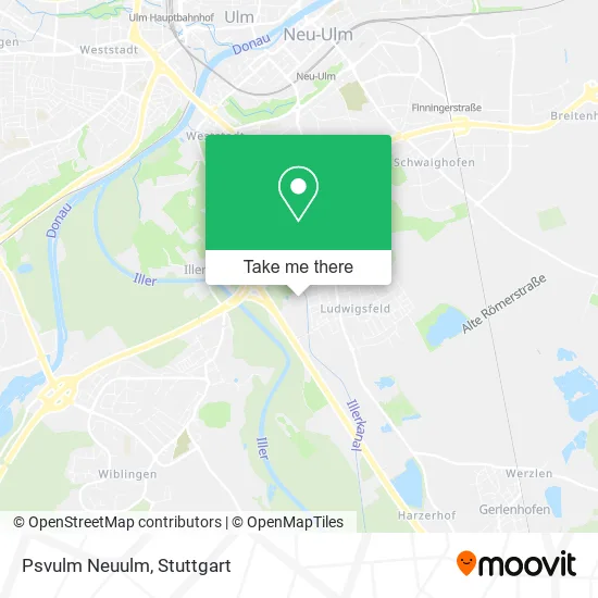
See Psvulm Neuulm, Neu-Ulm, on the map
Public Transit to Psvulm Neuulm in Neu-Ulm
Wondering how to get to Psvulm Neuulm in Neu-Ulm? Moovit helps you find the best way to get to Psvulm Neuulm with step-by-step directions from the nearest public transit station.
Moovit provides free maps and live directions to help you navigate through your city. View schedules, routes, timetables, and find out how long does it take to get to Psvulm Neuulm in real time.
Looking for the nearest stop or station to Psvulm Neuulm? Check out this list of stops closest to your destination: Ludwigsfeld Reichenberger Str.; Ludwigsfeld Danziger Straße; Ludwigsfeld Illerholzweg; Neu-Ulm Bahnhof.
Bus: 46, 5, 71, 72, 73, E, PF 7.Train: RB15, RS 7, RS71, RE 9, RB 15, RS 71, RE 75, RS7, RE9, RE75.
Want to see if there’s another route that gets you there at an earlier time? Moovit helps you find alternative routes or times. Get directions from and directions to Psvulm Neuulm easily from the Moovit App or Website.
We make riding to Psvulm Neuulm easy, which is why over 1.5 million users, including users in Neu-Ulm, trust Moovit as the best app for public transit. You don’t need to download an individual bus app or train app, Moovit is your all-in-one transit app that helps you find the best bus time or train time available.
For information on prices of bus and train, costs and ride fares to Psvulm Neuulm, please check the Moovit app.
Use the app to navigate to popular places including to the airport, hospital, stadium, grocery store, mall, coffee shop, school, college, and university.
Psvulm Neuulm Address: Illerholzweg 11 89231 Neu-Ulm street in Neu-Ulm
- Pferdesportverein Ulm/Neu-Ulm,
- Dal Cavallino,
- Interwert Immobilienbewertung,
- Lingl Consulting and Management,
- Casa Immobilien,
- Tagespflege Ludwigsfeld,
- Southern Spirits,
- Verborgene Engel,
- Leitgib Garten Und Landschaftsbau,
- Hans Liebl,
- Karl-Hans Defet,
- Kurt Gaub,
- Fdl Osterlehner,
- Wasserkraftwerk Ludwigsfeld,
- Hundeschule Little Wulf,
- Camundi Hundetraining,
- Hundetrainerin und Verhaltensberaterin Sabrina Finn,
- Ulf Brackmann,
- Stadtgeschichten: Andreaskirche,
- Werner Geitner
Places Near Psvulm Neuulm (Neu-Ulm)
- Hanns-Martin-Schleyer-Halle, Bad Cannstatt,
- SI-Centrum, Möhringen,
- Gasometer Pforzheim, Pforzheim,
- Porsche Museum, Zuffenhausen,
- Mettingen Eros-Center Puff Laufhaus, Esslingen Am Neckar,
- Klinikum Stuttgart - Katharinenhospital, Stuttgart-Mitte,
- Im Wizemann (Halle), Bad Cannstatt,
- Mercedes-Benz Museum, Bad Cannstatt,
- Marmorsaal Im Weissenburgpark, Stuttgart-Süd,
- Hanns-Martin-Schleyer-Halle (Stuttgart Hans-Martin-Schleyerhalle), Bad Cannstatt,
- Waldfriedhof, Degerloch,
- Gleis 101/102 (tief), Stuttgart-Mitte,
- Pariser Platz Stuttgart, Stuttgart-Mitte,
- Mercedes-Benz Museum (Mercedes Museum Stuttgart), Bad Cannstatt,
- Hauptbahnhof Stuttgart, Stuttgart-Mitte,
- Wilhelma (U-Bahn Wilhelma), Bad Cannstatt,
- FlixBus Haltestelle, Stuttgart,
- Geilhaus Haus 33a, Reutlingen-Betzingen,
- Schleyerhalle, Bad Cannstatt,
- Porsche-Arena, Bad Cannstatt
How to get to popular places in Stuttgart with public transit
Get around Neu-Ulm by public transit!
Traveling around Neu-Ulm has never been so easy. See step by step directions as you travel to any attraction, street or major public transit station. View bus and train schedules, arrival times, service alerts and detailed routes on a map, so you know exactly how to get to anywhere in Neu-Ulm.
When traveling to any destination around Neu-Ulm use Moovit's Live Directions with Get Off Notifications to know exactly where and how far to walk, how long to wait for your line, and how many stops are left. Moovit will alert you when it's time to get off — no need to constantly re-check whether yours is the next stop.
Wondering how to use public transit in Neu-Ulm or how to pay for public transit in Neu-Ulm? Moovit public transit app can help you navigate your way with public transit easily, and at minimum cost. It includes public transit fees, ticket prices, and costs. Looking for a map of Neu-Ulm public transit lines? Moovit public transit app shows all public transit maps in Neu-Ulm with all Bus, Train, Subway, Light Rail, Ferry, S-Bahn and Funicular routes and stops on an interactive map.
Stuttgart has 7 transit type(s), including: Bus, Train, Subway, Light Rail, Ferry, S-Bahn and Funicular, operated by several transit agencies, including SSB - Stadtbahn, SSB, SSB - Seilbahn / Zacke, S-Bahn Stuttgart, Rhein-Neckar-Verkehr GmbH (rnv), Karlsruher Verkehrsverbund, DB AG, DB Regiobus BW, Arverio Baden-Württemberg GmbH, DB RegioNetz Verkehrs GmbH Westfrankenbahn, DB Regio AG Baden-Württemberg, Südwestdeutsche Verkehrs-AG, DB Regio AG Mitte Region Hessen, DB and Bodensee-Oberschwaben-Bahn