How to get to Pt.Bnu by bus?
Click on the bus route to see step by step directions with maps, line arrival times and updated time schedules.
From Ptc, Surabaya
59 minFrom 1 Jalan Indrapura, Krembangan Selatan
50 minFrom Consulate General of The United States of America (USA), Sambikerep
61 minFrom Poltekkes Kemenkes Surabaya, Kertajaya
50 minFrom Jalan Raya Margomulyo, Surabaya
66 minFrom Kost Unesa Bu Siti Arifin, Lidah Wetan
47 minFrom Jl. Mawar Surabaya, Tegalsari
39 minFrom Bakmi Slot Gacor Ojol77, Sambikerep
75 minFrom Gedung Negara Grahadi, Embong Kaliasin
48 min
How to get to Pt.Bnu by train?
Click on the train route to see step by step directions with maps, line arrival times and updated time schedules.
Bus stops near Pt.Bnu in Gayungan
Train stations near Pt.Bnu in Gayungan
Bus lines to Pt.Bnu in Gayungan
- DKM, Menanggal,VIEW
- FD9, Terminal Manukan,VIEW
- R1, Perak,VIEW
- R4, Terminal Purabaya,VIEW
- SBT, Tembaan (Pirngadi),VIEW
- K2, Terminal Kertajaya,VIEW
- BUS D, Purabaya - Bratang,VIEW
- P2, Purabaya - Indrapura - Tambak Oso Wilangun,VIEW
- P7, Purabaya - Tambak Oso Wilangun,VIEW
- H2P, Pasar Wonokromo,VIEW
- BUS F, Purabaya,VIEW
What are the closest stations to Pt.Bnu?
The closest stations to Pt.Bnu are:
- Jalan Gayungsari I 30-32 is 153 meters away, 3 min walk.
- Kantor Dpw Pkb Jatim is 859 meters away, 12 min walk.
- Siwalankerto 1 is 992 meters away, 13 min walk.
- Siwalankerto 2 is 1104 meters away, 15 min walk.
- Jalan Raya Malang - Surabaya 287 is 1218 meters away, 16 min walk.
- Jalan Mesjid Agung Timur 4 is 1226 meters away, 16 min walk.
- Jalan Raya Malang - Surabaya 199 is 1254 meters away, 17 min walk.
- Stasiun Sepanjang is 3117 meters away, 40 min walk.
- Stasiun Waru is 3958 meters away, 51 min walk.
Which bus line stops near Pt.Bnu?
DKM (Menanggal)
Which train line stops near Pt.Bnu?
D (Blitar)
What’s the nearest bus station to Pt.Bnu in Gayungan?
The nearest bus station to Pt.Bnu in Gayungan is Jalan Gayungsari I 30-32. It’s a 3 min walk away.
What time is the first train to Pt.Bnu in Gayungan?
The S is the first train that goes to Pt.Bnu in Gayungan. It stops nearby at 3:31 AM.
What time is the last train to Pt.Bnu in Gayungan?
The SP is the last train that goes to Pt.Bnu in Gayungan. It stops nearby at 1:58 AM.
What time is the first bus to Pt.Bnu in Gayungan?
The BUS F is the first bus that goes to Pt.Bnu in Gayungan. It stops nearby at 4:24 AM.
What time is the last bus to Pt.Bnu in Gayungan?
The BUS F is the last bus that goes to Pt.Bnu in Gayungan. It stops nearby at 12:14 AM.
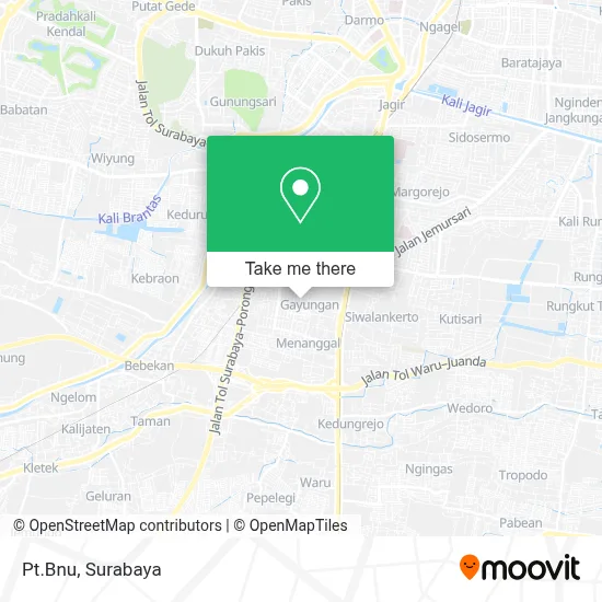
See Pt.Bnu, Gayungan, on the map
Public Transit to Pt.Bnu in Gayungan
Wondering how to get to Pt.Bnu in Gayungan? Moovit helps you find the best way to get to Pt.Bnu with step-by-step directions from the nearest public transit station.
Moovit provides free maps and live directions to help you navigate through your city. View schedules, routes, timetables, and find out how long does it take to get to Pt.Bnu in real time.
Looking for the nearest stop or station to Pt.Bnu? Check out this list of stops closest to your destination: Jalan Gayungsari I 30-32; Kantor Dpw Pkb Jatim; Siwalankerto 1; Siwalankerto 2; Jalan Raya Malang - Surabaya 287; Jalan Mesjid Agung Timur 4; Jalan Raya Malang - Surabaya 199; Stasiun Sepanjang; Stasiun Waru.
Bus: DKM, FD9, R1, R4, SBT, K2.Train: D, J, A, P, S, SP.
Want to see if there’s another route that gets you there at an earlier time? Moovit helps you find alternative routes or times. Get directions from and directions to Pt.Bnu easily from the Moovit App or Website.
We make riding to Pt.Bnu easy, which is why over 1.5 million users, including users in Gayungan, trust Moovit as the best app for public transit. You don’t need to download an individual bus app or train app, Moovit is your all-in-one transit app that helps you find the best bus time or train time available.
For information on prices of bus and train, costs and ride fares to Pt.Bnu, please check the Moovit app.
Use the app to navigate to popular places including to the airport, hospital, stadium, grocery store, mall, coffee shop, school, college, and university.
Pt.Bnu Address: Jalan Gayungsari VI Surabaya 60235 street in Gayungan
- Lapangan Basket Gayungsari VI,
- Polsek Gayungan Surabaya,
- Panti Asuhan Lydia,
- Jps Basketball Court,
- Lapangan Basket JPS 031,
- Yayasan Panti Asuhan Kristen Lydia,
- PT Total Mandiri Selaras,
- Lembaga Bimbingan Belajar Primagama Gayung Sari Surabaya,
- Telkom Msc Area V Jawa Timur PT,
- Head Office PT Teguh Karya Rahardjo,
- Dwi Karya Bekti CV,
- Berdikari,
- Jalan Raya Gayungsari Barat,
- Rumah Kompos Gayung Sari,
- No.17-19 Jalan Gayungan PTT,
- Nasi Babat Lamongan,
- Telkom STO Injoko,
- RSI Siti Hajar Sidoarjo,
- Balai Rw 4,
- Jbx Helmet
Places Near Pt.Bnu (Gayungan)
- Graha Pena, Ketintang,
- Pelabuhan Tanjung Perak,
- Taman Harmoni, Keputih,
- Bis Damri P1 (Perak-Bungurasih PP), Krembangan Selatan,
- Universitas Negeri Surabaya (UNESA), Lidah Wetan,
- Stadion gelora bung tomo(surabaya,jawa timur), Surabaya,
- Grand City Mall, Surabaya, Gubeng,
- BG Junction Mall, Bubutan,
- Bg Junction, Bubutan,
- Pakuwon City Mall, Keputih,
- Galaxy Mall Surabaya, Mulyorejo,
- Kebun Binatang Surabaya, Darmo,
- PTC, Surabaya,
- Masjid Al-Akbar, Surabaya,
- UPN Veteran Jawa Timur, Gunung Anyar,
- Pakuwon Mall, Lontar,
- GBT (Gelora Bung Tomo) Surabaya, Benowo,
- Kantor Regional II BKN Surabaya, Sidoarjo,
- Halte Bis Royal Plaza, Wonokromo,
- Smoking Room Terminal Domestik Juanda International Airport, Sidoarjo
How to get to popular places in Surabaya with public transit
Get around Gayungan by public transit!
Traveling around Gayungan has never been so easy. See step by step directions as you travel to any attraction, street or major public transit station. View bus and train schedules, arrival times, service alerts and detailed routes on a map, so you know exactly how to get to anywhere in Gayungan.
When traveling to any destination around Gayungan use Moovit's Live Directions with Get Off Notifications to know exactly where and how far to walk, how long to wait for your line, and how many stops are left. Moovit will alert you when it's time to get off — no need to constantly re-check whether yours is the next stop.
Wondering how to use public transit in Gayungan or how to pay for public transit in Gayungan? Moovit public transit app can help you navigate your way with public transit easily, and at minimum cost. It includes public transit fees, ticket prices, and costs. Looking for a map of Gayungan public transit lines? Moovit public transit app shows all public transit maps in Gayungan with all Bus and Train routes and stops on an interactive map.
Surabaya has 2 transit type(s), including: Bus and Train, operated by several transit agencies, including KAI Commuter, Angkutan Surabaya, Trans Semanggi Suroboyo, Suroboyo Bus, Feeder Wira Wiri Suroboyo, Trans Jatim and DAMRI