How to get to Ptlug by bus?
Click on the bus route to see step by step directions with maps, line arrival times and updated time schedules.
From Montemurlo, Montemurlo
116 minFrom Assembly Hall of Jehovah's Witnesses, Prato
131 minFrom Francesco Beccatelli Street / Galciana Church Square, Prato
128 minFrom Renzo Bonechi Quagliodromo - Federcaccia, Prato
175 minFrom Curtatone Montanara Square, Quarrata
48 minFrom Pistoiese Street, Prato
101 minFrom La Dogaia Prison, Prato
105 minFrom Quetzal Club. The Legendary '90s, Serravalle Pistoiese
52 minFrom Quarrata, Quarrata
51 minFrom Pistoia Zoo, Pistoia
47 min
How to get to Ptlug by train?
Click on the train route to see step by step directions with maps, line arrival times and updated time schedules.
Bus stops near Ptlug in Pistoia
Train station near Ptlug in Pistoia
- Pistoia, 36 min walk,VIEW
Bus lines to Ptlug in Pistoia
- 8, Le Fornaci Terminal,VIEW
- 15, Gello Terminal,VIEW
- 26, San Francesco Square (Church),VIEW
- 26, La Rena Terminal,VIEW
- 85GER, Piazza San Francesco,VIEW
- 27-28, San Francesco Square (Church),VIEW
- 25, Montale/Agliana Railway Station,VIEW
- 25B, Pistoia Alighieri Square [Railway Station],VIEW
- 25O, Oste di Montemurlo,VIEW
- 325, Montale Square,VIEW
What are the closest stations to Ptlug?
The closest stations to Ptlug are:
- Le Fornaci Via Capitini is 65 meters away, 1 min walk.
- Le Fornaci Conad is 388 meters away, 6 min walk.
- Via B. Sestini (Pallavicini) is 403 meters away, 6 min walk.
- Pistoia is 2790 meters away, 36 min walk.
Which bus lines stop near Ptlug?
These bus lines stop near Ptlug: 25, 8.
Which train line stops near Ptlug?
R (Pistoia/Pisa)
What’s the nearest bus station to Ptlug in Pistoia?
The nearest bus station to Ptlug in Pistoia is Le Fornaci Via Capitini. It’s a 1 min walk away.
What time is the first train to Ptlug in Pistoia?
The R is the first train that goes to Ptlug in Pistoia. It stops nearby at 5:20 AM.
What time is the last train to Ptlug in Pistoia?
The R is the last train that goes to Ptlug in Pistoia. It stops nearby at 1:13 AM.
What time is the first bus to Ptlug in Pistoia?
The 8 is the first bus that goes to Ptlug in Pistoia. It stops nearby at 7:00 AM.
What time is the last bus to Ptlug in Pistoia?
The 25 is the last bus that goes to Ptlug in Pistoia. It stops nearby at 9:37 PM.
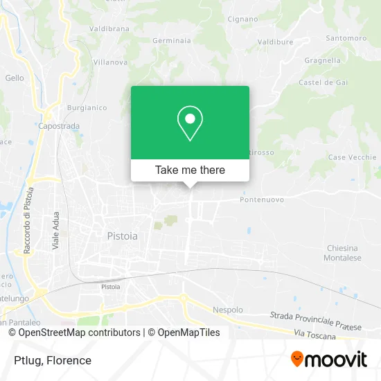
See Ptlug, Pistoia, on the map
Public Transit to Ptlug in Pistoia
Wondering how to get to Ptlug in Pistoia? Moovit helps you find the best way to get to Ptlug with step-by-step directions from the nearest public transit station.
Moovit provides free maps and live directions to help you navigate through your city. View schedules, routes, timetables, and find out how long does it take to get to Ptlug in real time.
Looking for the nearest stop or station to Ptlug? Check out this list of stops closest to your destination: Le Fornaci Via Capitini; Le Fornaci Conad; Via B. Sestini (Pallavicini); Pistoia.
Bus: 25, 8, 15, 26, 26, 85GER, 27-28, 25B, 25O, 325.Train: R.
Want to see if there’s another route that gets you there at an earlier time? Moovit helps you find alternative routes or times. Get directions from and directions to Ptlug easily from the Moovit App or Website.
We make riding to Ptlug easy, which is why over 1.5 million users, including users in Pistoia, trust Moovit as the best app for public transit. You don’t need to download an individual bus app or train app, Moovit is your all-in-one transit app that helps you find the best bus time or train time available.
For information on prices of bus and train, costs and ride fares to Ptlug, please check the Moovit app.
Use the app to navigate to popular places including to the airport, hospital, stadium, grocery store, mall, coffee shop, school, college, and university.
Ptlug Address: Via Aldo Capitini, 51100 Pistoia street in Pistoia
- Via Giuseppe Gentile, 366f Parking,
- Roberto Ciminelli,
- Aldo Capitini Street, 14 Parking,
- New Relationships Association,
- The Others Social Cooperative with Limited Liability,
- In Cammino Social Cooperative,
- SPI-CGIL Italian Pensioners Union,
- Bed Freest Wellness Planet,
- Marco Vannucci,
- Calosci Luana,
- L'Atelier,
- Fnp-Cisl Toscana Nord,
- Ciao,
- Ministry of Justice Social Service Center,
- Massimo Marrani,
- Nelson Mandela Square,
- G Idea,
- Bartoletti Galeazzo,
- Buontalenti Palace,
- Municipal Police Territorial Unit 2
Places Near Ptlug (Pistoia)
- OOO, Florence,
- IKEA Florence, Sesto Fiorentino,
- Torregalli Hospital Scandicci *, Scandicci,
- Michelangelo Square, Florence,
- Nelson Mandela Forum, Florence,
- Tobacco Manufacture, Florence,
- Field of Mars, Florence,
- Artemio Franchi Municipal Stadium, Florence,
- Verdi Theater, Florence,
- Santa Maria Nuova Hospital, Florence,
- I Gigli, Campi Bisenzio,
- Visarno Hippodrome, Florence,
- Santa Maria Novella Station, Florence,
- Asmana, Campi Bisenzio,
- Campi Bisenzio, Campi Bisenzio,
- Mandela Forum (Nelson Mandela Forum), Florence,
- Michelangelo Square, Florence,
- Cascine Park, Florence,
- Piero Palagi Hospital Facility-Florence, Florence,
- Visarno Arena, Florence
How to get to popular places in Florence with public transit
Get around Pistoia by public transit!
Traveling around Pistoia has never been so easy. See step by step directions as you travel to any attraction, street or major public transit station. View bus and train schedules, arrival times, service alerts and detailed routes on a map, so you know exactly how to get to anywhere in Pistoia.
When traveling to any destination around Pistoia use Moovit's Live Directions with Get Off Notifications to know exactly where and how far to walk, how long to wait for your line, and how many stops are left. Moovit will alert you when it's time to get off — no need to constantly re-check whether yours is the next stop.
Wondering how to use public transit in Pistoia or how to pay for public transit in Pistoia? Moovit public transit app can help you navigate your way with public transit easily, and at minimum cost. It includes public transit fees, ticket prices, and costs. Looking for a map of Pistoia public transit lines? Moovit public transit app shows all public transit maps in Pistoia with all Bus, Train, Light Rail, Ferry and Funicular routes and stops on an interactive map.
Florence has 5 transit type(s), including: Bus, Train, Light Rail, Ferry and Funicular, operated by several transit agencies, including Florence Urban - Tuscan Bus Lines, GEST, Livorno and Province - Tuscan Bus Lines, Arezzo, Florence and Provinces - Tuscan Bus Lines, Prato and Province - Tuscan Bus Lines, Lucca and Province - Tuscan Bus Lines, Massa, Carrara and Province - Tuscan Bus Lines, Pisa and Province - Tuscan Bus Lines, Grosseto, Siena and Provinces - Tuscan Bus Lines, Arezzo, Siena and Provinces - Tuscan Bus Lines, Florence and Province - Tuscan Bus Lines, Pistoia and Province - Tuscan Bus Lines, Siena and Province - Tuscan Bus Lines, Arezzo and Province - Tuscan Bus Lines and Trenitalia
Public transit lines with stations closest to Ptlug in Pistoia
Train lines with stations closest to Ptlug in Pistoia
Bus lines with stations closest to Ptlug in Pistoia
Le Fornaci Conad
 15Gello - Pistoia Station - Candeglia - Pistoia Station - Gello
- 26Pistoia Piazza San Francesco - Candeglia - Iano - Baggio - La Rena
- 26Pistoia Piazza San Francesco - Candeglia - Iano - Baggio - La Rena
- 85GERPistoia Piazza San Francesco - Corsini Bianchi E Neri - Germinaia
- 27-28Pistoia San Francesco Square - Candeglia - Santomoro - Lupicciano