How to get to Puffball Designs by bus?
Click on the bus route to see step by step directions with maps, line arrival times and updated time schedules.
From Fairfax County Government Center, Fairfax County
41 minFrom Kaiser Permanente Tysons Corner Medical Center, Fairfax County
47 minFrom Springfield Mall, Fairfax County
70 minFrom [I-495] Exit 54 - Braddock Road, Fairfax County
76 minFrom Office of the Director of National Intelligence (DNI), Fairfax County
69 minFrom Springfield Mall (franconia / Springfield Mall), Fairfax County
70 minFrom Walmart, Fairfax County
63 minFrom Oakton, Virginia, Fairfax County
55 minFrom Fair Oaks Mall, Fairfax County
58 minFrom Hilton Alexandria Mark Center, Alexandria
88 min
How to get to Puffball Designs by metro?
Click on the metro route to see step by step directions with maps, line arrival times and updated time schedules.
From Kaiser Permanente Tysons Corner Medical Center, Fairfax County
79 minFrom Springfield Mall, Fairfax County
113 minFrom Office of the Director of National Intelligence (DNI), Fairfax County
86 minFrom Springfield Mall (franconia / Springfield Mall), Fairfax County
113 minFrom Walmart, Fairfax County
68 min
Bus stops near Puffball Designs in Fairfax County
Metro station near Puffball Designs in Fairfax County
- Dunn Loring Merrifield Metro Station, 25 min walk,VIEW
Bus lines to Puffball Designs in Fairfax County
What are the closest stations to Puffball Designs?
The closest stations to Puffball Designs are:
- Williams Dr+Arlington Bl is 125 yards away, 2 min walk.
- Arlington Bl+Williams Dr is 279 yards away, 4 min walk.
- Willow Oaks Corporate Dr & Williams Dr is 334 yards away, 5 min walk.
- Dunn Loring Merrifield Metro Station is 2099 yards away, 25 min walk.
Which bus lines stop near Puffball Designs?
These bus lines stop near Puffball Designs: 401, 402, 671, F60, F61.
Which metro line stops near Puffball Designs?
ORANGE (Vienna)
What’s the nearest metro station to Puffball Designs in Fairfax County?
The nearest metro station to Puffball Designs in Fairfax County is Dunn Loring Merrifield Metro Station. It’s a 25 min walk away.
What’s the nearest bus station to Puffball Designs in Fairfax County?
The nearest bus station to Puffball Designs in Fairfax County is Williams Dr+Arlington Bl. It’s a 2 min walk away.
What time is the first metro to Puffball Designs in Fairfax County?
The ORANGE is the first metro that goes to Puffball Designs in Fairfax County. It stops nearby at 5:00 AM.
What time is the last metro to Puffball Designs in Fairfax County?
The ORANGE is the last metro that goes to Puffball Designs in Fairfax County. It stops nearby at 12:32 AM.
What time is the first bus to Puffball Designs in Fairfax County?
The F61 is the first bus that goes to Puffball Designs in Fairfax County. It stops nearby at 5:02 AM.
What time is the last bus to Puffball Designs in Fairfax County?
The F61 is the last bus that goes to Puffball Designs in Fairfax County. It stops nearby at 2:36 AM.
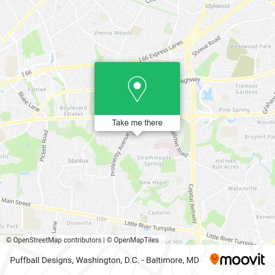
See Puffball Designs, Fairfax County, on the map
Public Transit to Puffball Designs in Fairfax County
Wondering how to get to Puffball Designs in Fairfax County? Moovit helps you find the best way to get to Puffball Designs with step-by-step directions from the nearest public transit station.
Moovit provides free maps and live directions to help you navigate through your city. View schedules, routes, timetables, and find out how long does it take to get to Puffball Designs in real time.
Looking for the nearest stop or station to Puffball Designs? Check out this list of stops closest to your destination: Williams Dr+Arlington Bl; Arlington Bl+Williams Dr; Willow Oaks Corporate Dr & Williams Dr; Dunn Loring Merrifield Metro Station.
Bus: 401, 402, 671, F60, F61, F62.Metro: ORANGE.
Want to see if there’s another route that gets you there at an earlier time? Moovit helps you find alternative routes or times. Get directions from and directions to Puffball Designs easily from the Moovit App or Website.
We make riding to Puffball Designs easy, which is why over 1.5 million users, including users in Fairfax County, trust Moovit as the best app for public transit. You don’t need to download an individual bus app or train app, Moovit is your all-in-one transit app that helps you find the best bus time or train time available.
For information on prices of bus and metro, costs and ride fares to Puffball Designs, please check the Moovit app.
Use the app to navigate to popular places including to the airport, hospital, stadium, grocery store, mall, coffee shop, school, college, and university.
Puffball Designs Address: 3232 Highland Ln street in Fairfax County
- Dianne OFlaragano,
- The Pine Ridge Group Inc,
- Unico Builders Inc,
- 8617 Crestview Dr,
- Monarch Ararat,
- 3309 Conquistador Ct,
- Astrobrite Carpet Cleaning Fairfax,
- Nvar Young Professionals Network,
- Nvar,
- Imex Worldwide,
- Northern Virginia Association of Realtors,
- Dr. Steven F. Berman M.D.,
- Dr. Eric Bruce Sklar M.D.,
- Virginia Nuclear Cardiology,
- Fairfax Hospital for Children,
- Michael B Rivers, MD,
- Bryan, Raybuck MD,
- Inova Cardiology,
- Retina Group of Washington PC,
- Sanjay Prasad MD
Places Near Puffball Designs (Fairfax County)
- Museum Of The Bible, Washington,
- Rock Creek Tennis Center, Washington,
- National Mall, Washington,
- Georgetown, Washington,
- The Anthem, Washington,
- Marriott Marquis Washington, DC, Washington,
- Amazon Hq2, Arlington County,
- National Museum of African American History and Culture, Washington,
- Warner Theatre, Washington,
- Pennsylvania Ave NW (3rd st and pennsylvania), Washington,
- Westfield Montgomery Mall, Montgomery County,
- Washington National Cathedral, Washington,
- Washington DC VA Medical Center, Washington,
- Camden Yards, Baltimore,
- M&T Bank Stadium, Baltimore,
- Sibley Memorial Hospital, Washington,
- Capital One Arena, Washington,
- Basilica of the National Shrine, Washington,
- National Zoo, Washington,
- PG Mall, Prince George's County
How to get to popular places in Washington, D.C. - Baltimore, MD with public transit
Get around Fairfax County by public transit!
Traveling around Fairfax County has never been so easy. See step by step directions as you travel to any attraction, street or major public transit station. View bus and train schedules, arrival times, service alerts and detailed routes on a map, so you know exactly how to get to anywhere in Fairfax County.
When traveling to any destination around Fairfax County use Moovit's Live Directions with Get Off Notifications to know exactly where and how far to walk, how long to wait for your line, and how many stops are left. Moovit will alert you when it's time to get off — no need to constantly re-check whether yours is the next stop.
Wondering how to use public transit in Fairfax County or how to pay for public transit in Fairfax County? Moovit public transit app can help you navigate your way with public transit easily, and at minimum cost. It includes public transit fees, ticket prices, and costs. Looking for a map of Fairfax County public transit lines? Moovit public transit app shows all public transit maps in Fairfax County with all Bus, Train, Metro, Light Rail and Ferry routes and stops on an interactive map.
Washington, D.C. - Baltimore, MD has 5 transit type(s), including: Bus, Train, Metro, Light Rail and Ferry, operated by several transit agencies, including WMATA, Montgomery County Ride On, Fairfax Connector, TheBus, PRTC, DASH - Alexandria, Arlington Transit (ART), RTA of Central Maryland, MDOT MTA, MDOT MTA Light RailLink, MDOT MTA Commuter Bus, MDOT MTA Local Bus, FXBGO!, Virginia Railway Express (VRE) and MARC