How to get to Pulsdata AS by bus?
Click on the bus route to see step by step directions with maps, line arrival times and updated time schedules.
From Sparkjøp Kokstad, Bergen
71 minFrom Equinor Asa, Avd. Kontor Bergen, Bergen
43 minFrom Slåtthaughallen, Bergen
52 minFrom Kokstad, Bergen
63 minFrom Scandic Kokstad, Bergen
56 minFrom Kanadaskogen, Bergen
42 minFrom Loddefjord, Bergen
33 minFrom Thon Hotel Bergen Airport, Bergen
55 minFrom Leo's Lekeland, Bergen
62 minFrom Lagunen, Bergen
34 min
Bus stops near Pulsdata AS in Bergen
Light Rail stations near Pulsdata AS in Bergen
Bus lines to Pulsdata AS in Bergen
What are the closest stations to Pulsdata AS?
The closest stations to Pulsdata AS are:
- Haukelandsveien is 157 meters away, 3 min walk.
- Haukeland Sjukehus Sør is 268 meters away, 4 min walk.
- Haukeland Sjukehus is 298 meters away, 4 min walk.
- Haukeland Sjukehus Nord is 731 meters away, 10 min walk.
- Kronstad is 858 meters away, 12 min walk.
- Montana Terrasse is 1243 meters away, 17 min walk.
Which bus lines stop near Pulsdata AS?
These bus lines stop near Pulsdata AS: 12, 16E, 20, 5, 51.
Which light rail line stops near Pulsdata AS?
1 (Nonneseter)
What’s the nearest light rail station to Pulsdata AS in Bergen?
The nearest light rail station to Pulsdata AS in Bergen is Haukeland Sjukehus. It’s a 11 min walk away.
What’s the nearest bus station to Pulsdata AS in Bergen?
The nearest bus station to Pulsdata AS in Bergen is Haukelandsveien. It’s a 3 min walk away.
What time is the first light rail to Pulsdata AS in Bergen?
The 2 is the first light rail that goes to Pulsdata AS in Bergen. It stops nearby at 3:00 AM.
What time is the last light rail to Pulsdata AS in Bergen?
The 1 is the last light rail that goes to Pulsdata AS in Bergen. It stops nearby at 1:08 AM.
What time is the first bus to Pulsdata AS in Bergen?
The 12 is the first bus that goes to Pulsdata AS in Bergen. It stops nearby at 3:00 AM.
What time is the last bus to Pulsdata AS in Bergen?
The 16E is the last bus that goes to Pulsdata AS in Bergen. It stops nearby at 12:54 AM.
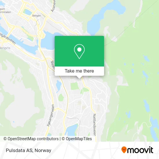
See Pulsdata AS, Bergen, on the map
Public Transit to Pulsdata AS in Bergen
Wondering how to get to Pulsdata AS in Bergen? Moovit helps you find the best way to get to Pulsdata AS with step-by-step directions from the nearest public transit station.
Moovit provides free maps and live directions to help you navigate through your city. View schedules, routes, timetables, and find out how long does it take to get to Pulsdata AS in real time.
Looking for the nearest stop or station to Pulsdata AS? Check out this list of stops closest to your destination: Haukelandsveien; Haukeland Sjukehus Sør; Haukeland Sjukehus; Haukeland Sjukehus Nord; Kronstad; Montana Terrasse.
Bus: 12, 16E, 20, 5, 51, 6, 27, 740, 934, NW420, 84.Light Rail: 1.
Want to see if there’s another route that gets you there at an earlier time? Moovit helps you find alternative routes or times. Get directions from and directions to Pulsdata AS easily from the Moovit App or Website.
We make riding to Pulsdata AS easy, which is why over 1.5 million users, including users in Bergen, trust Moovit as the best app for public transit. You don’t need to download an individual bus app or train app, Moovit is your all-in-one transit app that helps you find the best bus time or train time available.
For information on prices of bus and light rail, costs and ride fares to Pulsdata AS, please check the Moovit app.
Use the app to navigate to popular places including to the airport, hospital, stadium, grocery store, mall, coffee shop, school, college, and university.
Pulsdata AS Address: Gimlebakken 5 5052 Bergen street in Bergen
- Utsikta, Haukeland Universitetssjukehus,
- Helse Bergen - Haukeland Universitetssjukehus,
- Gerd Lillian Damm Knutsen,
- Jon Erik Thunold Oil,
- Linje 2 Birkelundstoppen-Strandkaiterminalen,
- Kunsthandler Eirik Nor Saghaug,
- Haukeland Universitetssjukehus,
- Marie Joys’ Hus,
- Konrad Birkhaugs Hus,
- Haukelandshallen,
- Gimle Oppveksttun - Skole,
- Montana Utsiktspunkt,
- Haukeland Sjukehus V / Hovedinngang Sør,
- Haukelandsveien 51,
- Slettebakksveien,
- Haukeland,
- Haukeland Sykehus P-Hus,
- Gimle Skole,
- Haukelandsbakken,
- Nedoverski Tor-Erik Haldorsen
Places Near Pulsdata AS (Bergen)
- Ulriken, Bergen,
- DFDS Seaways, Oslo,
- Jekta Storsenter, Tromsø,
- Voldsløkka, Oslo,
- Vestby Outlet Store, Vestby,
- Haukeland Universitetssjukehus, Bergen,
- Oslo S spor 19 (Trelastgata), Oslo,
- Radiumhospitalet, Oslo,
- Lovisenberg Diakonale Sykehus, Oslo,
- IKEA, Oslo,
- IKEA, Bergen,
- Quality Hotel Edvard Grieg, Bergen,
- Drammen Sykehus, Drammen,
- Color Line Terminal, Oslo,
- Tyholttårnet, Trondheim,
- Nylandsbrua, Oslo,
- Bjerke Travbane, Oslo,
- Ullevål Stadion (T), Oslo,
- Rikshospitalet (trikk), Oslo,
- Ikea Leangen, Trondheim
How to get to popular places in Norway with public transit
Get around Bergen by public transit!
Traveling around Bergen has never been so easy. See step by step directions as you travel to any attraction, street or major public transit station. View bus and train schedules, arrival times, service alerts and detailed routes on a map, so you know exactly how to get to anywhere in Bergen.
When traveling to any destination around Bergen use Moovit's Live Directions with Get Off Notifications to know exactly where and how far to walk, how long to wait for your line, and how many stops are left. Moovit will alert you when it's time to get off — no need to constantly re-check whether yours is the next stop.
Wondering how to use public transit in Bergen or how to pay for public transit in Bergen? Moovit public transit app can help you navigate your way with public transit easily, and at minimum cost. It includes public transit fees, ticket prices, and costs. Looking for a map of Bergen public transit lines? Moovit public transit app shows all public transit maps in Bergen with all Bus, Train, Subway, Light Rail, Ferry and Cable Car routes and stops on an interactive map.
Norway has 6 transit type(s), including: Bus, Train, Subway, Light Rail, Ferry and Cable Car, operated by several transit agencies, including Ruter, Skyss, AtB, Flytoget, Vy Tåg, SJ, Go-Ahead Norge AS, SJ Nord, Vestfold Kollektivtrafikk as, Snelandia, Innlandstrafikk, FRAM, FlixBus, Kolumbus and Brakar