How to get to Puma by bus?
Click on the bus route to see step by step directions with maps, line arrival times and updated time schedules.
From Randall's Island, Manhattan
93 minFrom Resorts World Shuttle Bus, Queens
59 minFrom East 96th Street, Manhattan
55 minFrom 103rd Street, Manhattan
57 minFrom Jackson Heights, NY, Queens
80 minFrom 68th Street-Hunter College, Manhattan
34 minFrom Hospital for Special Surgery, Manhattan
55 minFrom 23rd Street & 6th Ave., Manhattan
68 minFrom NJ 440, Jersey City
84 minFrom Walmart, North Bergen
80 min
How to get to Puma by train?
Click on the train route to see step by step directions with maps, line arrival times and updated time schedules.
How to get to Puma by subway?
Click on the subway route to see step by step directions with maps, line arrival times and updated time schedules.
From Randall's Island, Manhattan
57 minFrom Resorts World Shuttle Bus, Queens
43 minFrom East 96th Street, Manhattan
29 minFrom 103rd Street, Manhattan
30 minFrom Jackson Heights, NY, Queens
53 minFrom 68th Street-Hunter College, Manhattan
21 minFrom Hospital for Special Surgery, Manhattan
35 minFrom 23rd Street & 6th Ave., Manhattan
41 min
Bus stops near Puma in Manhattan
- Cleveland Pl/Spring St, 4 min walk,VIEW
- Broadway/Grand St, 4 min walk,VIEW
- Broadway/West Houston St, 5 min walk,VIEW
- Broadway & Spring St, 5 min walk,VIEW
- Broadway/Broome St, 6 min walk,VIEW
- West Houston St/Mercer St, 6 min walk,VIEW
- W Houston & Mercer St, 6 min walk,VIEW
- West Houston St/Greene St, 6 min walk,VIEW
Subway stations near Puma in Manhattan
Bus lines to Puma in Manhattan
- M1, Soho Centre St Via 5 Av/ Via Broadway,VIEW
- M55, South Ferry,VIEW
- SIM1, Eltngvlle Trans Ctr Via Hylan Via Rich,VIEW
- SIM1C, Eltngvlle Trans Ctr Via Hylan Via Rich,VIEW
- SIM3C, Pt Rchmnd Via Narrows Rd N Via Watchogue,VIEW
- SIM4C, Huguenot Via Richmond Av Via Arthur Kill,VIEW
- SIM33C, Mariners Harbor Via N Gannon Av,VIEW
- SIM34, Mariners Harbor Via Watchogue Rd,VIEW
- SHORTLINE HUDSON, 500 - Monroe - Chester - Goshen,VIEW
- SHORTLINE HUDSON, 200 - Northern District – Nanuet,VIEW
- SHORTLINE HUDSON, 800 - Pennsylvania,VIEW
- SHORTLINE HUDSON, 700 - Newburgh - Poughkeepsie,VIEW
- SHORTLINE HUDSON, 300 - NYC - Middletown,VIEW
- X27, Bay Ridge Shore Rd Via Broadway,VIEW
- X28, Coney Island Sea Gate Via Broadway,VIEW
- SIM7, Eltvlle Trans Ctr Via Hylan Via Richmond,VIEW
- SIM9, Eltingville Via F Cap Via Hylan Bl,VIEW
- SIM33, Mariners Harbor Via N Gannon Av,VIEW
- DOWNTOWN LOCAL, W Houston & Mercer St,VIEW
- M21, Soho Washington St Crosstown,VIEW
What are the closest stations to Puma?
The closest stations to Puma are:
- Cleveland Pl/Spring St is 235 yards away, 4 min walk.
- Broadway/Grand St is 254 yards away, 4 min walk.
- Broadway/West Houston St is 328 yards away, 5 min walk.
- Broadway & Spring St is 373 yards away, 5 min walk.
- Broadway/Broome St is 412 yards away, 6 min walk.
- West Houston St/Mercer St is 414 yards away, 6 min walk.
- W Houston & Mercer St is 425 yards away, 6 min walk.
- West Houston St/Greene St is 454 yards away, 6 min walk.
- Spring St is 545 yards away, 7 min walk.
- Prince St is 560 yards away, 7 min walk.
- Broadway-Lafayette St is 699 yards away, 9 min walk.
- Canal St is 809 yards away, 10 min walk.
Which bus lines stop near Puma?
These bus lines stop near Puma: 120, M1, M35.
Which train lines stop near Puma?
These train lines stop near Puma: 2, YEL.
Which subway lines stop near Puma?
These subway lines stop near Puma: 6, 6X, F, R, W.
What’s the nearest subway station to Puma in Manhattan?
The nearest subway stations to Puma in Manhattan are Spring St and Prince St. The closest one is a 7 min walk away.
What’s the nearest bus station to Puma in Manhattan?
The nearest bus stations to Puma in Manhattan are Cleveland Pl/Spring St and Broadway/Grand St. The closest one is a 4 min walk away.
What time is the first subway to Puma in Manhattan?
The N is the first subway that goes to Puma in Manhattan. It stops nearby at 3:00 AM.
What time is the last subway to Puma in Manhattan?
The 6 is the last subway that goes to Puma in Manhattan. It stops nearby at 4:01 AM.
What time is the first bus to Puma in Manhattan?
The SIM1C is the first bus that goes to Puma in Manhattan. It stops nearby at 3:48 AM.
What time is the last bus to Puma in Manhattan?
The SIM1C is the last bus that goes to Puma in Manhattan. It stops nearby at 2:49 AM.
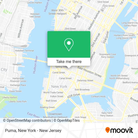
See Puma, Manhattan, on the map
Public Transit to Puma in Manhattan
Wondering how to get to Puma in Manhattan? Moovit helps you find the best way to get to Puma with step-by-step directions from the nearest public transit station.
Moovit provides free maps and live directions to help you navigate through your city. View schedules, routes, timetables, and find out how long does it take to get to Puma in real time.
Looking for the nearest stop or station to Puma? Check out this list of stops closest to your destination: Cleveland Pl/Spring St; Broadway/Grand St; Broadway/West Houston St; Broadway & Spring St; Broadway/Broome St; West Houston St/Mercer St; W Houston & Mercer St; West Houston St/Greene St; Spring St; Prince St; Broadway-Lafayette St; Canal St.
Bus: 120, M1, M35, M55.Train: 2, YEL.Subway: 6, 6X, F, R, W, 4, N, Q, B, D, FX, M, J, Z.
Want to see if there’s another route that gets you there at an earlier time? Moovit helps you find alternative routes or times. Get directions from and directions to Puma easily from the Moovit App or Website.
We make riding to Puma easy, which is why over 1.5 million users, including users in Manhattan, trust Moovit as the best app for public transit. You don’t need to download an individual bus app or train app, Moovit is your all-in-one transit app that helps you find the best bus time or train time available.
For information on prices of bus, subway and train, costs and ride fares to Puma, please check the Moovit app.
Use the app to navigate to popular places including to the airport, hospital, stadium, grocery store, mall, coffee shop, school, college, and university.
Location: Manhattan, New York - New Jersey
- Digital Asset Holdings,
- Vero Moda,
- Accessx,
- A-Ok Cafe,
- Cafe Bari Soho,
- SoHo,
- Testaurant,
- Victoria Beckham Beauty,
- Awara Sleep,
- Grasshopper Pilates,
- Alo Yoga,
- Aritzia,
- House Of Piff,
- Berta,
- NIKE Soho,
- Brett Micheals,
- Cherry Valley 529 Broadway,
- NIKE,
- Wknd Nation,
- Josh Lehrer Photography
Places Near Puma (Manhattan)
- Times Square, Manhattan,
- Bellevue Hospital, Manhattan,
- Chinatown, Manhattan,
- SoHo, Manhattan,
- Katz's Deli, Manhattan,
- 3 Stone St, Manhattan,
- 1 Police Plaza, Manhattan,
- 911 Memorial, Manhattan,
- qqqq, Manhattan,
- 26 Federal Plaza, Manhattan,
- Mountainside Hospital, Glen Ridge,
- 111 Centre New York City Supreme Court, Manhattan,
- Queens Center Mall, Queens,
- Rockefeller Center, Manhattan,
- Pier 83, Manhattan,
- 66 John Street, Manhattan,
- 376 Hudson Street, Manhattan,
- San Gennaro Feast, Manhattan,
- Hudson Yards, Manhattan,
- Wall Street, Manhattan
How to get to popular places in New York - New Jersey with public transit
Get around Manhattan by public transit!
Traveling around Manhattan has never been so easy. See step by step directions as you travel to any attraction, street or major public transit station. View bus and train schedules, arrival times, service alerts and detailed routes on a map, so you know exactly how to get to anywhere in Manhattan.
When traveling to any destination around Manhattan use Moovit's Live Directions with Get Off Notifications to know exactly where and how far to walk, how long to wait for your line, and how many stops are left. Moovit will alert you when it's time to get off — no need to constantly re-check whether yours is the next stop.
Wondering how to use public transit in Manhattan or how to pay for public transit in Manhattan? Moovit public transit app can help you navigate your way with public transit easily, and at minimum cost. It includes public transit fees, ticket prices, and costs. Looking for a map of Manhattan public transit lines? Moovit public transit app shows all public transit maps in Manhattan with all Bus, Train, Subway, Light Rail, Ferry and Cable Car routes and stops on an interactive map.
New York - New Jersey has 6 transit type(s), including: Bus, Train, Subway, Light Rail, Ferry and Cable Car, operated by several transit agencies, including MTA Subway, Metro-North Railroad, LIRR, PATH, MTA New York City Transit - Express routes, MTA Bus, NJ Transit, NYC Ferry, NICE bus, Bee-Line Bus, NJ Transit Rail, Norwalk Transit District, Hartford Line, River Valley Transit and HART