How to get to Punk Brother's Club by bus?
Click on the bus route to see step by step directions with maps, line arrival times and updated time schedules.
From Mimarsinan Devlet Hastanesi, Büyükçekmece
133 minFrom İstanbul Büyükçekmece Mimar Sinan Devlet Hastanesi, Büyükçekmece
129 minFrom Tekirdağ Yeniçiftlik, Büyükçekmece
113 minFrom Mimaroba, Büyükçekmece
132 minFrom Çatalca İETT Durağı, Çatalca
186 minFrom Büyükçekmece/Tepecik, Büyükçekmece
153 minFrom Kumburgaz, Büyükçekmece
113 minFrom Büyükçekmece Adliyesi, Büyükçekmece
130 min
Bus stop near Punk Brother's Club in Üsküdar
- Kavaklı Merkez Cami - Tüyap Yönü, 4 min walk,VIEW
Dolmus & Minibus stations near Punk Brother's Club in Üsküdar
Bus lines to Punk Brother's Club in Üsküdar
- 300M, Tüyap - Metrobüs-Toki 2,VIEW
What are the closest stations to Punk Brother's Club?
The closest stations to Punk Brother's Club are:
- Kavaklı Merkez Cami - Tüyap Yönü is 269 meters away, 4 min walk.
- Ihlamur Sk is 302 meters away, 5 min walk.
- Kavaklı Merkez - Silivri Yönü is 306 meters away, 5 min walk.
- Ihlamur Sokak is 330 meters away, 5 min walk.
Which bus lines stop near Punk Brother's Club?
These bus lines stop near Punk Brother's Club: 300G, 303A.
Which Dolmus & Minibus lines stop near Punk Brother's Club?
These Dolmus & Minibus lines stop near Punk Brother's Club: BL322, BL324.
What’s the nearest bus station to Punk Brother's Club in Üsküdar?
The nearest bus station to Punk Brother's Club in Üsküdar is Kavaklı Merkez Cami - Tüyap Yönü. It’s a 4 min walk away.
What’s the nearest Dolmus & Minibus station to Punk Brother's Club in Üsküdar?
The nearest Dolmus & Minibus stations to Punk Brother's Club in Üsküdar are Ihlamur Sk, Kavaklı Merkez - Silivri Yönü and Ihlamur Sokak. The closest one is a 5 min walk away.
What time is the first Dolmus & Minibus to Punk Brother's Club in Üsküdar?
The BL324 is the first Dolmus & Minibus that goes to Punk Brother's Club in Üsküdar. It stops nearby at 6:10 AM.
What time is the last Dolmus & Minibus to Punk Brother's Club in Üsküdar?
The BL322 is the last Dolmus & Minibus that goes to Punk Brother's Club in Üsküdar. It stops nearby at 11:37 PM.
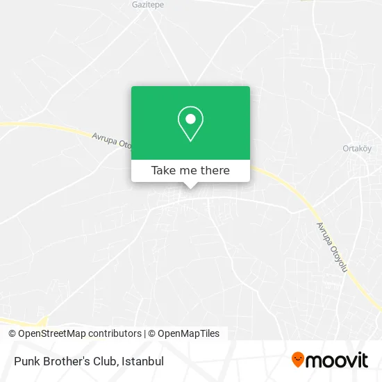
See Punk Brother's Club, Üsküdar, on the map
Public Transit to Punk Brother's Club in Üsküdar
Wondering how to get to Punk Brother's Club in Üsküdar? Moovit helps you find the best way to get to Punk Brother's Club with step-by-step directions from the nearest public transit station.
Moovit provides free maps and live directions to help you navigate through your city. View schedules, routes, timetables, and find out how long does it take to get to Punk Brother's Club in real time.
Looking for the nearest stop or station to Punk Brother's Club? Check out this list of stops closest to your destination: Kavaklı Merkez Cami - Tüyap Yönü; Ihlamur Sk; Kavaklı Merkez - Silivri Yönü; Ihlamur Sokak.
Bus: 300G, 303A, 300M.Dolmus & Minibus: BL322, BL324.
Want to see if there’s another route that gets you there at an earlier time? Moovit helps you find alternative routes or times. Get directions from and directions to Punk Brother's Club easily from the Moovit App or Website.
We make riding to Punk Brother's Club easy, which is why over 1.5 million users, including users in Üsküdar, trust Moovit as the best app for public transit. You don’t need to download an individual bus app or train app, Moovit is your all-in-one transit app that helps you find the best bus time or train time available.
For information on prices of Dolmus & Minibus and bus, costs and ride fares to Punk Brother's Club, please check the Moovit app.
Use the app to navigate to popular places including to the airport, hospital, stadium, grocery store, mall, coffee shop, school, college, and university.
Punk Brother's Club Address: Celil Sokak, 34596 Hürriyet, Silivri street in Üsküdar
- Ceviz Altında, Semaverde Çay Keyfi,
- Menekşe Sokak,
- Kavaklı PTT,
- Nolu TJK Bayii,
- Kavaklı Yonca Kuyumculuk,
- Selimpaşa/Ortaköy Ünal Kablo,
- Silivri Belediyesi Kavaklı Ek Hizmet Binası,
- Topaloğlu Holding,
- Betek/Tasdel/Cbk Muh,
- Şinasi Turizm,
- Ümm-Et Steakhouse,
- Kàhya Şark Köşesi,
- Istiklal Ceddesi,
- Kaya Turizm,
- Çilek,
- Tatil City,
- Yataş,
- Ölümcül Spor Kompleksi,
- Seyit Et Lokantası,
- Karabulut Çiftlik
Places Near Punk Brother's Club (Üsküdar)
- Karaköy Genelevi, Karaköy, Beyoğlu,
- Başakşehir Çam Ve Sakura Şehir Hastanesi, Basaksehir,
- Hilltown AVM, Maltepe,
- Şehit Prof. Dr. İlhan Varank Eğitim Ve Araştırma Hastanesi, Sancaktepe,
- Mehmet Emin Tokadî Hz. Türbesi, Fatih,
- 212 AVM, Bagcilar,
- 41 Burda AVM, Kocaeli Merkezi,
- Gebze-Harem Minibüs Hattı, Gebze,
- Gebze Koop Durağı, Gebze,
- 2 Nolu Minibüss, Beylikduzu,
- Mall Of İstanbul, Basaksehir,
- İstanbul,
- METROPOL IsTaNBuL, Ataşehir,
- Topkule Kışlası 47.Komando Tugay Komutanlığı, Esenler,
- Beylikdüzü - 4 Nolu Minibüs Hattı, Beylikduzu,
- Bakırköy Sosyete Pazarı, Bakirköy,
- Hz. Yuşa Tepesi, Beykoz,
- Tersane İstanbul, Beyoğlu,
- İstinye Park, Sariyer,
- VİALAND AVM, Eyüp
How to get to popular places in Istanbul with public transit
Get around Üsküdar by public transit!
Traveling around Üsküdar has never been so easy. See step by step directions as you travel to any attraction, street or major public transit station. View bus and train schedules, arrival times, service alerts and detailed routes on a map, so you know exactly how to get to anywhere in Üsküdar.
When traveling to any destination around Üsküdar use Moovit's Live Directions with Get Off Notifications to know exactly where and how far to walk, how long to wait for your line, and how many stops are left. Moovit will alert you when it's time to get off — no need to constantly re-check whether yours is the next stop.
Wondering how to use public transit in Üsküdar or how to pay for public transit in Üsküdar? Moovit public transit app can help you navigate your way with public transit easily, and at minimum cost. It includes public transit fees, ticket prices, and costs. Looking for a map of Üsküdar public transit lines? Moovit public transit app shows all public transit maps in Üsküdar with all Bus, Train, Metro, Tram, Ferry, Metrobus and Dolmus & Minibus routes and stops on an interactive map.
Istanbul has 7 transit type(s), including: Bus, Train, Metro, Tram, Ferry, Metrobus and Dolmus & Minibus, operated by several transit agencies, including Marmaray, Metro İstanbul, Metrobüs, UAB, İETT, İETT ÇIFT KATLI HATLAR, İETT BÖLGESEL HATLAR, TCDD, Şehir Hatları, Dentur Avrasya, Beyden, Turyol, Mavi Marmara, Havaist and Prenstur
