How to get to Pure Digital by bus?
Click on the bus route to see step by step directions with maps, line arrival times and updated time schedules.
From Hallets Point, Queens
96 minFrom Central Park, Manhattan
53 minFrom American Museum of Natural History, Manhattan
77 minFrom East 96th Street, Manhattan
67 minFrom John Jay College, Manhattan
71 minFrom Saks Fifth Avenue, Manhattan
40 minFrom Ghostbusters Building, Manhattan
68 minFrom Walmart Supercenter, Secaucus
97 minFrom Walmart Supercenter, Bayonne
70 minFrom Walmart, Secaucus
97 min
How to get to Pure Digital by train?
Click on the train route to see step by step directions with maps, line arrival times and updated time schedules.
How to get to Pure Digital by subway?
Click on the subway route to see step by step directions with maps, line arrival times and updated time schedules.
Bus stops near Pure Digital in Manhattan
Ferry stations near Pure Digital in Manhattan
Bus lines to Pure Digital in Manhattan
- DOWNTOWN CONNECTION, Chambers Street,VIEW
- M15, East Harlem 125 St Via 1 Av,VIEW
- SIM5, Eltvlle Trans Ctr Via F Cap Bl Via Gfrds,VIEW
- SIM35, Port Richmond Via Clove Rd,VIEW
- M15-SBS, Select Bus Service South Ferry Via 2 Av,VIEW
- BM1, Mill Basin - Downtown/Midtown,VIEW
- BM2, Canarsie/Spring Creek - Downtown/Midtown,VIEW
- BM3, Sheepshead Bay - Downtown/Midtown,VIEW
- BM4, Gerritsen Beach - Downtown/Midtown,VIEW
- SIM15, Eltingville Transit Center Via Richmond,VIEW
- QM7, Downtown,VIEW
- QM8, Super Express Glen Oaks 260 St Via Fresh Meadows,VIEW
- QM11, Forest Hills,VIEW
- QM25, Downtown Via Church St Via Water St,VIEW
- QM65, Laurelton,VIEW
What are the closest stations to Pure Digital?
The closest stations to Pure Digital are:
- Broad St is 44 yards away, 1 min walk.
- Water St/Wall St is 130 yards away, 2 min walk.
- Water St/Pine St is 139 yards away, 2 min walk.
- Wall St is 157 yards away, 3 min walk.
- Water St/Maiden Ln is 192 yards away, 3 min walk.
- Water St/Gouverneur Ln is 209 yards away, 3 min walk.
- Wall St/Pier 11 is 320 yards away, 4 min walk.
- Pier 11 / Wall Street is 382 yards away, 5 min walk.
Which bus lines stop near Pure Digital?
These bus lines stop near Pure Digital: 120, BXM18, M15, M15-SBS.
Which train line stops near Pure Digital?
GRE (Hoboken - World Trade Center)
Which subway lines stop near Pure Digital?
These subway lines stop near Pure Digital: 2, 3, A, C.
Which ferry lines stop near Pure Digital?
These ferry lines stop near Pure Digital: AS, PAULUS HOOK - PIER 11 / WALL ST.
What’s the nearest subway station to Pure Digital in Manhattan?
The nearest subway station to Pure Digital in Manhattan is Broad St. It’s a 1 min walk away.
What’s the nearest bus station to Pure Digital in Manhattan?
The nearest bus stations to Pure Digital in Manhattan are Water St/Wall St and Water St/Pine St. The closest one is a 2 min walk away.
What’s the nearest ferry station to Pure Digital in Manhattan?
The nearest ferry station to Pure Digital in Manhattan is Wall St/Pier 11. It’s a 4 min walk away.
What time is the first subway to Pure Digital in Manhattan?
The 3 is the first subway that goes to Pure Digital in Manhattan. It stops nearby at 3:00 AM.
What time is the last subway to Pure Digital in Manhattan?
The 2 is the last subway that goes to Pure Digital in Manhattan. It stops nearby at 4:12 AM.
What time is the first bus to Pure Digital in Manhattan?
The M15 is the first bus that goes to Pure Digital in Manhattan. It stops nearby at 3:02 AM.
What time is the last bus to Pure Digital in Manhattan?
The M15 is the last bus that goes to Pure Digital in Manhattan. It stops nearby at 3:14 AM.
What time is the first ferry to Pure Digital in Manhattan?
The RS is the first ferry that goes to Pure Digital in Manhattan. It stops nearby at 6:05 AM.
What time is the last ferry to Pure Digital in Manhattan?
The SG is the last ferry that goes to Pure Digital in Manhattan. It stops nearby at 10:08 PM.
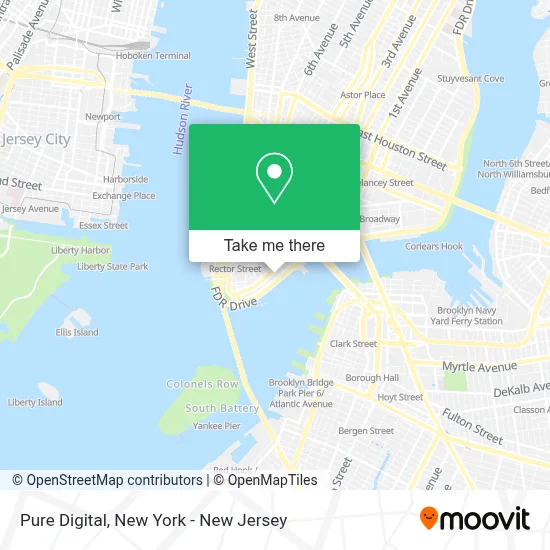
See Pure Digital, Manhattan, on the map
Public Transit to Pure Digital in Manhattan
Wondering how to get to Pure Digital in Manhattan? Moovit helps you find the best way to get to Pure Digital with step-by-step directions from the nearest public transit station.
Moovit provides free maps and live directions to help you navigate through your city. View schedules, routes, timetables, and find out how long does it take to get to Pure Digital in real time.
Looking for the nearest stop or station to Pure Digital? Check out this list of stops closest to your destination: Broad St; Water St/Wall St; Water St/Pine St; Wall St; Water St/Maiden Ln; Water St/Gouverneur Ln; Wall St/Pier 11; Pier 11 / Wall Street.
Bus: 120, BXM18, M15, M15-SBS, DOWNTOWN CONNECTION.Train: GRE.Subway: 2, 3, A, C, J, Z, 4, 5.Ferry: AS, PAULUS HOOK - PIER 11 / WALL ST, ER, GI, RS, SB.
Want to see if there’s another route that gets you there at an earlier time? Moovit helps you find alternative routes or times. Get directions from and directions to Pure Digital easily from the Moovit App or Website.
We make riding to Pure Digital easy, which is why over 1.5 million users, including users in Manhattan, trust Moovit as the best app for public transit. You don’t need to download an individual bus app or train app, Moovit is your all-in-one transit app that helps you find the best bus time or train time available.
For information on prices of subway, bus, ferry, light rail and train, costs and ride fares to Pure Digital, please check the Moovit app.
Use the app to navigate to popular places including to the airport, hospital, stadium, grocery store, mall, coffee shop, school, college, and university.
Pure Digital Address: 110 Wall St street in Manhattan
- American Financiers Group,
- Midtown Tours,
- Getmeontop,
- Seven Results,
- Green Building Worldwide,
- Martha Feeney Tax Services,
- Amaze Law Firm,
- Credit Clear North,
- Asset Protection Training,
- Welive Wall Street,
- Abe's Hebrew-English Translations (Manhattan, Boro Park, Li & Nj),
- Aiesec United States,
- Taxdoc,
- Elevate Marketing,
- Placemakr Wall Street,
- First Due,
- Together We Trade,
- Flume Internet, Inc.,
- Contact Kinetx,
- Wework Coworking & Office Space
Places Near Pure Digital (Manhattan)
- Mountainside Hospital, Glen Ridge,
- SoHo, Manhattan,
- San Gennaro Feast, Manhattan,
- Queens Center Mall, Queens,
- Rockefeller Center, Manhattan,
- 911 Memorial, Manhattan,
- 111 Centre New York City Supreme Court, Manhattan,
- 1 Police Plaza, Manhattan,
- 376 Hudson Street, Manhattan,
- Bellevue Hospital, Manhattan,
- Times Square, Manhattan,
- Hudson Yards, Manhattan,
- 66 John Street, Manhattan,
- 3 Stone St, Manhattan,
- Chinatown, Manhattan,
- 26 Federal Plaza, Manhattan,
- Katz's Deli, Manhattan,
- qqqq, Manhattan,
- Pier 83, Manhattan,
- Wall Street, Manhattan
How to get to popular places in New York - New Jersey with public transit
Get around Manhattan by public transit!
Traveling around Manhattan has never been so easy. See step by step directions as you travel to any attraction, street or major public transit station. View bus and train schedules, arrival times, service alerts and detailed routes on a map, so you know exactly how to get to anywhere in Manhattan.
When traveling to any destination around Manhattan use Moovit's Live Directions with Get Off Notifications to know exactly where and how far to walk, how long to wait for your line, and how many stops are left. Moovit will alert you when it's time to get off — no need to constantly re-check whether yours is the next stop.
Wondering how to use public transit in Manhattan or how to pay for public transit in Manhattan? Moovit public transit app can help you navigate your way with public transit easily, and at minimum cost. It includes public transit fees, ticket prices, and costs. Looking for a map of Manhattan public transit lines? Moovit public transit app shows all public transit maps in Manhattan with all Bus, Train, Subway, Light Rail, Ferry and Cable Car routes and stops on an interactive map.
New York - New Jersey has 6 transit type(s), including: Bus, Train, Subway, Light Rail, Ferry and Cable Car, operated by several transit agencies, including MTA Subway, Metro-North Railroad, LIRR, PATH, MTA New York City Transit - Express routes, MTA Bus, NJ Transit, NYC Ferry, NICE bus, Bee-Line Bus, NJ Transit Rail, Norwalk Transit District, Hartford Line, River Valley Transit and HART