Directions to Puzzling Adventures (Wichita) with public transportation
The following transit lines have routes that pass near Puzzling Adventures
How to get to Puzzling Adventures by bus?
Click on the bus route to see step by step directions with maps, line arrival times and updated time schedules.
From Intrust Bank, Wichita
24 minFrom Eddie's Cafe, Wichita
36 minFrom Midwest Kansas, Wichita
47 minFrom A 1 Mold Testing & Remediation Services, Wichita
41 minFrom Two Hands Corn Dogs, Wichita
28 minFrom Kaykays Bling Bling LLC- Plus Size Clothing Boutique, Wichita
28 minFrom Molino's, Wichita
70 minFrom Oaklawn Activity Center, Oaklawn-Sunview
45 minFrom W Central Ave, Wichita
36 minFrom Super, Wichita
67 min
Bus stops near Puzzling Adventures in Wichita
Bus lines to Puzzling Adventures in Wichita
- ROUTE28: KU MED-, 28 Inbound,VIEW
- NORTH HIGH SCHOO, North High To Sc,VIEW
- Q-LINE CLIFTON T, Q Westbound,VIEW
- ROUTE21: DOUGLAS, Route 21 Inbound,VIEW
- ROUTE14: DOUGLAS, Route 14 Outboun,VIEW
- ROUTE17: RIVERSI, Route 17 Outboun,VIEW
- ROUTE25: E CENTR, Route 25 Outboun,VIEW
- EAST HIGH SCHOOL, East High School,VIEW
What are the closest stations to Puzzling Adventures?
The closest stations to Puzzling Adventures are:
- Old Town Wsu Inbound is 133 yards away, 2 min walk.
- Old Town Wsu Outbound is 213 yards away, 3 min walk.
- Douglas And Mead Ib is 400 yards away, 5 min walk.
- Emporia & 2nd St Outbd Outbd is 434 yards away, 6 min walk.
- Douglas & Rock Island Inbd is 439 yards away, 6 min walk.
Which bus lines stop near Puzzling Adventures?
These bus lines stop near Puzzling Adventures: ROUTE11: MAPLE-R, ROUTE12: DOUGLAS, ROUTE15: DOUGLAS, ROUTE21: DOUGLAS, ROUTE28: KU MED-.
What’s the nearest bus station to Puzzling Adventures in Wichita?
The nearest bus station to Puzzling Adventures in Wichita is Old Town Wsu Inbound. It’s a 2 min walk away.
What time is the first bus to Puzzling Adventures in Wichita?
The ROUTE28: KU MED- is the first bus that goes to Puzzling Adventures in Wichita. It stops nearby at 5:11 AM.
What time is the last bus to Puzzling Adventures in Wichita?
The ROUTE21: DOUGLAS is the last bus that goes to Puzzling Adventures in Wichita. It stops nearby at 10:30 PM.
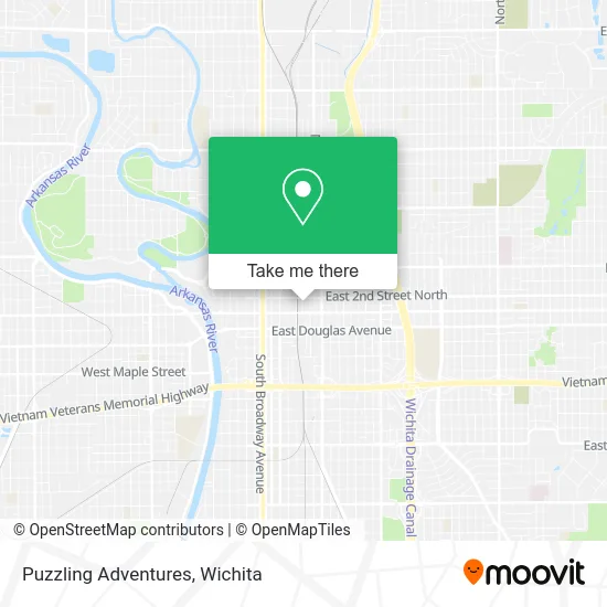
See Puzzling Adventures, Wichita, on the map
Public Transit to Puzzling Adventures in Wichita
Wondering how to get to Puzzling Adventures in Wichita? Moovit helps you find the best way to get to Puzzling Adventures with step-by-step directions from the nearest public transit station.
Moovit provides free maps and live directions to help you navigate through your city. View schedules, routes, timetables, and find out how long does it take to get to Puzzling Adventures in real time.
Looking for the nearest stop or station to Puzzling Adventures? Check out this list of stops closest to your destination: Old Town Wsu Inbound; Old Town Wsu Outbound; Douglas And Mead Ib; Emporia & 2nd St Outbd Outbd; Douglas & Rock Island Inbd.
Bus: ROUTE11: MAPLE-R, ROUTE12: DOUGLAS, ROUTE15: DOUGLAS, ROUTE21: DOUGLAS, ROUTE28: KU MED-, NORTH HIGH SCHOO, Q-LINE CLIFTON T, ROUTE14: DOUGLAS, ROUTE17: RIVERSI, ROUTE25: E CENTR, EAST HIGH SCHOOL.
Want to see if there’s another route that gets you there at an earlier time? Moovit helps you find alternative routes or times. Get directions from and directions to Puzzling Adventures easily from the Moovit App or Website.
We make riding to Puzzling Adventures easy, which is why over 1.5 million users, including users in Wichita, trust Moovit as the best app for public transit. You don’t need to download an individual bus app or train app, Moovit is your all-in-one transit app that helps you find the best bus time or train time available.
For information on prices of bus, costs and ride fares to Puzzling Adventures, please check the Moovit app.
Use the app to navigate to popular places including to the airport, hospital, stadium, grocery store, mall, coffee shop, school, college, and university.
Puzzling Adventures Address: 243 N Mead St Wichita, KS 67202 street in Wichita
- 243 N Mead Parking,
- Wichita State University Community Engagement Institute,
- WSU Old Town,
- 2nd St and Moore,
- Hitone Loft Apartments,
- Fresh Roast Coffee Company,
- Hana Next Door,
- Old Town Garage,
- Tamsyn's Gallery by Micky Maddux,
- Pumphouse,
- Katie Stuber: Hair Stylist,
- Meg Ingram,
- Salon Q,
- HFG Architecture,
- Todd Brian's Brick Street Cafe & Tavern,
- Adecco,
- Walker's Jazz Lounge,
- ATM,
- Sushiya,
- Spring Step
Places Near Puzzling Adventures (Wichita)
- Hubb's glory hole, Wichita,
- Lopez Services, Wichita,
- Ascencion Via Christi Hospital St Francis, Wichita,
- Four Corners Cafe @ Wesley Medical Center, Wichita,
- Wichita Dwight D. Eisenhower National Airport (ICT) (Wichita Eisenhower National Airport), Wichita,
- 21st & Maize, Wichita,
- East 21st Street North and Webb Road, Wichita,
- Ratcliff Auto and Truck Repair, Wichita,
- Total Card Solutions, Wichita,
- Paige Place Apartments, Wichita,
- Spirit Aerosystems Inc, Building 1-198D,
- McConnell Air Force Base, Mcconnell Afb,
- Spirit AeroSystems, Bldg 2-280J (Section 9),
- Afghan Halal Market, Wichita,
- Sena African Hair Braiding LLC, Wichita,
- North High School, Wichita,
- Westside Athletic Field (Friends University Baseball Field), Wichita,
- Bmer Tech Automotive, Wichita,
- Towne East Mall, Wichita,
- Spirit Aerosystems
How to get to popular places in Wichita with public transit
Get around Wichita by public transit!
Traveling around Wichita has never been so easy. See step by step directions as you travel to any attraction, street or major public transit station. View bus and train schedules, arrival times, service alerts and detailed routes on a map, so you know exactly how to get to anywhere in Wichita.
When traveling to any destination around Wichita use Moovit's Live Directions with Get Off Notifications to know exactly where and how far to walk, how long to wait for your line, and how many stops are left. Moovit will alert you when it's time to get off — no need to constantly re-check whether yours is the next stop.
Wondering how to use public transit in Wichita or how to pay for public transit in Wichita? Moovit public transit app can help you navigate your way with public transit easily, and at minimum cost. It includes public transit fees, ticket prices, and costs. Looking for a map of Wichita public transit lines? Moovit public transit app shows all public transit maps in Wichita with all bus routes and stops on an interactive map.
Wichita has 1 transit type(s), including: bus, operated by several transit agencies, including Wichita Transit, Greyhound-us and FlixBus-us