How to get to Pyramid Club by bus?
Click on the bus route to see step by step directions with maps, line arrival times and updated time schedules.
From Queens Center Mall, Queens
50 minFrom Macy's, Queens
48 minFrom 125th St & Park Ave, Manhattan
69 minFrom Middle Village, NY, Queens
68 minFrom 23rd Street & 6th Ave., Manhattan
68 minFrom East 85th Street, Manhattan
56 minFrom 125, Manhattan
67 minFrom Maspeth, NY, Queens
70 minFrom Museo Americano de Historia Natural, Manhattan
63 minFrom Hudson Mall, Jersey City
122 min
How to get to Pyramid Club by train?
Click on the train route to see step by step directions with maps, line arrival times and updated time schedules.
How to get to Pyramid Club by subway?
Click on the subway route to see step by step directions with maps, line arrival times and updated time schedules.
From Queens Center Mall, Queens
44 minFrom Macy's, Queens
44 minFrom 125th St & Park Ave, Manhattan
45 minFrom Middle Village, NY, Queens
46 minFrom 23rd Street & 6th Ave., Manhattan
48 minFrom East 85th Street, Manhattan
34 minFrom 125, Manhattan
43 minFrom Museo Americano de Historia Natural, Manhattan
29 min
Bus stops near Pyramid Club in Manhattan
Subway stations near Pyramid Club in Manhattan
Bus lines to Pyramid Club in Manhattan
What are the closest stations to Pyramid Club?
The closest stations to Pyramid Club are:
- Allen St/Stanton St is 247 yards away, 4 min walk.
- Allen St/E Houston St is 267 yards away, 4 min walk.
- Allen St/Delancey St is 281 yards away, 4 min walk.
- 2 Av is 305 yards away, 4 min walk.
- East Houston St/Forsyth St is 324 yards away, 4 min walk.
- Bowery/Prince St is 389 yards away, 5 min walk.
- Essex St/Rivington St is 395 yards away, 5 min walk.
- Delancey St-Essex St is 502 yards away, 7 min walk.
- Spring St is 674 yards away, 8 min walk.
- Grand St is 821 yards away, 10 min walk.
Which bus lines stop near Pyramid Club?
These bus lines stop near Pyramid Club: B39, M103, M15, M15-SBS.
Which train line stops near Pyramid Club?
BLU (Hoboken - 33rd Street)
Which subway lines stop near Pyramid Club?
These subway lines stop near Pyramid Club: 6X, B, F, J, M.
What’s the nearest subway station to Pyramid Club in Manhattan?
The nearest subway station to Pyramid Club in Manhattan is 2 Av. It’s a 4 min walk away.
What’s the nearest bus station to Pyramid Club in Manhattan?
The nearest bus stations to Pyramid Club in Manhattan are Allen St/Stanton St, Allen St/E Houston St, Allen St/Delancey St and East Houston St/Forsyth St. The closest one is a 4 min walk away.
What time is the first subway to Pyramid Club in Manhattan?
The F is the first subway that goes to Pyramid Club in Manhattan. It stops nearby at 3:01 AM.
What time is the last subway to Pyramid Club in Manhattan?
The F is the last subway that goes to Pyramid Club in Manhattan. It stops nearby at 3:58 AM.
What time is the first bus to Pyramid Club in Manhattan?
The M15 is the first bus that goes to Pyramid Club in Manhattan. It stops nearby at 3:02 AM.
What time is the last bus to Pyramid Club in Manhattan?
The M103 is the last bus that goes to Pyramid Club in Manhattan. It stops nearby at 3:28 AM.
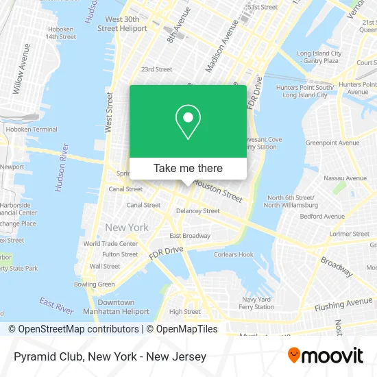
See Pyramid Club, Manhattan, on the map
Public Transit to Pyramid Club in Manhattan
Wondering how to get to Pyramid Club in Manhattan? Moovit helps you find the best way to get to Pyramid Club with step-by-step directions from the nearest public transit station.
Moovit provides free maps and live directions to help you navigate through your city. View schedules, routes, timetables, and find out how long does it take to get to Pyramid Club in real time.
Looking for the nearest stop or station to Pyramid Club? Check out this list of stops closest to your destination: Allen St/Stanton St; Allen St/E Houston St; Allen St/Delancey St; 2 Av; East Houston St/Forsyth St; Bowery/Prince St; Essex St/Rivington St; Delancey St-Essex St; Spring St; Grand St.
Bus: B39, M103, M15, M15-SBS.Train: BLU.Subway: 6X, B, F, J, M, FX, Z, 4, 6, D.
Want to see if there’s another route that gets you there at an earlier time? Moovit helps you find alternative routes or times. Get directions from and directions to Pyramid Club easily from the Moovit App or Website.
We make riding to Pyramid Club easy, which is why over 1.5 million users, including users in Manhattan, trust Moovit as the best app for public transit. You don’t need to download an individual bus app or train app, Moovit is your all-in-one transit app that helps you find the best bus time or train time available.
For information on prices of subway, bus and train, costs and ride fares to Pyramid Club, please check the Moovit app.
Use the app to navigate to popular places including to the airport, hospital, stadium, grocery store, mall, coffee shop, school, college, and university.
Pyramid Club Address: 101 Avenue A Frnt 1 street in Manhattan
- Rvng Intl.,
- Forsyth Salon,
- Apizz Restaurant,
- My Home Care Network,
- Ki Smith Gallery,
- Raddbarber,
- Apartments at 57 Stanton St,
- Tadhanà,
- Healthy Family University Settlement,
- The Creative Center,
- Manhattan Deli & Grill,
- Flamingos Vintage Pound,
- Mount Sinai-Behavioral Health Center,
- Steven S. Powers,
- Joshua Lowenfels,
- Rivington and Forsyth St,
- Good Time Pilates-Les,
- Tiengarden Vegan Kitchen,
- Sara D. Roosevelt Park,
- Effie Lei -Hair Stylist
Places Near Pyramid Club (Manhattan)
- Mountainside Hospital, Glen Ridge,
- San Gennaro Feast, Manhattan,
- Pier 83, Manhattan,
- Queens Center Mall, Queens,
- 3 Stone St, Manhattan,
- Chinatown, Manhattan,
- 911 Memorial, Manhattan,
- 66 John Street, Manhattan,
- 1 Police Plaza, Manhattan,
- Times Square, Manhattan,
- qqqq, Manhattan,
- 376 Hudson Street, Manhattan,
- Bellevue Hospital, Manhattan,
- SoHo, Manhattan,
- Rockefeller Center, Manhattan,
- Hudson Yards, Manhattan,
- Wall Street, Manhattan,
- 26 Federal Plaza, Manhattan,
- Katz's Deli, Manhattan,
- 111 Centre New York City Supreme Court, Manhattan
How to get to popular places in New York - New Jersey with public transit
Get around Manhattan by public transit!
Traveling around Manhattan has never been so easy. See step by step directions as you travel to any attraction, street or major public transit station. View bus and train schedules, arrival times, service alerts and detailed routes on a map, so you know exactly how to get to anywhere in Manhattan.
When traveling to any destination around Manhattan use Moovit's Live Directions with Get Off Notifications to know exactly where and how far to walk, how long to wait for your line, and how many stops are left. Moovit will alert you when it's time to get off — no need to constantly re-check whether yours is the next stop.
Wondering how to use public transit in Manhattan or how to pay for public transit in Manhattan? Moovit public transit app can help you navigate your way with public transit easily, and at minimum cost. It includes public transit fees, ticket prices, and costs. Looking for a map of Manhattan public transit lines? Moovit public transit app shows all public transit maps in Manhattan with all Bus, Train, Subway, Light Rail, Ferry and Cable Car routes and stops on an interactive map.
New York - New Jersey has 6 transit type(s), including: Bus, Train, Subway, Light Rail, Ferry and Cable Car, operated by several transit agencies, including MTA Subway, Metro-North Railroad, LIRR, PATH, MTA New York City Transit - Express routes, MTA Bus, NJ Transit, NYC Ferry, NICE bus, Bee-Line Bus, NJ Transit Rail, Norwalk Transit District, Hartford Line, River Valley Transit and HART