How to get to Pyramiden-Joe by bus?
Click on the bus route to see step by step directions with maps, line arrival times and updated time schedules.
From Neckar-Camping Tübingen, Tübingen
91 minFrom Paul-Horn-Arena, Tübingen
56 minFrom Bläsibad, Tübingen
90 minFrom Konrad-Adenauer-Straße, Tübingen
66 minFrom Landratsamt Tübingen, Tübingen
62 minFrom Festplatz, Tübingen
60 minFrom Arbeitsagentur, Tübingen
67 minFrom Campingplatz Schüttehof Horb, Gemarkung Horb am Neckar
77 minFrom Beatparade, Verwaltungsgemeinschaft Horb am Neckar
105 minFrom Gewerbliche Schule Derendingen, Tübingen
77 min
How to get to Pyramiden-Joe by train?
Click on the train route to see step by step directions with maps, line arrival times and updated time schedules.
From Paul-Horn-Arena, Tübingen
75 minFrom Konrad-Adenauer-Straße, Tübingen
71 minFrom Landratsamt Tübingen, Tübingen
70 minFrom Festplatz, Tübingen
78 minFrom Arbeitsagentur, Tübingen
68 minFrom Campingplatz Schüttehof Horb, Gemarkung Horb am Neckar
76 minFrom Gewerbliche Schule Derendingen, Tübingen
76 min
Bus stop near Pyramiden-Joe in Verwaltungsgemeinschaft Rottenburg am Neckar
- Frommenhausen Schwalld.Str., 3 min walk,VIEW
Train stations near Pyramiden-Joe in Verwaltungsgemeinschaft Rottenburg am Neckar
- Bad Niedernau Bahnhof, 31 min walk,VIEW
Bus lines to Pyramiden-Joe in Verwaltungsgemeinschaft Rottenburg am Neckar
What are the closest stations to Pyramiden-Joe?
The closest stations to Pyramiden-Joe are:
- Frommenhausen Schwalld.Str. is 161 meters away, 3 min walk.
- Bad Niedernau Bahnhof is 2417 meters away, 31 min walk.
Which bus line stops near Pyramiden-Joe?
7626 (Rottenburg Bahnhof)
Which train lines stop near Pyramiden-Joe?
These train lines stop near Pyramiden-Joe: RB 74, RB74.
What’s the nearest bus station to Pyramiden-Joe in Verwaltungsgemeinschaft Rottenburg am Neckar?
The nearest bus station to Pyramiden-Joe in Verwaltungsgemeinschaft Rottenburg am Neckar is Frommenhausen Schwalld.Str.. It’s a 3 min walk away.
What time is the first train to Pyramiden-Joe in Verwaltungsgemeinschaft Rottenburg am Neckar?
The RB 74 is the first train that goes to Pyramiden-Joe in Verwaltungsgemeinschaft Rottenburg am Neckar. It stops nearby at 5:05 AM.
What time is the last train to Pyramiden-Joe in Verwaltungsgemeinschaft Rottenburg am Neckar?
The RB 74 is the last train that goes to Pyramiden-Joe in Verwaltungsgemeinschaft Rottenburg am Neckar. It stops nearby at 11:09 PM.
What time is the first bus to Pyramiden-Joe in Verwaltungsgemeinschaft Rottenburg am Neckar?
The 7626 is the first bus that goes to Pyramiden-Joe in Verwaltungsgemeinschaft Rottenburg am Neckar. It stops nearby at 4:53 AM.
What time is the last bus to Pyramiden-Joe in Verwaltungsgemeinschaft Rottenburg am Neckar?
The 7626 is the last bus that goes to Pyramiden-Joe in Verwaltungsgemeinschaft Rottenburg am Neckar. It stops nearby at 2:47 AM.
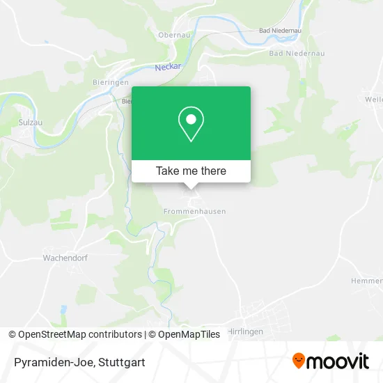
See Pyramiden-Joe, Verwaltungsgemeinschaft Rottenburg am Neckar, on the map
Public Transit to Pyramiden-Joe in Verwaltungsgemeinschaft Rottenburg am Neckar
Wondering how to get to Pyramiden-Joe in Verwaltungsgemeinschaft Rottenburg am Neckar? Moovit helps you find the best way to get to Pyramiden-Joe with step-by-step directions from the nearest public transit station.
Moovit provides free maps and live directions to help you navigate through your city. View schedules, routes, timetables, and find out how long does it take to get to Pyramiden-Joe in real time.
Looking for the nearest stop or station to Pyramiden-Joe? Check out this list of stops closest to your destination: Frommenhausen Schwalld.Str.; Bad Niedernau Bahnhof.
Bus: 7626, 7623A.Train: RB 74, RB74, RE6B, RB 6.
Want to see if there’s another route that gets you there at an earlier time? Moovit helps you find alternative routes or times. Get directions from and directions to Pyramiden-Joe easily from the Moovit App or Website.
We make riding to Pyramiden-Joe easy, which is why over 1.5 million users, including users in Verwaltungsgemeinschaft Rottenburg am Neckar, trust Moovit as the best app for public transit. You don’t need to download an individual bus app or train app, Moovit is your all-in-one transit app that helps you find the best bus time or train time available.
For information on prices of bus and train, costs and ride fares to Pyramiden-Joe, please check the Moovit app.
Use the app to navigate to popular places including to the airport, hospital, stadium, grocery store, mall, coffee shop, school, college, and university.
Pyramiden-Joe Address: Stiegelackerstraße 9/1 Frommenhausen, 72108 Rottenburg am Neckar street in Verwaltungsgemeinschaft Rottenburg am Neckar
- Friedhelm Capelle,
- Gitarre in Rottenburg,
- Frommenhausen Schwalldorfer Straße,
- Mehrzweckhalle,
- Kindergarten St. Maria,
- Feuerwehr Rottenburg,
- Diformatics,
- Wütz Blasorchesternoten,
- Evelyn Zeiler,
- St. Vitus,
- Pilgerherberge Frommenhausen,
- Bnl Bauunternehmung,
- Frommenhausen,
- Raumausstattung Piontek,
- P. U. b. Ton & Lichtanlagen,
- Ina Kaupat Werbetexte,
- Der Meisterschreiner,
- Küchen Rottenburg,
- Stefan Wütz der Meisterschreiner,
- Atelier Brigitte Abt-Harrer
Places Near Pyramiden-Joe (Verwaltungsgemeinschaft Rottenburg am Neckar)
- Gasometer Pforzheim, Pforzheim,
- Marmorsaal Im Weissenburgpark, Stuttgart-Süd,
- Mercedes-Benz Museum, Bad Cannstatt,
- Klinikum Stuttgart - Katharinenhospital, Stuttgart-Mitte,
- Porsche Museum, Zuffenhausen,
- Waldfriedhof, Degerloch,
- Porsche-Arena, Bad Cannstatt,
- FlixBus Haltestelle, Stuttgart,
- Im Wizemann (Halle), Bad Cannstatt,
- Pariser Platz Stuttgart, Stuttgart-Mitte,
- Schleyerhalle, Bad Cannstatt,
- Mercedes-Benz Museum (Mercedes Museum Stuttgart), Bad Cannstatt,
- Geilhaus Haus 33a, Reutlingen-Betzingen,
- Gleis 101/102 (tief), Stuttgart-Mitte,
- SI-Centrum, Möhringen,
- Mettingen Eros-Center Puff Laufhaus, Esslingen Am Neckar,
- Hauptbahnhof Stuttgart, Stuttgart-Mitte,
- Hanns-Martin-Schleyer-Halle, Bad Cannstatt,
- Wilhelma (U-Bahn Wilhelma), Bad Cannstatt,
- Hanns-Martin-Schleyer-Halle (Stuttgart Hans-Martin-Schleyerhalle), Bad Cannstatt
How to get to popular places in Stuttgart with public transit
Get around Verwaltungsgemeinschaft Rottenburg am Neckar by public transit!
Traveling around Verwaltungsgemeinschaft Rottenburg am Neckar has never been so easy. See step by step directions as you travel to any attraction, street or major public transit station. View bus and train schedules, arrival times, service alerts and detailed routes on a map, so you know exactly how to get to anywhere in Verwaltungsgemeinschaft Rottenburg am Neckar.
When traveling to any destination around Verwaltungsgemeinschaft Rottenburg am Neckar use Moovit's Live Directions with Get Off Notifications to know exactly where and how far to walk, how long to wait for your line, and how many stops are left. Moovit will alert you when it's time to get off — no need to constantly re-check whether yours is the next stop.
Wondering how to use public transit in Verwaltungsgemeinschaft Rottenburg am Neckar or how to pay for public transit in Verwaltungsgemeinschaft Rottenburg am Neckar? Moovit public transit app can help you navigate your way with public transit easily, and at minimum cost. It includes public transit fees, ticket prices, and costs. Looking for a map of Verwaltungsgemeinschaft Rottenburg am Neckar public transit lines? Moovit public transit app shows all public transit maps in Verwaltungsgemeinschaft Rottenburg am Neckar with all Bus, Train, Subway, Light Rail, Ferry, S-Bahn and Funicular routes and stops on an interactive map.
Stuttgart has 7 transit type(s), including: Bus, Train, Subway, Light Rail, Ferry, S-Bahn and Funicular, operated by several transit agencies, including SSB - Stadtbahn, SSB, SSB - Seilbahn / Zacke, S-Bahn Stuttgart, Rhein-Neckar-Verkehr GmbH (rnv), Karlsruher Verkehrsverbund, DB AG, DB Regiobus BW, Arverio Baden-Württemberg GmbH, DB RegioNetz Verkehrs GmbH Westfrankenbahn, DB Regio AG Baden-Württemberg, Südwestdeutsche Verkehrs-AG, DB Regio AG Mitte Region Hessen, DB and Bodensee-Oberschwaben-Bahn