How to get to Pyxis Formation by bus?
Click on the bus route to see step by step directions with maps, line arrival times and updated time schedules.
From Godrans - Les Halles, Dijon
72 minFrom Rue Bussy Rabutin, Dijon
78 minFrom Holiday Inn, Dijon
94 minFrom 30 Boulevard Maréchal Joffre, Dijon
90 minFrom Lycée Polyvalent Les Marcs D'Or, Dijon
75 minFrom 42 Rue de Longvic, Chenôve
98 minFrom 96 Avenue Victor Hugo, Dijon
74 minFrom Holiday Inn Dijon, Dijon
94 minFrom Parking Relais Zénith, Dijon
99 minFrom Lac Kir, Dijon
93 min
How to get to Pyxis Formation by train?
Click on the train route to see step by step directions with maps, line arrival times and updated time schedules.
Bus stops near Pyxis Formation in Crimolois
Train station near Pyxis Formation in Crimolois
- Neuilly-Lès-Dijon, 28 min walk,VIEW
Bus lines to Pyxis Formation in Crimolois
What are the closest stations to Pyxis Formation?
The closest stations to Pyxis Formation are:
- La Combe is 214 meters away, 3 min walk.
- St-Antoine is 461 meters away, 6 min walk.
- Neuilly Liberté is 1776 meters away, 23 min walk.
- Neuilly-Lès-Dijon is 2153 meters away, 28 min walk.
Which bus line stops near Pyxis Formation?
16 (Quetigny Allées Cavalières→Neuilly-Crimolois République)
Which train line stops near Pyxis Formation?
C1 (Dijon→Neuilly-Lès-Dijon)
What’s the nearest train station to Pyxis Formation in Crimolois?
The nearest train station to Pyxis Formation in Crimolois is Neuilly-Lès-Dijon. It’s a 28 min walk away.
What’s the nearest bus station to Pyxis Formation in Crimolois?
The nearest bus station to Pyxis Formation in Crimolois is La Combe. It’s a 3 min walk away.
What time is the first train to Pyxis Formation in Crimolois?
The C1 is the first train that goes to Pyxis Formation in Crimolois. It stops nearby at 7:09 AM.
What time is the last train to Pyxis Formation in Crimolois?
The C1 is the last train that goes to Pyxis Formation in Crimolois. It stops nearby at 6:40 PM.
What time is the first bus to Pyxis Formation in Crimolois?
The 16 is the first bus that goes to Pyxis Formation in Crimolois. It stops nearby at 5:27 AM.
What time is the last bus to Pyxis Formation in Crimolois?
The 16 is the last bus that goes to Pyxis Formation in Crimolois. It stops nearby at 9:17 PM.
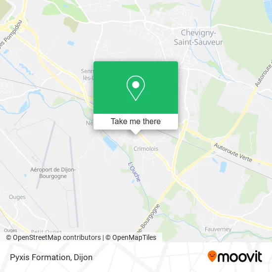
See Pyxis Formation, Crimolois, on the map
Public Transit to Pyxis Formation in Crimolois
Wondering how to get to Pyxis Formation in Crimolois? Moovit helps you find the best way to get to Pyxis Formation with step-by-step directions from the nearest public transit station.
Moovit provides free maps and live directions to help you navigate through your city. View schedules, routes, timetables, and find out how long does it take to get to Pyxis Formation in real time.
Looking for the nearest stop or station to Pyxis Formation? Check out this list of stops closest to your destination: La Combe; St-Antoine; Neuilly Liberté; Neuilly-Lès-Dijon.
Bus: 16, 69, 67, 66.Train: C1.
Want to see if there’s another route that gets you there at an earlier time? Moovit helps you find alternative routes or times. Get directions from and directions to Pyxis Formation easily from the Moovit App or Website.
We make riding to Pyxis Formation easy, which is why over 1.5 million users, including users in Crimolois, trust Moovit as the best app for public transit. You don’t need to download an individual bus app or train app, Moovit is your all-in-one transit app that helps you find the best bus time or train time available.
For information on prices of bus, light rail and train, costs and ride fares to Pyxis Formation, please check the Moovit app.
Use the app to navigate to popular places including to the airport, hospital, stadium, grocery store, mall, coffee shop, school, college, and university.
Pyxis Formation Address: 10 Rue Alexandra David-Néel 21800 Neuilly-Crimolois street in Crimolois
- Adeline Leau Énergétique Tradition. Chinoise Vietnamienne Acupuncture Dijon,
- O'Cafés Gourmands,
- Pierre Perrey Nathalie Patricia,
- Janvier Martin Valerie,
- École Henri Hirschy,
- Gare SNCF de Neuilly-lès-Dijon,
- Sc Maconnerie 21,
- Conf Syndicale,
- 2 Avenue de Strasbourg,
- pomona terre azur,
- Laboratoires Urgo,
- 13 Rue Jacques Prévert,
- Adecco,
- Samsic Indoors,
- Excellence 2000,
- 16 Rue Colette,
- Pimavi,
- Sepalumic Diffusion,
- Crossfit Canopée,
- Grill Restaurant la Flambée
Places Near Pyxis Formation (Crimolois)
- Fontaine-Lès-Dijon, Fontaine-Lès-Dijon,
- Lac Kir, Dijon,
- Amphi Courtois, Dijon,
- Clinique Drevon, Dijon,
- Clinique Bénigne Joly, Talant,
- Maison Médicale Valmy, Dijon,
- La Toison D'Or, Dijon,
- Chu - Hôpitaux, Dijon,
- Clinique De Talant, Talant,
- Chevigny-Saint-Sauveur, Chevigny-Saint-Sauveur,
- Parc De La Colombière, Dijon,
- Centre Leclerc (CGFL), Dijon,
- Zénith, Dijon,
- École Nationale Des Greffes, Dijon,
- Crématorium du Grand Dijon, Dijon,
- Palais Des Congrès, Dijon,
- Ikea, Dijon,
- Centre-Ville, Dijon,
- Parc Des Expositions, Dijon,
- Lycée Gustave Eiffel, Dijon
How to get to popular places in Dijon with public transit
Get around Crimolois by public transit!
Traveling around Crimolois has never been so easy. See step by step directions as you travel to any attraction, street or major public transit station. View bus and train schedules, arrival times, service alerts and detailed routes on a map, so you know exactly how to get to anywhere in Crimolois.
When traveling to any destination around Crimolois use Moovit's Live Directions with Get Off Notifications to know exactly where and how far to walk, how long to wait for your line, and how many stops are left. Moovit will alert you when it's time to get off — no need to constantly re-check whether yours is the next stop.
Wondering how to use public transit in Crimolois or how to pay for public transit in Crimolois? Moovit public transit app can help you navigate your way with public transit easily, and at minimum cost. It includes public transit fees, ticket prices, and costs. Looking for a map of Crimolois public transit lines? Moovit public transit app shows all public transit maps in Crimolois with all Bus, Train and Light Rail routes and stops on an interactive map.
Dijon has 3 transit type(s), including: Bus, Train and Light Rail, operated by several transit agencies, including Divia, Divia, OCEdefault and SNCF VOYAGEURS