How to get to Q-Prints&Service by bus?
Click on the bus route to see step by step directions with maps, line arrival times and updated time schedules.
From Kibungu, Verwaltungsverband Heckengäu
42 minFrom Enzkreisklinik Mühlacker, Vvg Der Stadt Mühlacker
118 minFrom Cts-Klinik Schloßberg, Liebenzell
63 minFrom Karlsruhe Primark, Mühlhausen An Der Enz
132 minFrom 75223, Niefern-Öschelbronn
67 minFrom Rkh Kliniken, Verwaltungsgemeinschaft Bretten
81 minFrom Schloss Neuenbürg, Verwaltungsgemeinschaft Neuenbürg
52 minFrom Monbachtal, Liebenzell
97 minFrom 75217, Birkenfeld
46 minFrom Klinik Öschelbronn, Niefern-Öschelbronn
109 min
How to get to Q-Prints&Service by train?
Click on the train route to see step by step directions with maps, line arrival times and updated time schedules.
Bus stops near Q-Prints&Service in Pforzheim
Train stations near Q-Prints&Service in Pforzheim
Bus lines to Q-Prints&Service in Pforzheim
- 17, Pforzheim Grünewaldstraße,VIEW
- 6, Pforzheim Fachmarktzentrum,VIEW
- 7, Pforzheim Heim am Hachel,VIEW
- E, Pforzheim J.Wittum Schule,VIEW
- 3, Weißenstein,VIEW
- 5, Pforzheim Hängsteig,VIEW
- 20, Brötzingen Bahnhof,VIEW
- 10, Pforzheim ZOB Bstg 10 - Brötzingen Gülichstraße,VIEW
- 16, Haidach Dresdener Straße - Pforzheim ZOB Bstg 13,VIEW
- 2, Sonnenhof Theodor Heuss Str. - Pforzheim Unterer Wingertweg,VIEW
- 4, Huchenfeld Hellerichstraße - Pforzheim ZOB Bstg 13,VIEW
- 41, Würm Kirche - Pforzheim ZOB Bstg 13,VIEW
- 42, Huchenfeld Hellerichstraße - Pforzheim ZOB Bstg 13,VIEW
- 43, Büchenbronn Panoramastraße - Pforzheim ZOB Bstg 13,VIEW
- 666, Weil der Stadt Bf Bstg 1 - Pforzheim ZOB Bstg 13,VIEW
- 712, Birkenfeld Kirchplatz - Pforzheim ZOB Bstg 8,VIEW
- 715, Pforzheim ZOB Bstg 8 - Ittersbach Descostraße,VIEW
- 716, Bad Herrenalb - Pforzheim ZOB Bstg 8,VIEW
- 717, Ittersbach Descostraße - Pforzheim ZOB Bstg 8,VIEW
- 718, Conweiler Schule - Pforzheim ZOB Bstg 8,VIEW
What are the closest stations to Q-Prints&Service?
The closest stations to Q-Prints&Service are:
- Pforzheim Phillipstraße is 245 meters away, 4 min walk.
- Pforzheim Hbf is 276 meters away, 5 min walk.
- Pforzheim Hauptbahnhof is 276 meters away, 5 min walk.
- Pforzheim Zähringer Allee is 377 meters away, 5 min walk.
- Pforzheim Bahnhofstraße is 464 meters away, 7 min walk.
- Pforzheim Bahnhofstr. is 517 meters away, 7 min walk.
- Pforzheim Pfälzer Straße is 541 meters away, 7 min walk.
- Pforzheim Leopoldplatz is 623 meters away, 9 min walk.
Which train lines stop near Q-Prints&Service?
These train lines stop near Q-Prints&Service: MEX 17A, MEX17, RB74, RE 1, S6.
Which bus lines stop near Q-Prints&Service?
These bus lines stop near Q-Prints&Service: 718, 733, 734, 735, 743, 744, 763, 916.
What’s the nearest train station to Q-Prints&Service in Pforzheim?
The nearest train stations to Q-Prints&Service in Pforzheim are Pforzheim Hbf and Pforzheim Hauptbahnhof. The closest one is a 5 min walk away.
What’s the nearest bus station to Q-Prints&Service in Pforzheim?
The nearest bus station to Q-Prints&Service in Pforzheim is Pforzheim Phillipstraße. It’s a 4 min walk away.
What time is the first light rail to Q-Prints&Service in Pforzheim?
The S5 is the first light rail that goes to Q-Prints&Service in Pforzheim. It stops nearby at 4:46 AM.
What time is the last light rail to Q-Prints&Service in Pforzheim?
The S5 is the last light rail that goes to Q-Prints&Service in Pforzheim. It stops nearby at 1:06 AM.
What time is the first train to Q-Prints&Service in Pforzheim?
The MEX17 is the first train that goes to Q-Prints&Service in Pforzheim. It stops nearby at 4:17 AM.
What time is the last train to Q-Prints&Service in Pforzheim?
The MEX17 is the last train that goes to Q-Prints&Service in Pforzheim. It stops nearby at 1:18 AM.
What time is the first bus to Q-Prints&Service in Pforzheim?
The 20 is the first bus that goes to Q-Prints&Service in Pforzheim. It stops nearby at 4:32 AM.
What time is the last bus to Q-Prints&Service in Pforzheim?
The 731 is the last bus that goes to Q-Prints&Service in Pforzheim. It stops nearby at 12:28 AM.
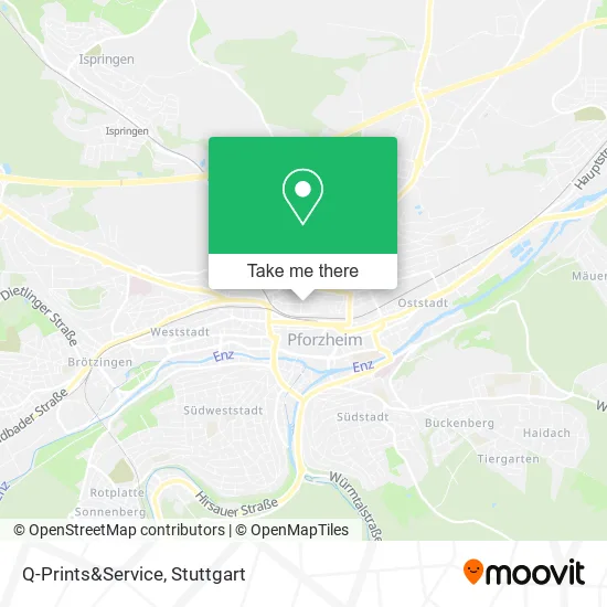
See Q-Prints&Service, Pforzheim, on the map
Public Transit to Q-Prints&Service in Pforzheim
Wondering how to get to Q-Prints&Service in Pforzheim? Moovit helps you find the best way to get to Q-Prints&Service with step-by-step directions from the nearest public transit station.
Moovit provides free maps and live directions to help you navigate through your city. View schedules, routes, timetables, and find out how long does it take to get to Q-Prints&Service in real time.
Looking for the nearest stop or station to Q-Prints&Service? Check out this list of stops closest to your destination: Pforzheim Phillipstraße; Pforzheim Hbf; Pforzheim Hauptbahnhof; Pforzheim Zähringer Allee; Pforzheim Bahnhofstraße; Pforzheim Bahnhofstr.; Pforzheim Pfälzer Straße; Pforzheim Leopoldplatz.
Train: MEX 17A, MEX17, RB74, RE 1, S6, RE1, S5, S51, RE1, MEX17A, S51, S5, S51.Bus: 718, 733, 734, 735, 743, 744, 763, 916, 17, 6, 7, E.
Want to see if there’s another route that gets you there at an earlier time? Moovit helps you find alternative routes or times. Get directions from and directions to Q-Prints&Service easily from the Moovit App or Website.
We make riding to Q-Prints&Service easy, which is why over 1.5 million users, including users in Pforzheim, trust Moovit as the best app for public transit. You don’t need to download an individual bus app or train app, Moovit is your all-in-one transit app that helps you find the best bus time or train time available.
For information on prices of bus and train, costs and ride fares to Q-Prints&Service, please check the Moovit app.
Use the app to navigate to popular places including to the airport, hospital, stadium, grocery store, mall, coffee shop, school, college, and university.
Q-Prints&Service Address: Kronprinzenstraße 30 75177 Pforzheim street in Pforzheim
- 30 Kronen Verwaltung,
- Atelier Miroir,
- Philipp Lichtenfeld,
- Moeller Gloss Airchetekt,
- Maultaschenmanufaktur und Catering,
- Derma Beauty Pforzheim,
- Terra Nostra da Priolo,
- Lutz T.,
- Umit Backerei,
- Dipl.-Des. Matthias Holz,
- Schuetzende Hand Heinz Kurth,
- Eberhart,
- Grüne - Bündnis 90 Pforzheim und Enzkreis,
- Stroh zu Gold,
- Bozan Lebensmittel,
- Nickerl S.,
- Billard-Freunde Pforzheim,
- Terra-Log,
- Hotel-Pension Morlock,
- Günter Zeeb Brillenherstellung
Places Near Q-Prints&Service (Pforzheim)
- Waldfriedhof, Degerloch,
- SI-Centrum, Möhringen,
- Mercedes-Benz Museum (Mercedes Museum Stuttgart), Bad Cannstatt,
- FlixBus Haltestelle, Stuttgart,
- Im Wizemann (Halle), Bad Cannstatt,
- Marmorsaal Im Weissenburgpark, Stuttgart-Süd,
- Klinikum Stuttgart - Katharinenhospital, Stuttgart-Mitte,
- Mettingen Eros-Center Puff Laufhaus, Esslingen Am Neckar,
- Geilhaus Haus 33a, Reutlingen-Betzingen,
- Gleis 101/102 (tief), Stuttgart-Mitte,
- Gasometer Pforzheim, Pforzheim,
- Hanns-Martin-Schleyer-Halle, Bad Cannstatt,
- Pariser Platz Stuttgart, Stuttgart-Mitte,
- Schleyerhalle, Bad Cannstatt,
- Mercedes-Benz Museum, Bad Cannstatt,
- Hauptbahnhof Stuttgart, Stuttgart-Mitte,
- Hanns-Martin-Schleyer-Halle (Stuttgart Hans-Martin-Schleyerhalle), Bad Cannstatt,
- Porsche-Arena, Bad Cannstatt,
- Porsche Museum, Zuffenhausen,
- Wilhelma (U-Bahn Wilhelma), Bad Cannstatt
How to get to popular places in Stuttgart with public transit
Get around Pforzheim by public transit!
Traveling around Pforzheim has never been so easy. See step by step directions as you travel to any attraction, street or major public transit station. View bus and train schedules, arrival times, service alerts and detailed routes on a map, so you know exactly how to get to anywhere in Pforzheim.
When traveling to any destination around Pforzheim use Moovit's Live Directions with Get Off Notifications to know exactly where and how far to walk, how long to wait for your line, and how many stops are left. Moovit will alert you when it's time to get off — no need to constantly re-check whether yours is the next stop.
Wondering how to use public transit in Pforzheim or how to pay for public transit in Pforzheim? Moovit public transit app can help you navigate your way with public transit easily, and at minimum cost. It includes public transit fees, ticket prices, and costs. Looking for a map of Pforzheim public transit lines? Moovit public transit app shows all public transit maps in Pforzheim with all Bus, Train, Subway, Light Rail, Ferry, S-Bahn and Funicular routes and stops on an interactive map.
Stuttgart has 7 transit type(s), including: Bus, Train, Subway, Light Rail, Ferry, S-Bahn and Funicular, operated by several transit agencies, including SSB - Stadtbahn, SSB, SSB - Seilbahn / Zacke, S-Bahn Stuttgart, Rhein-Neckar-Verkehr GmbH (rnv), Karlsruher Verkehrsverbund, DB AG, DB Regiobus BW, Arverio Baden-Württemberg GmbH, DB RegioNetz Verkehrs GmbH Westfrankenbahn, DB Regio AG Baden-Württemberg, Südwestdeutsche Verkehrs-AG, DB Regio AG Mitte Region Hessen, DB and Bodensee-Oberschwaben-Bahn