How to get to Qgol by bus?
Click on the bus route to see step by step directions with maps, line arrival times and updated time schedules.
From Avenida Geremario Dantas, Pechincha
36 minFrom Av. Erico Veríssimo, Barra Da Tijuca
36 minFrom Itanhangá, Itanhangá
36 minFrom Brt Linha Expressa 41 Madureira X Recreio, Taquara
24 minFrom BRT - Estação Terminal Sulacap, Vila Militar
37 minFrom Shopping Cittá América, Barra Da Tijuca
28 minFrom Parque Shopping Sulacap, Jardim Sulacap
37 minFrom Vila Valqueire, Vila Valqueire
46 minFrom Jardim Sulacap, Jardim Sulacap
40 min
Bus stops near Qgol in Jacarepaguá
Bus lines to Qgol in Jacarepaguá
What are the closest stations to Qgol?
The closest stations to Qgol are:
- Novotel is 122 meters away, 2 min walk.
- Av. Embaixador Abelardo Bueno | Shopping Metropolitano Barra is 240 meters away, 4 min walk.
- Rede Sarah is 432 meters away, 6 min walk.
Which bus lines stop near Qgol?
These bus lines stop near Qgol: 46, 52, 613, 881.
What’s the nearest bus station to Qgol in Jacarepaguá?
The nearest bus station to Qgol in Jacarepaguá is Novotel. It’s a 2 min walk away.
What time is the first bus to Qgol in Jacarepaguá?
The 613 is the first bus that goes to Qgol in Jacarepaguá. It stops nearby at 3:13 AM.
What time is the last bus to Qgol in Jacarepaguá?
The 38 is the last bus that goes to Qgol in Jacarepaguá. It stops nearby at 12:59 AM.
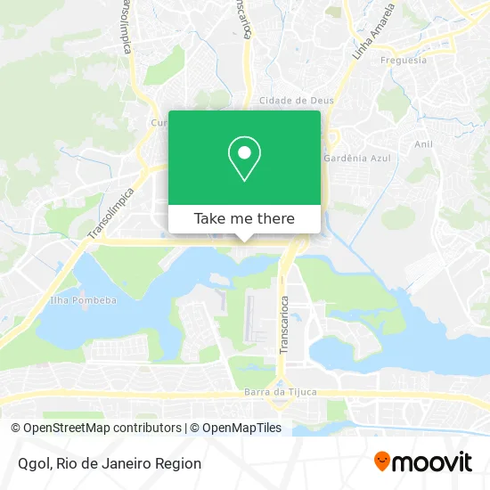
See Qgol, Jacarepaguá, on the map
Public Transit to Qgol in Jacarepaguá
Wondering how to get to Qgol in Jacarepaguá? Moovit helps you find the best way to get to Qgol with step-by-step directions from the nearest public transit station.
Moovit provides free maps and live directions to help you navigate through your city. View schedules, routes, timetables, and find out how long does it take to get to Qgol in real time.
Looking for the nearest stop or station to Qgol? Check out this list of stops closest to your destination: Novotel; Av. Embaixador Abelardo Bueno | Shopping Metropolitano Barra; Rede Sarah.
Bus: 46, 52, 613, 881, 961, 352, SC460S, SPA 613, 2613, 35, 50.
Want to see if there’s another route that gets you there at an earlier time? Moovit helps you find alternative routes or times. Get directions from and directions to Qgol easily from the Moovit App or Website.
We make riding to Qgol easy, which is why over 1.5 million users, including users in Jacarepaguá, trust Moovit as the best app for public transit. You don’t need to download an individual bus app or train app, Moovit is your all-in-one transit app that helps you find the best bus time or train time available.
For information on prices of bus, costs and ride fares to Qgol, please check the Moovit app.
Use the app to navigate to popular places including to the airport, hospital, stadium, grocery store, mall, coffee shop, school, college, and university.
Qgol Address: Avenida Embaixador Abelardo Bueno street in Jacarepaguá
- Ibis Parque Olimpico hotel,
- One World Offices,
- Camisaria Colombo,
- Novotel Rio de Janeiro Parque Olímpico,
- Novotel Parque Olímpico,
- Avenida Embaixador Abelardo Bueno 1511,
- Ipan,
- Consultores Habiles Sistemas e Consultoria Ltda,
- Ibtc,
- Belem Church,
- Lojas Centauro,
- Igreja Profetizando às Nações,
- Rádio FM O Dia,
- BR Machine,
- Cheirin Bao,
- Casas Pedro,
- Casa do Vídeo - Produtora,
- Inovar Desenvolvimento Integrado,
- Escritório Sonho Dos Pés,
- Mge Studios
Places Near Qgol (Jacarepaguá)
- Praia do Arpoador, Ipanema,
- Rodoviária Novo Rio (Rodoviária do Rio de Janeiro), Santo Cristo,
- Niterói, Niterói,
- Museu Do Amanhã, Centro,
- Shopping Nova América, Del Castilho,
- Hospital Federal Do Andaraí, Andaraí,
- Rua Ulysses Guimarães 16, Cidade Nova,
- Shopping Rio Sul, Botafogo,
- Hospital Municipal Ronaldo Gazolla, Acari,
- Hospital Federal Cardoso Fontes, Jacarepaguá,
- Feirão De Malhas, Duque De Caxias,
- Rua Licínio Cardoso, São Francisco Xavier,
- Feira Livre da Gloria, Glória,
- Rio De Janeiro,
- Avenida Venezuela 134, Saúde,
- Shopping Downtown, Barra Da Tijuca,
- Shopping RioSul, Botafogo,
- Hospital Pedro Ernesto, Vila Isabel,
- Avenida Rio Branco, Centro,
- Norte Shopping, Cachambi
How to get to popular places in Rio de Janeiro Region with public transit
Get around Jacarepaguá by public transit!
Traveling around Jacarepaguá has never been so easy. See step by step directions as you travel to any attraction, street or major public transit station. View bus and train schedules, arrival times, service alerts and detailed routes on a map, so you know exactly how to get to anywhere in Jacarepaguá.
When traveling to any destination around Jacarepaguá use Moovit's Live Directions with Get Off Notifications to know exactly where and how far to walk, how long to wait for your line, and how many stops are left. Moovit will alert you when it's time to get off — no need to constantly re-check whether yours is the next stop.
Wondering how to use public transit in Jacarepaguá or how to pay for public transit in Jacarepaguá? Moovit public transit app can help you navigate your way with public transit easily, and at minimum cost. It includes public transit fees, ticket prices, and costs. Looking for a map of Jacarepaguá public transit lines? Moovit public transit app shows all public transit maps in Jacarepaguá with all Bus, Train, Metro, Light Rail, Ferry, Cable Car, Gondola and Funicular routes and stops on an interactive map.
Rio de Janeiro Region has 8 transit type(s), including: Bus, Train, Metro, Light Rail, Ferry, Cable Car, Gondola and Funicular, operated by several transit agencies, including TrensRJ, Metrô Rio, VLT Carioca, Barcas Rio, BRT MOBI-Rio, Auto Viação Alpha, Auto Viação Tijuca, Gire Transportes, Transurb, Viação Nossa Senhora das Graças, Consórcio INTERSUL, Braso Lisboa (Municipal), Caprichosa Auto Ônibus, Auto Viação Três Amigos and Rodoviária Âncora Matias