How to get to Que Technology Group by bus?
Click on the bus route to see step by step directions with maps, line arrival times and updated time schedules.
From The Maryland Zoo In Baltimore, Baltimore
69 minFrom Hippodrome Theatre, Baltimore
43 minFrom Druid Hill Park, Baltimore
92 minFrom Baltimore Penn Station, Baltimore
43 minFrom Clarence M. Mitchell, Jr. Courthouse, Baltimore
46 minFrom Arundel Mills, Anne Arundel County
107 minFrom Hanover, Baltimore
53 minFrom Hyatt Regency Baltimore Inner Harbor, Baltimore
50 minFrom National Aquarium-Baltimore, Baltimore
56 minFrom National Aquarium, Baltimore
57 min
How to get to Que Technology Group by train?
Click on the train route to see step by step directions with maps, line arrival times and updated time schedules.
Bus stop near Que Technology Group in Baltimore County
- Hilltop Cir & Administration Building Nb, 11 min walk,VIEW
Train station near Que Technology Group in Baltimore County
- Halethorpe Marc Nb, 51 min walk,VIEW
Bus lines to Que Technology Group in Baltimore County
What are the closest stations to Que Technology Group?
The closest stations to Que Technology Group are:
- Hilltop Cir & Administration Building Nb is 846 yards away, 11 min walk.
- Halethorpe Marc Nb is 4303 yards away, 51 min walk.
Which bus lines stop near Que Technology Group?
These bus lines stop near Que Technology Group: 32, 76.
Which train line stops near Que Technology Group?
MARC (Inbound - Penn)
What’s the nearest bus station to Que Technology Group in Baltimore County?
The nearest bus station to Que Technology Group in Baltimore County is Hilltop Cir & Administration Building Nb. It’s a 11 min walk away.
What time is the first train to Que Technology Group in Baltimore County?
The MARC is the first train that goes to Que Technology Group in Baltimore County. It stops nearby at 4:46 AM.
What time is the last train to Que Technology Group in Baltimore County?
The MARC is the last train that goes to Que Technology Group in Baltimore County. It stops nearby at 10:46 PM.
What time is the first bus to Que Technology Group in Baltimore County?
The 76 is the first bus that goes to Que Technology Group in Baltimore County. It stops nearby at 3:45 AM.
What time is the last bus to Que Technology Group in Baltimore County?
The 37 is the last bus that goes to Que Technology Group in Baltimore County. It stops nearby at 1:50 AM.
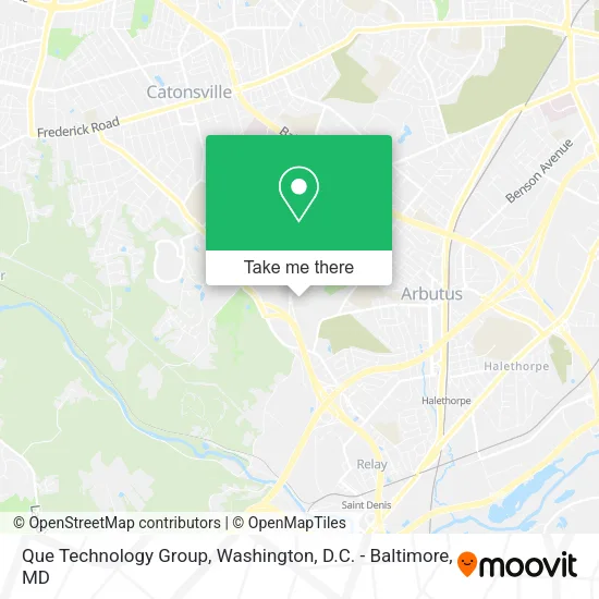
See Que Technology Group, Baltimore County, on the map
Public Transit to Que Technology Group in Baltimore County
Wondering how to get to Que Technology Group in Baltimore County? Moovit helps you find the best way to get to Que Technology Group with step-by-step directions from the nearest public transit station.
Moovit provides free maps and live directions to help you navigate through your city. View schedules, routes, timetables, and find out how long does it take to get to Que Technology Group in real time.
Looking for the nearest stop or station to Que Technology Group? Check out this list of stops closest to your destination: Hilltop Cir & Administration Building Nb; Halethorpe Marc Nb.
Bus: 32, 76, 37.Train: MARC.
Want to see if there’s another route that gets you there at an earlier time? Moovit helps you find alternative routes or times. Get directions from and directions to Que Technology Group easily from the Moovit App or Website.
We make riding to Que Technology Group easy, which is why over 1.5 million users, including users in Baltimore County, trust Moovit as the best app for public transit. You don’t need to download an individual bus app or train app, Moovit is your all-in-one transit app that helps you find the best bus time or train time available.
For information on prices of bus and train, costs and ride fares to Que Technology Group, please check the Moovit app.
Use the app to navigate to popular places including to the airport, hospital, stadium, grocery store, mall, coffee shop, school, college, and university.
Que Technology Group Address: 5520 Research Park Dr Catonsville, MD 21228 street in Baltimore County
- Bluesteel Cybersecurity,
- Bwtech at Umbc Research & Technology Park,
- Imperial Cyber Group LLC,
- It Leadership,
- Anchor Technology & Consultants LLC,
- Cera,
- Umbc Stadium Complex,
- Clear Resolution Consulting,
- LCG Technologies Corp.,
- We Are Platinum,
- Rivue,
- Roofpro,
- Southwest Park & Ride,
- Chesapeake Employers Insurance Arena,
- Erickson Laundry Room,
- Music City Water Damage,
- Soapstone Trail,
- Umbc Theatre,
- Arbutus Brunch Library,
- University Center UMBC
Places Near Que Technology Group (Baltimore County)
- Amazon Hq2, Arlington County,
- Washington DC VA Medical Center, Washington,
- Marriott Marquis Washington, DC, Washington,
- National Mall, Washington,
- PG Mall, Prince George's County,
- Pennsylvania Ave NW (3rd st and pennsylvania), Washington,
- M&T Bank Stadium, Baltimore,
- Museum Of The Bible, Washington,
- National Zoo, Washington,
- Capital One Arena, Washington,
- Camden Yards, Baltimore,
- Washington National Cathedral, Washington,
- Rock Creek Tennis Center, Washington,
- Sibley Memorial Hospital, Washington,
- Basilica of the National Shrine, Washington,
- Warner Theatre, Washington,
- Georgetown, Washington,
- Westfield Montgomery Mall, Montgomery County,
- The Anthem, Washington,
- National Museum of African American History and Culture, Washington
How to get to popular places in Washington, D.C. - Baltimore, MD with public transit
Get around Baltimore County by public transit!
Traveling around Baltimore County has never been so easy. See step by step directions as you travel to any attraction, street or major public transit station. View bus and train schedules, arrival times, service alerts and detailed routes on a map, so you know exactly how to get to anywhere in Baltimore County.
When traveling to any destination around Baltimore County use Moovit's Live Directions with Get Off Notifications to know exactly where and how far to walk, how long to wait for your line, and how many stops are left. Moovit will alert you when it's time to get off — no need to constantly re-check whether yours is the next stop.
Wondering how to use public transit in Baltimore County or how to pay for public transit in Baltimore County? Moovit public transit app can help you navigate your way with public transit easily, and at minimum cost. It includes public transit fees, ticket prices, and costs. Looking for a map of Baltimore County public transit lines? Moovit public transit app shows all public transit maps in Baltimore County with all Bus, Train, Metro, Light Rail and Ferry routes and stops on an interactive map.
Washington, D.C. - Baltimore, MD has 5 transit type(s), including: Bus, Train, Metro, Light Rail and Ferry, operated by several transit agencies, including WMATA, Montgomery County Ride On, Fairfax Connector, TheBus, PRTC, DASH - Alexandria, Arlington Transit (ART), RTA of Central Maryland, MDOT MTA, MDOT MTA Light RailLink, MDOT MTA Commuter Bus, MDOT MTA Local Bus, FXBGO!, Virginia Railway Express (VRE) and MARC