How to get to Quecia Servicos by bus?
Click on the bus route to see step by step directions with maps, line arrival times and updated time schedules.
From Rua Aurélio de Figueiredo 40, Campo Grande
39 minFrom Cemitério Jardim Da Saudade, Jardim Sulacap
56 minFrom Mesquita, Mesquita
64 minFrom Campo Dos Afonsos, Campo Dos Afonsos
54 minFrom BRT Transolímpica, Deodoro
36 minFrom Linha 458S - Campo Grande / Itaguaí (Via Palmares), Campo Grande
48 minFrom Lar de Frei Luiz, Taquara
56 minFrom Linha 754 - Santa Cruz / Coelho Neto, Campo Grande
47 minFrom Cemitério De Ricardo De Albuquerque, Ricardo De Albuquerque
31 minFrom Estrada do Rio Grande, Jacarepaguá
58 min
How to get to Quecia Servicos by train?
Click on the train route to see step by step directions with maps, line arrival times and updated time schedules.
Bus stops near Quecia Servicos in Bangu
Train station near Quecia Servicos in Bangu
- Guilherme Da Silveira, 30 min walk,VIEW
Bus lines to Quecia Servicos in Bangu
- 67, Terminal Deodoro,VIEW
- SN 388, Candelária,VIEW
- 1900T (EXECUTIVO), Caxias,VIEW
- 112B, Itaguaí - Central (Brs I),VIEW
- 113D, Itaguaí - Niterói,VIEW
- 388, Cesarão - Candelária (Brs 5 - Via Santa Cruz - Parador),VIEW
- SR 388, Cesarão - Candelária (Brs 5 - Via Santa Cruz - Expresso),VIEW
- 442L, Itaguaí - Coelho Neto,VIEW
- 451T, Caxias - Campo Grande (Via Éden / Anchieta),VIEW
- VAN M521, Itaguaí - Rio de Janeiro (Central),VIEW
- 564T, Caxias - Campo Grande (Via Parada de Lucas),VIEW
- 712L, Seropédica - Coelho Neto,VIEW
- 713B, Cabuçu - Coelho Neto,VIEW
- 753, Santa Cruz - Coelho Neto (Via Urucânia / Estr. do Tinguí),VIEW
- 754, Santa Cruz - Terminal Deodoro (Via Jardim Palmares),VIEW
- 756, Santa Cruz - Metrô Coelho Neto (Via Vila Kennedy),VIEW
- 757, Sepetiba - Metrô Coelho Neto (Via Estr. Urucânia / Rio-São Paulo),VIEW
- 759, Cesarão - Coelho Neto,VIEW
- SP 759, Cesarão - Terminal Deodoro (via Santa Cruz),VIEW
- 765, Carobinha - Terminal Deodoro (via Presídio),VIEW
What are the closest stations to Quecia Servicos?
The closest stations to Quecia Servicos are:
- Catiri is 477 meters away, 7 min walk.
- Avenida Brasil - Coca-Cola | Catiri is 497 meters away, 7 min walk.
- Avenida Brasil - Praça Do Engenho is 656 meters away, 9 min walk.
- Rua Monte Alto, 30-150 is 945 meters away, 13 min walk.
- Guilherme Da Silveira is 2335 meters away, 30 min walk.
Which bus lines stop near Quecia Servicos?
These bus lines stop near Quecia Servicos: 2336, 451T, 67, 798, 812, 904T.
Which train line stops near Quecia Servicos?
RAMAL SANTA CRUZ (Central Do Brasil (Expresso))
What’s the nearest train station to Quecia Servicos in Bangu?
The nearest train station to Quecia Servicos in Bangu is Guilherme Da Silveira. It’s a 30 min walk away.
What’s the nearest bus station to Quecia Servicos in Bangu?
The nearest bus stations to Quecia Servicos in Bangu are Catiri and Avenida Brasil - Coca-Cola | Catiri. The closest one is a 7 min walk away.
What time is the first train to Quecia Servicos in Bangu?
The RAMAL SANTA CRUZ is the first train that goes to Quecia Servicos in Bangu. It stops nearby at 4:25 AM.
What time is the last train to Quecia Servicos in Bangu?
The RAMAL SANTA CRUZ is the last train that goes to Quecia Servicos in Bangu. It stops nearby at 11:27 PM.
What time is the first bus to Quecia Servicos in Bangu?
The SN 388 is the first bus that goes to Quecia Servicos in Bangu. It stops nearby at 3:01 AM.
What time is the last bus to Quecia Servicos in Bangu?
The 388 is the last bus that goes to Quecia Servicos in Bangu. It stops nearby at 3:47 AM.
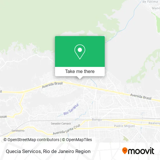
See Quecia Servicos, Bangu, on the map
Public Transit to Quecia Servicos in Bangu
Wondering how to get to Quecia Servicos in Bangu? Moovit helps you find the best way to get to Quecia Servicos with step-by-step directions from the nearest public transit station.
Moovit provides free maps and live directions to help you navigate through your city. View schedules, routes, timetables, and find out how long does it take to get to Quecia Servicos in real time.
Looking for the nearest stop or station to Quecia Servicos? Check out this list of stops closest to your destination: Catiri; Avenida Brasil - Coca-Cola | Catiri; Avenida Brasil - Praça Do Engenho; Rua Monte Alto; Guilherme Da Silveira.
Bus: 2336, 451T, 67, 798, 812, 904T, SN 388, 1900T (EXECUTIVO), 112B, 113D, 388, SR 388, 442L, 121T, 441B, 444B, 1901T, 2381, 764.Train: RAMAL SANTA CRUZ.
Want to see if there’s another route that gets you there at an earlier time? Moovit helps you find alternative routes or times. Get directions from and directions to Quecia Servicos easily from the Moovit App or Website.
We make riding to Quecia Servicos easy, which is why over 1.5 million users, including users in Bangu, trust Moovit as the best app for public transit. You don’t need to download an individual bus app or train app, Moovit is your all-in-one transit app that helps you find the best bus time or train time available.
For information on prices of bus and train, costs and ride fares to Quecia Servicos, please check the Moovit app.
Use the app to navigate to popular places including to the airport, hospital, stadium, grocery store, mall, coffee shop, school, college, and university.
Quecia Servicos Address: Estrada de Gericinó, 815 Gericinó Rio de Janeiro-RJ 21853-000 street in Bangu
- Leandro Ferreira Sergio,
- Ln Lanches,
- Auto Chaveiro Vithoria,
- Estrada de Gericinó,
- Petiscaria Desestressa,
- Tem Tudo Bazar,
- Estrada De Gericinó (Em Frente Ao Nº 817),
- CO Usina Bangu - DELTA Construção,
- Salao Dany e Pry,
- Rodrigues Ltda,
- Espaço Geyza Costa,
- Paty Versartily Comesticos e Outros,
- Estrada do Gericino & Travessa Chicó Mendes,
- Mamc Bebidas e Delicias,
- Bar Parada Obrigatoria e Mercearia,
- Caminho do Encanamento do Guandu, 460,
- King Imports,
- Amp Pintura,
- Ione Ri,
- Refrimarq Climatizacao
Places Near Quecia Servicos (Bangu)
- Museu Do Amanhã, Centro,
- Hospital Municipal Ronaldo Gazolla, Acari,
- Hospital Pedro Ernesto, Vila Isabel,
- Shopping Nova América, Del Castilho,
- Norte Shopping, Cachambi,
- Hospital Federal Cardoso Fontes, Jacarepaguá,
- Praia do Arpoador, Ipanema,
- Feira Livre da Gloria, Glória,
- Rio De Janeiro,
- Avenida Venezuela 134, Saúde,
- Feirão De Malhas, Duque De Caxias,
- Shopping RioSul, Botafogo,
- Hospital Federal Do Andaraí, Andaraí,
- Shopping Downtown, Barra Da Tijuca,
- Rua Licínio Cardoso, São Francisco Xavier,
- Shopping Rio Sul, Botafogo,
- Niterói, Niterói,
- Rodoviária Novo Rio (Rodoviária do Rio de Janeiro), Santo Cristo,
- Rua Ulysses Guimarães 16, Cidade Nova,
- Avenida Rio Branco, Centro
How to get to popular places in Rio de Janeiro Region with public transit
Get around Bangu by public transit!
Traveling around Bangu has never been so easy. See step by step directions as you travel to any attraction, street or major public transit station. View bus and train schedules, arrival times, service alerts and detailed routes on a map, so you know exactly how to get to anywhere in Bangu.
When traveling to any destination around Bangu use Moovit's Live Directions with Get Off Notifications to know exactly where and how far to walk, how long to wait for your line, and how many stops are left. Moovit will alert you when it's time to get off — no need to constantly re-check whether yours is the next stop.
Wondering how to use public transit in Bangu or how to pay for public transit in Bangu? Moovit public transit app can help you navigate your way with public transit easily, and at minimum cost. It includes public transit fees, ticket prices, and costs. Looking for a map of Bangu public transit lines? Moovit public transit app shows all public transit maps in Bangu with all Bus, Train, Metro, Light Rail, Ferry, Cable Car, Gondola and Funicular routes and stops on an interactive map.
Rio de Janeiro Region has 8 transit type(s), including: Bus, Train, Metro, Light Rail, Ferry, Cable Car, Gondola and Funicular, operated by several transit agencies, including TrensRJ, Metrô Rio, VLT Carioca, Barcas Rio, BRT MOBI-Rio, Auto Viação Alpha, Auto Viação Tijuca, Gire Transportes, Transurb, Viação Nossa Senhora das Graças, Consórcio INTERSUL, Braso Lisboa (Municipal), Caprichosa Auto Ônibus, Auto Viação Três Amigos and Rodoviária Âncora Matias