Directions to Queens Public Library with public transportation
The following transit lines have routes that pass near Queens Public Library
 Bus: Q110, Q27, Q88, Q36, N24.
- Train: HEMPSTEAD BRANCH, PORT JEFFERSON BRANCH, RONKONKOMA BRANCH.
How to get to Queens Public Library by bus?
Click on the bus route to see step by step directions with maps, line arrival times and updated time schedules.
How to get to Queens Public Library by train?
Click on the train route to see step by step directions with maps, line arrival times and updated time schedules.
Bus stops near Queens Public Library
Train station near Queens Public Library
- Queens Village, 27 min walk,VIEW
Bus lines to Queens Public Library
What are the closest stations to Queens Public Library?
The closest stations to Queens Public Library are:
- Amboy Ln/Jamaica Av is 431 yards away, 6 min walk.
- Springfield Blvd/93 Av is 466 yards away, 6 min walk.
- Springfield Bl / Jamaica is 500 yards away, 7 min walk.
- Queens Village is 2278 yards away, 27 min walk.
Which bus lines stop near Queens Public Library?
These bus lines stop near Queens Public Library: Q110, Q27, Q88.
Which train line stops near Queens Public Library?
HEMPSTEAD BRANCH (Hempstead)
What’s the nearest train station to Queens Public Library?
The nearest train station to Queens Public Library is Queens Village. It’s a 27 min walk away.
What’s the nearest bus station to Queens Public Library?
The nearest bus stations to Queens Public Library are Amboy Ln/Jamaica Av and Springfield Blvd/93 Av. The closest one is a 6 min walk away.
What time is the first train to Queens Public Library?
The HEMPSTEAD BRANCH is the first train that goes to Queens Public Library. It stops nearby at 3:09 AM.
What time is the last train to Queens Public Library?
The HEMPSTEAD BRANCH is the last train that goes to Queens Public Library. It stops nearby at 3:13 AM.
What time is the first bus to Queens Public Library?
The Q27 is the first bus that goes to Queens Public Library. It stops nearby at 3:00 AM.
What time is the last bus to Queens Public Library?
The Q27 is the last bus that goes to Queens Public Library. It stops nearby at 3:13 AM.
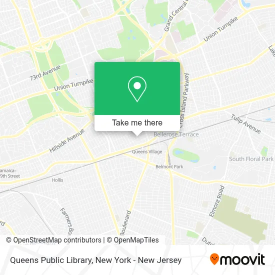
See Queens Public Library on the map
Public Transportation to Queens Public Library
Wondering how to get to Queens Public Library? Moovit helps you find the best way to get to Queens Public Library with step-by-step directions from the nearest public transit station.
Moovit provides free maps and live directions to help you navigate through your city. View schedules, routes, timetables, and find out how long does it take to get to Queens Public Library in real time.
Looking for the nearest stop or station to Queens Public Library? Check out this list of stops closest to your destination: Amboy Ln/Jamaica Av; Springfield Blvd/93 Av; Springfield Bl / Jamaica; Queens Village.
Bus: Q110, Q27, Q88, Q36, N24.Train: HEMPSTEAD BRANCH, PORT JEFFERSON BRANCH, RONKONKOMA BRANCH.
Want to see if there’s another route that gets you there at an earlier time? Moovit helps you find alternative routes or times. Get directions from and directions to Queens Public Library easily from the Moovit App or Website.
We make riding to Queens Public Library easy, which is why over 1.5 million users, including users in Queens, trust Moovit as the best app for public transit. You don’t need to download an individual bus app or train app, Moovit is your all-in-one transit app that helps you find the best bus time or train time available.
For information on prices of bus, train, light rail and subway, costs and ride fares to Queens Public Library, please check the Moovit app.
Use the app to navigate to popular places including to the airport, hospital, stadium, grocery store, mall, coffee shop, school, college, and university.
Queens Public Library Address: 94-11 217th St street in Queens
- Project Hope- the New Direction, Inc,
- Bruce's Sewer Service Corp.,
- Ab&G Travel and Tours Llc,
- Seventh-Day Adventist Church,
- Queens Village, NY,
- Thai Phong Dpm,
- Mia Treats Nyc,
- Zahra Boutique,
- Ben It Solution,
- Layla Halal Food,
- Vigo,
- Capital One Atm,
- Ups Access Point Location,
- Oraclemarketer,
- Village Delicatessen,
- Thomson's Travel and Realty,
- CD Restaurant and Bar,
- Lorenzo's Pizza & Brew,
- Kim's Nail Salon,
- Spice on A Slice
Places Near Queens Public Library
- Mountainside Hospital, Glen Ridge,
- San Gennaro Feast, Manhattan,
- 66 John Street, Manhattan,
- Pier 83, Manhattan,
- Bellevue Hospital, Manhattan,
- SoHo, Manhattan,
- 111 Centre New York City Supreme Court, Manhattan,
- qqqq, Manhattan,
- Hudson Yards, Manhattan,
- 376 Hudson Street, Manhattan,
- 1 Police Plaza, Manhattan,
- 3 Stone St, Manhattan,
- Katz's Deli, Manhattan,
- Times Square, Manhattan,
- Rockefeller Center, Manhattan,
- 911 Memorial, Manhattan,
- 26 Federal Plaza, Manhattan,
- Queens Center Mall, Queens,
- Chinatown, Manhattan,
- Wall Street, Manhattan
How to get to popular places in New York - New Jersey with public transit
Get around Queens by public transit!
Traveling around Queens has never been so easy. See step by step directions as you travel to any attraction, street or major public transit station. View bus and train schedules, arrival times, service alerts and detailed routes on a map, so you know exactly how to get to anywhere in Queens.
When traveling to any destination around Queens use Moovit's Live Directions with Get Off Notifications to know exactly where and how far to walk, how long to wait for your line, and how many stops are left. Moovit will alert you when it's time to get off — no need to constantly re-check whether yours is the next stop.
Wondering how to use public transit in Queens or how to pay for public transit in Queens? Moovit public transit app can help you navigate your way with public transit easily, and at minimum cost. It includes public transit fees, ticket prices, and costs. Looking for a map of Queens public transit lines? Moovit public transit app shows all public transit maps in Queens with all Bus, Train, Subway, Light Rail, Ferry and Cable Car routes and stops on an interactive map.
New York - New Jersey has 6 transit type(s), including: Bus, Train, Subway, Light Rail, Ferry and Cable Car, operated by several transit agencies, including MTA Subway, Metro-North Railroad, LIRR, PATH, MTA New York City Transit - Express routes, MTA Bus, NJ Transit, NYC Ferry, NICE bus, Bee-Line Bus, NJ Transit Rail, Norwalk Transit District, Hartford Line, River Valley Transit and HART