How to get to Quel Che by bus?
Click on the bus route to see step by step directions with maps, line arrival times and updated time schedules.
From New Maltraverso Sports Center, Colle Di Val D'Elsa
124 minFrom Gaiole In Chianti, Gaiole In Chianti
53 minFrom Prada - Space Outlet, Arezzo
132 minFrom Le Pozze Di Lecchi, Gaiole In Chianti
63 minFrom Alta Val d'Elsa River Park, Colle Di Val D'Elsa
130 minFrom Antica Querciolaia Thermal Baths, Rapolano Terme
39 minFrom Greve In Chianti, Greve In Chianti
170 minFrom Siena Eye Laser, Poggibonsi
103 minFrom Rapolano Terme, Rapolano Terme
35 minFrom Colle Di Val D'Elsa, Colle Di Val D'Elsa
38 min
How to get to Quel Che by train?
Click on the train route to see step by step directions with maps, line arrival times and updated time schedules.
Bus stops near Quel Che in Siena
Train station near Quel Che in Siena
- Siena, 16 min walk,VIEW
Bus lines to Quel Che in Siena
- 0S3, Massetana-Via Tozzi-Railway-Hospital-Due Ponti,VIEW
- 0S5, Petriccio-Porta Sale-Pispini-Arbia-San Piero,VIEW
- 0S9, Via Tozzi-Camollia-Station-Petriccio-Via Gabrielli,VIEW
- S10, Fornacelle-Belverde-Tozzi-Station-Hospital-San Miniato,VIEW
- 60N, Gramsci Square - Siena Outskirts,VIEW
- 511, Gramsci Square - Acquacalda - Montarioso,VIEW
- 521, Piazza Gramsci - Railway - San Miniato - Schools,VIEW
- 524, Center-Vico Alto-San Miniato-Due Ponti,VIEW
- 638, Piazza Gramsci-Railway-Biological Institutes,VIEW
- 671, Via Tozzi - Medical Center,VIEW
- 676, Gramsci Square-Vico Alto-Gramsci Square,VIEW
- 705, Viale Toselli Whirlpool - Via Tozzi,VIEW
- S30, Gramsci Square-San Rocco-Castle,VIEW
- S32, Piazza Sale-Taverne-Casetta-Monteaperti-San Piero,VIEW
- S33, Piazza Gramsci-Volte Basse-Sovicille-Rosia-Brenna,VIEW
- S34, Piazza Gramsci-Ponte a Bozzone-Pontignano-Vagliagli,VIEW
- S38, Pianella-Ponte A Bozzone-Bottega Nuova-Piazza Gramsci,VIEW
- 104, Siena-Ancaiano-Pievescola,VIEW
- 107, Sinalunga-Rapolano Terme-Siena,VIEW
- 110, Siena-Ville Di Corsano-Casciano-Vescovado-Murlo,VIEW
What are the closest stations to Quel Che?
The closest stations to Quel Che are:
- Campansi is 173 meters away, 3 min walk.
- Biagio di Montluc is 221 meters away, 3 min walk.
- Gazzani is 271 meters away, 4 min walk.
- Nazario Sauro is 301 meters away, 4 min walk.
- Montluc is 307 meters away, 4 min walk.
- Salt Square is 318 meters away, 5 min walk.
- Don Minzoni is 506 meters away, 7 min walk.
- Mazzini 73 is 1051 meters away, 14 min walk.
- Siena is 1175 meters away, 16 min walk.
Which bus lines stop near Quel Che?
These bus lines stop near Quel Che: 102, 131, 138, GT1, S10.
Which train line stops near Quel Che?
R (Siena)
What’s the nearest train station to Quel Che in Siena?
The nearest train station to Quel Che in Siena is Siena. It’s a 16 min walk away.
What’s the nearest bus station to Quel Che in Siena?
The nearest bus stations to Quel Che in Siena are Campansi and Biagio di Montluc. The closest one is a 3 min walk away.
What time is the first train to Quel Che in Siena?
The R is the first train that goes to Quel Che in Siena. It stops nearby at 5:45 AM.
What time is the last train to Quel Che in Siena?
The R is the last train that goes to Quel Che in Siena. It stops nearby at 11:17 PM.
What time is the first bus to Quel Che in Siena?
The S10 is the first bus that goes to Quel Che in Siena. It stops nearby at 5:30 AM.
What time is the last bus to Quel Che in Siena?
The 60N is the last bus that goes to Quel Che in Siena. It stops nearby at 1:05 AM.
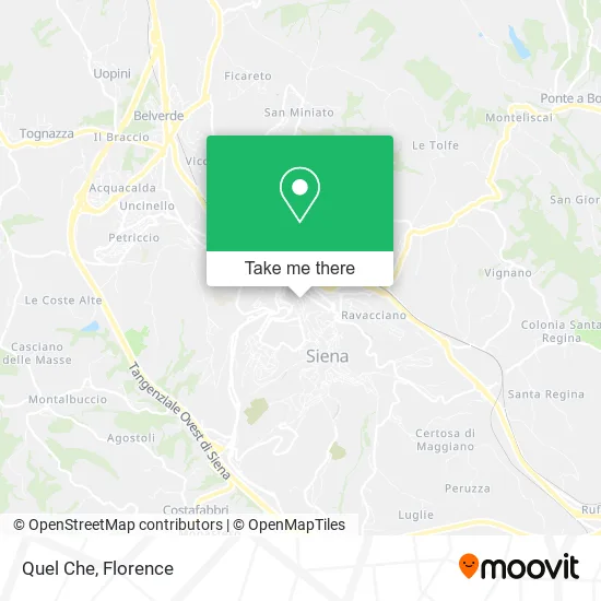
See Quel Che, Siena, on the map
Public Transit to Quel Che in Siena
Wondering how to get to Quel Che in Siena? Moovit helps you find the best way to get to Quel Che with step-by-step directions from the nearest public transit station.
Moovit provides free maps and live directions to help you navigate through your city. View schedules, routes, timetables, and find out how long does it take to get to Quel Che in real time.
Looking for the nearest stop or station to Quel Che? Check out this list of stops closest to your destination: Campansi; Biagio di Montluc; Gazzani; Nazario Sauro; Montluc; Salt Square; Don Minzoni; Mazzini 73; Siena.
Bus: 102, 131, 138, GT1, S10, 0S3, 0S5, 0S9, 60N, S30, S30, S32, S32, S33, 501, 530, 616, 640, S30, S31, S33, S33, S33, 0S1, 0S8, 0S8, S11, S35.Train: R.
Want to see if there’s another route that gets you there at an earlier time? Moovit helps you find alternative routes or times. Get directions from and directions to Quel Che easily from the Moovit App or Website.
We make riding to Quel Che easy, which is why over 1.5 million users, including users in Siena, trust Moovit as the best app for public transit. You don’t need to download an individual bus app or train app, Moovit is your all-in-one transit app that helps you find the best bus time or train time available.
For information on prices of bus and train, costs and ride fares to Quel Che, please check the Moovit app.
Use the app to navigate to popular places including to the airport, hospital, stadium, grocery store, mall, coffee shop, school, college, and university.
Quel Che Address: Costa dei Paparoni, 2 53100 Siena street in Siena
- Franco Marzi,
- S.C.A.M.E. Siena Vintage Car and Motorcycle Club,
- Alvaro School,
- Right Source,
- Look Center Hair Salon,
- Air. Radio and Television Equipment Apparatus,
- Collini Coppi Associated Legal Studio,
- One Hundred Seventh Heaven,
- Nencini Optics,
- Maurizio Teucci,
- Alessandro Farnetani,
- Leonardo Bisconti,
- Dr. Matteo Financial Advisor Dettori,
- Burroni Paolo,
- Cheap Phone Center by Hamiyani H. & C.,
- Terrosi Tobacco Shop,
- Perferi Andrea,
- Camulio Pinseria,
- Cartazucchero Bookstore and Cafe,
- Monciatti Carlo
Places Near Quel Che (Siena)
- Santa Maria Novella Station, Florence,
- Michelangelo Square, Florence,
- I Gigli, Campi Bisenzio,
- Torregalli Hospital Scandicci *, Scandicci,
- Artemio Franchi Municipal Stadium, Florence,
- Nelson Mandela Forum, Florence,
- Asmana, Campi Bisenzio,
- Verdi Theater, Florence,
- Santa Maria Nuova Hospital, Florence,
- Field of Mars, Florence,
- Campi Bisenzio, Campi Bisenzio,
- Mandela Forum (Nelson Mandela Forum), Florence,
- IKEA Florence, Sesto Fiorentino,
- Cascine Park, Florence,
- Viola Park, Bagno a Ripoli,
- Michelangelo Square, Florence,
- OOO, Florence,
- Tobacco Manufacture, Florence,
- Wanny Palace, Florence,
- Piero Palagi Hospital Facility-Florence, Florence
How to get to popular places in Florence with public transit
Get around Siena by public transit!
Traveling around Siena has never been so easy. See step by step directions as you travel to any attraction, street or major public transit station. View bus and train schedules, arrival times, service alerts and detailed routes on a map, so you know exactly how to get to anywhere in Siena.
When traveling to any destination around Siena use Moovit's Live Directions with Get Off Notifications to know exactly where and how far to walk, how long to wait for your line, and how many stops are left. Moovit will alert you when it's time to get off — no need to constantly re-check whether yours is the next stop.
Wondering how to use public transit in Siena or how to pay for public transit in Siena? Moovit public transit app can help you navigate your way with public transit easily, and at minimum cost. It includes public transit fees, ticket prices, and costs. Looking for a map of Siena public transit lines? Moovit public transit app shows all public transit maps in Siena with all Bus, Train, Light Rail, Ferry and Funicular routes and stops on an interactive map.
Florence has 5 transit type(s), including: Bus, Train, Light Rail, Ferry and Funicular, operated by several transit agencies, including Florence Urban - Tuscan Bus Lines, GEST, Livorno and Province - Tuscan Bus Lines, Arezzo, Florence and Provinces - Tuscan Bus Lines, Prato and Province - Tuscan Bus Lines, Lucca and Province - Tuscan Bus Lines, Massa, Carrara and Province - Tuscan Bus Lines, Pisa and Province - Tuscan Bus Lines, Grosseto, Siena and Provinces - Tuscan Bus Lines, Arezzo, Siena and Provinces - Tuscan Bus Lines, Florence and Province - Tuscan Bus Lines, Pistoia and Province - Tuscan Bus Lines, Siena and Province - Tuscan Bus Lines, Arezzo and Province - Tuscan Bus Lines and Trenitalia