Directions to Quell Collections (Baltimore) with public transportation
The following transit lines have routes that pass near Quell Collections
 Bus: 22, CITYLINK BROWN, CITYLINK PINK, CITYLINK GOLD, 63.
- Train: NORTHEAST REGIONAL, ACELA, CARDINAL, CAROLINIAN, CRESCENT.
- Metro: METRO.
How to get to Quell Collections by bus?
Click on the bus route to see step by step directions with maps, line arrival times and updated time schedules.
From Medstar Harbor Hospital, Baltimore
52 minFrom Horseshoe Baltimore, Baltimore
57 minFrom I-695 Exit 29 (Loch Raven Blvd (MD 542)/Cromwell Bridge Rd), Baltimore County
59 minFrom Walmart, Baltimore County
64 minFrom Western High School, Baltimore
54 minFrom Mva, Baltimore
62 minFrom Medstar Franklin Square Medical Center, Baltimore County
44 minFrom Towson Town Center, Baltimore County
58 minFrom Walmart Supercenter, Baltimore County
65 minFrom M&T Bank Stadium, Baltimore
43 min
How to get to Quell Collections by train?
Click on the train route to see step by step directions with maps, line arrival times and updated time schedules.
How to get to Quell Collections by metro?
Click on the metro route to see step by step directions with maps, line arrival times and updated time schedules.
Bus stops near Quell Collections in Baltimore
Metro station near Quell Collections in Baltimore
- Shot Tower Metro, 21 min walk,VIEW
Train stations near Quell Collections in Baltimore
Bus lines to Quell Collections in Baltimore
What are the closest stations to Quell Collections?
The closest stations to Quell Collections are:
- Preston & Linwood Eb is 462 yards away, 6 min walk.
- Milton & Federal FS Nb is 476 yards away, 7 min walk.
- Edison Hwy & Duncanwood Ln Nb is 593 yards away, 8 min walk.
- Belair Rd & North Ave Sb is 997 yards away, 12 min walk.
- Shot Tower Metro is 1743 yards away, 21 min walk.
- Baltimore Penn Station is 5086 yards away, 60 min walk.
- Penn Station Marc Sb is 5162 yards away, 61 min walk.
Which bus lines stop near Quell Collections?
These bus lines stop near Quell Collections: 22, CITYLINK BROWN, CITYLINK PINK.
Which train line stops near Quell Collections?
NORTHEAST REGIONAL (Springfield)
Which metro line stops near Quell Collections?
METRO (Towards John Hopkins)
What’s the nearest metro station to Quell Collections in Baltimore?
The nearest metro station to Quell Collections in Baltimore is Shot Tower Metro. It’s a 21 min walk away.
What’s the nearest bus station to Quell Collections in Baltimore?
The nearest bus station to Quell Collections in Baltimore is Preston & Linwood Eb. It’s a 6 min walk away.
What time is the first metro to Quell Collections in Baltimore?
The METRO is the first metro that goes to Quell Collections in Baltimore. It stops nearby at 4:21 AM.
What time is the last metro to Quell Collections in Baltimore?
The METRO is the last metro that goes to Quell Collections in Baltimore. It stops nearby at 12:29 AM.
What time is the first train to Quell Collections in Baltimore?
The MARC is the first train that goes to Quell Collections in Baltimore. It stops nearby at 4:30 AM.
What time is the last train to Quell Collections in Baltimore?
The SILVER METEOR is the last train that goes to Quell Collections in Baltimore. It stops nearby at 7:57 AM.
What time is the first bus to Quell Collections in Baltimore?
The CITYLINK PINK is the first bus that goes to Quell Collections in Baltimore. It stops nearby at 3:00 AM.
What time is the last bus to Quell Collections in Baltimore?
The CITYLINK PINK is the last bus that goes to Quell Collections in Baltimore. It stops nearby at 3:12 AM.
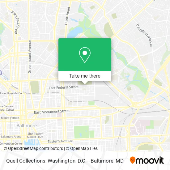
See Quell Collections, Baltimore, on the map
Public Transit to Quell Collections in Baltimore
Wondering how to get to Quell Collections in Baltimore? Moovit helps you find the best way to get to Quell Collections with step-by-step directions from the nearest public transit station.
Moovit provides free maps and live directions to help you navigate through your city. View schedules, routes, timetables, and find out how long does it take to get to Quell Collections in real time.
Looking for the nearest stop or station to Quell Collections? Check out this list of stops closest to your destination: Preston & Linwood Eb; Milton & Federal FS Nb; Edison Hwy & Duncanwood Ln Nb; Belair Rd & North Ave Sb; Shot Tower Metro; Baltimore Penn Station; Penn Station Marc Sb.
Bus: 22, CITYLINK BROWN, CITYLINK PINK, CITYLINK GOLD, 63, 105.Train: NORTHEAST REGIONAL, ACELA, CARDINAL, CAROLINIAN, CRESCENT, MARC.Metro: METRO.
Want to see if there’s another route that gets you there at an earlier time? Moovit helps you find alternative routes or times. Get directions from and directions to Quell Collections easily from the Moovit App or Website.
We make riding to Quell Collections easy, which is why over 1.5 million users, including users in Baltimore, trust Moovit as the best app for public transit. You don’t need to download an individual bus app or train app, Moovit is your all-in-one transit app that helps you find the best bus time or train time available.
For information on prices of bus, metro, light rail and train, costs and ride fares to Quell Collections, please check the Moovit app.
Use the app to navigate to popular places including to the airport, hospital, stadium, grocery store, mall, coffee shop, school, college, and university.
Quell Collections Address: 2816 E Federal St Baltimore, MD 21213 street in Baltimore
- Fort Worthington Elementary / Middle School,
- Headquarters Barbershop & Salon,
- Federal St & N Luzerne Ave,
- Baltimore Best Movers,
- Pearl' S Party,
- Homes for Sale and Rent,
- Family Affairs Grocery,
- Apache Lounge,
- Edison E Federal St,
- Wesley Chavis Funeral Home,
- Edison Hwy (edison highway and federal street),
- Hoffman N Milton Ave,
- Hope Academy,
- E Biddle St Building 2735,
- Watoto From the Nile,
- Market Grocery,
- Boss Boyz Towing,
- Montford Mini Market,
- Belair Rd (north ave and belair rd),
- Belair Rd (belair road and E North Ave)
Places Near Quell Collections (Baltimore)
- Museum Of The Bible, Washington,
- Pennsylvania Ave NW (3rd st and pennsylvania), Washington,
- Rock Creek Tennis Center, Washington,
- Camden Yards, Baltimore,
- Washington National Cathedral, Washington,
- M&T Bank Stadium, Baltimore,
- Basilica of the National Shrine, Washington,
- Amazon Hq2, Arlington County,
- Washington DC VA Medical Center, Washington,
- National Museum of African American History and Culture, Washington,
- PG Mall, Prince George's County,
- Warner Theatre, Washington,
- Georgetown, Washington,
- National Mall, Washington,
- Marriott Marquis Washington, DC, Washington,
- National Zoo, Washington,
- Capital One Arena, Washington,
- Westfield Montgomery Mall, Montgomery County,
- Sibley Memorial Hospital, Washington,
- The Anthem, Washington
How to get to popular places in Washington, D.C. - Baltimore, MD with public transit
Get around Baltimore by public transit!
Traveling around Baltimore has never been so easy. See step by step directions as you travel to any attraction, street or major public transit station. View bus and train schedules, arrival times, service alerts and detailed routes on a map, so you know exactly how to get to anywhere in Baltimore.
When traveling to any destination around Baltimore use Moovit's Live Directions with Get Off Notifications to know exactly where and how far to walk, how long to wait for your line, and how many stops are left. Moovit will alert you when it's time to get off — no need to constantly re-check whether yours is the next stop.
Wondering how to use public transit in Baltimore or how to pay for public transit in Baltimore? Moovit public transit app can help you navigate your way with public transit easily, and at minimum cost. It includes public transit fees, ticket prices, and costs. Looking for a map of Baltimore public transit lines? Moovit public transit app shows all public transit maps in Baltimore with all Bus, Train, Metro, Light Rail and Ferry routes and stops on an interactive map.
Washington, D.C. - Baltimore, MD has 5 transit type(s), including: Bus, Train, Metro, Light Rail and Ferry, operated by several transit agencies, including WMATA, Montgomery County Ride On, Fairfax Connector, TheBus, PRTC, DASH - Alexandria, Arlington Transit (ART), RTA of Central Maryland, MDOT MTA, MDOT MTA Light RailLink, MDOT MTA Commuter Bus, MDOT MTA Local Bus, FXBGO!, Virginia Railway Express (VRE) and MARC