How to get to Quick Lock by bus?
Click on the bus route to see step by step directions with maps, line arrival times and updated time schedules.
From Affirmative Insurance Holdings, Speedway
35 minFrom Super 8-Indianapolis Emerson Ave (Indianapolis Super Eight), Beech Grove
49 minFrom Walmart 5443 Indianapolis, Beech Grove
48 minFrom Elevated Esthetics Relax and Rejuvenate, Indianapolis City (Balance)
41 minFrom University of Indianapolis (UINDY), Indianapolis City (Balance)
41 minFrom Scott's Candy Shop, Indianapolis City (Balance)
40 minFrom Northern Tool Equipment, Indianapolis City (Balance)
53 minFrom Alucast Inc., Indianapolis City (Balance)
39 minFrom D & I Carreto Construction, Indianapolis City (Balance)
37 minFrom Walmart Supercenter, Beech Grove
49 min
Bus stops near Quick Lock in Indianapolis City (Balance)
Bus lines to Quick Lock in Indianapolis City (Balance)
What are the closest stations to Quick Lock?
The closest stations to Quick Lock are:
- East St & Michigan St is 206 yards away, 3 min walk.
- Michigan St & East St is 229 yards away, 3 min walk.
- Alabama St & North St is 292 yards away, 4 min walk.
- Delaware St & New York St is 342 yards away, 5 min walk.
Which bus lines stop near Quick Lock?
These bus lines stop near Quick Lock: 10, 16, 37, 38, 56, 90.
What’s the nearest bus station to Quick Lock in Indianapolis City (Balance)?
The nearest bus stations to Quick Lock in Indianapolis City (Balance) are East St & Michigan St and Michigan St & East St. The closest one is a 3 min walk away.
What time is the first bus to Quick Lock in Indianapolis City (Balance)?
The 37 is the first bus that goes to Quick Lock in Indianapolis City (Balance). It stops nearby at 4:47 AM.
What time is the last bus to Quick Lock in Indianapolis City (Balance)?
The 6 is the last bus that goes to Quick Lock in Indianapolis City (Balance). It stops nearby at 11:47 PM.
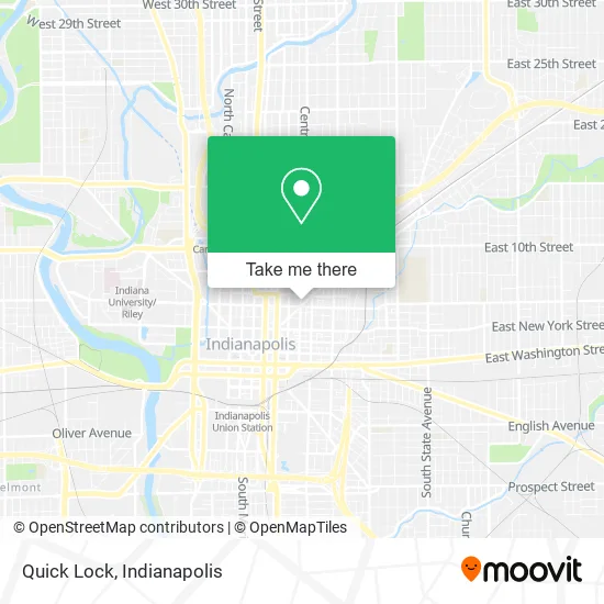
See Quick Lock, Indianapolis City (Balance), on the map
Public Transit to Quick Lock in Indianapolis City (Balance)
Wondering how to get to Quick Lock in Indianapolis City (Balance)? Moovit helps you find the best way to get to Quick Lock with step-by-step directions from the nearest public transit station.
Moovit provides free maps and live directions to help you navigate through your city. View schedules, routes, timetables, and find out how long does it take to get to Quick Lock in real time.
Looking for the nearest stop or station to Quick Lock? Check out this list of stops closest to your destination: East St & Michigan St; Michigan St & East St; Alabama St & North St; Delaware St & New York St.
Bus: 10, 16, 37, 38, 56, 90, 21, 3, 2, 4, 5, 19, 6, 15, 34.
Want to see if there’s another route that gets you there at an earlier time? Moovit helps you find alternative routes or times. Get directions from and directions to Quick Lock easily from the Moovit App or Website.
We make riding to Quick Lock easy, which is why over 1.5 million users, including users in Indianapolis City (Balance), trust Moovit as the best app for public transit. You don’t need to download an individual bus app or train app, Moovit is your all-in-one transit app that helps you find the best bus time or train time available.
For information on prices of bus, costs and ride fares to Quick Lock, please check the Moovit app.
Use the app to navigate to popular places including to the airport, hospital, stadium, grocery store, mall, coffee shop, school, college, and university.
Quick Lock Address: 501 N New Jersey St Indianapolis, IN 46204 street in Indianapolis City (Balance)
- Huston Electric,
- Mass Ave Sweets,
- Noble Lodge F&am,
- Murat Theater At Old National Center,
- Centerplate at the Old National Centre,
- Centerplate Catering (Centerplate at the Old National Centre),
- Latea Bubble Tea Lounge - Coming Soon,
- Krista Bermeo Studio,
- Penrose on Mass,
- North Street and New Jersey Street,
- Amazon Locker-Napeequa,
- Nine Irish Brothers Mass Ave Indy,
- San Holo,
- Laz Parking Block 20,
- The Knotted Spoon,
- Diamond Plate Properties,
- Massachusetts Avenue, Indianapolis,
- El Mana Mexican Food,
- Zion Evangelical Ucc,
- Richelieu on the Avenue Apartments Of Indianapolis
Places Near Quick Lock (Indianapolis City (Balance))
- St. Vincent entrance #1, Indianapolis City (Balance),
- Lucas Oil Stadium, Indianapolis City (Balance),
- St. Vincent Hospital - Indianapolis, Indianapolis City (Balance),
- Cotter's Massage Parlor With Happy Endings, Indianapolis City (Balance),
- I U Health Methodist Hospital, Indianapolis City (Balance),
- Methodist Hospital of Indianapolis, Indianapolis City (Balance),
- 119 W 19th St Parking, Indianapolis City (Balance),
- Indiana, Indianapolis City (Balance),
- Plainfield, IN, Plainfield,
- Indiana Convention Center, Indianapolis City (Balance),
- Indianapolis Airport Zone 2, Indianapolis City (Balance),
- Castleton Square Mall, Indianapolis,
- I-465 / I-65 Interchange, Indianapolis City (Balance),
- Gainbridge Fieldhouse, Indianapolis City (Balance),
- Eskenazi Hospital, Indianapolis City (Balance),
- Lilly Corporate Center (Eli Lilly & Co), Indianapolis City (Balance),
- Indianapolis Motor Speedway, Speedway,
- Train Ride At Castleton Mall, Indianapolis City (Balance),
- Jersey Barn, Indianapolis City (Balance),
- THE BALT, Indianapolis City (Balance)
How to get to popular places in Indianapolis with public transit
Get around Indianapolis City (Balance) by public transit!
Traveling around Indianapolis City (Balance) has never been so easy. See step by step directions as you travel to any attraction, street or major public transit station. View bus and train schedules, arrival times, service alerts and detailed routes on a map, so you know exactly how to get to anywhere in Indianapolis City (Balance).
When traveling to any destination around Indianapolis City (Balance) use Moovit's Live Directions with Get Off Notifications to know exactly where and how far to walk, how long to wait for your line, and how many stops are left. Moovit will alert you when it's time to get off — no need to constantly re-check whether yours is the next stop.
Wondering how to use public transit in Indianapolis City (Balance) or how to pay for public transit in Indianapolis City (Balance)? Moovit public transit app can help you navigate your way with public transit easily, and at minimum cost. It includes public transit fees, ticket prices, and costs. Looking for a map of Indianapolis City (Balance) public transit lines? Moovit public transit app shows all public transit maps in Indianapolis City (Balance) with all bus routes and stops on an interactive map.
Indianapolis has 1 transit type(s), including: bus, operated by several transit agencies, including IndyGo, FlixBus-us and Greyhound-us