How to get to Quick Stop by bus?
Click on the bus route to see step by step directions with maps, line arrival times and updated time schedules.
From Lake Worth Tri Rail Station, Lake Worth
74 minFrom Greenacres, FL, Lake Worth
94 minFrom John I. Leonard High School, Lake Worth
85 minFrom The Ballpark of the Palm Beaches, West Palm Beach
43 minFrom Palm Beach State College, Lake Worth
61 minFrom Whispers All Girl Staff, West Palm Beach
63 minFrom Mar a Lago, West Palm Beach
63 minFrom West Palm Beach Palm Beach Airport PBI, West Palm Beach
30 minFrom Lake Worth, FL, Lake Worth
56 minFrom Suncoast Community High School, Riviera Beach
63 min
How to get to Quick Stop by train?
Click on the train route to see step by step directions with maps, line arrival times and updated time schedules.
Bus stops near Quick Stop in West Palm Beach
Train stations near Quick Stop in West Palm Beach
Bus lines to Quick Stop in West Palm Beach
What are the closest stations to Quick Stop?
The closest stations to Quick Stop are:
- TAMARIND AVE at GRANT ST is 17 yards away, 1 min walk.
- AUSTRALIAN AVE at A J GAINES PK is 1039 yards away, 13 min walk.
- Mangonia Park Station is 1118 yards away, 14 min walk.
- West Palm Beach is 3378 yards away, 40 min walk.
- West Palm Beach Amtrak Station is 4098 yards away, 48 min walk.
Which bus line stops near Quick Stop?
31 (Rt 31 Northbound)
Which train line stops near Quick Stop?
TRIRAIL (Northbound To Mangonia Park)
What’s the nearest train station to Quick Stop in West Palm Beach?
The nearest train station to Quick Stop in West Palm Beach is Mangonia Park Station. It’s a 14 min walk away.
What’s the nearest bus station to Quick Stop in West Palm Beach?
The nearest bus station to Quick Stop in West Palm Beach is TAMARIND AVE at GRANT ST. It’s a 1 min walk away.
What time is the first train to Quick Stop in West Palm Beach?
The TRIRAIL is the first train that goes to Quick Stop in West Palm Beach. It stops nearby at 3:50 AM.
What time is the last train to Quick Stop in West Palm Beach?
The FLORIDIAN is the last train that goes to Quick Stop in West Palm Beach. It stops nearby at 4:16 PM.
What time is the first bus to Quick Stop in West Palm Beach?
The 31 is the first bus that goes to Quick Stop in West Palm Beach. It stops nearby at 5:16 AM.
What time is the last bus to Quick Stop in West Palm Beach?
The 33 is the last bus that goes to Quick Stop in West Palm Beach. It stops nearby at 10:09 PM.
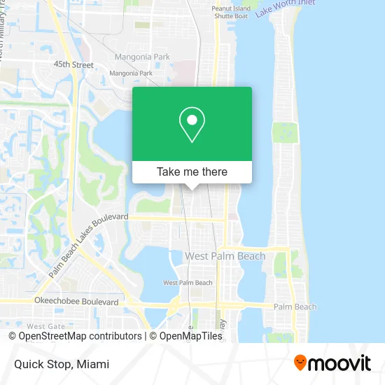
See Quick Stop, West Palm Beach, on the map
Public Transit to Quick Stop in West Palm Beach
Wondering how to get to Quick Stop in West Palm Beach? Moovit helps you find the best way to get to Quick Stop with step-by-step directions from the nearest public transit station.
Moovit provides free maps and live directions to help you navigate through your city. View schedules, routes, timetables, and find out how long does it take to get to Quick Stop in real time.
Looking for the nearest stop or station to Quick Stop? Check out this list of stops closest to your destination: TAMARIND AVE at GRANT ST; AUSTRALIAN AVE at A J GAINES PK; Mangonia Park Station; West Palm Beach; West Palm Beach Amtrak Station.
Bus: 31, 33.Train: TRIRAIL, BLFM, FLORIDIAN, SILVER METEOR.
Want to see if there’s another route that gets you there at an earlier time? Moovit helps you find alternative routes or times. Get directions from and directions to Quick Stop easily from the Moovit App or Website.
We make riding to Quick Stop easy, which is why over 1.5 million users, including users in West Palm Beach, trust Moovit as the best app for public transit. You don’t need to download an individual bus app or train app, Moovit is your all-in-one transit app that helps you find the best bus time or train time available.
For information on prices of bus and train, costs and ride fares to Quick Stop, please check the Moovit app.
Use the app to navigate to popular places including to the airport, hospital, stadium, grocery store, mall, coffee shop, school, college, and university.
Quick Stop Address: 1909 N Tamarind Ave West Palm Beach, FL 33407 street in West Palm Beach
- Brian Woods Team Realty and Investment Solutions, LLC,
- Tamarind Ave @ 18th St,
- The Tricoli Team,
- Pine Ridge Holistic Living Center,
- Seven Days Electrical Repair,
- Apostolic Child Development Center,
- Quik Stop Mobile Tire Service,
- Coleman Park Community Center,
- Brightline,
- T Grocery,
- The Palm Beach Post,
- Beyel Brothers,
- Sunshine Plumbing,
- Healthy Creations,
- Fat Boy Sauceless Ribs,
- Luxe Events and Catering,
- Apostolic Church of Jesus-WPB $Acojwpb,
- KDW Cleaning Service,
- Jacobs Upholstery & Home Decor,
- Workshop B(Brightline Maintenance Facilty)
Places Near Quick Stop (West Palm Beach)
- Miami Design District, Miami,
- Richard E. Gerstein Justice Building, Miami,
- Sawgrass Mall, Miami,
- Dolphin Mall Bus, Miami,
- Keiser University Flagship Campus, West Palm Beach,
- Port of Miami Cruise Terminal, Miami,
- Aventura Mall, Miami,
- Hard Rock Stadium, Miami Gardens,
- Sawgrass mall ( FL ), Miami Beach,
- Dolphin Mall, Miami,
- Miami VA Hospital, Miami,
- Little Havana, Miami,
- Aventura Mall, Miami Beach,
- Marlins Park, Miami,
- Brickell City Centre, Miami,
- Miami-Dade County Courthouse, Miami,
- Zoo Miami, Miami,
- Miami Freedom Park, Miami,
- Wynwood, Miami,
- Bayside Marketplace, Miami
How to get to popular places in Miami with public transit
Get around West Palm Beach by public transit!
Traveling around West Palm Beach has never been so easy. See step by step directions as you travel to any attraction, street or major public transit station. View bus and train schedules, arrival times, service alerts and detailed routes on a map, so you know exactly how to get to anywhere in West Palm Beach.
When traveling to any destination around West Palm Beach use Moovit's Live Directions with Get Off Notifications to know exactly where and how far to walk, how long to wait for your line, and how many stops are left. Moovit will alert you when it's time to get off — no need to constantly re-check whether yours is the next stop.
Wondering how to use public transit in West Palm Beach or how to pay for public transit in West Palm Beach? Moovit public transit app can help you navigate your way with public transit easily, and at minimum cost. It includes public transit fees, ticket prices, and costs. Looking for a map of West Palm Beach public transit lines? Moovit public transit app shows all public transit maps in West Palm Beach with all Bus, Train, Light Rail and Ferry routes and stops on an interactive map.
Miami has 4 transit type(s), including: Bus, Train, Light Rail and Ferry, operated by several transit agencies, including Broward County Transit, Miami-Dade Transit, Metrorail, Palm Tran, Tri-Rail, Brightline, MARTY, City of Homestead Trolley, Key West Transit, Treasure Coast Connector, GoLine IRT, Amtrak, Greyhound-us, FlixBus-us and Aventura Express Shuttle Bus