Bus stop near Quick Tag in Naugatuck
- Walmart @ New Haven Rd, 2 min walk,VIEW
Train station near Quick Tag in Naugatuck
- Naugatuck, 51 min walk,VIEW
Bus lines to Quick Tag in Naugatuck
- 472, 472 - New Haven Rd-Naugatuck Green,VIEW
- Western Union,
- Minute Key,
- Walmart Pharmacy,
- Blue Rhino Propane Exchange,
- Walmart #002284,
- Walmart Vision & Glasses,
- Walmart Grocery Pickup and Delivery,
- Ecoatm,
- Charleys Cheesesteaks and Wings,
- Summers Firearms Services,
- Shell,
- Atlantis,
- St. Vincent Ferrer Roman Catholic Church,
- Pack 110 - Naugy Cub Scouts,
- Freihofer Charles Baking Co Retail Store,
- Joe Vige Showcase Realty,
- Russell Speeder's Car Wash,
- Tractor Supply Co.,
- Verizon,
- At&T
Places Near Quick Tag (Naugatuck)
- 66 John Street, Manhattan,
- Hudson Yards, Manhattan,
- Wall Street, Manhattan,
- Pier 83, Manhattan,
- qqqq, Manhattan,
- Queens Center Mall, Queens,
- Times Square, Manhattan,
- 376 Hudson Street, Manhattan,
- 1 Police Plaza, Manhattan,
- 26 Federal Plaza, Manhattan,
- 3 Stone St, Manhattan,
- 911 Memorial, Manhattan,
- Bellevue Hospital, Manhattan,
- Mountainside Hospital, Glen Ridge,
- SoHo, Manhattan,
- Chinatown, Manhattan,
- San Gennaro Feast, Manhattan,
- 111 Centre New York City Supreme Court, Manhattan,
- Katz's Deli, Manhattan,
- Rockefeller Center, Manhattan
How to get to popular places in New York - New Jersey with public transit
What are the closest stations to Quick Tag?
The closest stations to Quick Tag are:
- Walmart @ New Haven Rd is 97 yards away, 2 min walk.
- Naugatuck is 4335 yards away, 51 min walk.
Which bus line stops near Quick Tag?
472 (472 - New Haven Rd-Straitsville)
What’s the nearest bus station to Quick Tag in Naugatuck?
The nearest bus station to Quick Tag in Naugatuck is Walmart @ New Haven Rd. It’s a 2 min walk away.
What time is the first train to Quick Tag in Naugatuck?
The 6 is the first train that goes to Quick Tag in Naugatuck. It stops nearby at 4:54 AM.
What time is the last train to Quick Tag in Naugatuck?
The 6 is the last train that goes to Quick Tag in Naugatuck. It stops nearby at 12:33 AM.
What time is the first bus to Quick Tag in Naugatuck?
The 472 is the first bus that goes to Quick Tag in Naugatuck. It stops nearby at 10:08 AM.
What time is the last bus to Quick Tag in Naugatuck?
The 472 is the last bus that goes to Quick Tag in Naugatuck. It stops nearby at 4:59 PM.
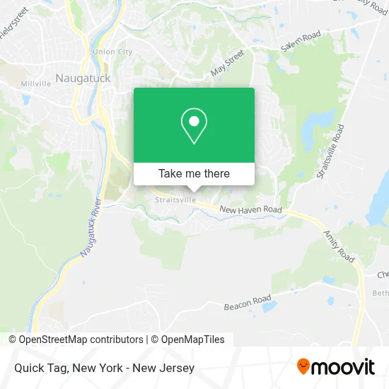
See Quick Tag, Naugatuck, on the map
Public Transit to Quick Tag in Naugatuck
Wondering how to get to Quick Tag in Naugatuck? Moovit helps you find the best way to get to Quick Tag with step-by-step directions from the nearest public transit station.
Moovit provides free maps and live directions to help you navigate through your city. View schedules, routes, timetables, and find out how long does it take to get to Quick Tag in real time.
Looking for the nearest stop or station to Quick Tag? Check out this list of stops closest to your destination: Walmart @ New Haven Rd; Naugatuck.
Bus: 472.Train: 6.
Want to see if there’s another route that gets you there at an earlier time? Moovit helps you find alternative routes or times. Get directions from and directions to Quick Tag easily from the Moovit App or Website.
We make riding to Quick Tag easy, which is why over 1.5 million users, including users in Naugatuck, trust Moovit as the best app for public transit. You don’t need to download an individual bus app or train app, Moovit is your all-in-one transit app that helps you find the best bus time or train time available.
For information on prices of train and bus, costs and ride fares to Quick Tag, please check the Moovit app.
Use the app to navigate to popular places including to the airport, hospital, stadium, grocery store, mall, coffee shop, school, college, and university.
Quick Tag Address: 1100 New Haven Rd street in Naugatuck
Get around Naugatuck by public transit!
Traveling around Naugatuck has never been so easy. See step by step directions as you travel to any attraction, street or major public transit station. View bus and train schedules, arrival times, service alerts and detailed routes on a map, so you know exactly how to get to anywhere in Naugatuck.
When traveling to any destination around Naugatuck use Moovit's Live Directions with Get Off Notifications to know exactly where and how far to walk, how long to wait for your line, and how many stops are left. Moovit will alert you when it's time to get off — no need to constantly re-check whether yours is the next stop.
Wondering how to use public transit in Naugatuck or how to pay for public transit in Naugatuck? Moovit public transit app can help you navigate your way with public transit easily, and at minimum cost. It includes public transit fees, ticket prices, and costs. Looking for a map of Naugatuck public transit lines? Moovit public transit app shows all public transit maps in Naugatuck with all Bus, Train, Subway, Light Rail, Ferry and Cable Car routes and stops on an interactive map.
New York - New Jersey has 6 transit type(s), including: Bus, Train, Subway, Light Rail, Ferry and Cable Car, operated by several transit agencies, including MTA Subway, Metro-North Railroad, LIRR, PATH, MTA New York City Transit - Express routes, MTA Bus, NJ Transit, NYC Ferry, NICE bus, Bee-Line Bus, NJ Transit Rail, Norwalk Transit District, Hartford Line, River Valley Transit and HART