How to get to Quints by bus?
Click on the bus route to see step by step directions with maps, line arrival times and updated time schedules.
From Agaplesion Bethanien Krankenhaus Heidelberg, Südstadt
140 minFrom Antalya Pizza & Kebaphaus, Verwaltungsgemeinschaft Eppingen
110 minFrom Thingstätte, Handschuhsheim
140 minFrom SAP Headquarters, Walldorf
45 minFrom Vulpiusklinik, Bad Rappenau
54 minFrom Luxor Filmpalast, Bahnstadt
121 minFrom SAP Walldorf P18, Walldorf
47 minFrom Kaufland, Mosbach
61 minFrom SAP Campus, Walldorf
40 min
How to get to Quints by train?
Click on the train route to see step by step directions with maps, line arrival times and updated time schedules.
Bus stops near Quints in Sinsheim
Train stations near Quints in Sinsheim
Bus lines to Quints in Sinsheim
- 761, Sinsheim, Hauptbahnhof - Waldangelloch, Rathaus,VIEW
- 768, Sinsheim, Hauptbahnhof - Sinsheim, Hauptbahnhof,VIEW
- 7955, Sinsheim, Sparkasse - Sinsheim, Hauptbahnhof,VIEW
- 741, Sinsheim, Hauptbahnhof,VIEW
- 762, Reihen, Wingertsbergstraße,VIEW
- 763, Hilsbach, Seewaldstraße,VIEW
- 767, Sinsheim, Theodor-Heuss-Schule,VIEW
- 7958, Sinsheim, Hauptbahnhof,VIEW
- 797, Helmstadt, Rathaus,VIEW
- 797, Reichartshausen, Freibad,VIEW
- 797, Neckarbischofsheim, Gymnasium,VIEW
- 899, Neckarelz, Bahnhof,VIEW
- 765, Sinsheim, Sparkasse,VIEW
- 771, Sinsheim, Hauptbahnhof,VIEW
- 772, Sinsheim, Hauptbahnhof,VIEW
- 7956, Sinsheim, Hauptbahnhof,VIEW
- 796, Reichartshausen, Freibad,VIEW
- 796, Sinsheim, Hauptbahnhof,VIEW
- 7960, Untergimpern, Bahnhof,VIEW
- 755, Sinsheim, Hauptbahnhof,VIEW
What are the closest stations to Quints?
The closest stations to Quints are:
- Sinsheim, Muthstraße is 375 meters away, 5 min walk.
- Sinsheim, Sparkasse is 387 meters away, 5 min walk.
- Sinsheim, Lärchenweg is 618 meters away, 9 min walk.
- Sinsheim (Elsenz) Hbf is 887 meters away, 12 min walk.
- Sinsheim, Hauptbahnhof is 891 meters away, 12 min walk.
Which train lines stop near Quints?
These train lines stop near Quints: RE10B, RE7, S42, S7.
Which bus lines stop near Quints?
These bus lines stop near Quints: 797, 799, 899.
What’s the nearest train station to Quints in Sinsheim?
The nearest train stations to Quints in Sinsheim are Sinsheim (Elsenz) Hbf and Sinsheim, Hauptbahnhof. The closest one is a 12 min walk away.
What’s the nearest bus station to Quints in Sinsheim?
The nearest bus stations to Quints in Sinsheim are Sinsheim, Muthstraße and Sinsheim, Sparkasse. The closest one is a 5 min walk away.
What time is the first light rail to Quints in Sinsheim?
The S42 is the first light rail that goes to Quints in Sinsheim. It stops nearby at 4:40 AM.
What time is the last light rail to Quints in Sinsheim?
The S5 is the last light rail that goes to Quints in Sinsheim. It stops nearby at 1:20 AM.
What time is the first train to Quints in Sinsheim?
The S42 is the first train that goes to Quints in Sinsheim. It stops nearby at 4:40 AM.
What time is the last train to Quints in Sinsheim?
The S7 is the last train that goes to Quints in Sinsheim. It stops nearby at 1:20 AM.
What time is the first bus to Quints in Sinsheim?
The 7955 is the first bus that goes to Quints in Sinsheim. It stops nearby at 3:25 AM.
What time is the last bus to Quints in Sinsheim?
The 7956 is the last bus that goes to Quints in Sinsheim. It stops nearby at 2:22 AM.
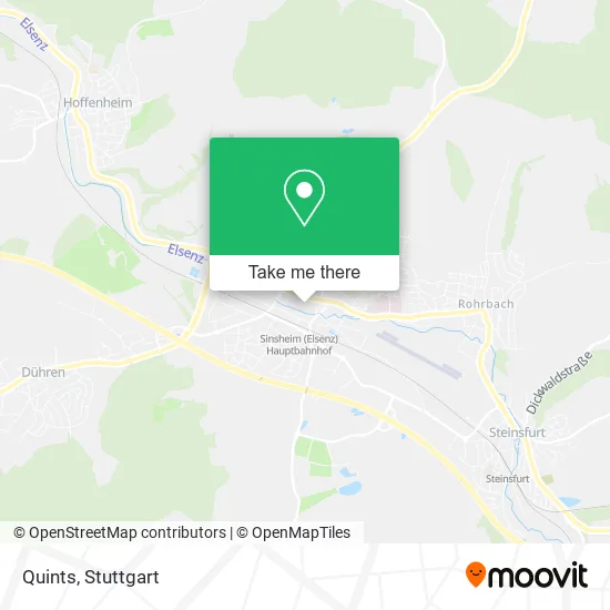
See Quints, Sinsheim, on the map
Public Transit to Quints in Sinsheim
Wondering how to get to Quints in Sinsheim? Moovit helps you find the best way to get to Quints with step-by-step directions from the nearest public transit station.
Moovit provides free maps and live directions to help you navigate through your city. View schedules, routes, timetables, and find out how long does it take to get to Quints in real time.
Looking for the nearest stop or station to Quints? Check out this list of stops closest to your destination: Sinsheim, Muthstraße; Sinsheim, Sparkasse; Sinsheim, Lärchenweg; Sinsheim (Elsenz) Hbf; Sinsheim, Hauptbahnhof.
Train: RE10B, RE7, S42, S7.Bus: 797, 799, 899, 761, 768, 7955, 741, 762, 763, 767, 7958, 765, 771, 772, 7956, 796, 755.
Want to see if there’s another route that gets you there at an earlier time? Moovit helps you find alternative routes or times. Get directions from and directions to Quints easily from the Moovit App or Website.
We make riding to Quints easy, which is why over 1.5 million users, including users in Sinsheim, trust Moovit as the best app for public transit. You don’t need to download an individual bus app or train app, Moovit is your all-in-one transit app that helps you find the best bus time or train time available.
For information on prices of bus, train and light rail, costs and ride fares to Quints, please check the Moovit app.
Use the app to navigate to popular places including to the airport, hospital, stadium, grocery store, mall, coffee shop, school, college, and university.
Quints Address: Bahnhofstraße 14 74889 Sinsheim street in Sinsheim
- Wunderschön Store,
- RENO,
- Quints Café Restaurant Lounge,
- J. Doll,
- Wolf-Dieter Fischer Detlev,
- Wow Mode Exklusiv,
- Jeunesse Health & Beauty,
- Aura Beauty Salon,
- Galerie der Schönheit,
- Hörgeräte Langer GmbH&Co.Kg,
- Rutz,
- Juwelier Schick,
- Dana Stoica,
- Dr. med. dent. Dana Stoica,
- WISSMACH,
- Cecil,
- Volker Straub Rentsanwaltskanzlei,
- Rink,
- H&M,
- H & M
Places Near Quints (Sinsheim)
- Im Wizemann (Halle), Bad Cannstatt,
- Mercedes-Benz Museum, Bad Cannstatt,
- Porsche-Arena, Bad Cannstatt,
- Hanns-Martin-Schleyer-Halle (Stuttgart Hans-Martin-Schleyerhalle), Bad Cannstatt,
- Schleyerhalle, Bad Cannstatt,
- Wilhelma (U-Bahn Wilhelma), Bad Cannstatt,
- Marmorsaal Im Weissenburgpark, Stuttgart-Süd,
- Gleis 101/102 (tief), Stuttgart-Mitte,
- Geilhaus Haus 33a, Reutlingen-Betzingen,
- Waldfriedhof, Degerloch,
- Hauptbahnhof Stuttgart, Stuttgart-Mitte,
- Klinikum Stuttgart - Katharinenhospital, Stuttgart-Mitte,
- Pariser Platz Stuttgart, Stuttgart-Mitte,
- Hanns-Martin-Schleyer-Halle, Bad Cannstatt,
- Porsche Museum, Zuffenhausen,
- Mettingen Eros-Center Puff Laufhaus, Esslingen Am Neckar,
- Gasometer Pforzheim, Pforzheim,
- Mercedes-Benz Museum (Mercedes Museum Stuttgart), Bad Cannstatt,
- SI-Centrum, Möhringen,
- FlixBus Haltestelle, Stuttgart
How to get to popular places in Stuttgart with public transit
Get around Sinsheim by public transit!
Traveling around Sinsheim has never been so easy. See step by step directions as you travel to any attraction, street or major public transit station. View bus and train schedules, arrival times, service alerts and detailed routes on a map, so you know exactly how to get to anywhere in Sinsheim.
When traveling to any destination around Sinsheim use Moovit's Live Directions with Get Off Notifications to know exactly where and how far to walk, how long to wait for your line, and how many stops are left. Moovit will alert you when it's time to get off — no need to constantly re-check whether yours is the next stop.
Wondering how to use public transit in Sinsheim or how to pay for public transit in Sinsheim? Moovit public transit app can help you navigate your way with public transit easily, and at minimum cost. It includes public transit fees, ticket prices, and costs. Looking for a map of Sinsheim public transit lines? Moovit public transit app shows all public transit maps in Sinsheim with all Bus, Train, Subway, Light Rail, Ferry, S-Bahn and Funicular routes and stops on an interactive map.
Stuttgart has 7 transit type(s), including: Bus, Train, Subway, Light Rail, Ferry, S-Bahn and Funicular, operated by several transit agencies, including SSB - Stadtbahn, SSB, SSB - Seilbahn / Zacke, S-Bahn Stuttgart, Rhein-Neckar-Verkehr GmbH (rnv), Karlsruher Verkehrsverbund, DB AG, DB Regiobus BW, Arverio Baden-Württemberg GmbH, DB RegioNetz Verkehrs GmbH Westfrankenbahn, DB Regio AG Baden-Württemberg, Südwestdeutsche Verkehrs-AG, DB Regio AG Mitte Region Hessen, DB and Bodensee-Oberschwaben-Bahn