Directions to Quitanda do Bolinha (Paulista) with public transportation
The following transit lines have routes that pass near Quitanda do Bolinha
How to get to Quitanda do Bolinha by bus?
Click on the bus route to see step by step directions with maps, line arrival times and updated time schedules.
From Previdência Social - Encruzilhada, Encruzilhada
55 minFrom Avenida Governador Carlos de Lima Cavalcante, Olinda
41 minFrom Instituto Tavares Buril - Secretaria de Defesa Social, Campo Grande
51 minFrom Avenida Pan Nordestina, Olinda
28 minFrom Rua Do Futuro, Graças
58 minFrom Avenida João de Barros 1664, Espinheiro
57 minFrom Clinica Hapvida Olinda, Olinda
45 minFrom Rodovia BR-101 Norte, Km 48 s/n, Abreu E Lima
51 minFrom Inss Encruzilhada, Encruzilhada
55 minFrom Alto Do Mandu, Alto Do Mandu
43 min
Bus stop near Quitanda do Bolinha in Paulista
- Avenida Ministro Marcos De Barros Freire 15, 3 min walk,VIEW
Bus lines to Quitanda do Bolinha in Paulista
- 1902 TI ABREU E LIMA / MIRUEIRA, TI Abreu e Lima / Mirueira ,VIEW
- 1906 TI PELÓPIDAS / TI MACAXEIRA, Ti Pelópidas / Ti Macaxeira,VIEW
- 1907 PAULISTA / RIO DOCE, Via Nobre E Bultrins,VIEW
- 1931 JARDIM PAULISTA BAIXO / TI PELÓPIDAS, Jardim Paulista Baixo / Ti Pelópidas,VIEW
- 1932 JARDIM PAULISTA ALTO / TI PELÓPIDAS, Jardim Paulista Alto / Ti Pelópidas,VIEW
- 1936 MIRUEIRA (BACURAU), Mirueira (Bacurau),VIEW
- 1943 MIRUEIRA / TI PELÓPIDAS, Atende ao Hospital Geral da Mirueira ,VIEW
- 1949 TI ABREU E LIMA (CIRCULAR PAULISTA), Ti Abreu e Lima (Circular Paulista),VIEW
What are the closest stations to Quitanda do Bolinha?
The closest stations to Quitanda do Bolinha are:
- Avenida Ministro Marcos De Barros Freire 15 is 221 meters away, 3 min walk.
Which bus lines stop near Quitanda do Bolinha?
These bus lines stop near Quitanda do Bolinha: 1906 TI PELÓPIDAS / TI MACAXEIRA, 1907 PAULISTA / RIO DOCE.
What’s the nearest bus station to Quitanda do Bolinha in Paulista?
The nearest bus station to Quitanda do Bolinha in Paulista is Avenida Ministro Marcos De Barros Freire 15. It’s a 3 min walk away.
What time is the first bus to Quitanda do Bolinha in Paulista?
The 1936 MIRUEIRA (BACURAU) is the first bus that goes to Quitanda do Bolinha in Paulista. It stops nearby at 3:00 AM.
What time is the last bus to Quitanda do Bolinha in Paulista?
The 1936 MIRUEIRA (BACURAU) is the last bus that goes to Quitanda do Bolinha in Paulista. It stops nearby at 3:00 AM.
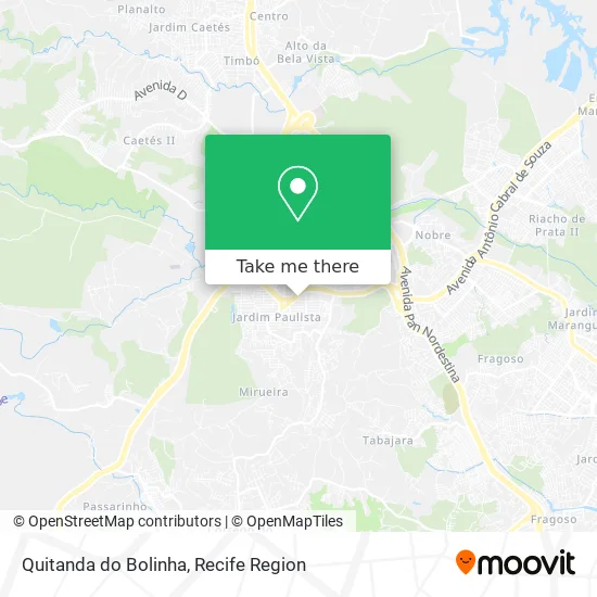
See Quitanda do Bolinha, Paulista, on the map
Public Transit to Quitanda do Bolinha in Paulista
Wondering how to get to Quitanda do Bolinha in Paulista? Moovit helps you find the best way to get to Quitanda do Bolinha with step-by-step directions from the nearest public transit station.
Moovit provides free maps and live directions to help you navigate through your city. View schedules, routes, timetables, and find out how long does it take to get to Quitanda do Bolinha in real time.
Looking for the nearest stop or station to Quitanda do Bolinha? Check out this list of stops closest to your destination: Avenida Ministro Marcos De Barros Freire 15.
Bus: 1906 TI PELÓPIDAS / TI MACAXEIRA, 1907 PAULISTA / RIO DOCE, 1902 TI ABREU E LIMA / MIRUEIRA, 1931 JARDIM PAULISTA BAIXO / TI PELÓPIDAS, 1932 JARDIM PAULISTA ALTO / TI PELÓPIDAS.
Want to see if there’s another route that gets you there at an earlier time? Moovit helps you find alternative routes or times. Get directions from and directions to Quitanda do Bolinha easily from the Moovit App or Website.
We make riding to Quitanda do Bolinha easy, which is why over 1.5 million users, including users in Paulista, trust Moovit as the best app for public transit. You don’t need to download an individual bus app or train app, Moovit is your all-in-one transit app that helps you find the best bus time or train time available.
For information on prices of bus, costs and ride fares to Quitanda do Bolinha, please check the Moovit app.
Use the app to navigate to popular places including to the airport, hospital, stadium, grocery store, mall, coffee shop, school, college, and university.
Quitanda do Bolinha Address: Rua Cento e Quinze, 115 Jardim Paulista Paulista-PE 53407-331 street in Paulista
- CFC - Auto Escola Nova Geração,
- Jorge Farias Transportes,
- Glauce Rodrigues de Oliveira Albuquerqu,
- Ta na Chapa Burger,
- Igreja Evangélica Assembleia De Deus - Jd Paulista Baixo,
- Clínica Médica Raimundo Xavier,
- Posto Shell,
- Assembléia De Deus - Jardim Paulista Baixo (Ministério Abreu E Lima),
- rua 88 n.46 jd paulista baixo,
- Igreja Evangélica Batista Em Rio Doce,
- Universal Paratibe,
- Policlínica Hélio Inácio,
- Pizza 10,
- Vibre Express,
- Igreja Nova Assembléia de Deus,
- Capela Santa Clara,
- o cantinho do lanche.,
- Salao de Beleza Arte Visual,
- Juarez Jato,
- Mercadinho Espaco Da Economia
Places Near Quitanda do Bolinha (Paulista)
- SHOPPING TACARUNA, Santo Amaro,
- Shopping Recife, Boa Viagem,
- Parque da Jaqueira, Jaqueira,
- Shopping RioMar Recife, Pina,
- Hospital Altino Ventura, Iputinga,
- tuuuuu, Olinda,
- Imbiribeira, Imbiribeira,
- Arena de Pernambuco, São Lourenço Da Mata,
- SHOPPING GUARARAPES, Jaboatão Dos Guararapes,
- Centro de Convenções de Pernambuco, Olinda,
- Hospital Eduardo Campus Da Pessoa Idosa, Areias,
- hospital otavio de freitas - UTI, Tejipió,
- Hospital Universitário Oswaldo Cruz, Santo Amaro,
- Imip (Instituto Materno-Infantil De Pernambuco), Coelhos,
- Shopping Patteo Olinda, Olinda,
- Hospital Maria Lucinda, Parnamirim,
- Hospital Geral De Areias, Areias,
- Marco Zero, Bairro Do Recife,
- llll, Fundão,
- Hospital Agamenon Magalhães, Tamarineira
How to get to popular places in Recife Region with public transit
Get around Paulista by public transit!
Traveling around Paulista has never been so easy. See step by step directions as you travel to any attraction, street or major public transit station. View bus and train schedules, arrival times, service alerts and detailed routes on a map, so you know exactly how to get to anywhere in Paulista.
When traveling to any destination around Paulista use Moovit's Live Directions with Get Off Notifications to know exactly where and how far to walk, how long to wait for your line, and how many stops are left. Moovit will alert you when it's time to get off — no need to constantly re-check whether yours is the next stop.
Wondering how to use public transit in Paulista or how to pay for public transit in Paulista? Moovit public transit app can help you navigate your way with public transit easily, and at minimum cost. It includes public transit fees, ticket prices, and costs. Looking for a map of Paulista public transit lines? Moovit public transit app shows all public transit maps in Paulista with all Bus, Train, Subway and Ferry routes and stops on an interactive map.
Recife Region has 4 transit type(s), including: Bus, Train, Subway and Ferry, operated by several transit agencies, including CBTU (Metrorec), BRT (Via Livre), Grande Recife, BORBOREMA IMPERIAL (TIP), BORBOREMA IMPERIAL (B.V), RODOVIÁRIA POTENGY, EMPRESA METROPOLITANA, CONSÓRCIO RECIFE, SÃO JUDAS TADEU, Expresso 1002, Rodotur Turismo, Complementar Recife, Sistema Municipal - Jaboatão, Sistema Municipal - Cabo and Sistema Municipal - Ipojuca
Public transit lines with stations closest to Quitanda do Bolinha in Paulista
Bus lines with stations closest to Quitanda do Bolinha in Paulista
Avenida Ministro Marcos De Barros Freire 15
 1902 TI ABREU E LIMA / MIRUEIRATI Abreu e Lima/ Mirueira
- 1906 TI PELÓPIDAS / TI MACAXEIRATI Pelópidas / TI Macaxeira
- 1907 PAULISTA / RIO DOCEPaulista / Rio Doce
- 1931 JARDIM PAULISTA BAIXO / TI PELÓPIDASJardim Paulista Baixo / TI Pelópidas
- 1932 JARDIM PAULISTA ALTO / TI PELÓPIDASJardim Paulista Alto / TI Pelópidas