How to get to Rätz Manfred by bus?
Click on the bus route to see step by step directions with maps, line arrival times and updated time schedules.
From Marie-Baum-Schule Heidelberg, Wieblingen
173 minFrom Globus Getränkemarkt, Ludwigshafen-Oggersheim
54 minFrom MVV Energie Ladestation, Käfertal
65 minFrom Globus Getränkecenter, Ludwigshafen-Oggersheim
53 minFrom Thoraxklinik Heidelberg, Neuenheim
143 minFrom Friedhof Käfertal, Käfertal
76 minFrom GRN-Klinik Schwetzingen, Schwetzingen
120 minFrom Möbel Höffner, Schwetzingen
78 minFrom FH 1863, Neckarstadt-Ost/Wohlgelegen
54 min
How to get to Rätz Manfred by train?
Click on the train route to see step by step directions with maps, line arrival times and updated time schedules.
Bus stops near Rätz Manfred in Ludwigshafen-Nördliche Innenstadt
Light Rail stations near Rätz Manfred in Ludwigshafen-Nördliche Innenstadt
Bus lines to Rätz Manfred in Ludwigshafen-Nördliche Innenstadt
- 70, LU Hauptbahnhof - LU Rathaus - Marienkirche - BASF (Tor 1+2) - Friesenheim Mitte - Sternstraße - Hans-Warsch-Platz - Adolf-Kolping-Straße,VIEW
- 78, BASF Süd (Tor 1+7) – LU Hauptbahnhof – LU Hochschule – Kallstadter Str. – Maudach Kleestraße,VIEW
- 80, BASF Süd (Tor 1+7) – BASF (Tor 1+2) – Goerdelerplatz – Marienkirche – Rohrlachstraße – Valentin-Bauer-Siedlung – LU Hochschule – Mundenheim Bf,VIEW
- 80E, BASF Süd (Tor 1+7) – BASF (Tor 1+2) – Goerdelerplatz – Marienkirche – Rohrlachstraße – Valentin-Bauer-Siedlung – LU Hochschule – Mundenheim Bf,VIEW
- E, Oppau, Fritz-Haber-Straße BASF Tor 12+13 - Valentin-Bauer-Siedlung,VIEW
- E, Hans-Warsch-Platz - Valentin-Bauer-Siedlung,VIEW
- E, Saarbrücker Straße - Goerdelerplatz,VIEW
- 78E, Basf Süd,VIEW
- E, Schulbus,VIEW
- 90, Berliner Platz,VIEW
- 90E, Berliner Platz,VIEW
- 4, Frankenthal am Römig,VIEW
- 4, Bad Dürkheim,VIEW
- 4, Lu Hauptbahnhof,VIEW
- 4, Berliner Platz,VIEW
- 71, Notwende,VIEW
What are the closest stations to Rätz Manfred?
The closest stations to Rätz Manfred are:
- Goerdelerplatz is 142 meters away, 2 min walk.
- Marienkirche is 422 meters away, 6 min walk.
- Ludwigshafen, Marienkirche is 435 meters away, 6 min walk.
- Heinrich-Ries-Halle is 647 meters away, 9 min walk.
- Rohrlachstraße is 701 meters away, 10 min walk.
Which bus lines stop near Rätz Manfred?
These bus lines stop near Rätz Manfred: 60, 62, 70, 710, RNV 60, RNV 65.
Which train lines stop near Rätz Manfred?
These train lines stop near Rätz Manfred: S3, S6.
Which light rail lines stop near Rätz Manfred?
These light rail lines stop near Rätz Manfred: 10, 4A, 7, RNV 4, RNV 4A.
What’s the nearest light rail station to Rätz Manfred in Ludwigshafen-Nördliche Innenstadt?
The nearest light rail stations to Rätz Manfred in Ludwigshafen-Nördliche Innenstadt are Marienkirche and Ludwigshafen, Marienkirche. The closest one is a 6 min walk away.
What’s the nearest bus station to Rätz Manfred in Ludwigshafen-Nördliche Innenstadt?
The nearest bus station to Rätz Manfred in Ludwigshafen-Nördliche Innenstadt is Goerdelerplatz. It’s a 2 min walk away.
What time is the first light rail to Rätz Manfred in Ludwigshafen-Nördliche Innenstadt?
The E is the first light rail that goes to Rätz Manfred in Ludwigshafen-Nördliche Innenstadt. It stops nearby at 4:25 AM.
What time is the last light rail to Rätz Manfred in Ludwigshafen-Nördliche Innenstadt?
The E is the last light rail that goes to Rätz Manfred in Ludwigshafen-Nördliche Innenstadt. It stops nearby at 9:05 PM.
What time is the first bus to Rätz Manfred in Ludwigshafen-Nördliche Innenstadt?
The 90E is the first bus that goes to Rätz Manfred in Ludwigshafen-Nördliche Innenstadt. It stops nearby at 4:17 AM.
What time is the last bus to Rätz Manfred in Ludwigshafen-Nördliche Innenstadt?
The 90 is the last bus that goes to Rätz Manfred in Ludwigshafen-Nördliche Innenstadt. It stops nearby at 12:40 AM.
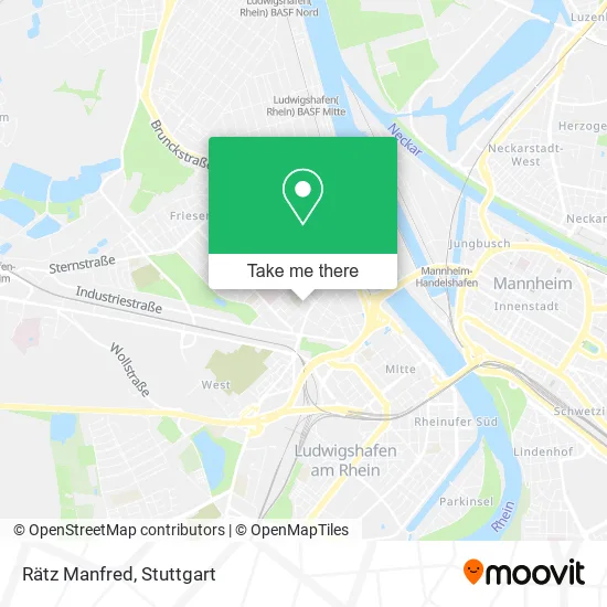
See Rätz Manfred, Ludwigshafen-Nördliche Innenstadt, on the map
Public Transit to Rätz Manfred in Ludwigshafen-Nördliche Innenstadt
Wondering how to get to Rätz Manfred in Ludwigshafen-Nördliche Innenstadt? Moovit helps you find the best way to get to Rätz Manfred with step-by-step directions from the nearest public transit station.
Moovit provides free maps and live directions to help you navigate through your city. View schedules, routes, timetables, and find out how long does it take to get to Rätz Manfred in real time.
Looking for the nearest stop or station to Rätz Manfred? Check out this list of stops closest to your destination: Goerdelerplatz; Marienkirche; Ludwigshafen; Heinrich-Ries-Halle; Rohrlachstraße.
Bus: 60, 62, 70, 710, RNV 60, RNV 65, 78, 80, 80E, E, 78E, E, 90, 90E, 4, 4, 4, 4, 71, E.Train: S3, S6.Light Rail: 10, 4A, 7, RNV 4, RNV 4A.
Want to see if there’s another route that gets you there at an earlier time? Moovit helps you find alternative routes or times. Get directions from and directions to Rätz Manfred easily from the Moovit App or Website.
We make riding to Rätz Manfred easy, which is why over 1.5 million users, including users in Ludwigshafen-Nördliche Innenstadt, trust Moovit as the best app for public transit. You don’t need to download an individual bus app or train app, Moovit is your all-in-one transit app that helps you find the best bus time or train time available.
For information on prices of light rail, bus and train, costs and ride fares to Rätz Manfred, please check the Moovit app.
Use the app to navigate to popular places including to the airport, hospital, stadium, grocery store, mall, coffee shop, school, college, and university.
Rätz Manfred Address: Falkenstraße 11 Hemshof, 67063 Ludwigshafen am Rhein street in Ludwigshafen-Nördliche Innenstadt
- Rätz + Sinsch Schuhmacher,
- Fahrschule Rakowski,
- Ralf Rakowski,
- Fachpsychologin für Verkehrspsychologie Bdp - Angelica Jennevé,
- Mädchennotruf.,
- Wildwasser,
- Diakonisches Werk d.,
- Haus Der Diakonie,
- Wildwasser Und Notruf Ludwigshafen E.V.,
- Ökumenische Fördergemeinschaft Ludwigshafen,
- Vehra Förderung des Ehrenamts,
- Diakonischen Werk Pfalz,
- Suppenküche,
- Prophylaxe Center - Dr. Hondralis & Partner,
- Bistro Aksu,
- Spektrum, Büro Für Visuelle Kommunikation,
- Chicken Hut,
- Hondralis Prophylaxecentrum,
- Fotini's Hair Angels,
- Genius Design
Places Near Rätz Manfred (Ludwigshafen-Nördliche Innenstadt)
- Klinikum Stuttgart - Katharinenhospital, Stuttgart-Mitte,
- Porsche Museum, Zuffenhausen,
- Hanns-Martin-Schleyer-Halle (Stuttgart Hans-Martin-Schleyerhalle), Bad Cannstatt,
- Hauptbahnhof Stuttgart, Stuttgart-Mitte,
- Mercedes-Benz Museum (Mercedes Museum Stuttgart), Bad Cannstatt,
- Mettingen Eros-Center Puff Laufhaus, Esslingen Am Neckar,
- SI-Centrum, Möhringen,
- Wilhelma (U-Bahn Wilhelma), Bad Cannstatt,
- Mercedes-Benz Museum, Bad Cannstatt,
- Hanns-Martin-Schleyer-Halle, Bad Cannstatt,
- Geilhaus Haus 33a, Reutlingen-Betzingen,
- Schleyerhalle, Bad Cannstatt,
- Porsche-Arena, Bad Cannstatt,
- Waldfriedhof, Degerloch,
- FlixBus Haltestelle, Stuttgart,
- Pariser Platz Stuttgart, Stuttgart-Mitte,
- Marmorsaal Im Weissenburgpark, Stuttgart-Süd,
- Gasometer Pforzheim, Pforzheim,
- Gleis 101/102 (tief), Stuttgart-Mitte,
- Im Wizemann (Halle), Bad Cannstatt
How to get to popular places in Stuttgart with public transit
Get around Ludwigshafen-Nördliche Innenstadt by public transit!
Traveling around Ludwigshafen-Nördliche Innenstadt has never been so easy. See step by step directions as you travel to any attraction, street or major public transit station. View bus and train schedules, arrival times, service alerts and detailed routes on a map, so you know exactly how to get to anywhere in Ludwigshafen-Nördliche Innenstadt.
When traveling to any destination around Ludwigshafen-Nördliche Innenstadt use Moovit's Live Directions with Get Off Notifications to know exactly where and how far to walk, how long to wait for your line, and how many stops are left. Moovit will alert you when it's time to get off — no need to constantly re-check whether yours is the next stop.
Wondering how to use public transit in Ludwigshafen-Nördliche Innenstadt or how to pay for public transit in Ludwigshafen-Nördliche Innenstadt? Moovit public transit app can help you navigate your way with public transit easily, and at minimum cost. It includes public transit fees, ticket prices, and costs. Looking for a map of Ludwigshafen-Nördliche Innenstadt public transit lines? Moovit public transit app shows all public transit maps in Ludwigshafen-Nördliche Innenstadt with all Bus, Train, Subway, Light Rail, Ferry, S-Bahn and Funicular routes and stops on an interactive map.
Stuttgart has 7 transit type(s), including: Bus, Train, Subway, Light Rail, Ferry, S-Bahn and Funicular, operated by several transit agencies, including SSB - Stadtbahn, SSB, SSB - Seilbahn / Zacke, S-Bahn Stuttgart, Rhein-Neckar-Verkehr GmbH (rnv), Karlsruher Verkehrsverbund, DB AG, DB Regiobus BW, Arverio Baden-Württemberg GmbH, DB RegioNetz Verkehrs GmbH Westfrankenbahn, DB Regio AG Baden-Württemberg, Südwestdeutsche Verkehrs-AG, DB Regio AG Mitte Region Hessen, DB and Bodensee-Oberschwaben-Bahn
Public transit lines with stations closest to Rätz Manfred in Ludwigshafen-Nördliche Innenstadt
Bus lines with stations closest to Rätz Manfred in Ludwigshafen-Nördliche Innenstadt
Goerdelerplatz
 70LU Hauptbahnhof - LU Rathaus - Marienkirche - BASF (Tor 1+2) - Friesenheim Mitte - Sternstraße - Hans-Warsch-Platz - Adolf-Kolping-Straße
- 78BASF Süd (Tor 1+7) – LU Hauptbahnhof – LU Hochschule – Kallstadter Str. – Maudach Kleestraße
- 80BASF Süd (Tor 1+7) – BASF (Tor 1+2) – Goerdelerplatz – Marienkirche – Rohrlachstraße – Valentin-Bauer-Siedlung – LU Hochschule – Mundenheim Bf
- 80EBASF Süd (Tor 1+7) – BASF (Tor 1+2) – Goerdelerplatz – Marienkirche – Rohrlachstraße – Valentin-Bauer-Siedlung – LU Hochschule – Mundenheim Bf
- EOppau, Fritz-Haber-Straße BASF Tor 12+13 - Valentin-Bauer-Siedlung