Råde Stasjon station - Monday schedule
| Line | Direction | Time |
|---|---|---|
| RE20 | Oslo S | 5:49 AM |
| RE20 | Oslo S | 6:46 AM |
| RE20 | Göteborg C | 7:10 AM |
| RE20 | Oslo S | 7:54 AM |
| RE20 | Halden | 8:19 AM |
| RE20 | Malmö Central | 9:19 AM |
| RE20 | Oslo S | 9:42 AM |
| RE20 | Oslo S | 9:51 AM |
| RE20 | Halden | 10:17 AM |
| RE20 | Göteborg C | 11:12 AM |
| RE20 | Oslo S | 11:36 AM |
| RE20 | Oslo S | 11:47 AM |
| RE20 | Halden | 12:12 PM |
| RE20 | Göteborg C | 1:12 PM |
| RE20 | Oslo S | 1:47 PM |
| RE20 | Halden | 2:12 PM |
| RE20 | Oslo S | 2:17 PM |
| RE20 | Malmö Central | 3:13 PM |
| RE20 | Oslo S | 3:29 PM |
| RE20 | Oslo S | 3:52 PM |
| RE20 | Halden | 4:19 PM |
| RE20 | Göteborg C | 5:20 PM |
| RE20 | Oslo S | 5:42 PM |
| RE20 | Oslo S | 5:50 PM |
| RE20 | Halden | 6:20 PM |
Directions to Råde Stasjon station with public transit
The following transit lines have routes that pass near Råde Stasjon
 Bus: 633, FB11, VY6, 159, 160.
- Train: RE20.
How to get to Råde Stasjon station by bus?
Click on the bus route to see step by step directions with maps, line arrival times and updated time schedules.
Bus stops near Råde Stasjon stop
- Karlshus Skole, 3 min walk,
- Skråtorp, 6 min walk,
- Strømshaug, 10 min walk,
- Karlshus Esso, 11 min walk,
Bus lines to Råde Stasjon station
- 159, Solli-Sognshøy,
- 160, Sognshøy-Tomb,
- 600, Kirkestien,
- 165, Missingmyr,
- VY6, Hvaler - Skjærhalden,
- 199, Glemmen Vgs.,
- 630, Fredrikstad,
- 633, Moss,
What are the closest stations to Råde Stasjon?
The closest stations to Råde Stasjon are:
- Karlshus Skole stop is 152 meters away, 3 min walk.
- Skråtorp stop is 440 meters away, 6 min walk.
- Strømshaug stop is 740 meters away, 10 min walk.
- Karlshus Esso stop is 805 meters away, 11 min walk.
Which bus lines stop near Råde Stasjon?
These bus lines stop near Råde Stasjon: 633, FB11, VY6.
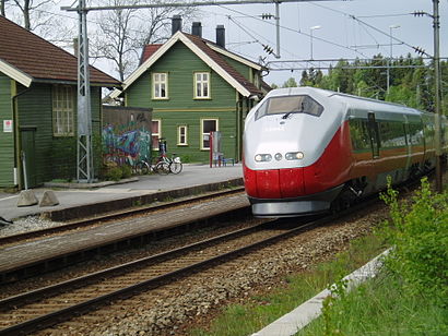
Which train line stops near Råde Stasjon?
RE20 (Oslo S)
What’s the nearest bus station to Råde Stasjon?
The nearest bus station to Råde Stasjon is Karlshus Skole. It’s a 3 min walk away.
What time is the first bus to Råde Stasjon?
The VY6 is the first bus that goes to Råde Stasjon. It stops nearby at 10:11 AM.
What time is the last bus to Råde Stasjon?
The VY6 is the last bus that goes to Råde Stasjon. It stops nearby at 12:03 AM.
See Råde Stasjon station on the map
Public transit to Råde Stasjon station
Looking for directions to Råde Stasjon in Råde, Norway?
Download the Moovit App to find the current schedule and step-by-step directions for Bus or Train routes that pass through Råde Stasjon.
Looking for the nearest stops closest to Råde Stasjon ? Check out this list of closest stops to your destination: Karlshus Skole; Skråtorp; Strømshaug; Karlshus Esso.
Bus: 633, FB11, VY6, 159, 160, 600, 165, 199, 630.Train: RE20.
We make riding on public transit to Råde Stasjon easy, which is why over 1.7 billion users, including users in Råde trust Moovit as the best app for public transit.
Use the app to navigate to popular places including to the airport, hospital, stadium, grocery store, mall, coffee shop, school, college, and university.
The station has the following entrances: Stasjonsveien
The first line to this station is RE20, at 5:49 AM, and the last line is RE20 at 4:40 AM.
This station serves Vy’s lines
Popular routes from Råde Stasjon station
- Karlshus Skole,
- Skråtorp,
- Strømshaug,
- Karlshus Esso
Bus stops near Råde Stasjon stop
- Eikanger Bru,
- Eineåsen,
- Sofienberg,
- Bryne Kro & Hotell,
- Erfjord,
- Nordstrand Bad,
- Rønningen,
- Høvik Skole,
- Fjøsangerkrysset,
- Stange Stasjon,
- Torvik Kystrutekai,
- Hjerkinn Stasjon,
- Skedsmo Kirke,
- Vang Sentrum,
- Sykehuset Kragerø,
- Nationaltheatret Stasjon,
- Brulandsvellene,
- Furuset,
- Lokevegen,
- Bråten
Popular public transit stations in Råde
Get around Råde by public transit!
Traveling around Råde has never been so easy. See step by step directions as you travel to any attraction, street or major public transit station. View bus and train schedules, arrival times, service alerts and detailed routes on a map, so you know exactly how to get to anywhere in Råde.
When traveling to any destination around Råde use Moovit's Live Directions with Get Off Notifications to know exactly where and how far to walk, how long to wait for your line, and how many stops are left. Moovit will alert you when it's time to get off — no need to constantly re-check whether yours is the next stop.
Wondering how to use public transit in Råde or how to pay for public transit in Råde? Moovit public transit app can help you navigate your way with public transit easily, and at minimum cost. It includes public transit fees, ticket prices, and costs. Looking for a map of Råde public transit lines? Moovit public transit app shows all public transit maps in Råde with all Bus, Train, Subway, Light Rail, Ferry and Cable Car routes and stops on an interactive map.
Norway has 6 transit type(s), including: Bus, Train, Subway, Light Rail, Ferry and Cable Car, operated by several transit agencies, including Ruter, Skyss, AtB, Flytoget, Vy Tåg, SJ, Go-Ahead Norge AS, SJ Nord, Vestfold Kollektivtrafikk as, Snelandia, Innlandstrafikk, FRAM, FlixBus, Kolumbus and Brakar