How to get to Réactif by bus?
Click on the bus route to see step by step directions with maps, line arrival times and updated time schedules.
How to get to Réactif by train?
Click on the train route to see step by step directions with maps, line arrival times and updated time schedules.
Bus stops near Réactif in Beauvais
Train station near Réactif in Beauvais
- Beauvais, 8 min walk,VIEW
Bus lines to Réactif in Beauvais
- 6, Tillé Aéroport,VIEW
- NA, Tillé Aéroport,VIEW
- C2, Hôpital,VIEW
- 3, Délie,VIEW
- 5, Châtaigniers,VIEW
- 8, Plan D'Eau du Canada,VIEW
- GB, Parking Saint-Quentin,VIEW
- 4, Maladrerie,VIEW
- C1, St Jean,VIEW
- 511, Beauvais - Hôtel de Ville,VIEW
- 521, Bailleul-Sur-Thérain - Centre,VIEW
- 531, Crèvecœur-Le-Grand - Centre,VIEW
- 502, Beauvais - Lebesgue (Lycée J.B. Corot),VIEW
What are the closest stations to Réactif?
The closest stations to Réactif are:
- Madeleine is 118 meters away, 2 min walk.
- Beauvais Centre - Hôtel de Ville is 168 meters away, 3 min walk.
- Hôtel de Ville is 171 meters away, 3 min walk.
- Halles is 183 meters away, 3 min walk.
- Gare Routière Interurbaine is 199 meters away, 3 min walk.
- Beauvais is 596 meters away, 8 min walk.
Which bus line stops near Réactif?
511 (Beauvais - Hôtel de Ville)
Which train line stops near Réactif?
TER (Beauvais)
What’s the nearest train station to Réactif in Beauvais?
The nearest train station to Réactif in Beauvais is Beauvais. It’s a 8 min walk away.
What’s the nearest bus station to Réactif in Beauvais?
The nearest bus station to Réactif in Beauvais is Madeleine. It’s a 2 min walk away.
What time is the first train to Réactif in Beauvais?
The TER is the first train that goes to Réactif in Beauvais. It stops nearby at 6:40 AM.
What time is the last train to Réactif in Beauvais?
The TER is the last train that goes to Réactif in Beauvais. It stops nearby at 8:20 PM.
What time is the first bus to Réactif in Beauvais?
The NA is the first bus that goes to Réactif in Beauvais. It stops nearby at 4:15 AM.
What time is the last bus to Réactif in Beauvais?
The NA is the last bus that goes to Réactif in Beauvais. It stops nearby at 11:25 PM.
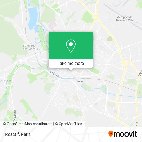
See Réactif, Beauvais, on the map
Public Transit to Réactif in Beauvais
Wondering how to get to Réactif in Beauvais? Moovit helps you find the best way to get to Réactif with step-by-step directions from the nearest public transit station.
Moovit provides free maps and live directions to help you navigate through your city. View schedules, routes, timetables, and find out how long does it take to get to Réactif in real time.
Looking for the nearest stop or station to Réactif? Check out this list of stops closest to your destination: Madeleine; Beauvais Centre - Hôtel de Ville; Hôtel de Ville; Halles; Gare Routière Interurbaine; Beauvais.
Bus: 511, 6, NA, C2, 3, 5, 8, GB, 4, C1.Train: TER.
Want to see if there’s another route that gets you there at an earlier time? Moovit helps you find alternative routes or times. Get directions from and directions to Réactif easily from the Moovit App or Website.
We make riding to Réactif easy, which is why over 1.5 million users, including users in Beauvais, trust Moovit as the best app for public transit. You don’t need to download an individual bus app or train app, Moovit is your all-in-one transit app that helps you find the best bus time or train time available.
For information on prices of train, RER and bus, costs and ride fares to Réactif, please check the Moovit app.
Use the app to navigate to popular places including to the airport, hospital, stadium, grocery store, mall, coffee shop, school, college, and university.
Réactif Address: Rue de Malherbe 60000 Beauvais street in Beauvais
- Pro'Vap,
- Bâtiment Malherbe,
- L'Atelier Gourmand,
- Bga 03,
- Tfi-Info60,
- Adrexo,
- Decathlon,
- Centre Médico Psychopédagogique C.M.P.P,
- Mega Destock Beauvais,
- Hôtel de Ville de Beauvais,
- Ancey Patrick,
- Plomion Sandra,
- Kaporn,
- Aesio Mutuelle,
- Idees Fixes,
- Bo Way Ink,
- Nikola Bws Tatouages,
- Maroquinerie Cormier Père et Fils,
- Ezio,
- T-Miz Food
Places Near Réactif (Beauvais)
- Hopital Foch, Suresnes,
- Marché Saint-Pierre, Paris,
- Théâtre Mogador, Paris,
- Hôpital Pitié Salpêtrière, Paris,
- Fondation Louis Vuitton, Paris,
- Gare Routière Flixbus, Paris,
- Galeries Lafayette, Paris,
- Hôpital Necker, Paris,
- Hôpital de la Pitié-Salpêtrière, Paris,
- Galeries Lafayette Haussmann, Paris,
- Hôpital Henri Mondor, Creteil,
- Atelier Des Lumieres, Paris,
- Hôpital Beaujon, Clichy,
- Hôpital Saint-Joseph, Paris,
- Créteil Soleil, Creteil,
- Hôpital Cochin, Paris,
- Centre Hospitalier des 15/20, Paris,
- Hopital Lariboisière, Paris,
- 29 Rue Manin, Paris,
- Institut Curie, Paris
How to get to popular places in Paris with public transit
Get around Beauvais by public transit!
Traveling around Beauvais has never been so easy. See step by step directions as you travel to any attraction, street or major public transit station. View bus and train schedules, arrival times, service alerts and detailed routes on a map, so you know exactly how to get to anywhere in Beauvais.
When traveling to any destination around Beauvais use Moovit's Live Directions with Get Off Notifications to know exactly where and how far to walk, how long to wait for your line, and how many stops are left. Moovit will alert you when it's time to get off — no need to constantly re-check whether yours is the next stop.
Wondering how to use public transit in Beauvais or how to pay for public transit in Beauvais? Moovit public transit app can help you navigate your way with public transit easily, and at minimum cost. It includes public transit fees, ticket prices, and costs. Looking for a map of Beauvais public transit lines? Moovit public transit app shows all public transit maps in Beauvais with all Bus, Train, Metro, Light Rail, RER, Funicular and Gondola routes and stops on an interactive map.
Paris has 7 transit type(s), including: Bus, Train, Metro, Light Rail, RER, Funicular and Gondola, operated by several transit agencies, including RATP, RER, RER Bus de remplacement, Train, Train Bus de remplacement, Tramway Bus de remplacement, TER, ADP, Magical Shuttle, Argenteuil - Boucles de Seine, Autocars Dominique, Bièvre, Brie et 2 Morin, Le Bus - C.C. du Clermontois and Cœur d’Essonne