How to get to Réno Habitation by bus?
Click on the bus route to see step by step directions with maps, line arrival times and updated time schedules.
How to get to Réno Habitation by train?
Click on the train route to see step by step directions with maps, line arrival times and updated time schedules.
From La Maison Close, Lille
52 minFrom Quartier Saint Michel, Lille
49 minFrom Mairie De La Madeleine, La Madeleine
43 minFrom 59130, Lambersart
58 minFrom BTWIN Village, Lille
97 minFrom Le Pont Des Arts, Marcq-En-Barœul
45 minFrom Tribunal Administratif, Lille
49 minFrom Antoine Iter l'Appartement, Lille
42 minFrom Rue D'Arras, Lille
52 min
How to get to Réno Habitation by metro?
Click on the metro route to see step by step directions with maps, line arrival times and updated time schedules.
From La Maison Close, Lille
52 minFrom Quartier Saint Michel, Lille
50 minFrom Mairie De La Madeleine, La Madeleine
61 minFrom 59130, Lambersart
71 minFrom BTWIN Village, Lille
56 minFrom PARC de la HAUTE BORNE, Villeneuve-D'Ascq
70 minFrom Tribunal Administratif, Lille
55 minFrom Antoine Iter l'Appartement, Lille
45 minFrom Rue D'Arras, Lille
51 min
Metro station near Réno Habitation in Tourcoing
- Alsace, 13 min walk,VIEW
Train stations near Réno Habitation in Tourcoing
Light Rail stations near Réno Habitation in Tourcoing
- Faidherbe, 21 min walk,VIEW
What are the closest stations to Réno Habitation?
The closest stations to Réno Habitation are:
- Alsace is 948 meters away, 13 min walk.
- Gare Jean Lebas Roubaix is 1004 meters away, 14 min walk.
- Roubaix is 1041 meters away, 14 min walk.
- Faidherbe is 1625 meters away, 21 min walk.
Which bus lines stop near Réno Habitation?
These bus lines stop near Réno Habitation: 78, 87, 902.
Which train lines stop near Réno Habitation?
These train lines stop near Réno Habitation: K80, P80.
Which metro line stops near Réno Habitation?
M2 (Tourcoing C.H. Dron)
Which light rail line stops near Réno Habitation?
TRAM (Tourcoing Tourcoing Centre)
What’s the nearest light rail station to Réno Habitation in Tourcoing?
The nearest light rail station to Réno Habitation in Tourcoing is Faidherbe. It’s a 21 min walk away.
What’s the nearest metro station to Réno Habitation in Tourcoing?
The nearest metro station to Réno Habitation in Tourcoing is Alsace. It’s a 13 min walk away.
What’s the nearest train station to Réno Habitation in Tourcoing?
The nearest train stations to Réno Habitation in Tourcoing are Gare Jean Lebas Roubaix and Roubaix. The closest one is a 14 min walk away.
What time is the first light rail to Réno Habitation in Tourcoing?
The TRAM is the first light rail that goes to Réno Habitation in Tourcoing. It stops nearby at 5:22 AM.
What time is the last light rail to Réno Habitation in Tourcoing?
The TRAM is the last light rail that goes to Réno Habitation in Tourcoing. It stops nearby at 12:58 AM.
What time is the first metro to Réno Habitation in Tourcoing?
The M2 is the first metro that goes to Réno Habitation in Tourcoing. It stops nearby at 5:11 AM.
What time is the last metro to Réno Habitation in Tourcoing?
The M2 is the last metro that goes to Réno Habitation in Tourcoing. It stops nearby at 12:54 AM.
What time is the first train to Réno Habitation in Tourcoing?
The 261B is the first train that goes to Réno Habitation in Tourcoing. It stops nearby at 5:25 AM.
What time is the last train to Réno Habitation in Tourcoing?
The 261B is the last train that goes to Réno Habitation in Tourcoing. It stops nearby at 11:38 PM.
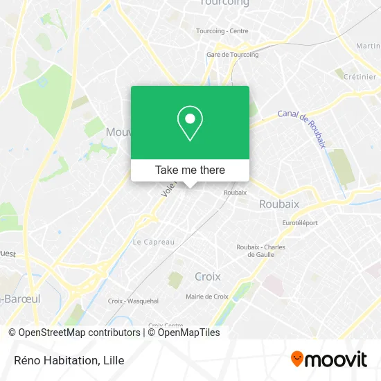
See Réno Habitation, Tourcoing, on the map
Public Transit to Réno Habitation in Tourcoing
Wondering how to get to Réno Habitation in Tourcoing? Moovit helps you find the best way to get to Réno Habitation with step-by-step directions from the nearest public transit station.
Moovit provides free maps and live directions to help you navigate through your city. View schedules, routes, timetables, and find out how long does it take to get to Réno Habitation in real time.
Looking for the nearest stop or station to Réno Habitation? Check out this list of stops closest to your destination: Alsace; Gare Jean Lebas Roubaix; Roubaix; Faidherbe.
Bus: 78, 87, 902.Train: K80, P80, 261B.Metro: M2.Light Rail: TRAM.
Want to see if there’s another route that gets you there at an earlier time? Moovit helps you find alternative routes or times. Get directions from and directions to Réno Habitation easily from the Moovit App or Website.
We make riding to Réno Habitation easy, which is why over 1.5 million users, including users in Tourcoing, trust Moovit as the best app for public transit. You don’t need to download an individual bus app or train app, Moovit is your all-in-one transit app that helps you find the best bus time or train time available.
For information on prices of metro, train, bus and light rail, costs and ride fares to Réno Habitation, please check the Moovit app.
Use the app to navigate to popular places including to the airport, hospital, stadium, grocery store, mall, coffee shop, school, college, and university.
Réno Habitation Address: 110 Rue de Mouvaux 59200 Tourcoing street in Tourcoing
- Aux Délices,
- Fernandes da Silva Joaquim,
- Pmu au Châlet,
- La Médiathèque du Blanc-Seau Devient la Médiathèque Aimé Césaire,
- Square Leman,
- Céli Shoes,
- Az Pièces Auto,
- Au Blanc-Seau,
- Rue des Villas 63,
- Amazon Locker-Jakline,
- Sam Khel,
- Ls Services,
- Speedlab,
- Intermarché,
- Aldi,
- Kaci Yamine,
- ALDI Nord,
- Solferino,
- Lavotec,
- Yoga Roubaix Bhogakalâ
Places Near Réno Habitation (Tourcoing)
- Saint-André-Lez-Lille, Saint-André-Lez-Lille,
- Marché De Wazemmes, Lille,
- Champ De Mars, Lille,
- Rue de la Porte d'Ypres 1, Lille,
- Université Catholique, Lille,
- Clinique du Bois, Lille,
- Euratechnologies, Lille,
- L'Usine, Roubaix,
- Consulat General D'Algerie, Lille,
- Hôpital Salengro, Lille,
- Zénith Arena, Lille,
- Ffffff, Lezennes,
- Théâtre Sébastopol, Lille,
- Kinepolis Lomme, Lille,
- Zoo De Lille, Lille,
- Auchan Englos, Englos,
- Ikea, Lille,
- Centre Commercial V2, Villeneuve-D'Ascq,
- Hôpital Claude Huriez, Lille,
- Hôpital Saint-Vincent De Paul, Lille
How to get to popular places in Lille with public transit
Get around Tourcoing by public transit!
Traveling around Tourcoing has never been so easy. See step by step directions as you travel to any attraction, street or major public transit station. View bus and train schedules, arrival times, service alerts and detailed routes on a map, so you know exactly how to get to anywhere in Tourcoing.
When traveling to any destination around Tourcoing use Moovit's Live Directions with Get Off Notifications to know exactly where and how far to walk, how long to wait for your line, and how many stops are left. Moovit will alert you when it's time to get off — no need to constantly re-check whether yours is the next stop.
Wondering how to use public transit in Tourcoing or how to pay for public transit in Tourcoing? Moovit public transit app can help you navigate your way with public transit easily, and at minimum cost. It includes public transit fees, ticket prices, and costs. Looking for a map of Tourcoing public transit lines? Moovit public transit app shows all public transit maps in Tourcoing with all Bus, Train, Metro and Light Rail routes and stops on an interactive map.
Lille has 4 transit type(s), including: Bus, Train, Metro and Light Rail, operated by several transit agencies, including TRANSPOLE and SNCF VOYAGEURS