How to get to Röhrenlager Mannheim by bus?
Click on the bus route to see step by step directions with maps, line arrival times and updated time schedules.
From Möbel Höffner, Schwetzingen
73 minFrom Marie-Baum-Schule Heidelberg, Wieblingen
146 minFrom GRN-Klinik Schwetzingen, Schwetzingen
102 minFrom Hauptfeuerwache, Berufsfeuerwehr Mannheim, Neckarau
51 minFrom Hans-Warsch-Platz,Ludwigshafen Oggersheim, Ludwigshafen-Oggersheim
91 minFrom Berufsbildende Schule Technik 2, Ludwigshafen-Mundenheim
187 min
How to get to Röhrenlager Mannheim by train?
Click on the train route to see step by step directions with maps, line arrival times and updated time schedules.
From Krankenhaus GRN, Weinheim
96 minFrom Möbel Höffner, Schwetzingen
62 minFrom Marie-Baum-Schule Heidelberg, Wieblingen
73 minFrom GRN-Klinik Schwetzingen, Schwetzingen
67 minFrom Hauptfeuerwache, Berufsfeuerwehr Mannheim, Neckarau
57 minFrom Schön Klinik Lorsch Se, Lorsch
94 minFrom Hans-Warsch-Platz,Ludwigshafen Oggersheim, Ludwigshafen-Oggersheim
95 minFrom Berufsbildende Schule Technik 2, Ludwigshafen-Mundenheim
73 min
Bus stops near Röhrenlager Mannheim in Neckarstadt-West
Light Rail stations near Röhrenlager Mannheim in Neckarstadt-West
- Mannheim, Untermühlaustraße Bstg B, 7 min walk,VIEW
Bus lines to Röhrenlager Mannheim in Neckarstadt-West
What are the closest stations to Röhrenlager Mannheim?
The closest stations to Röhrenlager Mannheim are:
- Fries. Insel, Weidenwörth Bstg A is 32 meters away, 1 min walk.
- Fries. Insel, Weidenwörth Bstg D is 125 meters away, 2 min walk.
- Mannheim, Untermühlaustraße Bstg B is 502 meters away, 7 min walk.
Which train line stops near Röhrenlager Mannheim?
S9 (Groß-Rohrheim)
Which bus lines stop near Röhrenlager Mannheim?
These bus lines stop near Röhrenlager Mannheim: 53, 83, RNV 50, RNV 53, RNV 60.
What’s the nearest light rail station to Röhrenlager Mannheim in Neckarstadt-West?
The nearest light rail station to Röhrenlager Mannheim in Neckarstadt-West is Mannheim, Untermühlaustraße Bstg B. It’s a 7 min walk away.
What’s the nearest bus station to Röhrenlager Mannheim in Neckarstadt-West?
The nearest bus station to Röhrenlager Mannheim in Neckarstadt-West is Fries. Insel, Weidenwörth Bstg A. It’s a 1 min walk away.
What time is the first light rail to Röhrenlager Mannheim in Neckarstadt-West?
The 1 is the first light rail that goes to Röhrenlager Mannheim in Neckarstadt-West. It stops nearby at 3:11 AM.
What time is the last light rail to Röhrenlager Mannheim in Neckarstadt-West?
The 1 is the last light rail that goes to Röhrenlager Mannheim in Neckarstadt-West. It stops nearby at 3:11 AM.
What time is the first bus to Röhrenlager Mannheim in Neckarstadt-West?
The 3 is the first bus that goes to Röhrenlager Mannheim in Neckarstadt-West. It stops nearby at 4:18 AM.
What time is the last bus to Röhrenlager Mannheim in Neckarstadt-West?
The 3 is the last bus that goes to Röhrenlager Mannheim in Neckarstadt-West. It stops nearby at 1:18 AM.
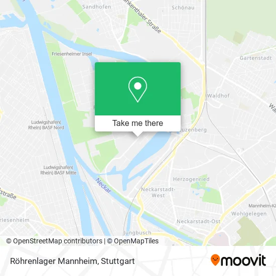
See Röhrenlager Mannheim, Neckarstadt-West, on the map
Public Transit to Röhrenlager Mannheim in Neckarstadt-West
Wondering how to get to Röhrenlager Mannheim in Neckarstadt-West? Moovit helps you find the best way to get to Röhrenlager Mannheim with step-by-step directions from the nearest public transit station.
Moovit provides free maps and live directions to help you navigate through your city. View schedules, routes, timetables, and find out how long does it take to get to Röhrenlager Mannheim in real time.
Looking for the nearest stop or station to Röhrenlager Mannheim? Check out this list of stops closest to your destination: Fries. Insel; Fries. Insel; Mannheim.
Train: S9.Bus: 53, 83, RNV 50, RNV 53, RNV 60, RNV 58.
Want to see if there’s another route that gets you there at an earlier time? Moovit helps you find alternative routes or times. Get directions from and directions to Röhrenlager Mannheim easily from the Moovit App or Website.
We make riding to Röhrenlager Mannheim easy, which is why over 1.5 million users, including users in Neckarstadt-West, trust Moovit as the best app for public transit. You don’t need to download an individual bus app or train app, Moovit is your all-in-one transit app that helps you find the best bus time or train time available.
For information on prices of bus, light rail and train, costs and ride fares to Röhrenlager Mannheim, please check the Moovit app.
Use the app to navigate to popular places including to the airport, hospital, stadium, grocery store, mall, coffee shop, school, college, and university.
Röhrenlager Mannheim Address: Friesenheimer Straße 19 68169 Mannheim street in Neckarstadt-West
- Fuchs Lubricants Germany,
- Sca,
- Matrapharm Gmbh,
- Inselstürmer,
- Peter Braun,
- Planquadrat Europa,
- Pizzataxi,
- Opmfotografie,
- Raum Mannheim,
- Inselstürmer Werbeagentur,
- Susann el Salamoni, Frank Hoffmann, Kerstin Gunga, Alexander Wagner,
- Büro Freistil Visuelle Kommunikation Ilona Engelhardt U Uli Goedel,
- Friesenheimer Str. 19,
- Matrapharm,
- N.I.S Gebäude-Service / Natique Industrie Service,
- N-Bahn-Club Rhein-Neckar,
- Benteler Distribution,
- Ebert Hera Group,
- Benteler Distribution Deutschland Gmbh & Co. Kg,
- Raum Mannheim | Büro Für Visuelle Kommunikation
Places Near Röhrenlager Mannheim (Neckarstadt-West)
- Im Wizemann (Halle), Bad Cannstatt,
- Hanns-Martin-Schleyer-Halle, Bad Cannstatt,
- Mercedes-Benz Museum (Mercedes Museum Stuttgart), Bad Cannstatt,
- Klinikum Stuttgart - Katharinenhospital, Stuttgart-Mitte,
- Mettingen Eros-Center Puff Laufhaus, Esslingen Am Neckar,
- Gasometer Pforzheim, Pforzheim,
- Pariser Platz Stuttgart, Stuttgart-Mitte,
- Marmorsaal Im Weissenburgpark, Stuttgart-Süd,
- Wilhelma (U-Bahn Wilhelma), Bad Cannstatt,
- Waldfriedhof, Degerloch,
- Porsche Museum, Zuffenhausen,
- Geilhaus Haus 33a, Reutlingen-Betzingen,
- Porsche-Arena, Bad Cannstatt,
- Hanns-Martin-Schleyer-Halle (Stuttgart Hans-Martin-Schleyerhalle), Bad Cannstatt,
- Gleis 101/102 (tief), Stuttgart-Mitte,
- Hauptbahnhof Stuttgart, Stuttgart-Mitte,
- SI-Centrum, Möhringen,
- Schleyerhalle, Bad Cannstatt,
- FlixBus Haltestelle, Stuttgart,
- Mercedes-Benz Museum, Bad Cannstatt
How to get to popular places in Stuttgart with public transit
Get around Neckarstadt-West by public transit!
Traveling around Neckarstadt-West has never been so easy. See step by step directions as you travel to any attraction, street or major public transit station. View bus and train schedules, arrival times, service alerts and detailed routes on a map, so you know exactly how to get to anywhere in Neckarstadt-West.
When traveling to any destination around Neckarstadt-West use Moovit's Live Directions with Get Off Notifications to know exactly where and how far to walk, how long to wait for your line, and how many stops are left. Moovit will alert you when it's time to get off — no need to constantly re-check whether yours is the next stop.
Wondering how to use public transit in Neckarstadt-West or how to pay for public transit in Neckarstadt-West? Moovit public transit app can help you navigate your way with public transit easily, and at minimum cost. It includes public transit fees, ticket prices, and costs. Looking for a map of Neckarstadt-West public transit lines? Moovit public transit app shows all public transit maps in Neckarstadt-West with all Bus, Train, Subway, Light Rail, Ferry, S-Bahn and Funicular routes and stops on an interactive map.
Stuttgart has 7 transit type(s), including: Bus, Train, Subway, Light Rail, Ferry, S-Bahn and Funicular, operated by several transit agencies, including SSB - Stadtbahn, SSB, SSB - Seilbahn / Zacke, S-Bahn Stuttgart, Rhein-Neckar-Verkehr GmbH (rnv), Karlsruher Verkehrsverbund, DB AG, DB Regiobus BW, Arverio Baden-Württemberg GmbH, DB RegioNetz Verkehrs GmbH Westfrankenbahn, DB Regio AG Baden-Württemberg, Südwestdeutsche Verkehrs-AG, DB Regio AG Mitte Region Hessen, DB and Bodensee-Oberschwaben-Bahn