How to get to Rødberg by bus?
Click on the bus route to see step by step directions with maps, line arrival times and updated time schedules.
From Vågsbygd, Kristiansand
99 minFrom Scandic Hotell Bystranda, Kristiansand
85 minFrom Returbil.No, Kristiansand
79 minFrom Bortelid, Åseral
128 minFrom Sørlandet Sykehus Kristiansand, Kristiansand
107 minFrom Kongsgård Spesialsykehuset For Rehabilitering, Kristiansand
105 minFrom Fjord Line Ferry Terminal (Kristiansand-Hirtshals), Kristiansand
84 minFrom Statens Vegvesen Kristiansand, Kristiansand
112 minFrom Sørlandssenteret, Kristiansand
124 min
Bus stop near Rødberg in Lindesnes
- Rødberg, 1 min walk,VIEW
Bus lines to Rødberg in Lindesnes
- 203, Vigeland,VIEW
What are the closest stations to Rødberg?
The closest stations to Rødberg are:
- Rødberg is 8 meters away, 1 min walk.
Which bus line stops near Rødberg?
NW192 (Stavanger Bussterminal)
What’s the nearest bus station to Rødberg in Lindesnes?
The nearest bus station to Rødberg in Lindesnes is Rødberg. It’s a 1 min walk away.
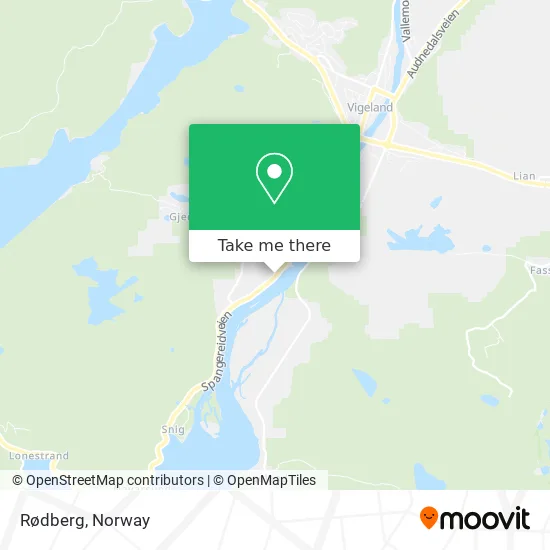
See Rødberg, Lindesnes, on the map
Public Transit to Rødberg in Lindesnes
Wondering how to get to Rødberg in Lindesnes? Moovit helps you find the best way to get to Rødberg with step-by-step directions from the nearest public transit station.
Moovit provides free maps and live directions to help you navigate through your city. View schedules, routes, timetables, and find out how long does it take to get to Rødberg in real time.
Looking for the nearest stop or station to Rødberg? Check out this list of stops closest to your destination: Rødberg.
Bus: NW192, 203.
Want to see if there’s another route that gets you there at an earlier time? Moovit helps you find alternative routes or times. Get directions from and directions to Rødberg easily from the Moovit App or Website.
We make riding to Rødberg easy, which is why over 1.5 million users, including users in Lindesnes, trust Moovit as the best app for public transit. You don’t need to download an individual bus app or train app, Moovit is your all-in-one transit app that helps you find the best bus time or train time available.
For information on prices of bus, costs and ride fares to Rødberg, please check the Moovit app.
Use the app to navigate to popular places including to the airport, hospital, stadium, grocery store, mall, coffee shop, school, college, and university.
Rødberg Address: Spangereidveien 213 4520 Sør-Audnedal street in Lindesnes
- Rauberg,
- Homme,
- Ferienhaus in Lussevika,
- Kongsknipen,
- Dråben Verkstedgalleri,
- Hestehaven Barnehage,
- Audnastrand Leirsted,
- Lindesnes Minifyr,
- Tjøms Trafikkskole Roy Tjøm,
- Imf Gjenbruk Vigeland,
- Rema 1000,
- Indremisjonsforbundet Sør Administrasjon,
- Skagestad Oddleiv,
- Snig,
- Snig Bedehus,
- Gamleveien 37,
- Spiseriet,
- Vigelandsstua,
- Vigeland,
- Undal River
Places Near Rødberg (Lindesnes)
- Drammen Sykehus, Drammen,
- Oslo S spor 19 (Trelastgata), Oslo,
- Lovisenberg Diakonale Sykehus, Oslo,
- Ulriken, Bergen,
- Haukeland Universitetssjukehus, Bergen,
- Quality Hotel Edvard Grieg, Bergen,
- Rikshospitalet (trikk), Oslo,
- Ikea Leangen, Trondheim,
- Tyholttårnet, Trondheim,
- Voldsløkka, Oslo,
- Bjerke Travbane, Oslo,
- IKEA, Bergen,
- Jekta Storsenter, Tromsø,
- IKEA, Oslo,
- Color Line Terminal, Oslo,
- Vestby Outlet Store, Vestby,
- Nylandsbrua, Oslo,
- Ullevål Stadion (T), Oslo,
- Radiumhospitalet, Oslo,
- DFDS Seaways, Oslo
How to get to popular places in Norway with public transit
Get around Lindesnes by public transit!
Traveling around Lindesnes has never been so easy. See step by step directions as you travel to any attraction, street or major public transit station. View bus and train schedules, arrival times, service alerts and detailed routes on a map, so you know exactly how to get to anywhere in Lindesnes.
When traveling to any destination around Lindesnes use Moovit's Live Directions with Get Off Notifications to know exactly where and how far to walk, how long to wait for your line, and how many stops are left. Moovit will alert you when it's time to get off — no need to constantly re-check whether yours is the next stop.
Wondering how to use public transit in Lindesnes or how to pay for public transit in Lindesnes? Moovit public transit app can help you navigate your way with public transit easily, and at minimum cost. It includes public transit fees, ticket prices, and costs. Looking for a map of Lindesnes public transit lines? Moovit public transit app shows all public transit maps in Lindesnes with all Bus, Train, Subway, Light Rail, Ferry and Cable Car routes and stops on an interactive map.
Norway has 6 transit type(s), including: Bus, Train, Subway, Light Rail, Ferry and Cable Car, operated by several transit agencies, including Ruter, Skyss, AtB, Flytoget, Vy Tåg, SJ, Go-Ahead Norge AS, SJ Nord, Vestfold Kollektivtrafikk as, Snelandia, Innlandstrafikk, FRAM, FlixBus, Kolumbus and Brakar